Classic Maps and Prints
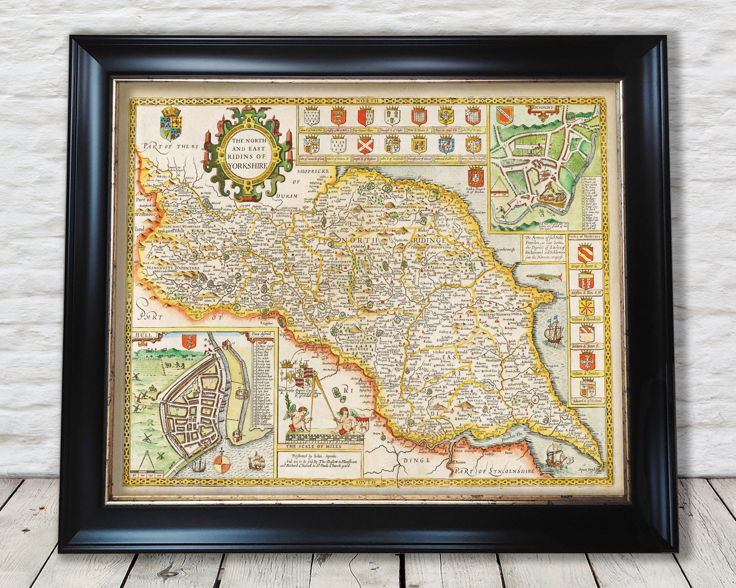
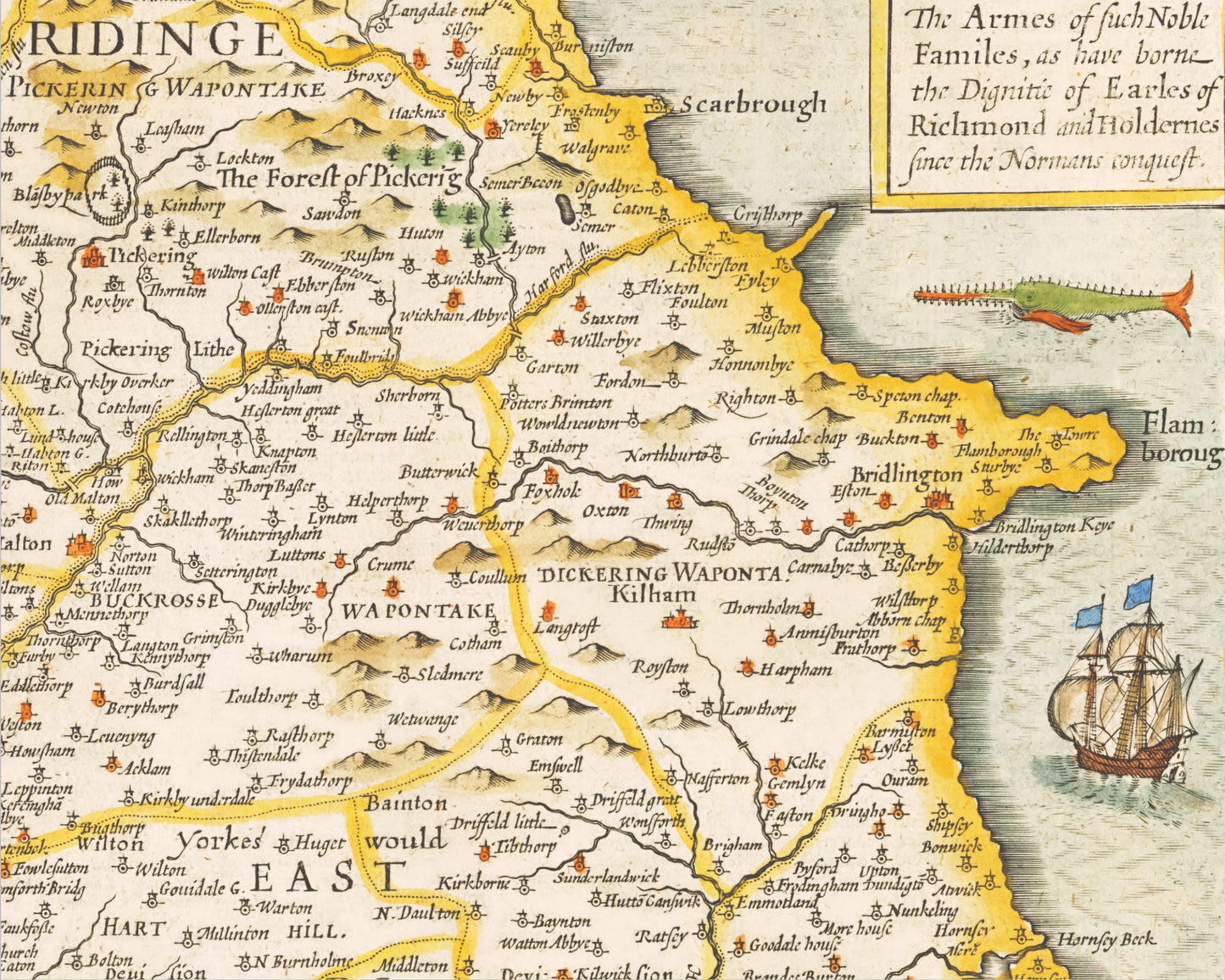
YORKSHIRE North and East Ridings Map John Speed 1676 Richmond Hull
YORKSHIRE North and East Ridings Map John Speed 1676 Richmond Hull
Couldn't load pickup availability
This classic piece was produced by John Speed the best known mapmaker of the Stuart period. This wonderful decorative county map was produced over 400 years since.
Of the North and East Ridings of Yorkshire Speed noted "The agriculture of the two Ridings was a varied as their geography, the less bleak fells and moorland supporting sheep and cattle and the lowlands pasture and arable, the East Riding being one of the most prosperous agrarian communities in England."
This is a highly sought after work and is sure to form an interesting conversation piece to any living room. This piece looks stunning mounted.
Features:
-------------
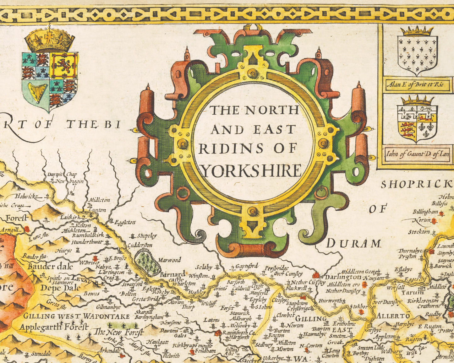
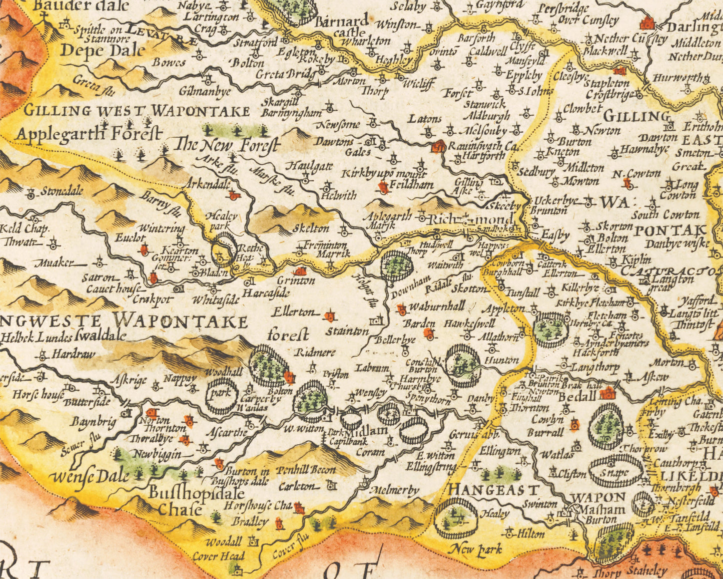
• This superb map provides a highly detailed geography of the hills, rivers and forests of the North and East Ridings from the early 17th century
• Many towns and villages are accurately plotted on this colourful map
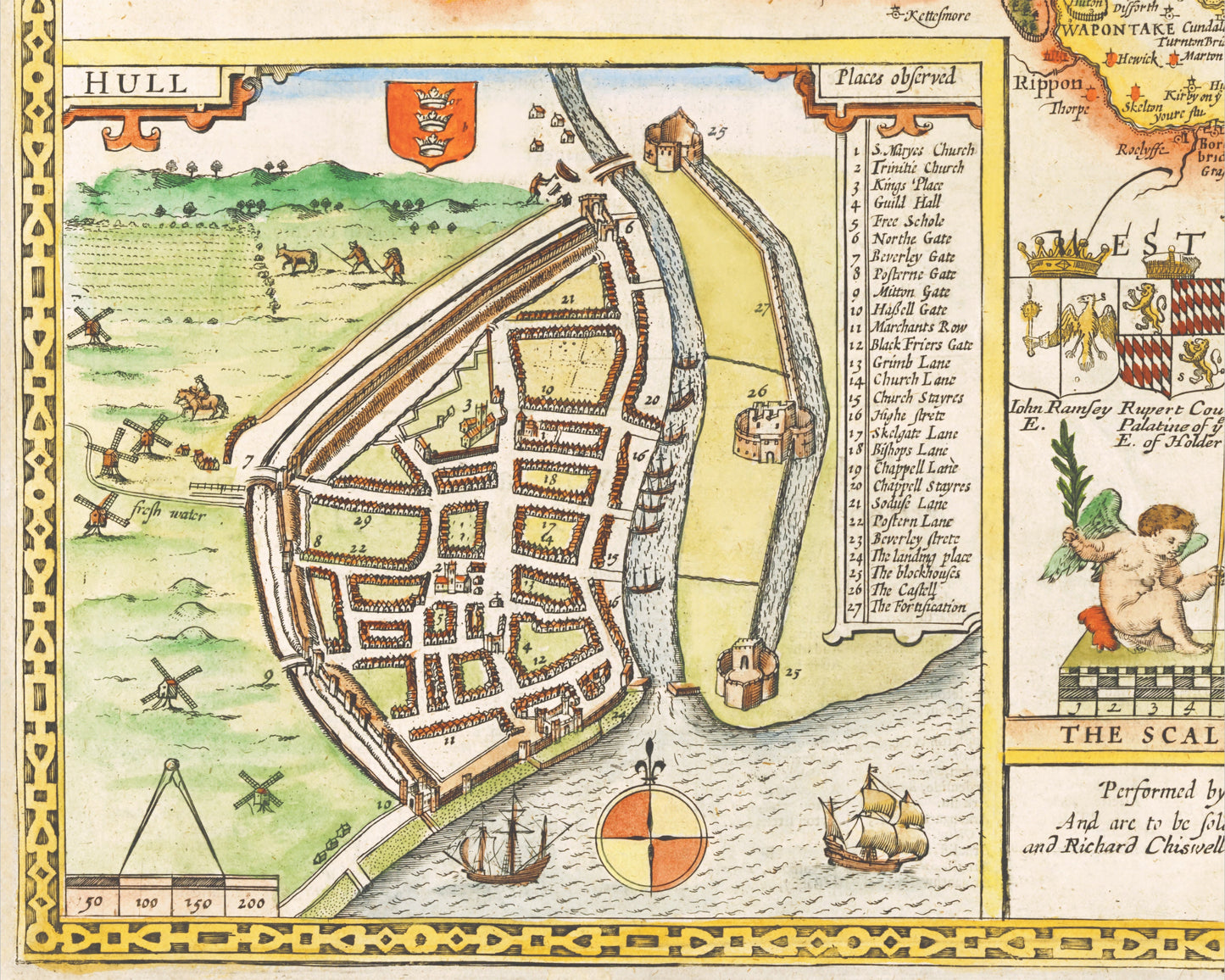
• Two fantastic inset maps of Hull and Richmond
• Contemporary galleons are illustrated along with a fearsome sea monster!
• A striking title of "The North and East Ridings of Yorkshire"
• Coat of Arms are depicted for the noble Families of Richmond and Holderness
• All offset with a stylish border
Share