
Classic Maps and Prints
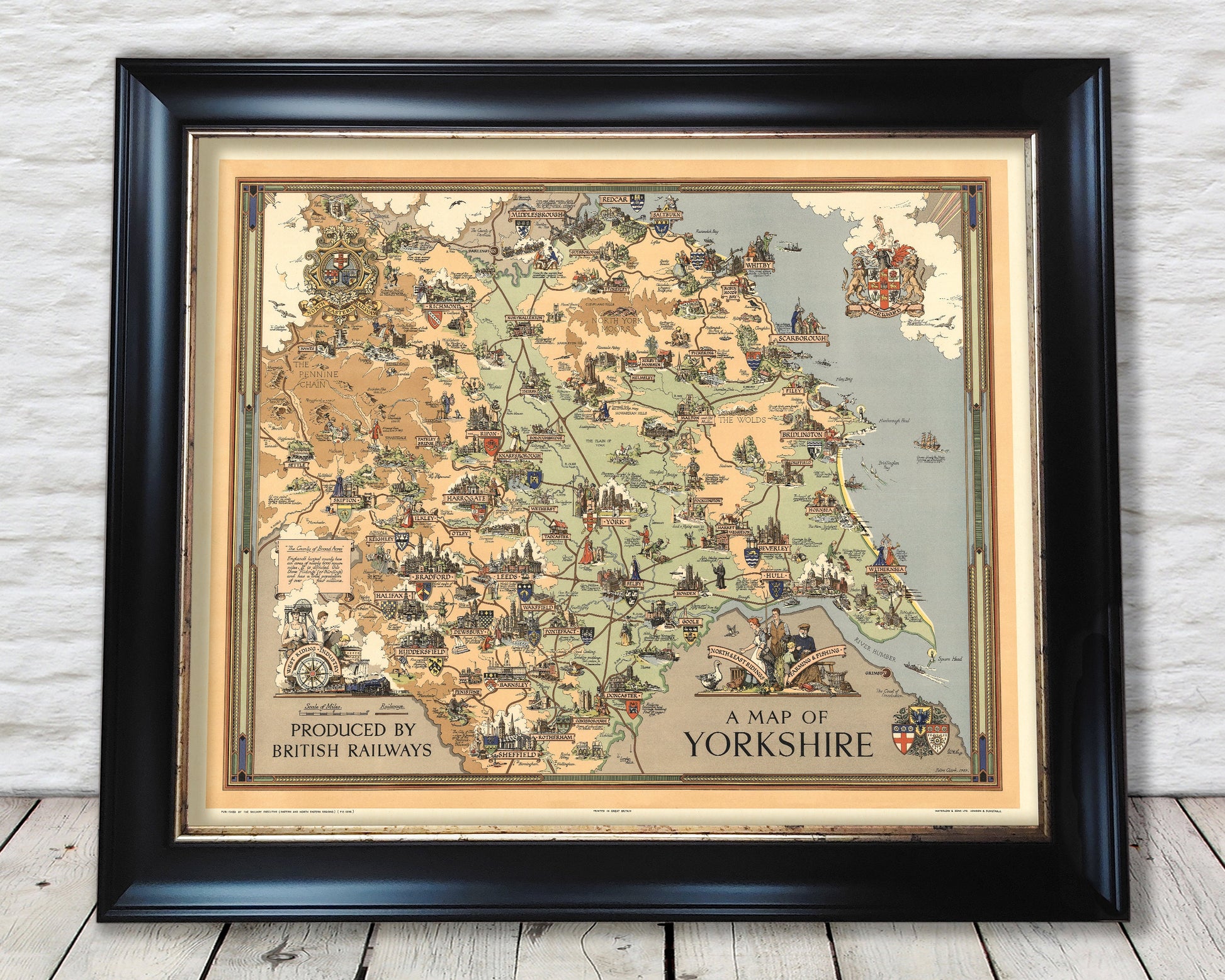
Vintage YORKSHIRE RAILWAYS Map, 1949 by Estra Clark, pictorial map
Vintage YORKSHIRE RAILWAYS Map, 1949 by Estra Clark, pictorial map
Couldn't load pickup availability
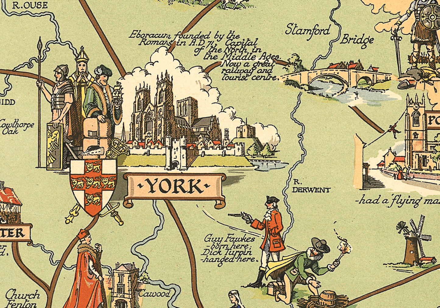
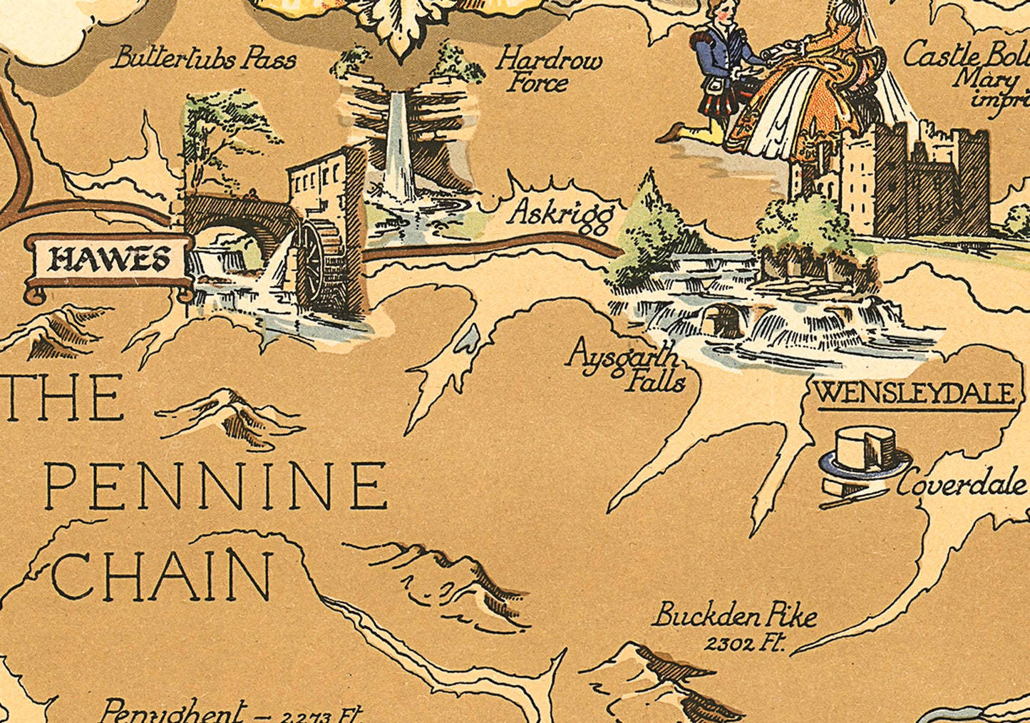
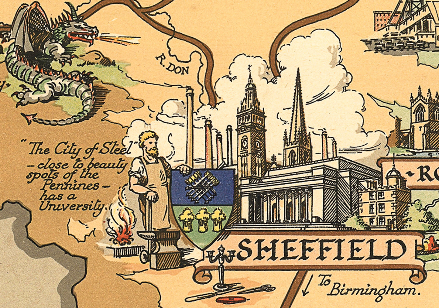
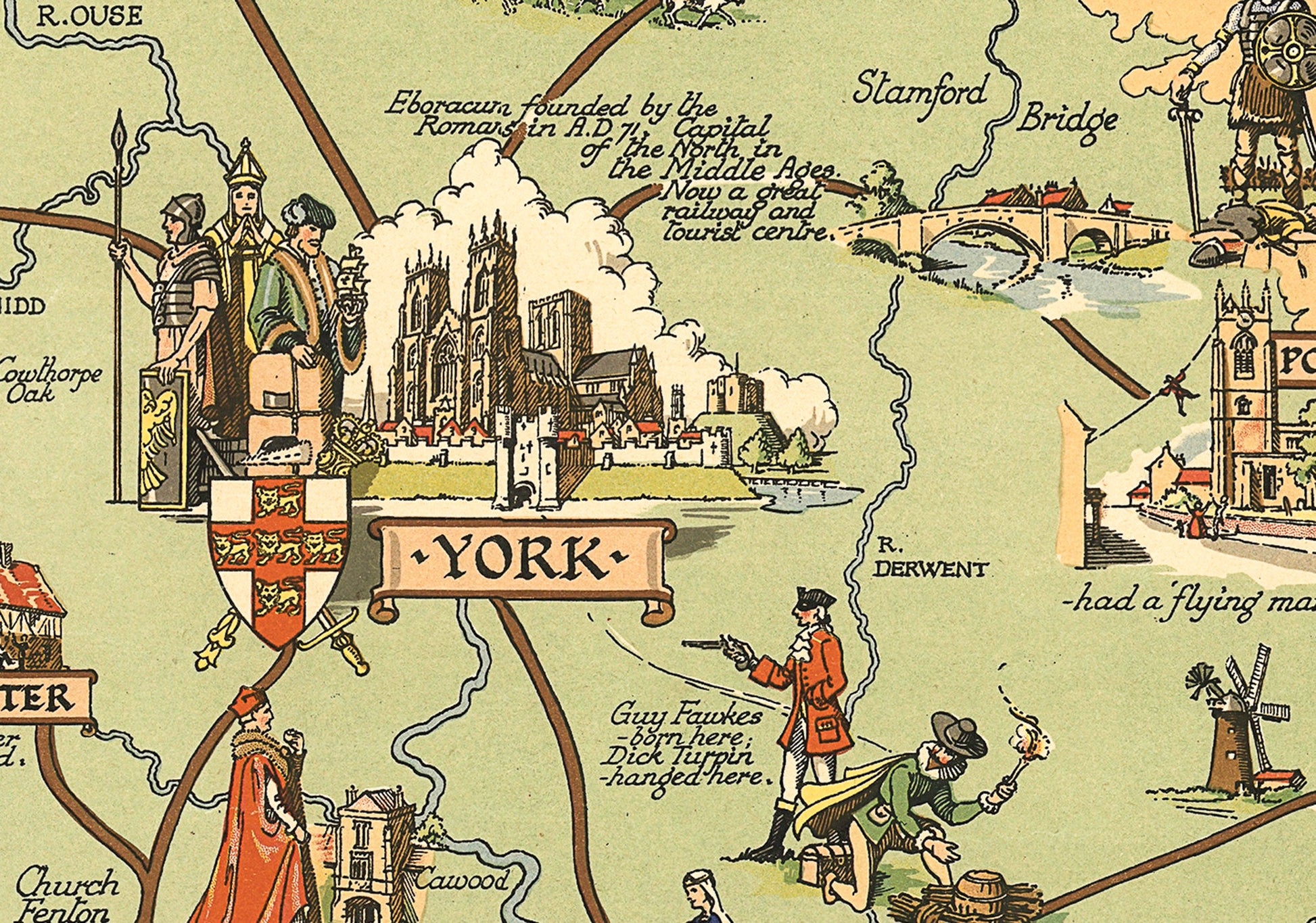
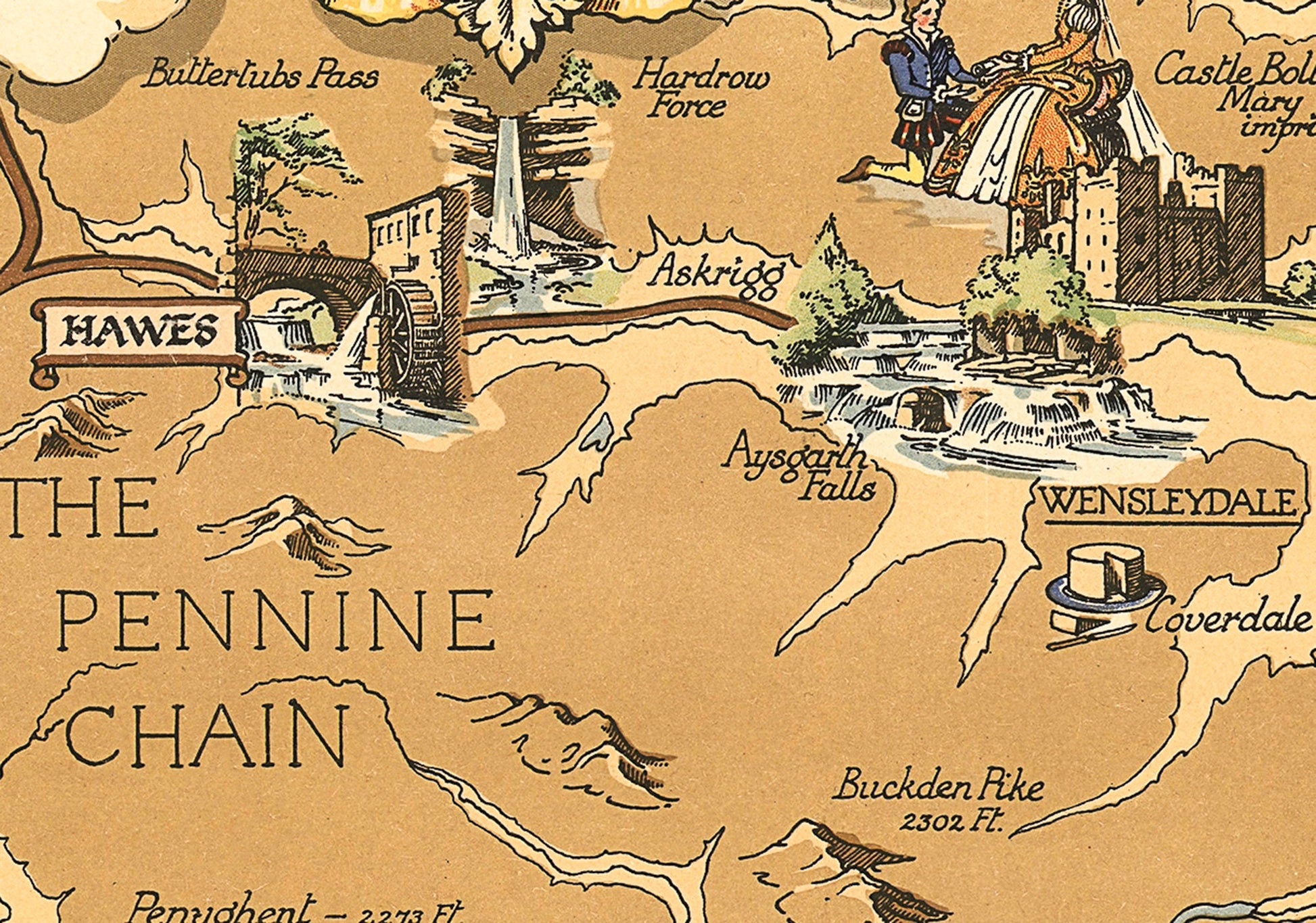
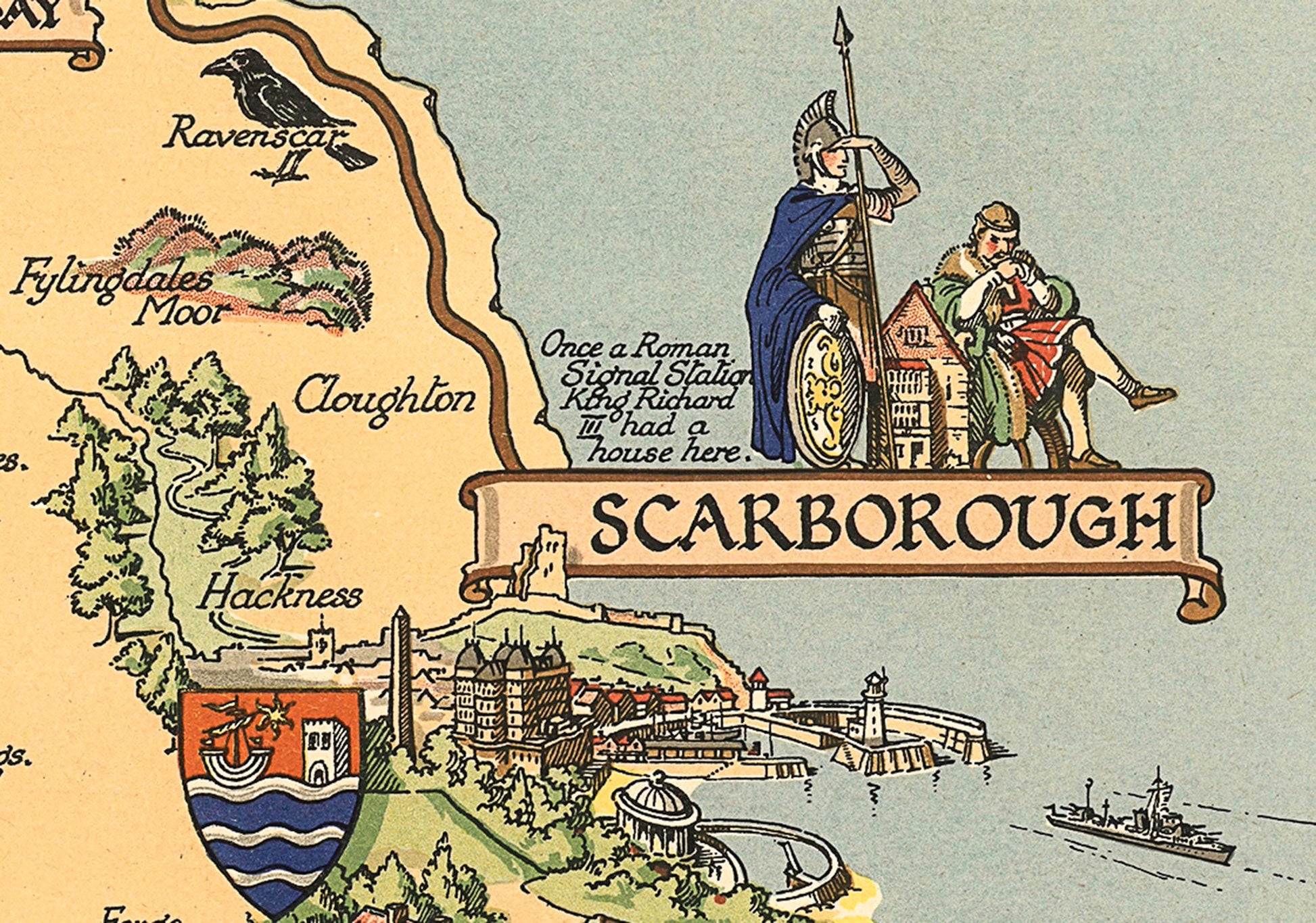
This print has it all. Created by York's own pictorial cartographer artist Estra Clark this piece depicts the Ridings of Yorkshire in their entirety North, East and West. This charming piece was commissioned by British Railways to promote rail travel to and within the Yorkshire region. Estra captures Yorkshire in this stunning work in which each town and city have their own beautiful illustration along with a complementary historical note or literal anecdote to further spellbind the viewer. It is far more than just a map; it tells a story of Yorkshire and of the Yorkshire people.
This piece has been digitally cleaned in order to remove blemishes and most signs of ageing but keeps the look, feel and integrity of the original.
A classic work that creates a centrepiece for any home and would look stunning framed. This print is produced on premium heavyweight 230 gsm paper and uses the finest quality inks that will not fade or smudge.
This is a much sought-after work.
Features:
-------------
• Over 50 beautiful illustrations of Yorkshire towns and cities
• Anecdotes and facts that add a true Yorkshireness to this piece
• An illustration depicting the industry of the West Riding
• Motif portraying the farming and fishing industries of the North and East Ridings
• Arms shields of all three Ridings
• A clean, crisp digitally cleaned print
• All offset by a stunning, colourful border
Share