

Classic Maps and Prints
Vintage YORKSHIRE Map, West Riding 1946, Ernest Clegg, pictorial map
Vintage YORKSHIRE Map, West Riding 1946, Ernest Clegg, pictorial map
Couldn't load pickup availability
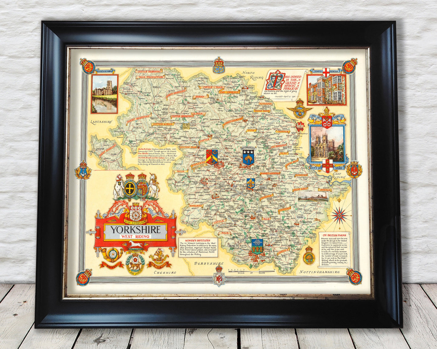
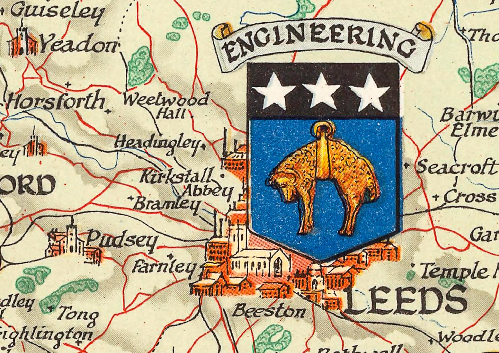
A wonderful piece commissioned to commemorate World War II and to mark the importance that agriculture, industry and the role that women played on the home front in securing that victory. The West Riding of Yorkshire extended far beyond the boundaries of current day West Yorkshire and included Skipton, Ripon, Harrogate, Sheffield, Doncaster, Rotherham, Barnsley, Selby and Goole amongst numerous others.
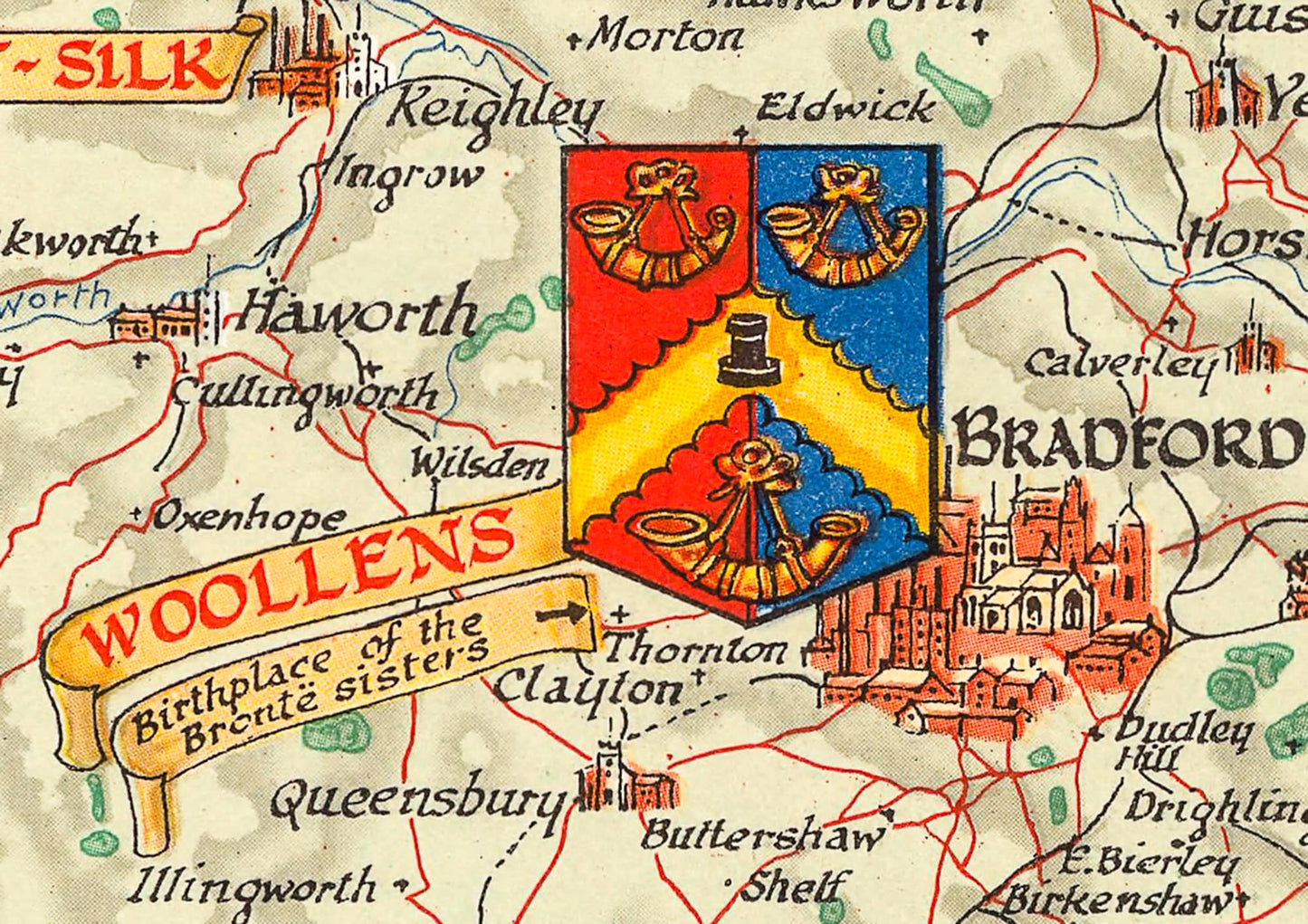
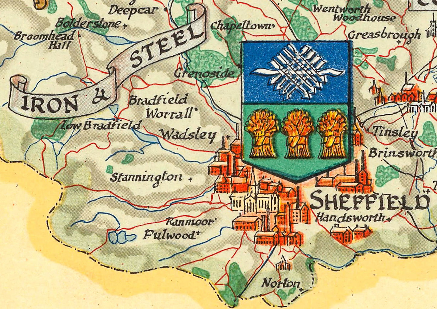
The map details towns, larger villages, rivers and the industrial and agricultural products produced within those areas. It gives special mention to the role of the Women's Institute and the importance of British farms along with excerpts of Winston Churchill's speeches.
This vibrant work brings to life part of our recent history and is a masterpiece of it's kind. This classic piece would look stunning mounted and would form a centrepiece of any room.
This print is produced on premium heavyweight 230gsm paper and uses the finest quality inks that will not fade or smudge.
Features:
-------------
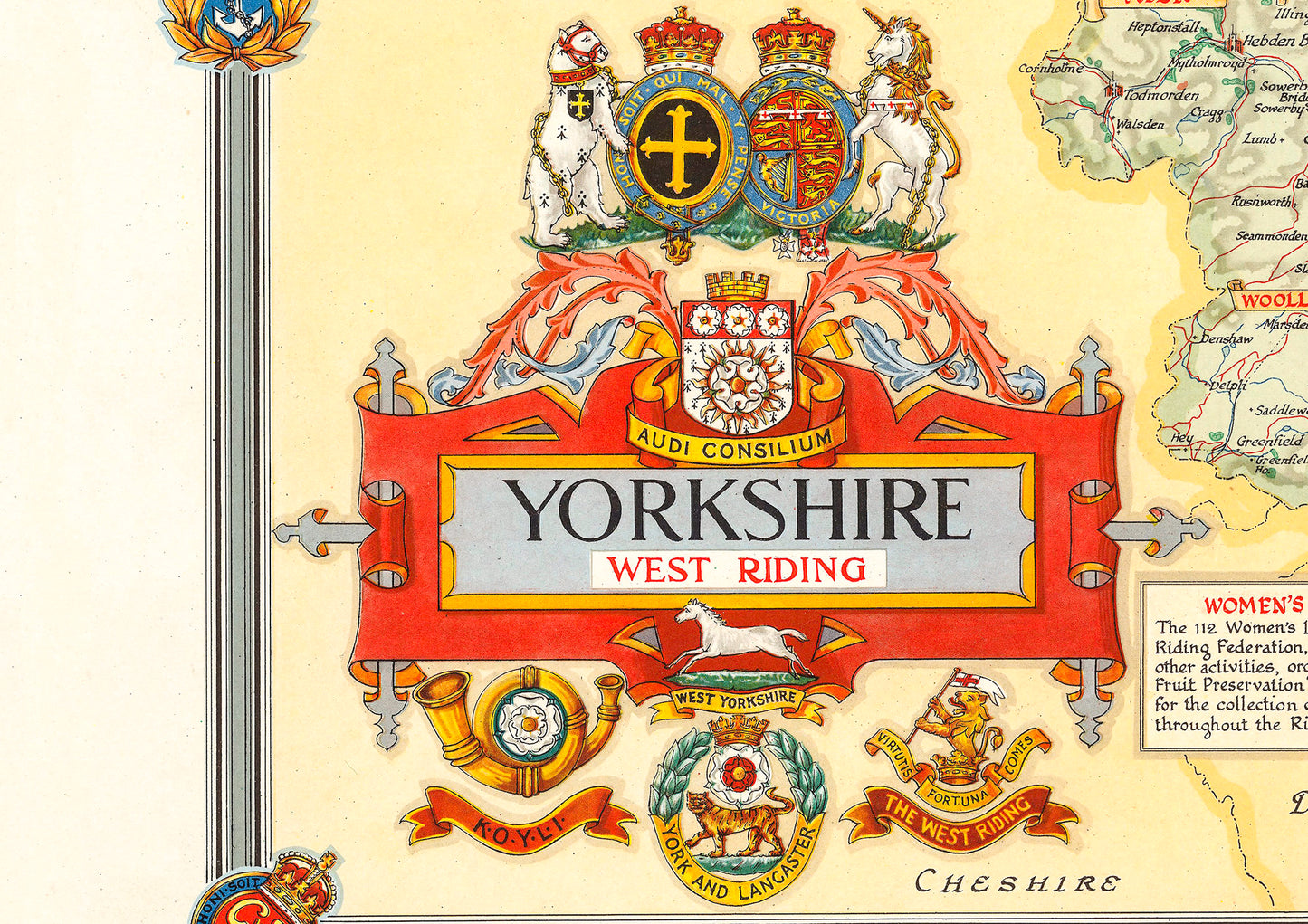
• A crest of the West Riding
• Insignias of the King's Own Yorkshire Light Infantry, York & Lancaster Regiment, the West Yorkshire Regiment and the Duke of Wellington Regiment
• Vignettes of Fountains Abbey, Temple Newsam and the City of York
• The Women's Land Army crest
• A detailed geographical representation of the West Riding of Yorkshire
Share