Classic Maps and Prints
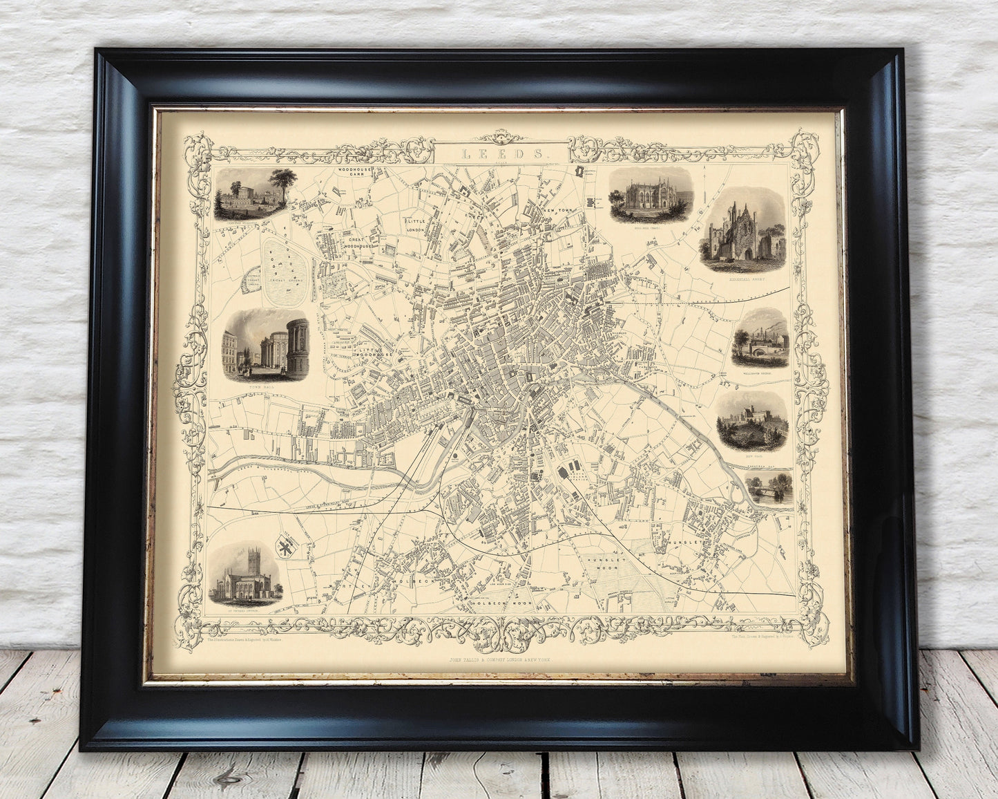
Vintage LEEDS map c. 1851 by Rapkin and Tallis, fine reproduction
Vintage LEEDS map c. 1851 by Rapkin and Tallis, fine reproduction
Couldn't load pickup availability
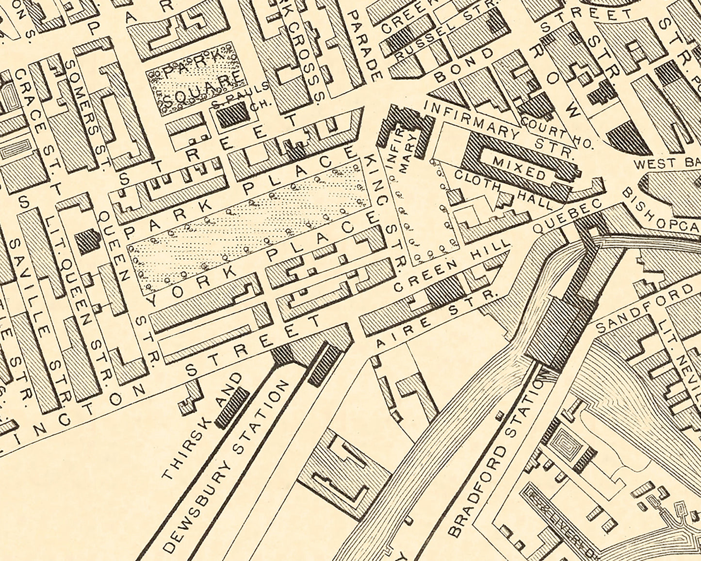
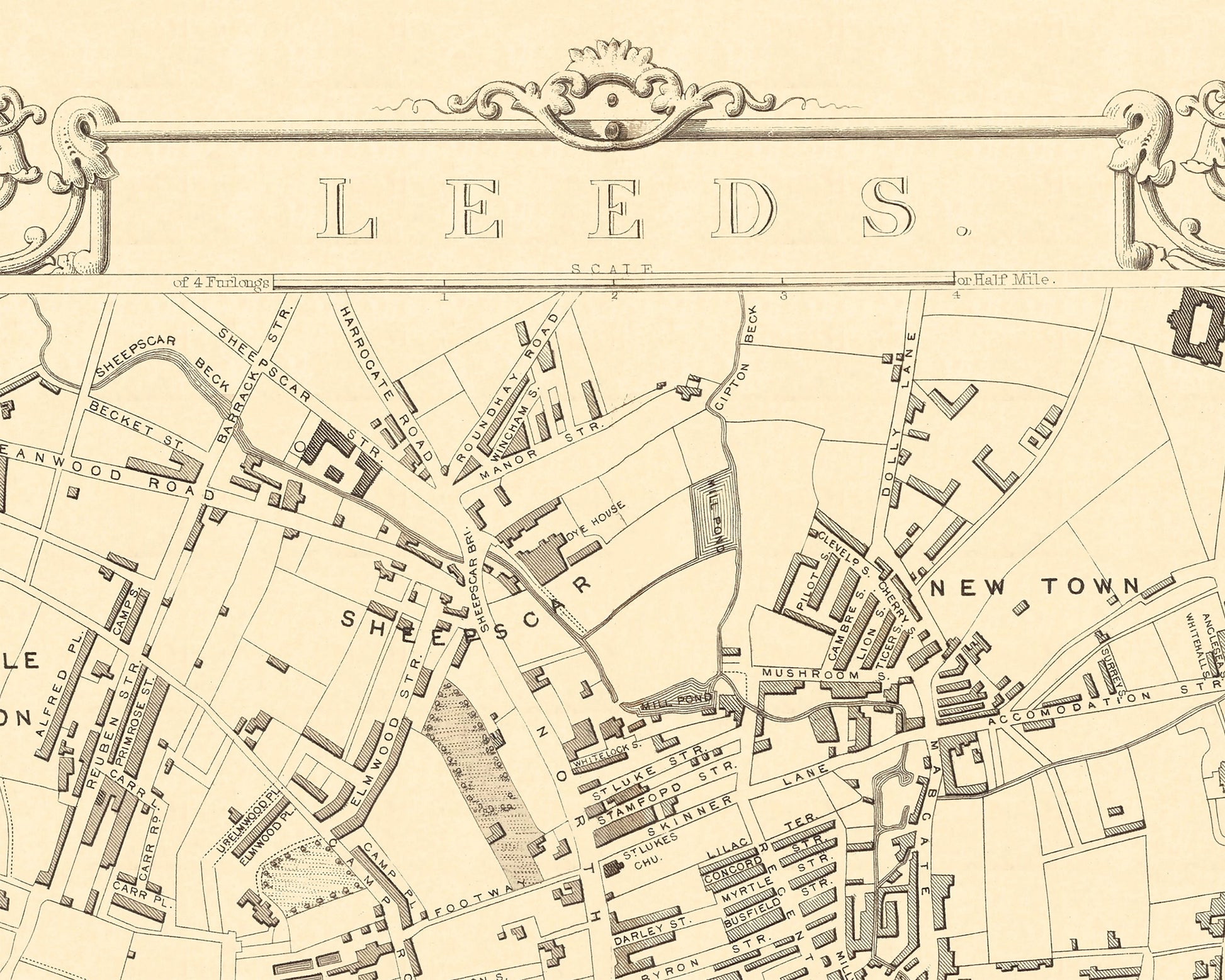
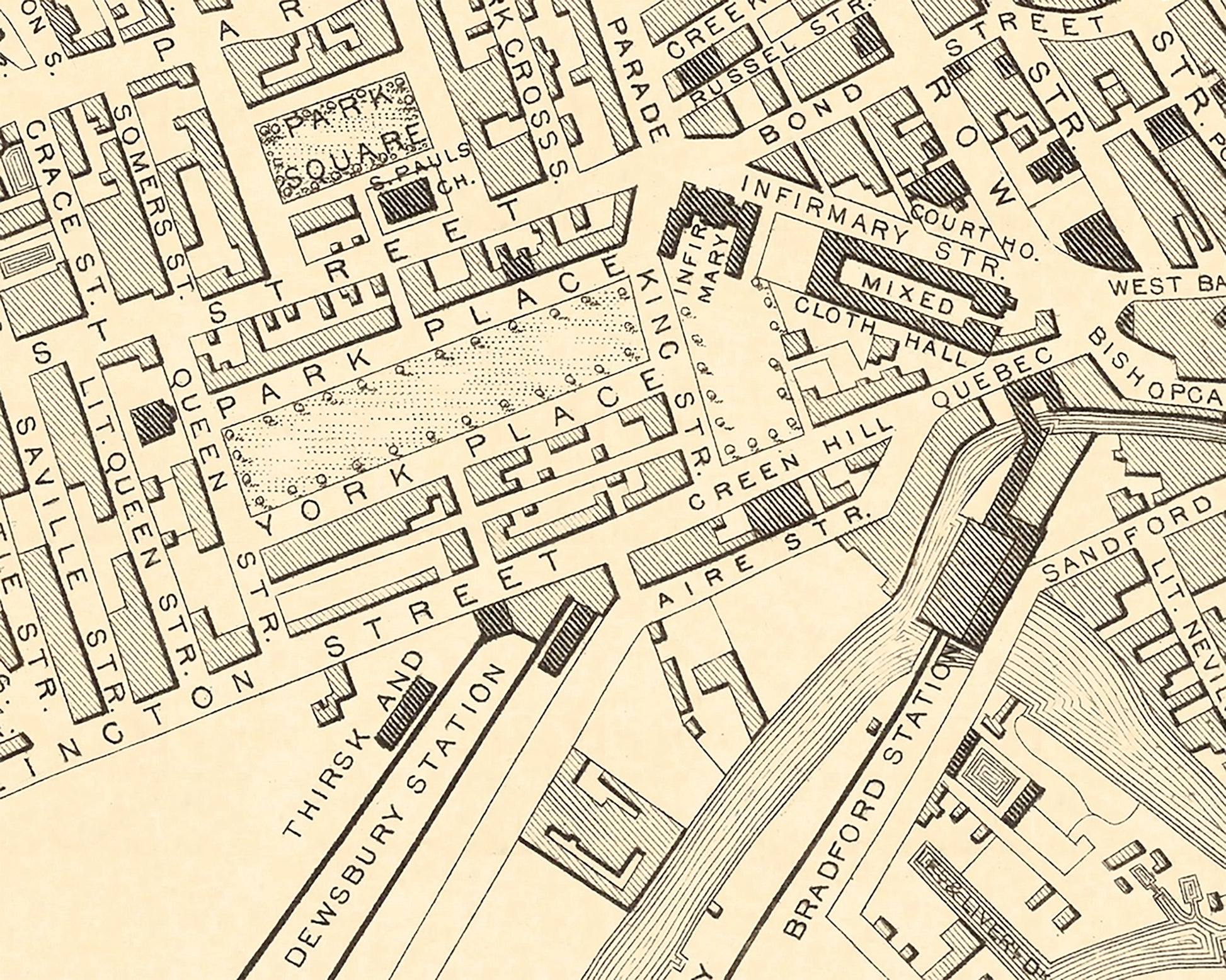
This striking piece was created by the renowned cartographer John Tallis (1818-1876) and engraved by the skilled artisan John Rapkin. Leeds was at the forefront of the Industrial Revolution when this map was made. Its population had already surpassed 150,000 souls by 1840. Leeds’ transport links were an essential part of its growth served by the River Aire and the Leeds and Liverpool canal by 1816. Railways came early to Leeds. In 1834 the Leeds and Selby Railway opened to be followed by Wellington station in 1848 and Central Station in 1854. Leeds boasted many a trade including machine tools, chemicals, pottery and of course textiles – a staple across much of the West Riding. Now you can examine those times more closely on this superb map.
This piece has been digitally cleaned in order to remove blemishes and most signs of ageing but keeps the look, feel and integrity of the original. This reproduction has a sepia tone to add that look of authenticity.
A classic work that creates a centrepiece for any home and would look stunning framed. This print is produced on premium heavyweight paper and uses the finest quality inks that will not fade or smudge.
Features:
-------------
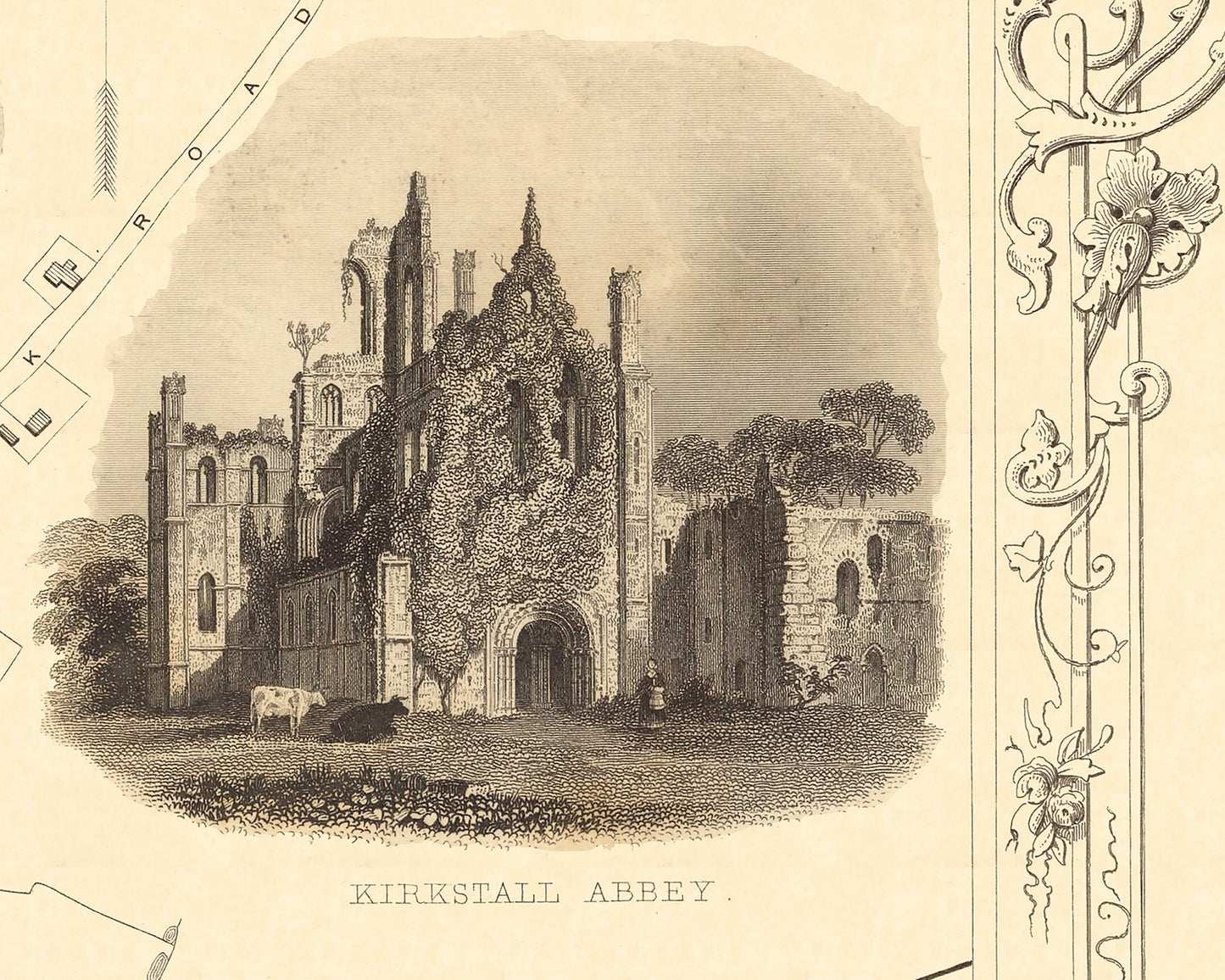
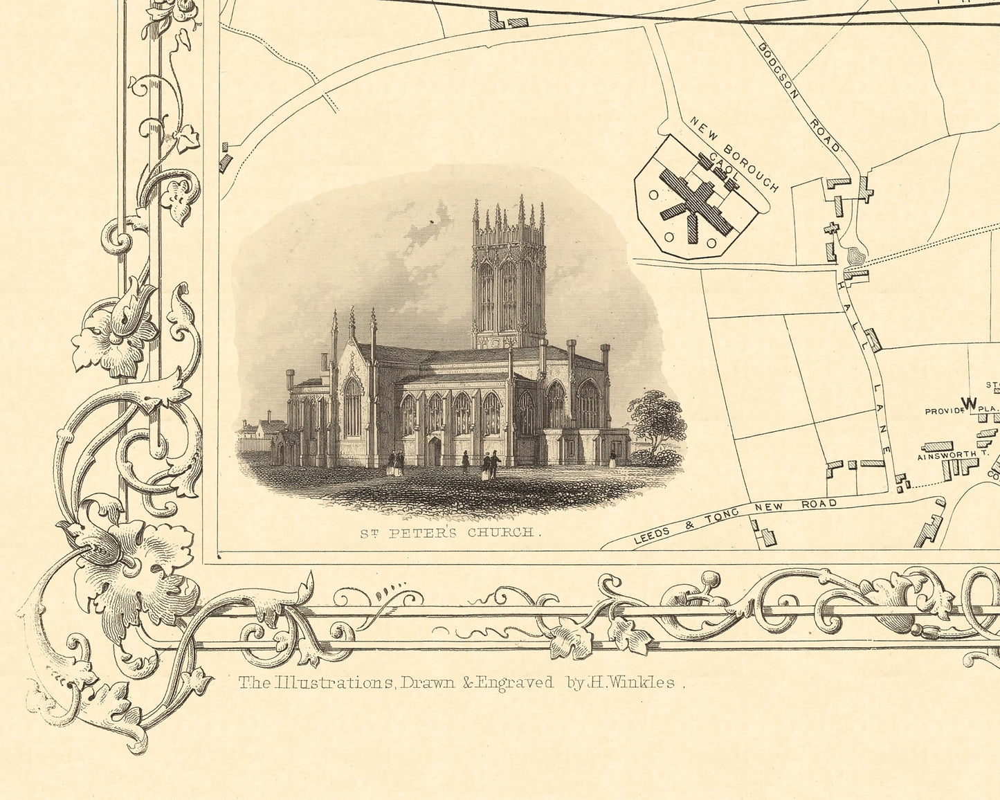
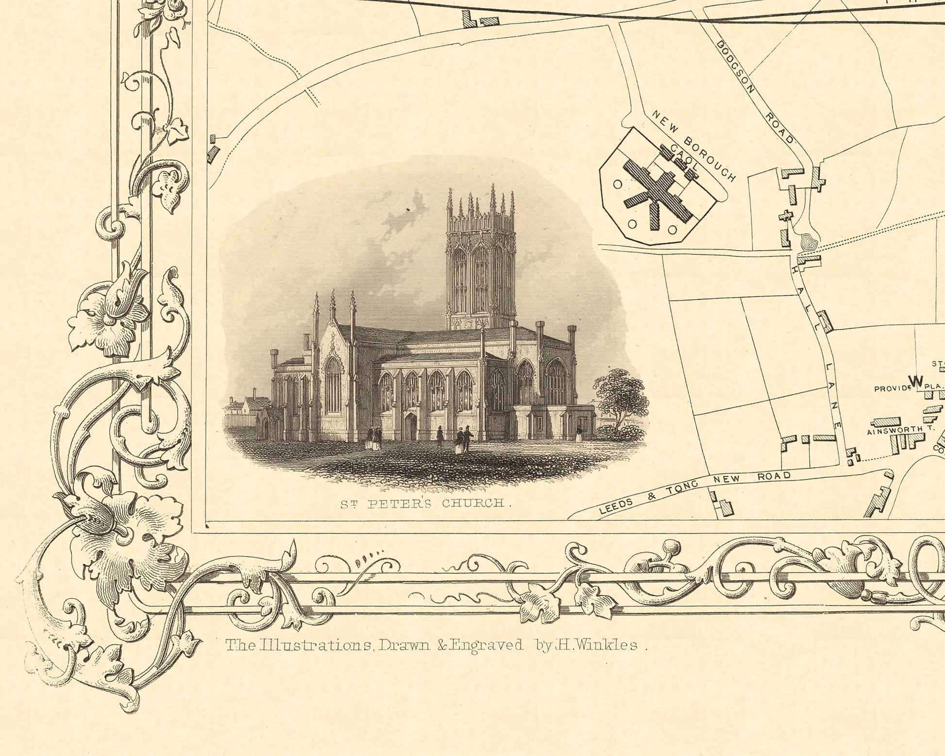
• Eight wonderful vignettes towards the edges of the map including St Peter’s Church, Leeds Town Hall and Kirkstall Abbey
• An accurate and artistic depiction of the roads, railways and buildings of 1850s Leeds
• A beautiful border embellishment and title of Leeds
• A clean, crisp detailed map of Leeds lovingly restored
Share