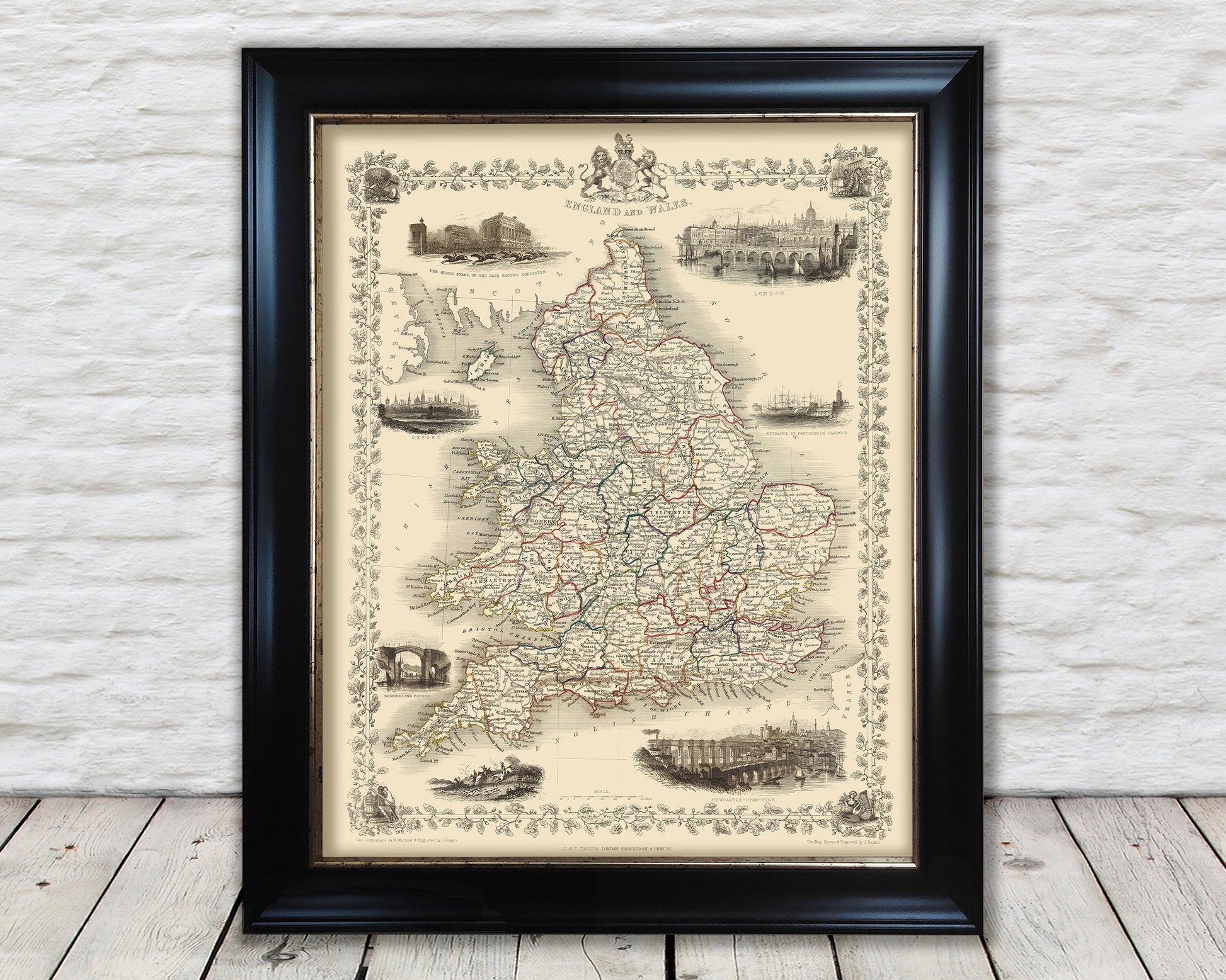
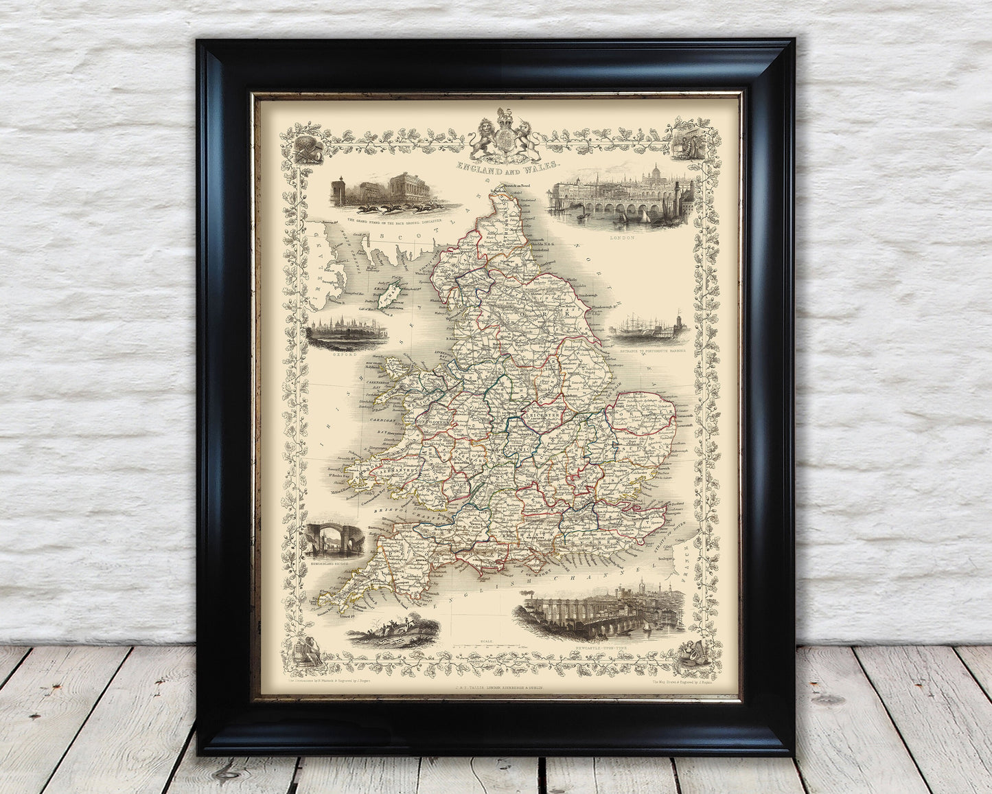
This stunning map of England and Wales was created by the magical combination of John Tallis and John Rapkin who produced some of the greatest maps of the nineteenth century.
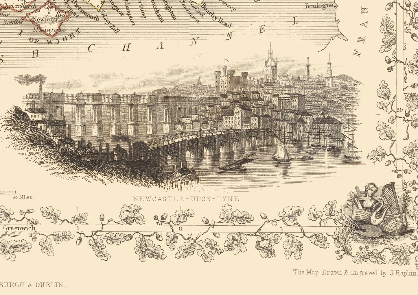
This map shows England and Wales in the 1850s two major powers of Great Britain who lead the world in manufacturing, industry, commerce, transport and trade. This was the Golden Era of Great Britain the world's first steam powered industrialized super power.
This piece has been digitally cleaned in order to remove blemishes and most signs of ageing but keeps the look, feel and integrity of the original.
A classic work that creates a centrepiece for any home and would look stunning mounted. This print is produced on premium heavyweight 230 gsm paper and uses the finest quality inks that will not fade or smudge.
It is a highly sought after work.
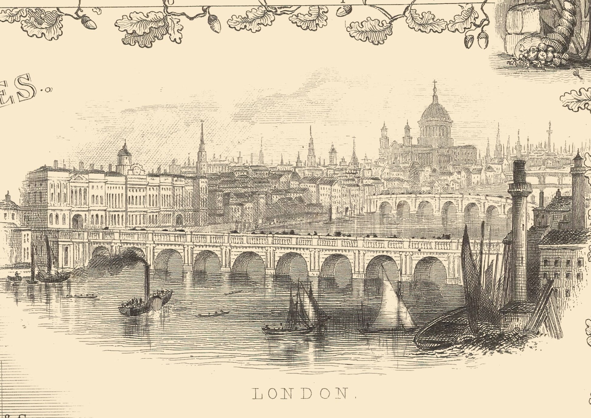
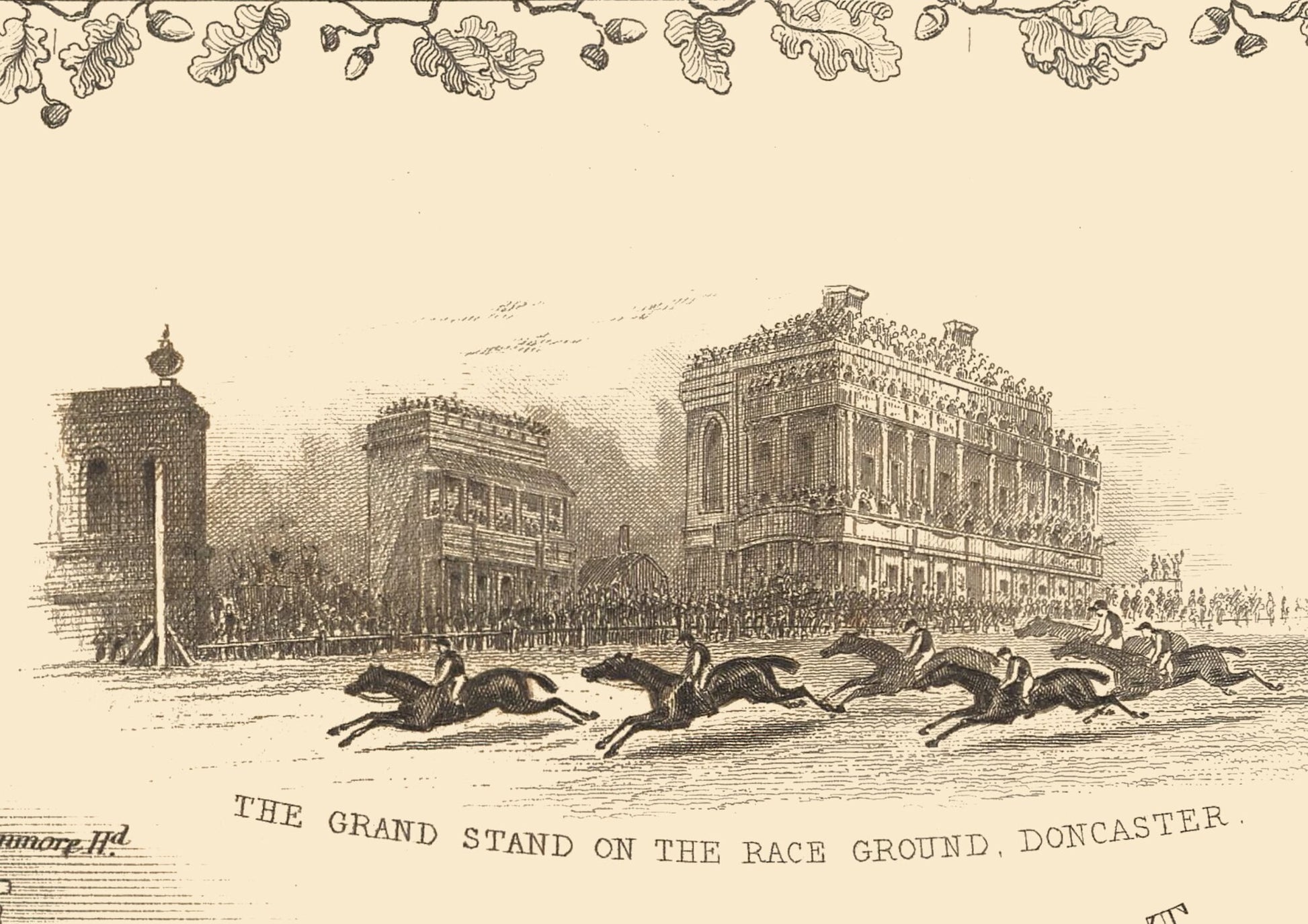
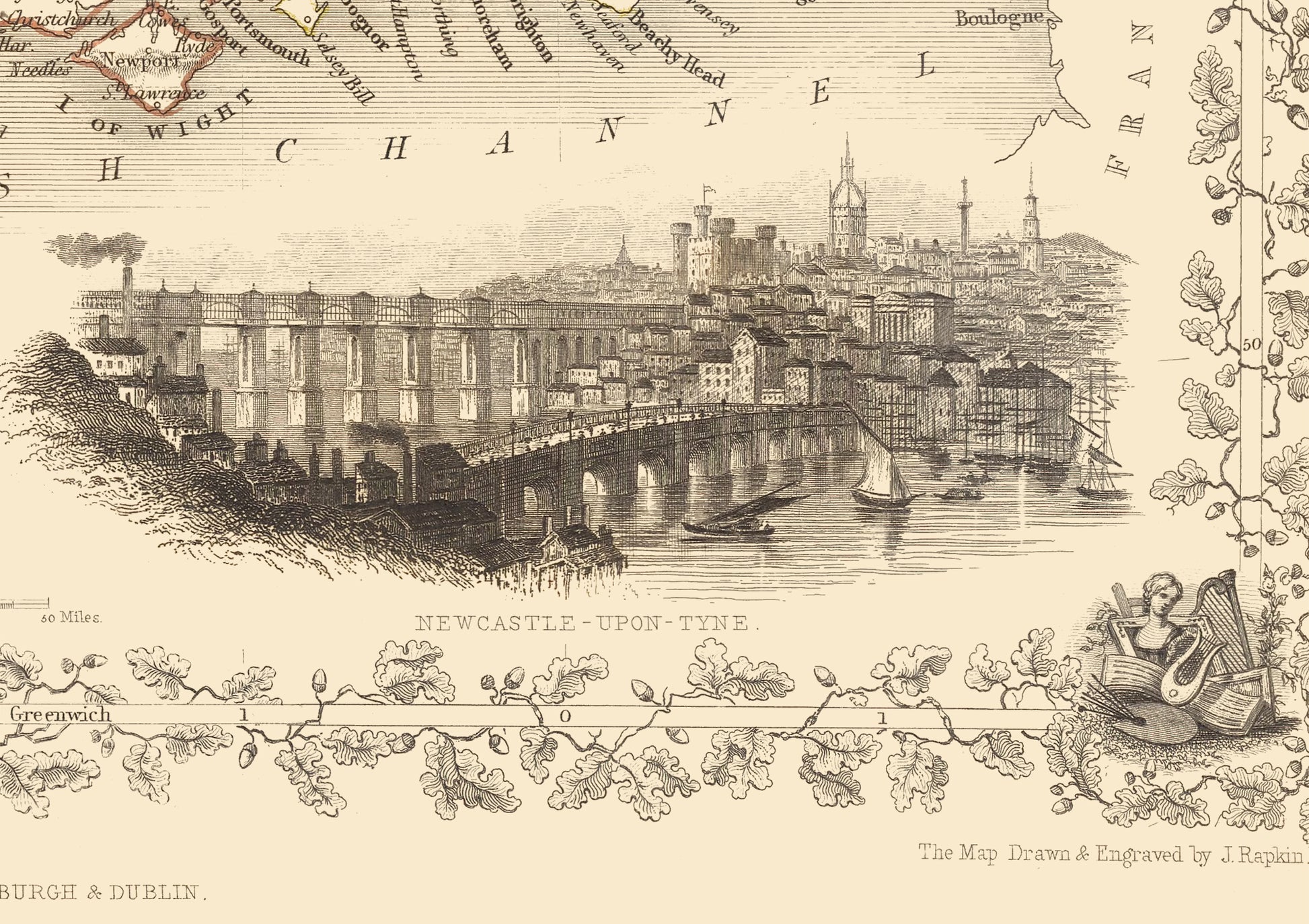
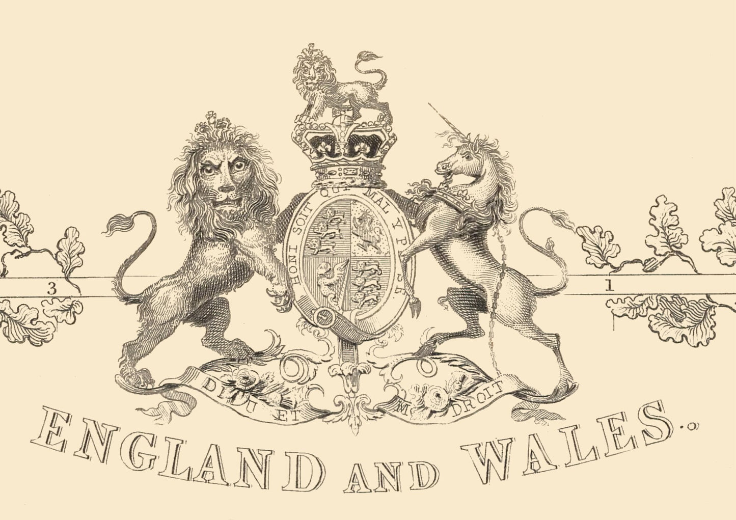
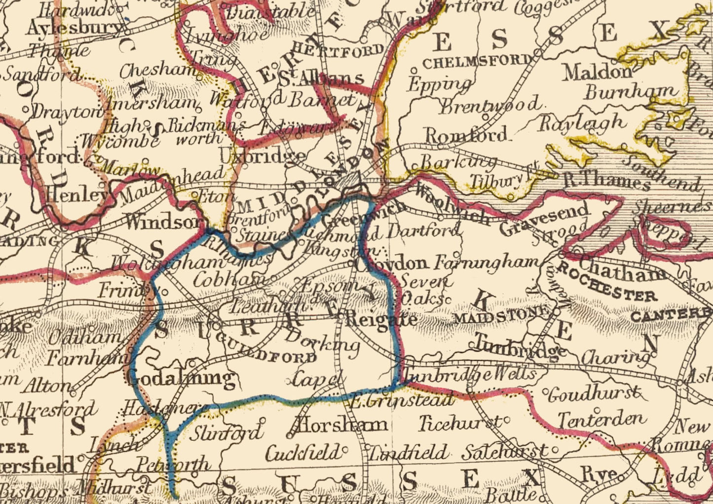
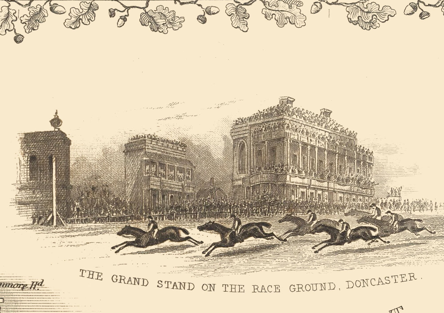
Features: ------------- • A comprehensively detailed map of England and Wales including topographical features and major railways • Seven beautiful vignettes including London, Oxford, Newcastle and Doncaster race course • A wonderful illustration of the Great British Coat of Arms inscribed "Honi Soit Qui Mal Y Pense" • Four corner pieces representing farming, the arts, shipping and science • A decorative title in beautiful calligraphic font • All offset by a wonderfully eye-catching border