


Classic Maps and Prints
Superb GEOGRAPHICAL Definitions Illustrated by Yevi Yaggy 1893 - Geography
Superb GEOGRAPHICAL Definitions Illustrated by Yevi Yaggy 1893 - Geography
Couldn't load pickup availability
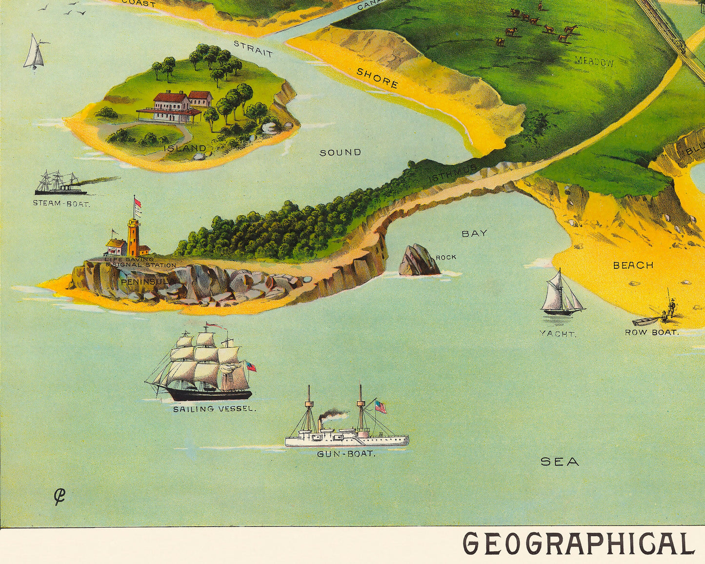
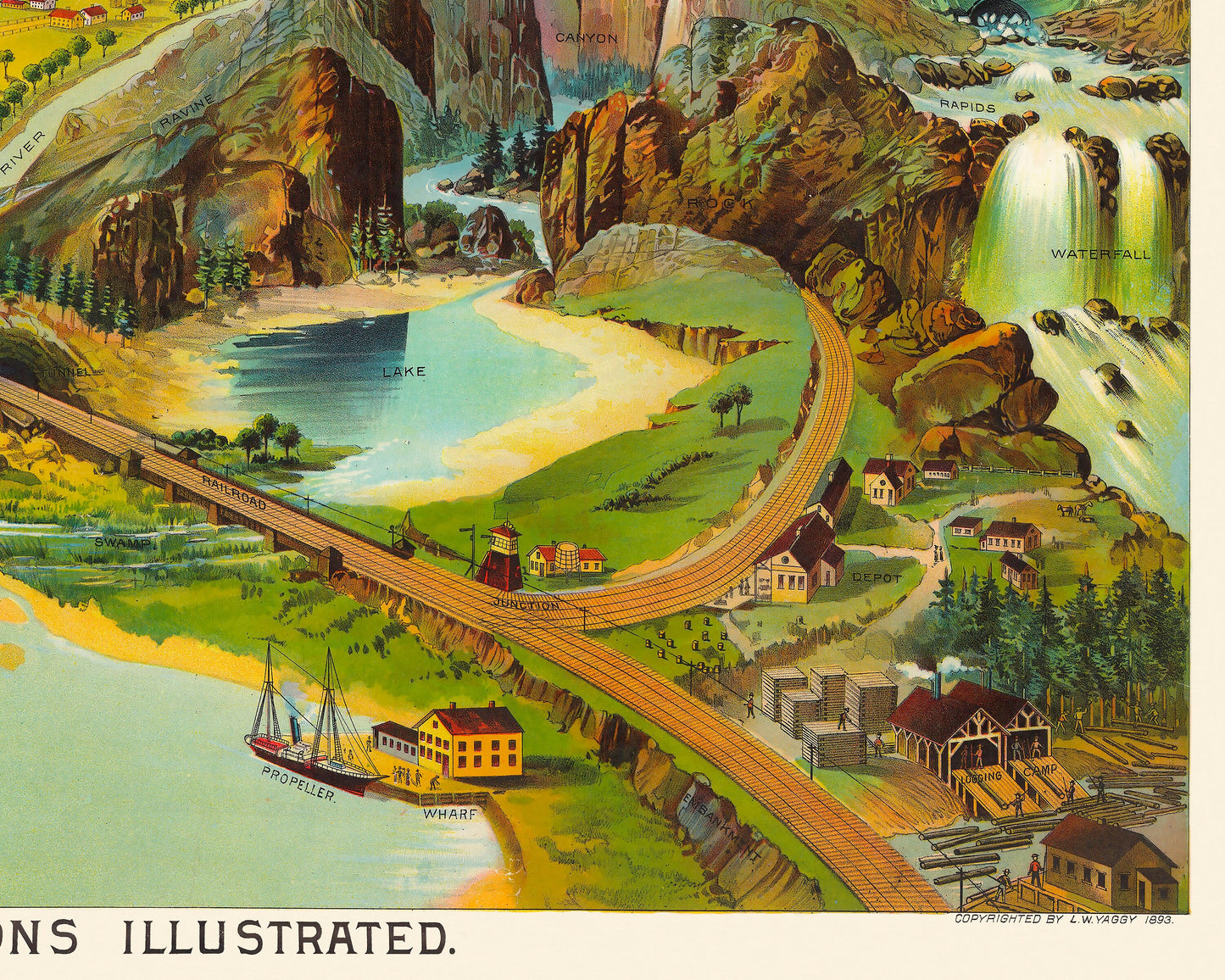
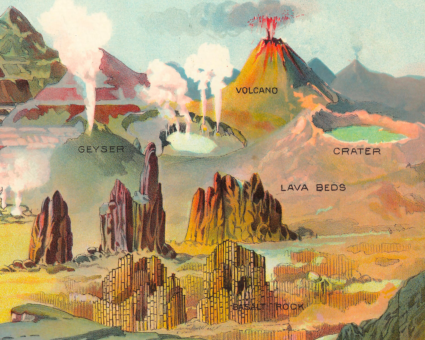
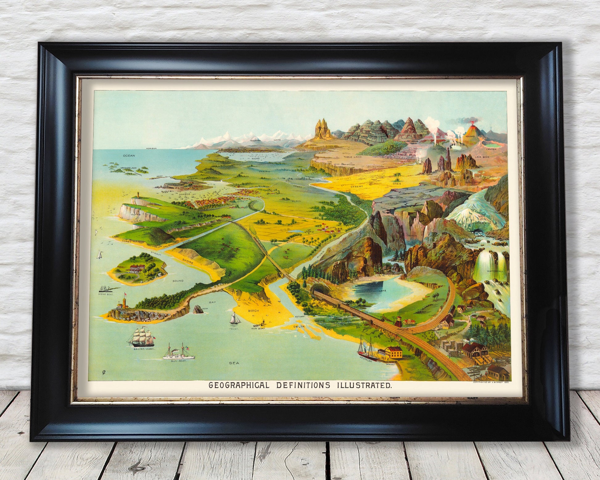
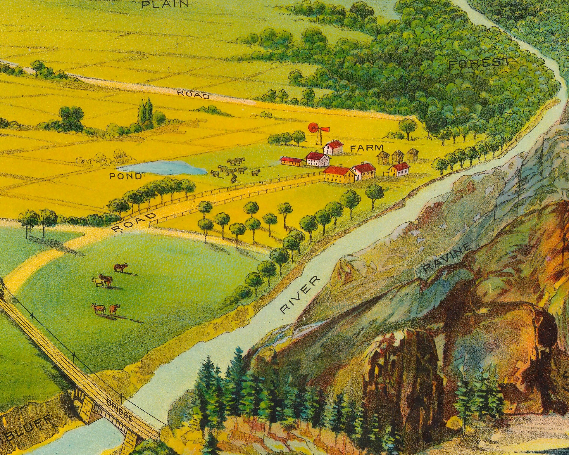
Yaggy's large geographical charts are among the most beautiful and impressive educational charts published in the 19th century. Using chromolithography, Yaggy created stunning colours and contrasts in his images of the world, its regions, and peoples. This Geological Chart was one of 10 such geographical works. Yaggy's chart of geographical definitions illustrated seamlessly blends the wide variety of landforms, seascapes, elements of topography, geothermal activity, as well as human adaptations to the environment and transportation into one beautiful imaginary yet realistic world. Mountains, deserts, lakes, geysers, lava beds, craters, creeks, cliffs, sounds, prairies, table lands, sandstone formations, and so much more is presented in a manner that needs no words for students to understand. The human element is also represented by the inclusion of a railroad, wharf, city, harbour, farm, logging camp, and a variety of boats tastefully places throughout the image.
This piece is sure to suit anyone with an interest in geography, has an enquiring mind or appreciates information portrayed in artistic manner.
This is a truly wonderful work is pleasing to the eye and much sought after. It is sure to be a conversation piece in any living room and would look stunning framed. Please note this piece is print only and the frame used is purely for illustrative purposes only.
Share