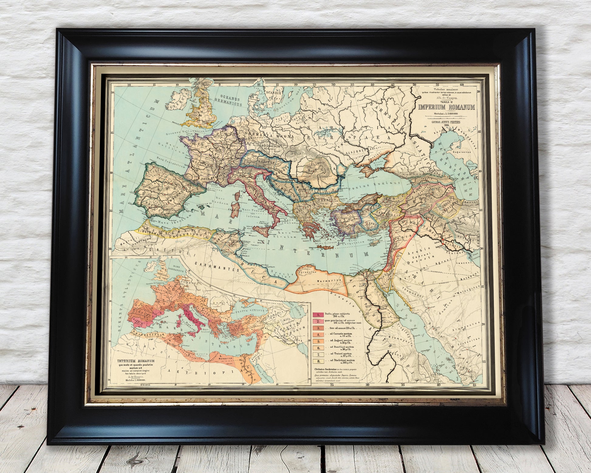
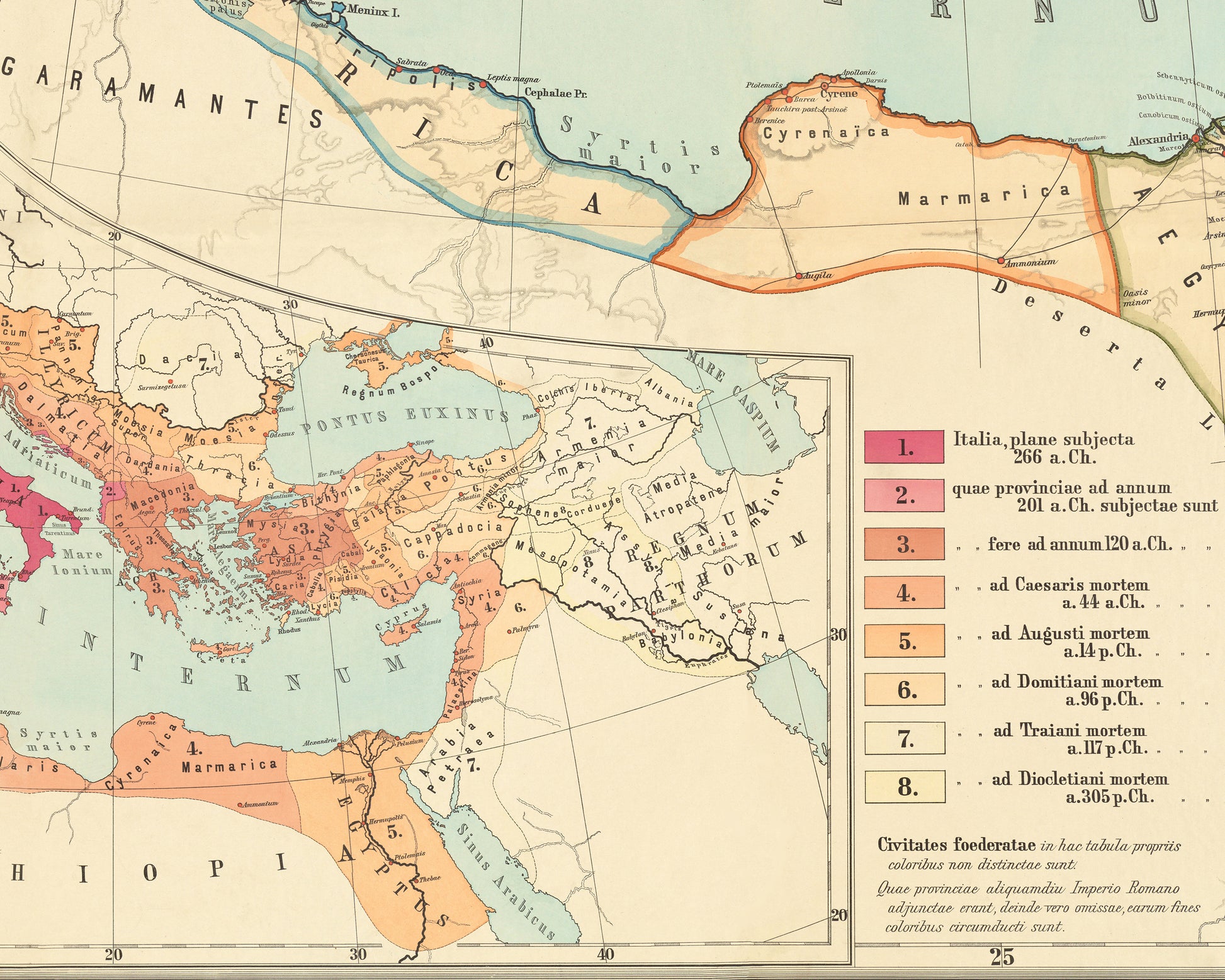
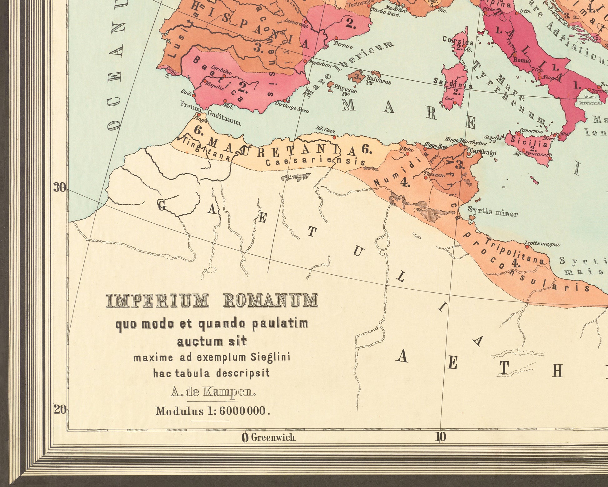
Discover the Roman Empire at its peak with the Roman Empire Map by Albert Von Kampen. Perfect for any historian or world geography enthusiast, this detailed map accurately displays the ancient European countries in the Roman Empire. Explore its boundaries and see its history come to life.
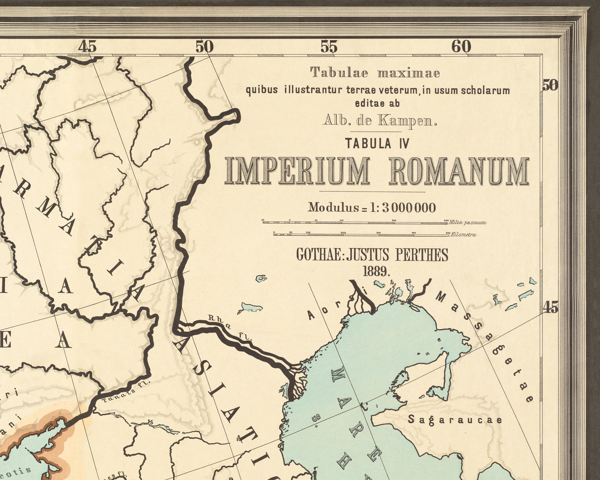
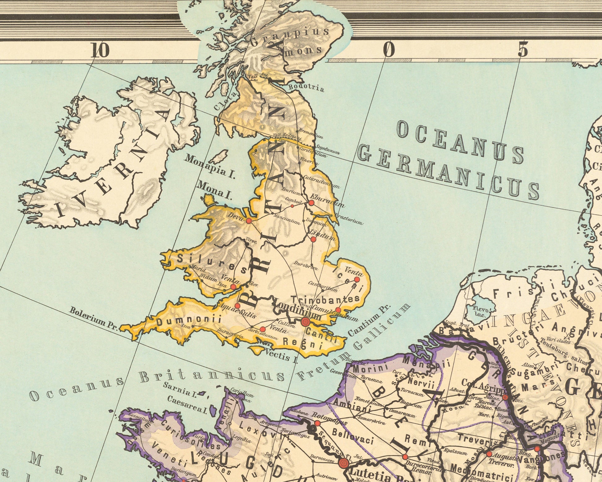
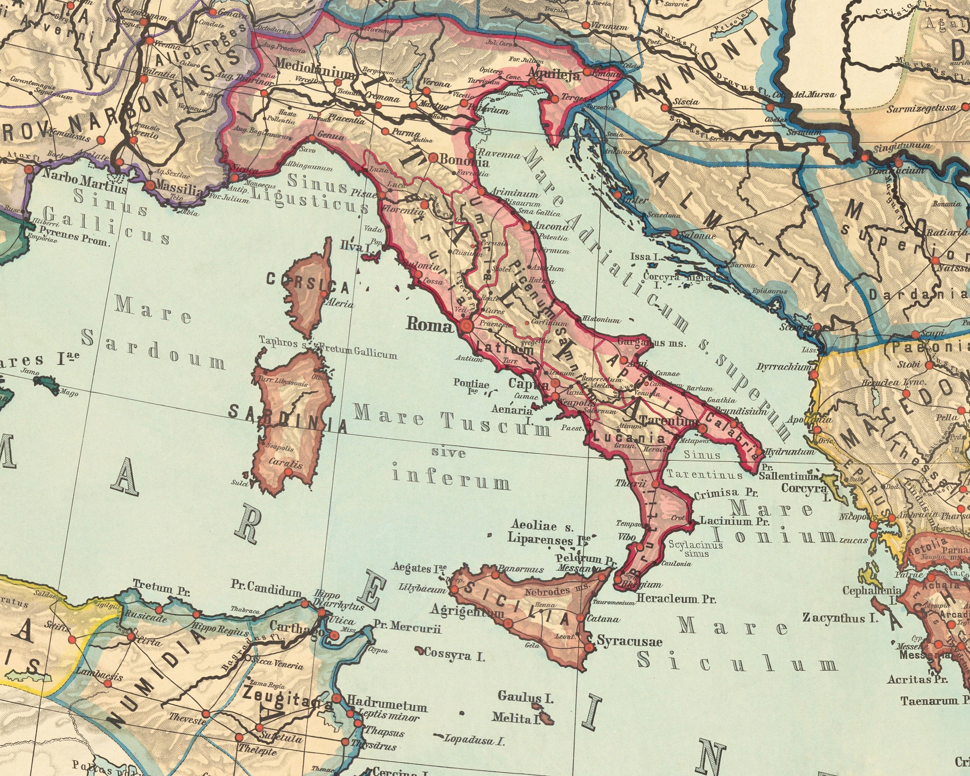
This exquisite map created by Albert Von Kampen charts over 500 years history from the fledging Roman Empire in 266 BCE until the close of Emperor Diocletian's reign in 305 CE. Truly one of the most powerful Empires of ancient times the Roman Empire encompassed much of modern day Europe and at its height included territories in Northern Africa and the lands of Meospotamia and Babylonia in Asia. It is commonly held that the Empire ruled over 55-65 million people at its peak - a quite remarkable feat.
The map itself was originally divided into 12 wooden pieces secured onto a cloth backing. I have faithfully recreated the map to encompass its full glory and to repair damaged and discoloured sections of the original map. Von Kampen's map is a truly remarkable piece mixing a highly detailed map along with a subtle palette that is most pleasing to the eye.
This is a highly sought after work and is sure to form an interesting conversation piece to any living room. This piece would look stunning mounted (see framed edition) and comes ready trimmed to fit in popular sizes 16x12, 20x16, 24x20 and 30x24 inch frames