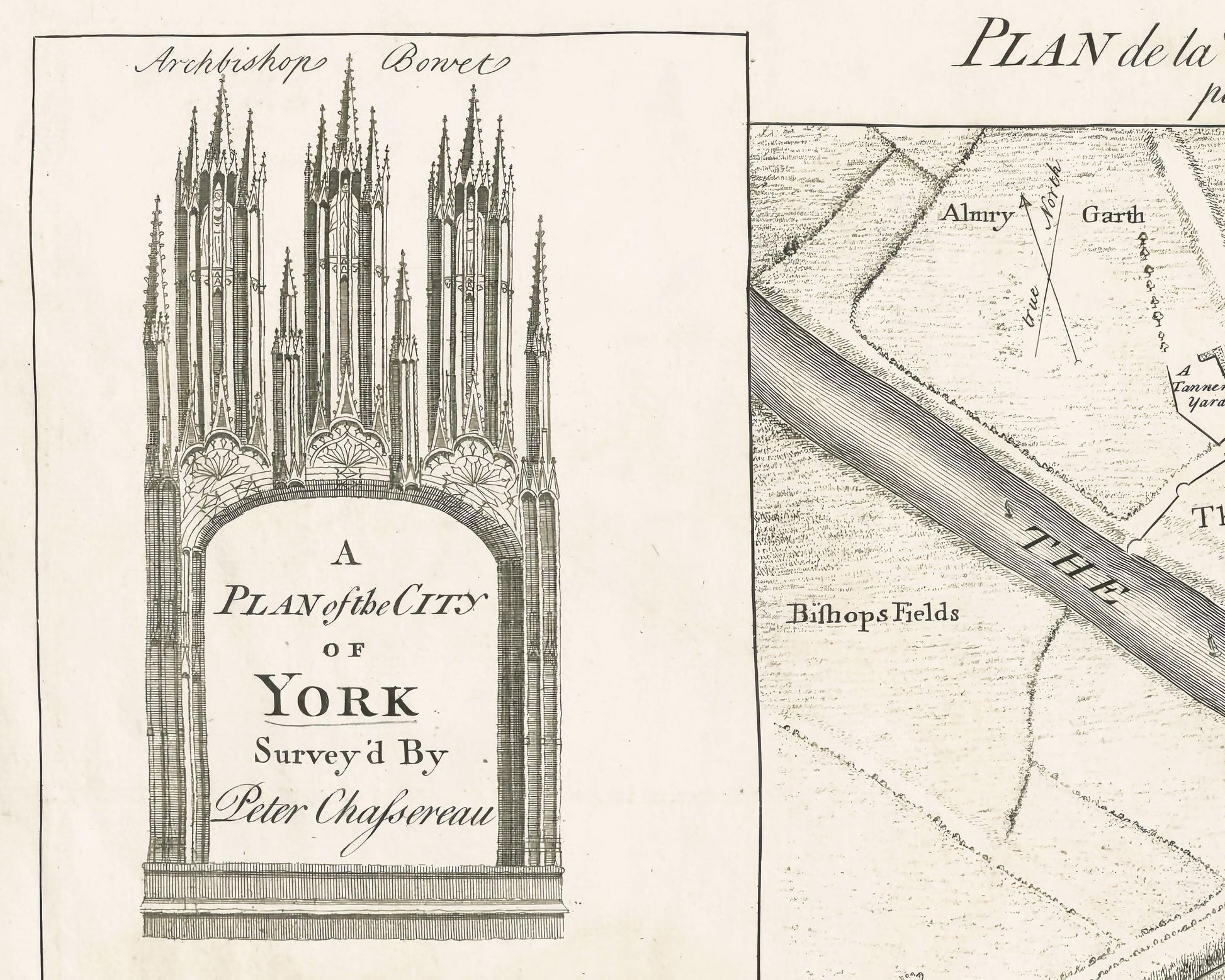
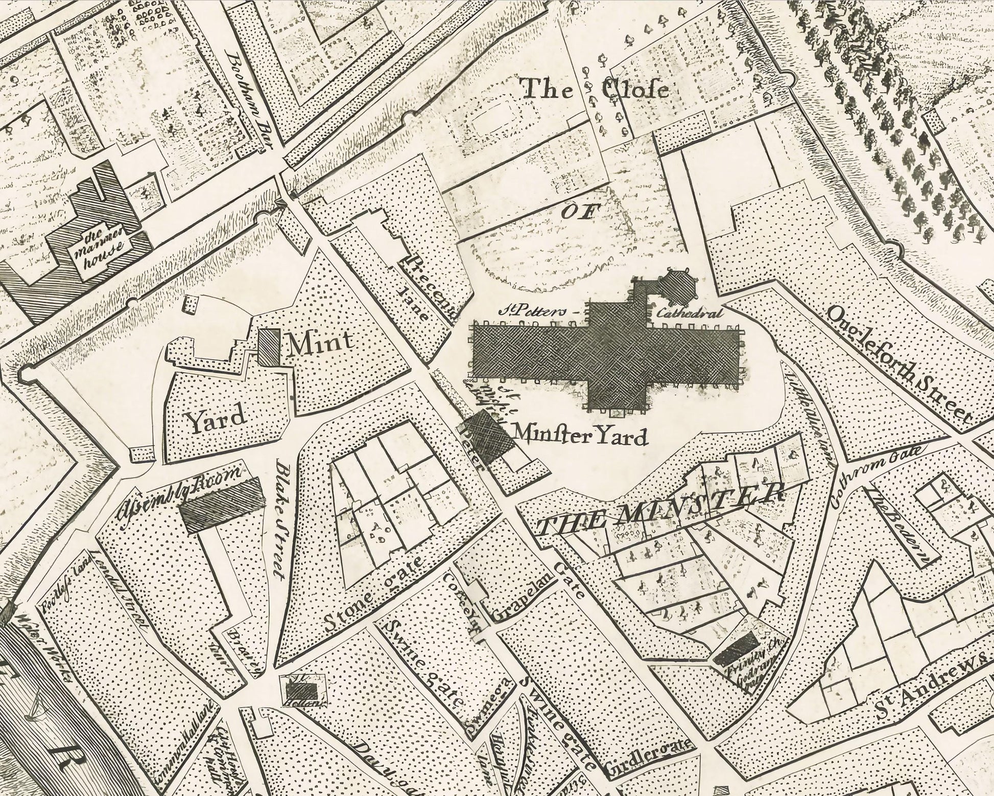
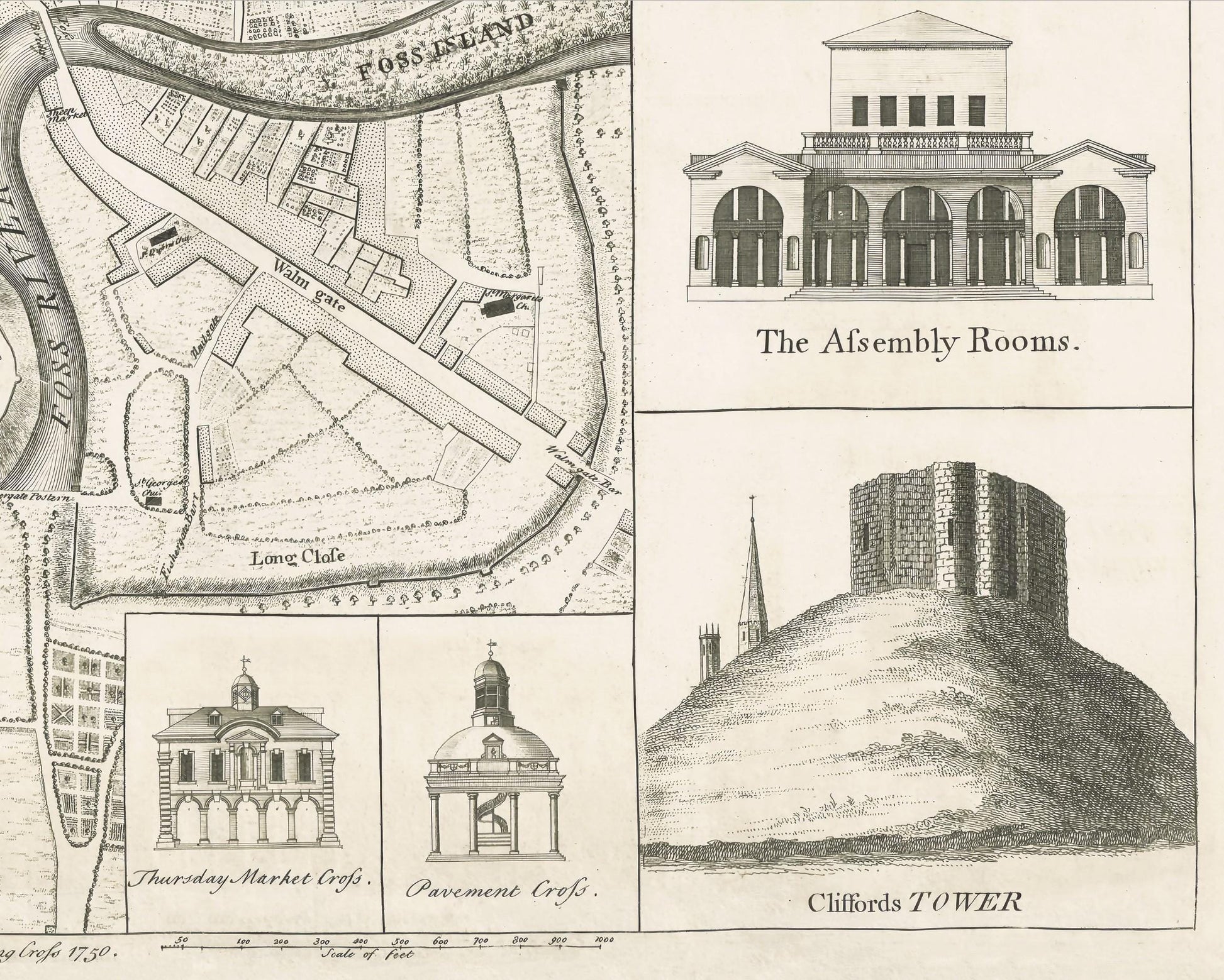
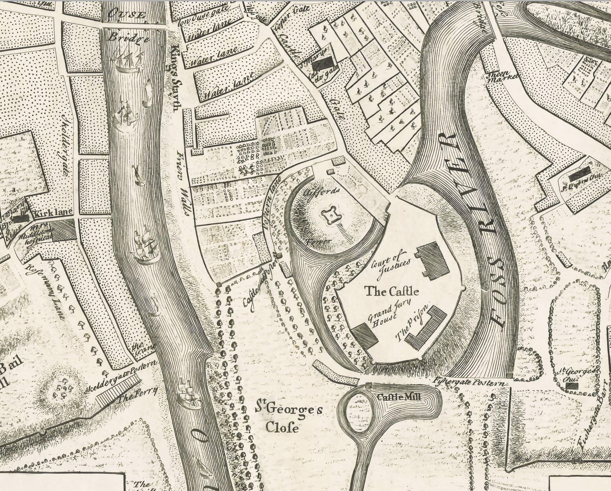
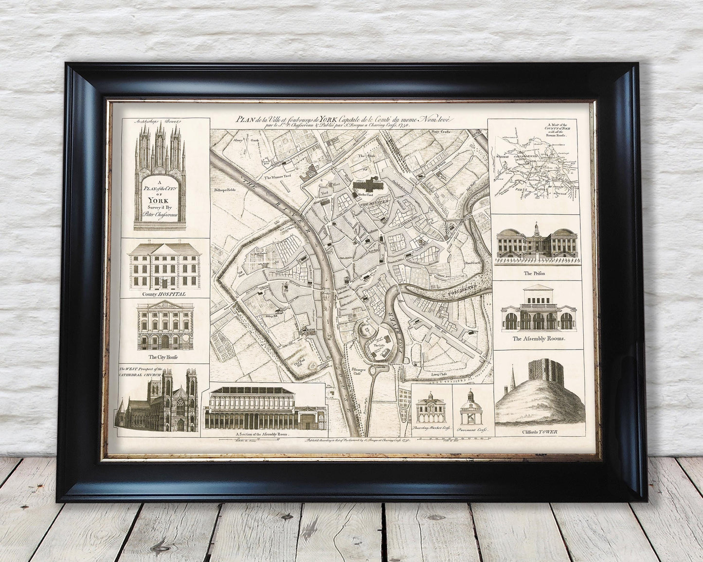
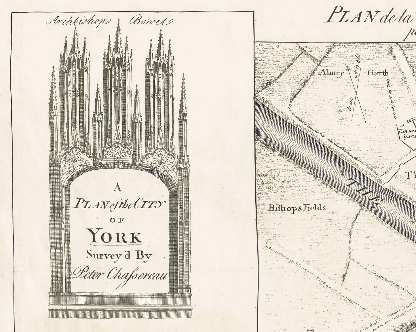
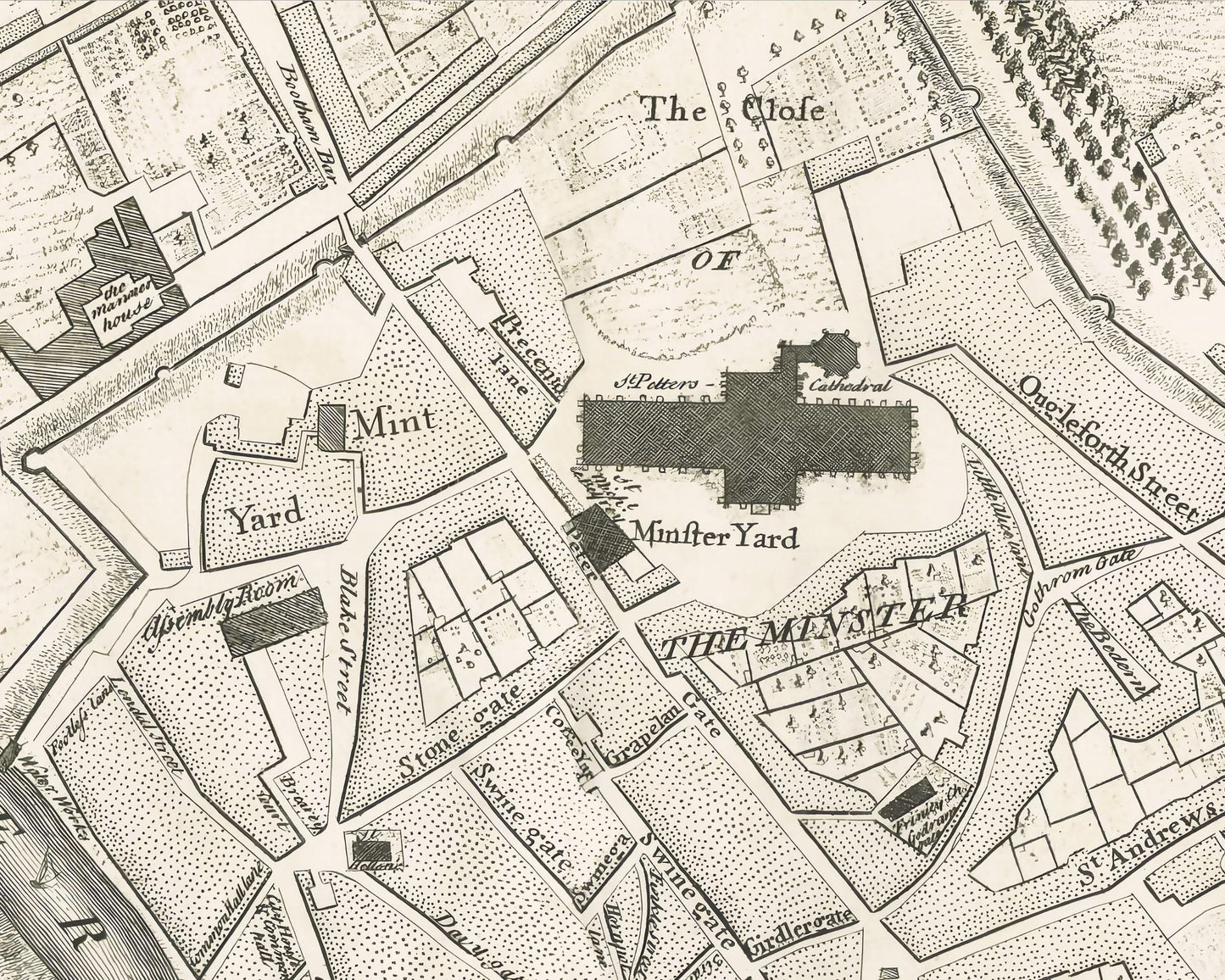
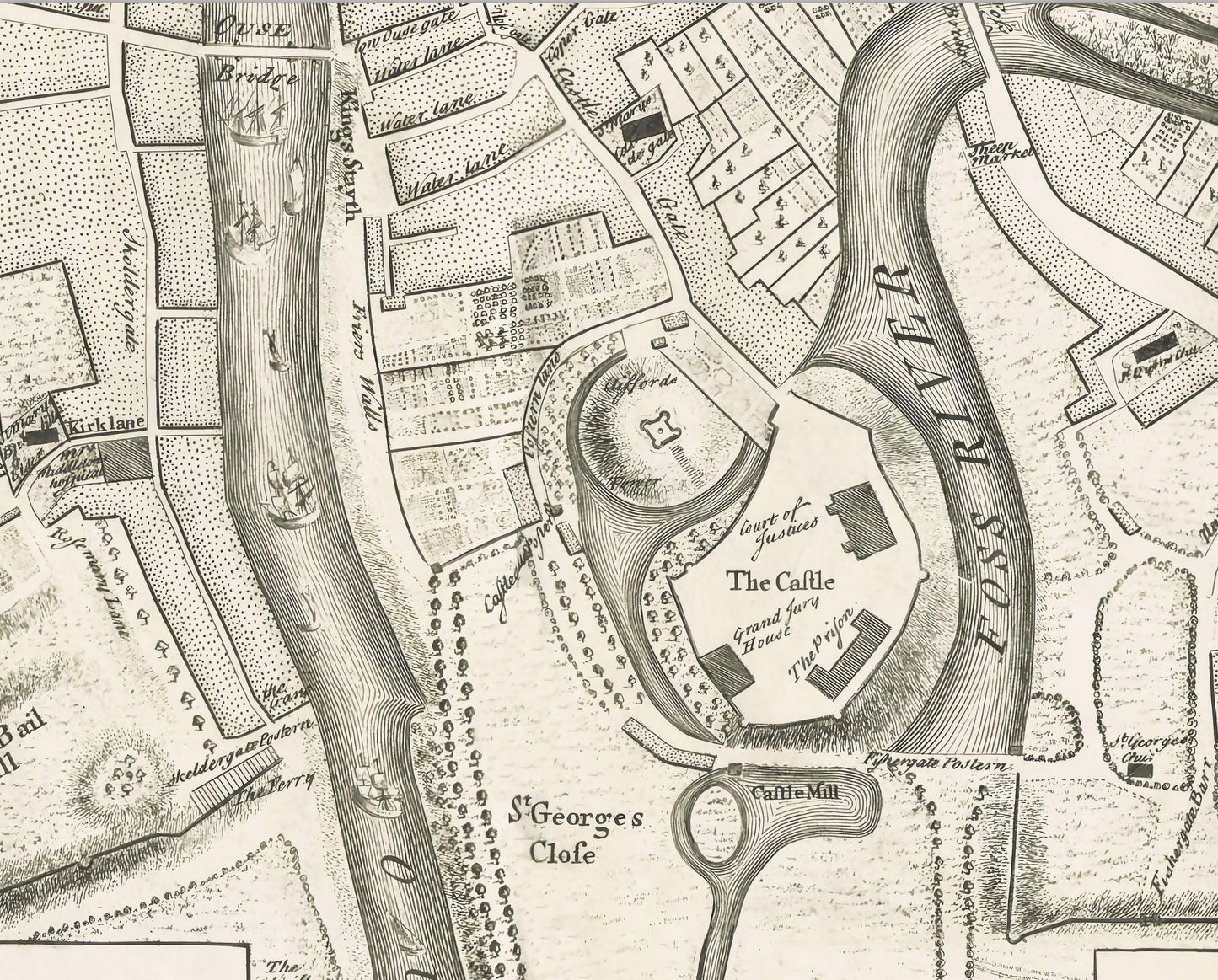
A large and detailed copper engraved plan of York, published by John Rocque in 1750 after a survey of Peter Chassereau. Surrounded by 10 inset view and one inset map. Showing the archbishop's bonet, the county hospital, the city house, the west prospect of the cathedral church, a section of the assembly room, the Thursday market cross, the pavement cross, the prison, the assembly rooms and Cliffords tower, and with an inset 'Map of the County of York with all the Roman roads'. At the bottom of the plate the address of Rocque: 'Publish'd according to Act of Parliament by J. Rocque at Charing Cross 1750.'
This rare work is highly sought-after work and is sure to form an interesting conversation piece to any living room. This piece looks stunning mounted as shown in our A2 framed edition.