
Classic Maps and Prints
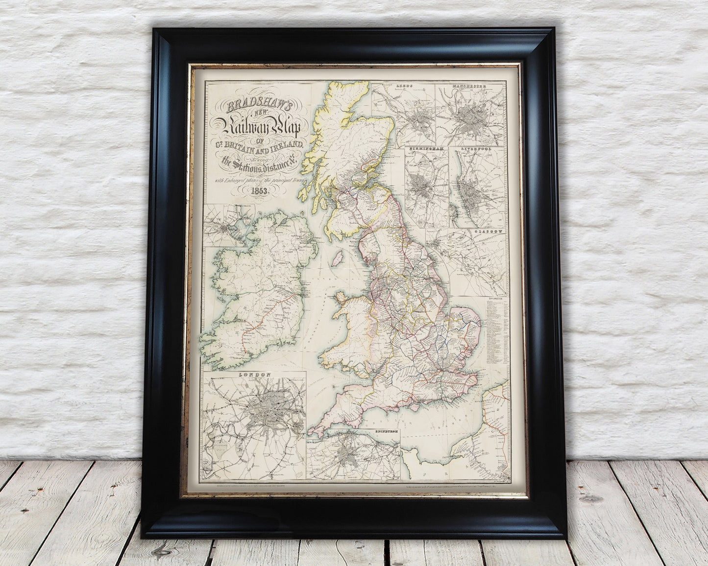
Rare Famous BRADSHAW'S RAILWAY Map 1853 restored reproduction
Rare Famous BRADSHAW'S RAILWAY Map 1853 restored reproduction
Couldn't load pickup availability
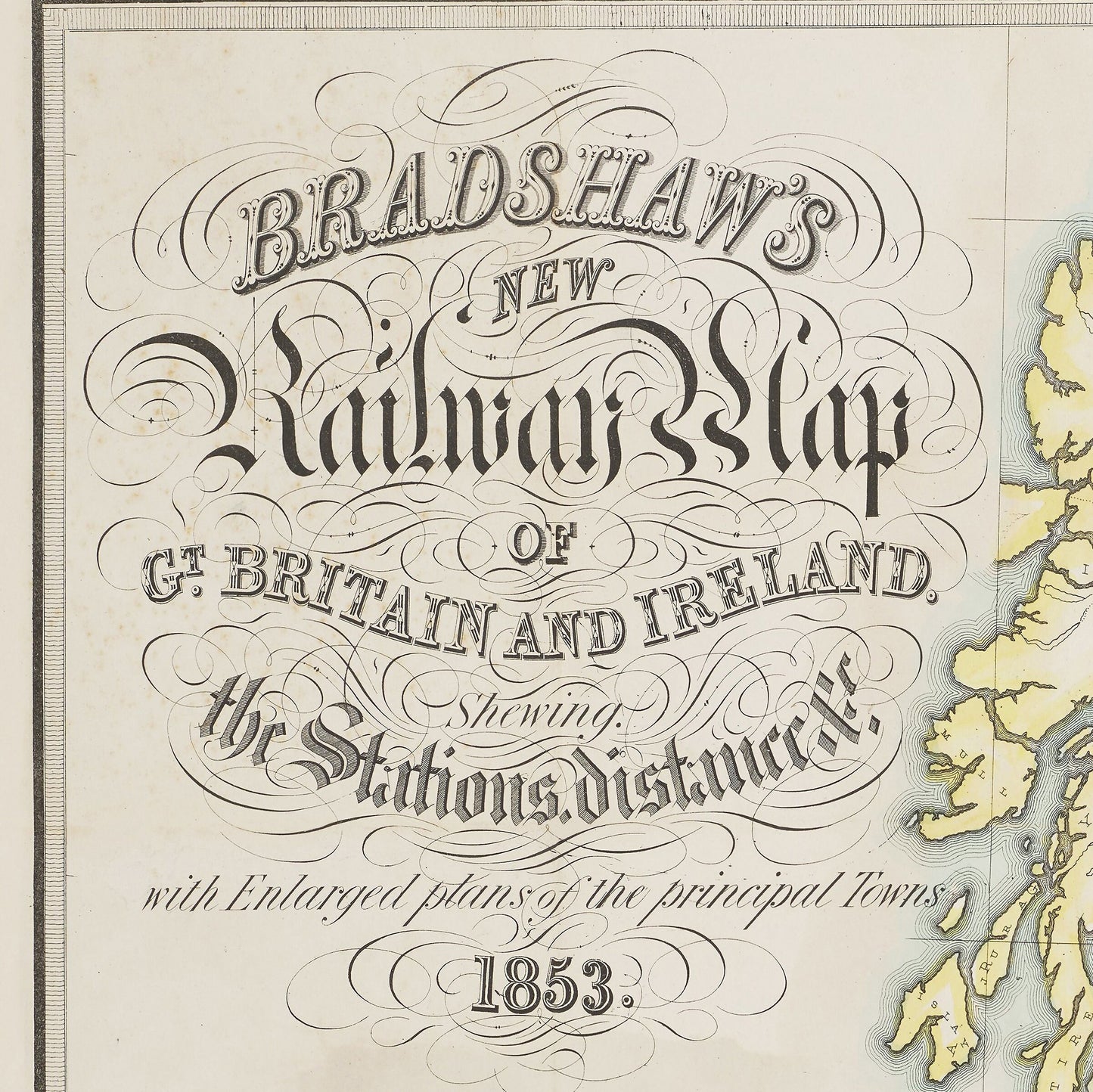
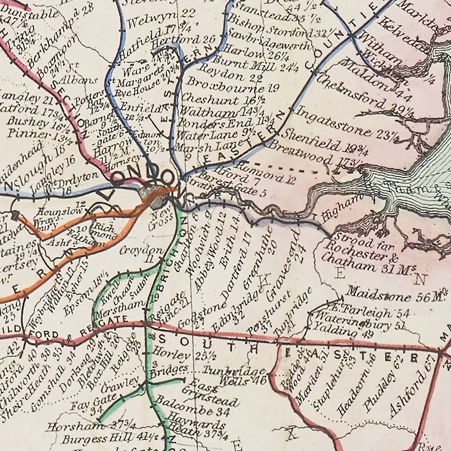
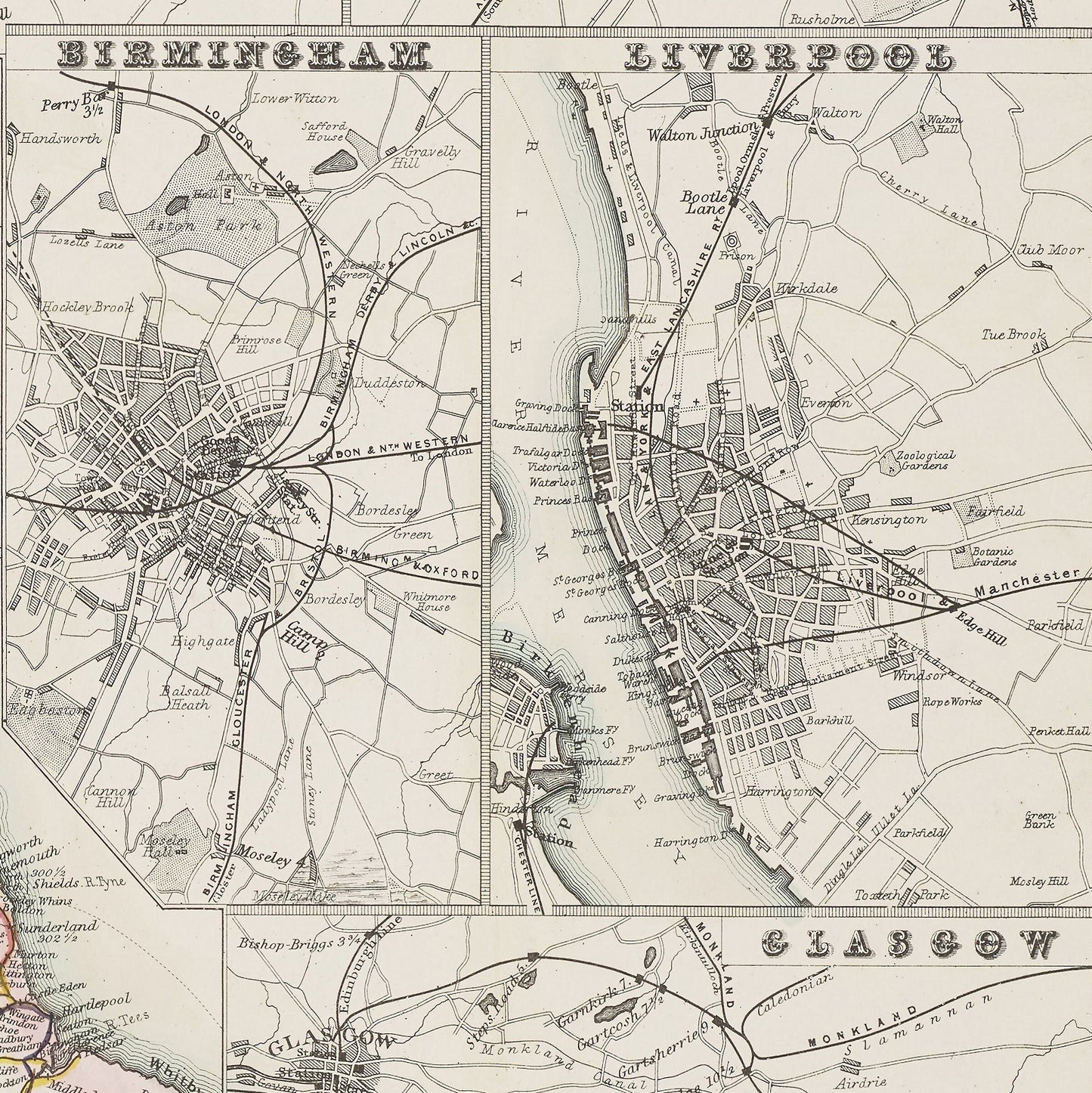
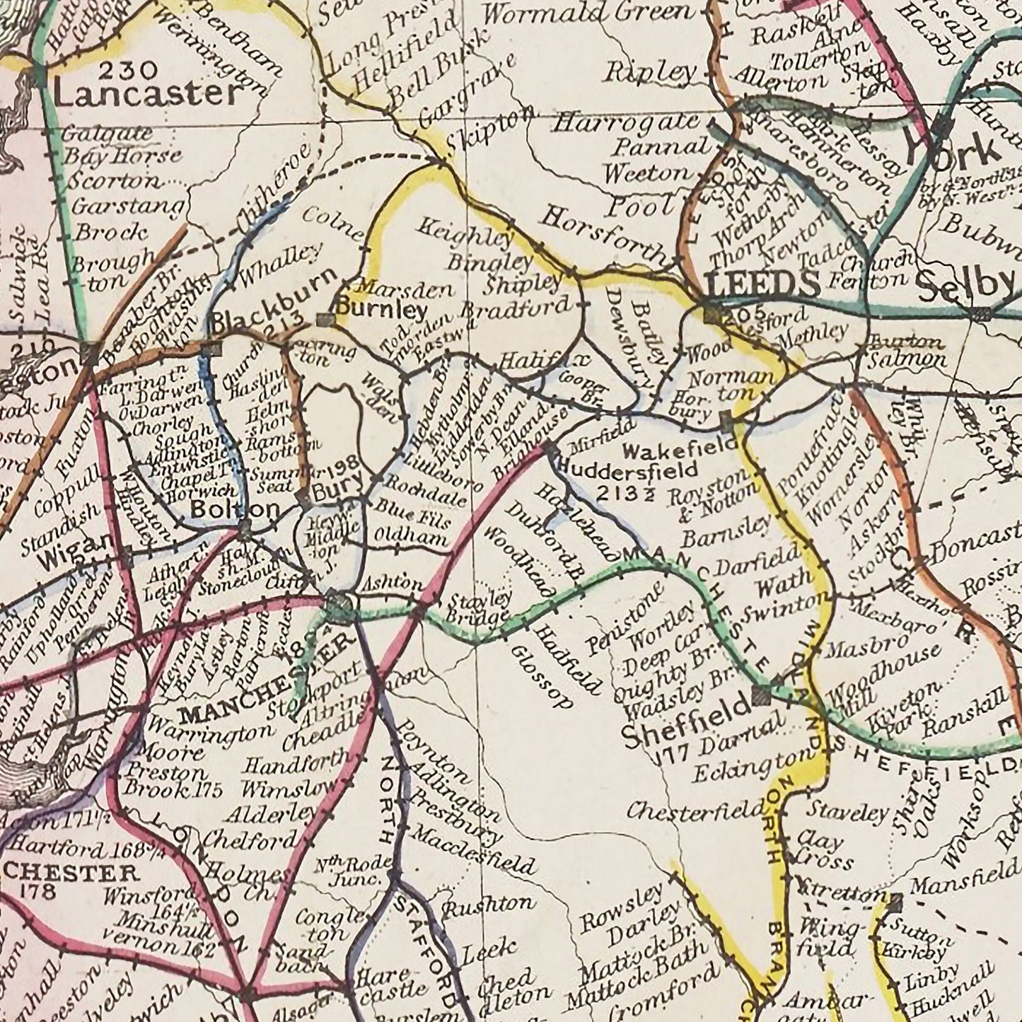
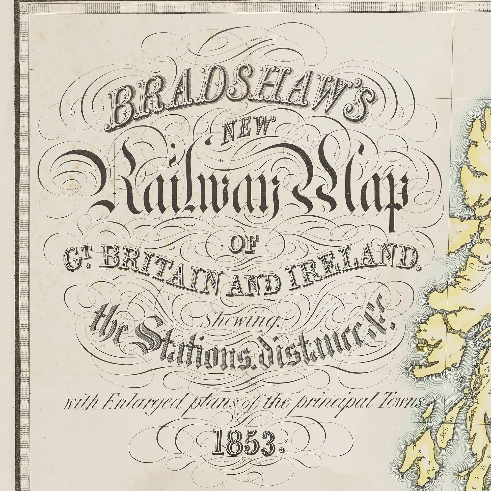
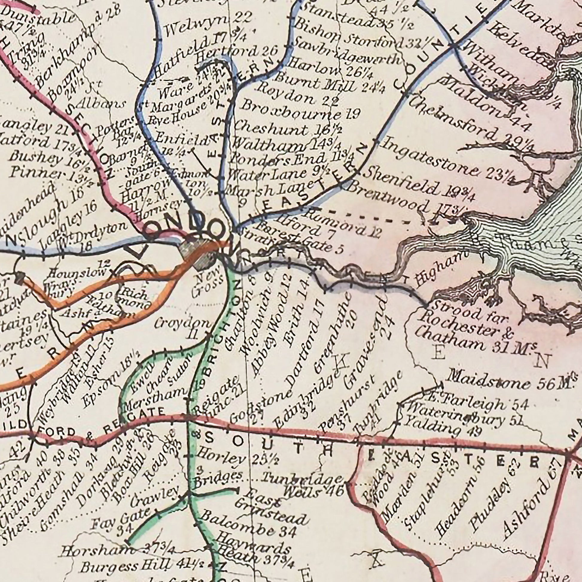
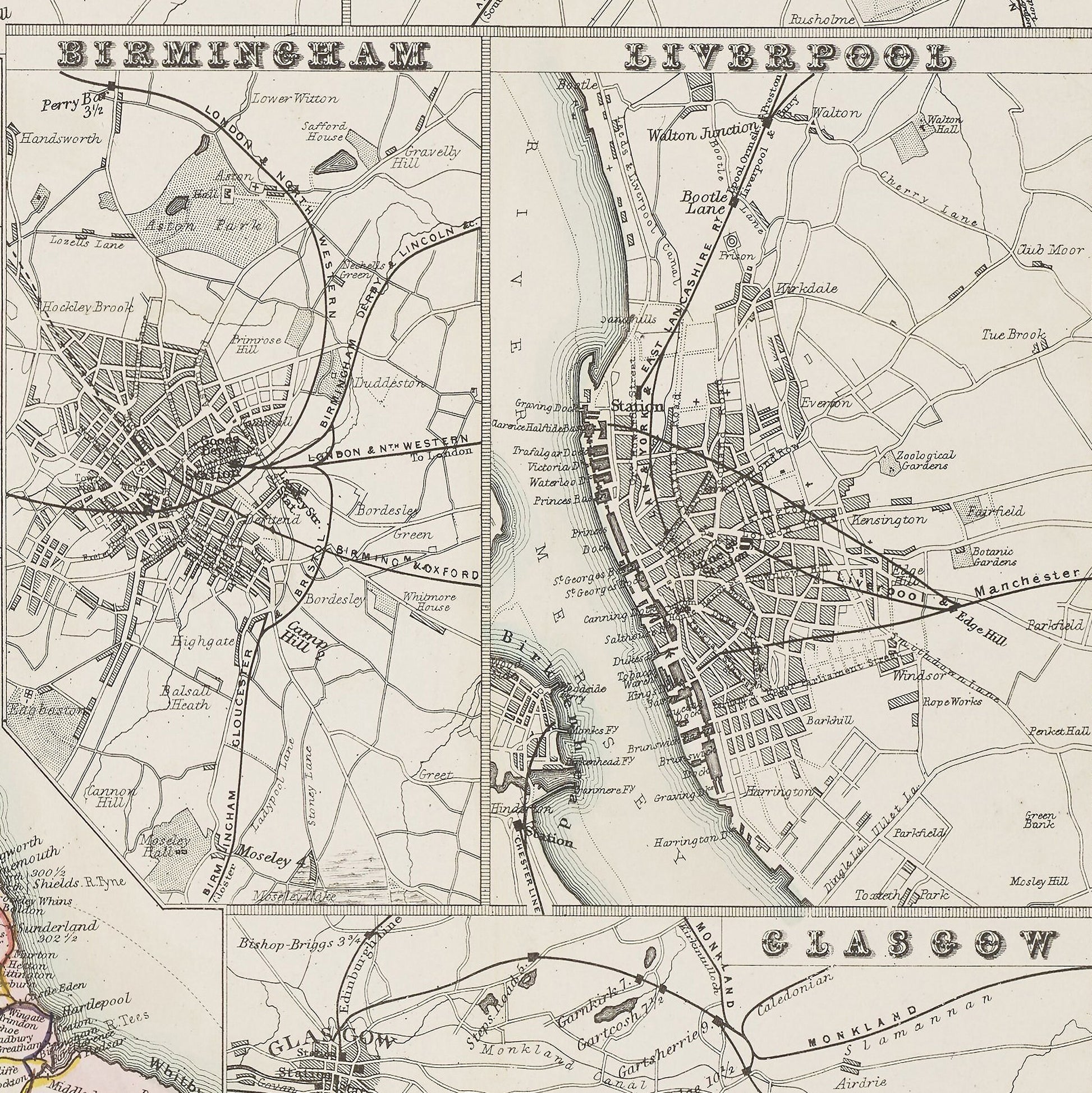
The name of George Bradshaw (1800-1853) is synonymous with the Great British Railway Journeys presented by Michael Portillo for it was Bradshaw who produced the early editions of Bradshaw's Guide, however Bradshaw was also a cartographer (mapmaker). To the railway hobbyist and aficionado Bradshaw's Railway Map represents the pinnacle of railway maps. The amount of detail crammed in to one map is quite staggering. The entire railway network of England, Ireland, Scotland and Wales as it stood in 1853 is comprehensively detailed - every line, every station. Mile markings from the capital cities are also shown - for English towns/cities miles from London, for Scottish towns/cities miles from Edinburgh etc. A total of 38 different lines are shown with a colour-coded key included. From ports mileage markers show the distances to various other destinations including New York and India. County and national borders are also delineated. Perhaps the crowning glory is the inclusion of 8 detailed mini-maps of town/city centres showing railway stations and track layouts - these include London, Edinburgh, Birmingham, Glasgow, Manchester, Leeds, Liverpool and Dublin. The final treasure is a wonderful calligraphic title of "Bradshaw's New Railways Map of Great Britain and Ireland shewing the stations distance with Enlarged plans of the principal Towns".
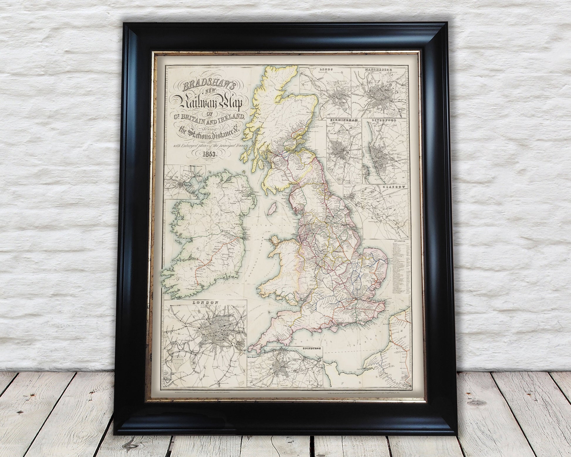
This map is highly sort after and is an ideal gift for any rail enthusiast. This piece looks absolutely stunning framed and we do have a 20"x16" framed print available for purchase.
Share