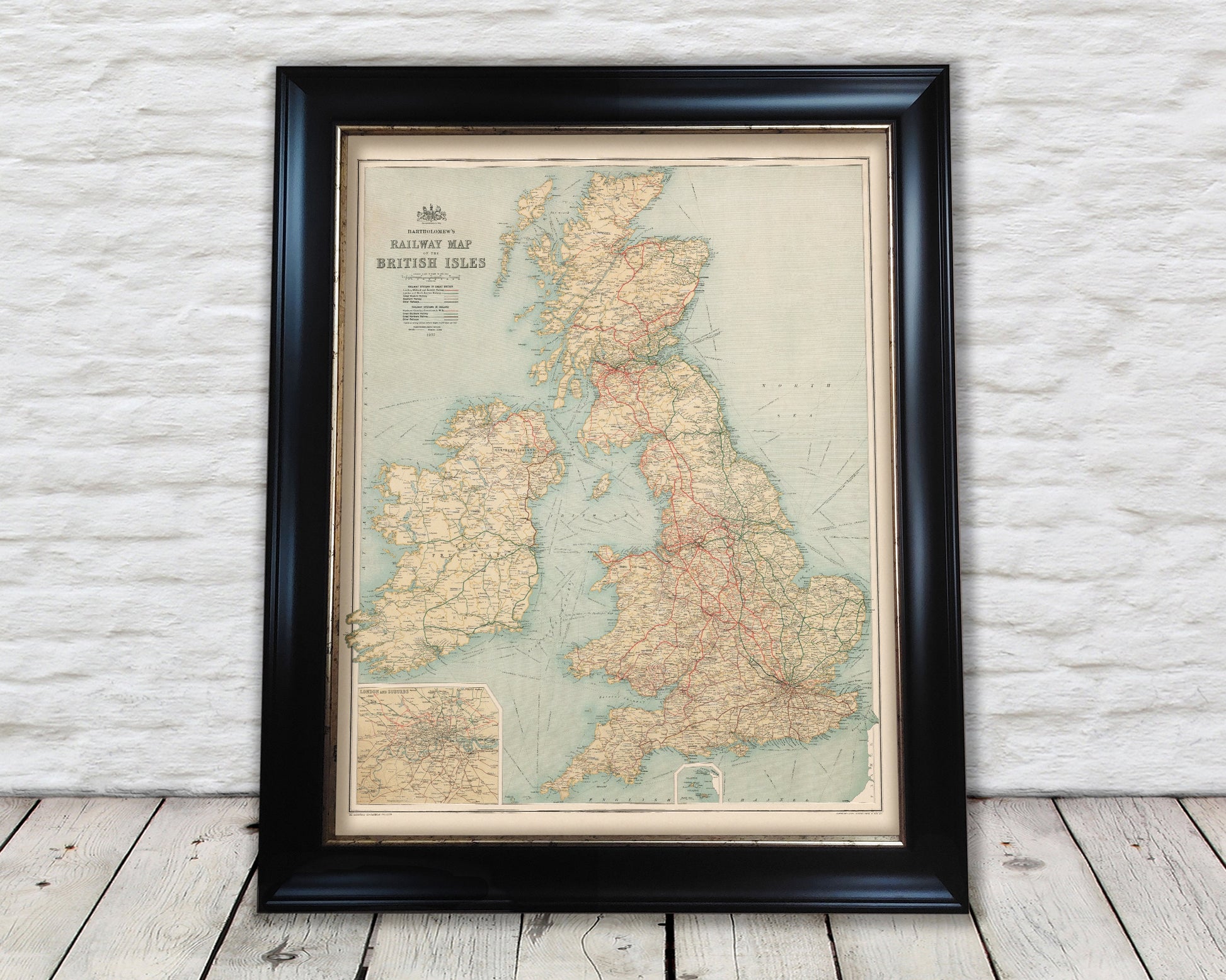
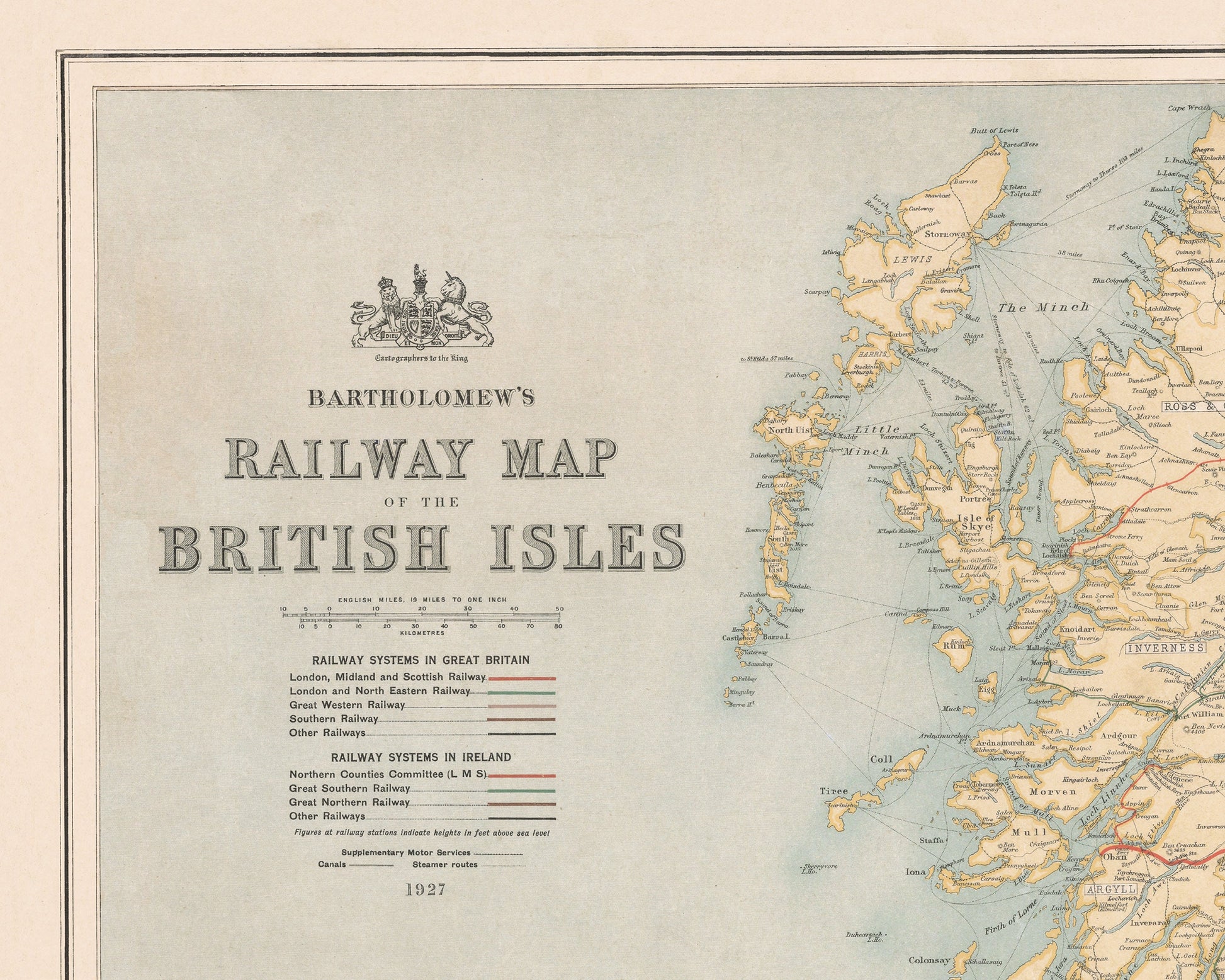
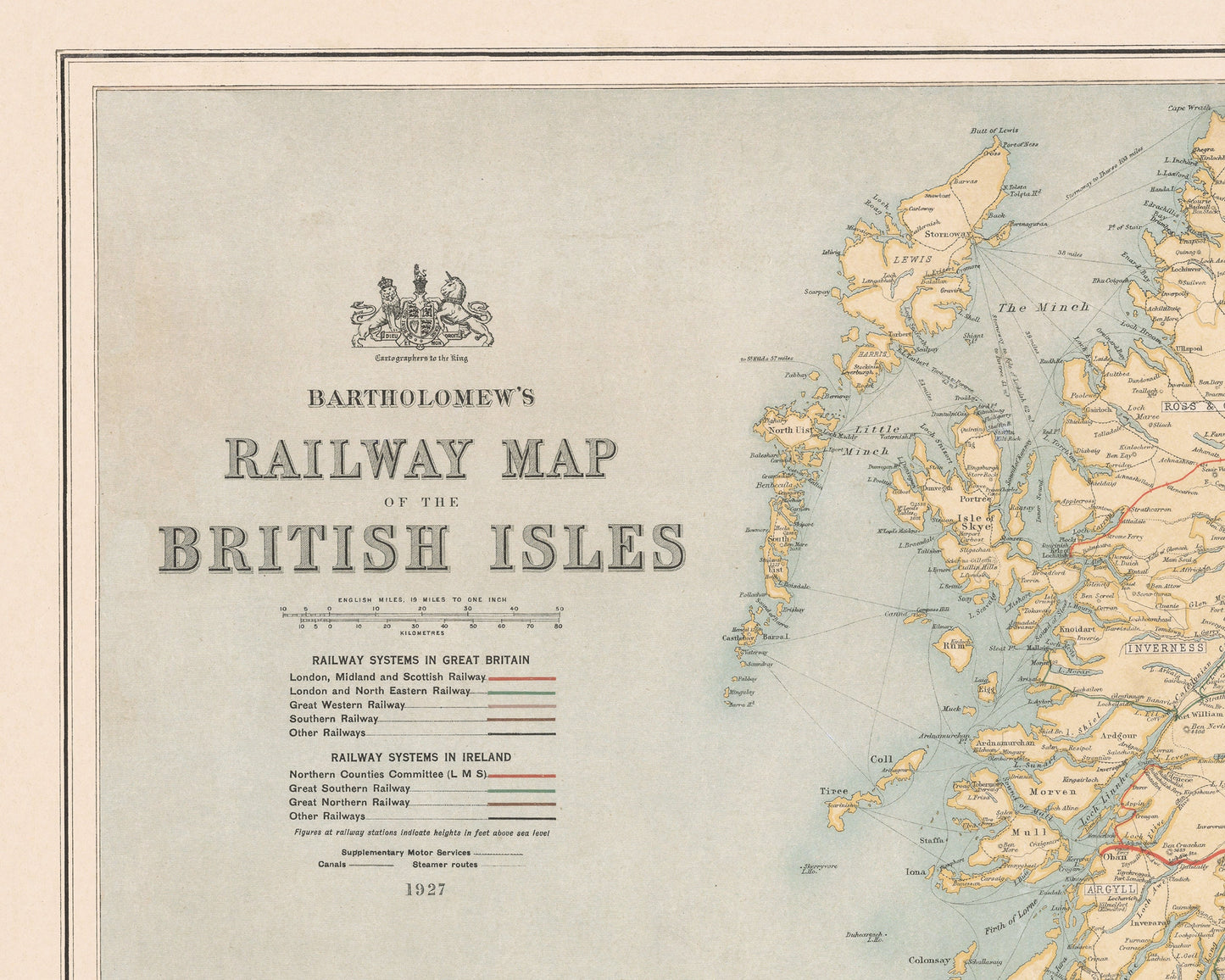
The Bartholomew's Railway map was one of the first created after the foundation of the 'Big Four' railway companies in 1923. The culmination of the 1921 Railways Act saw the creation of Great Western Railway (GWR), London, Midland and Scottish Railway (LMS), London and North Eastern Railway (LNER) and Southern Railways (SR).
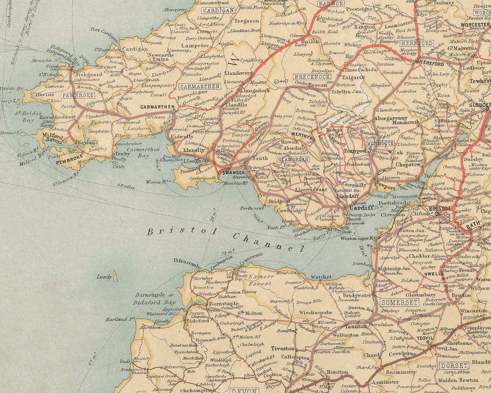
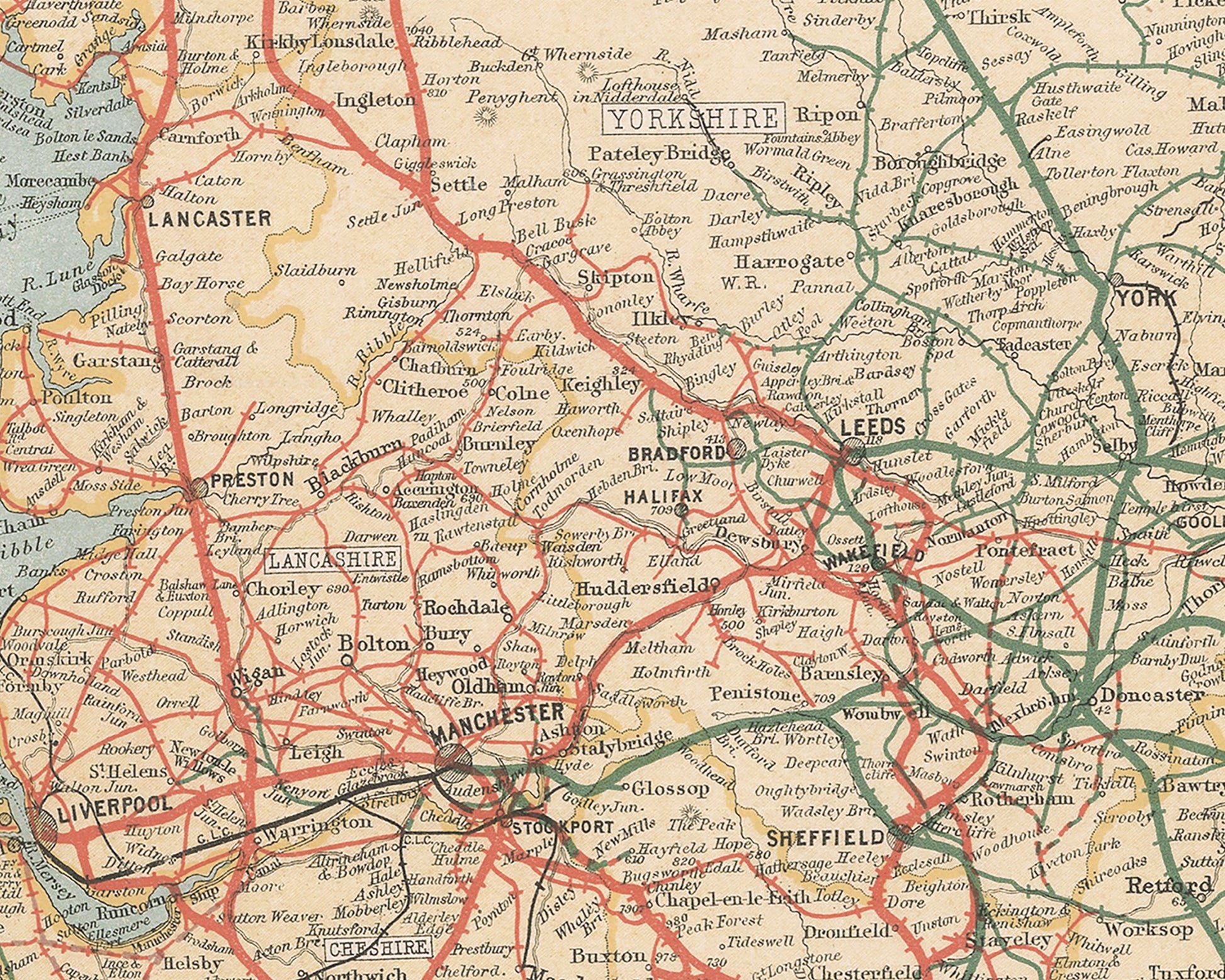
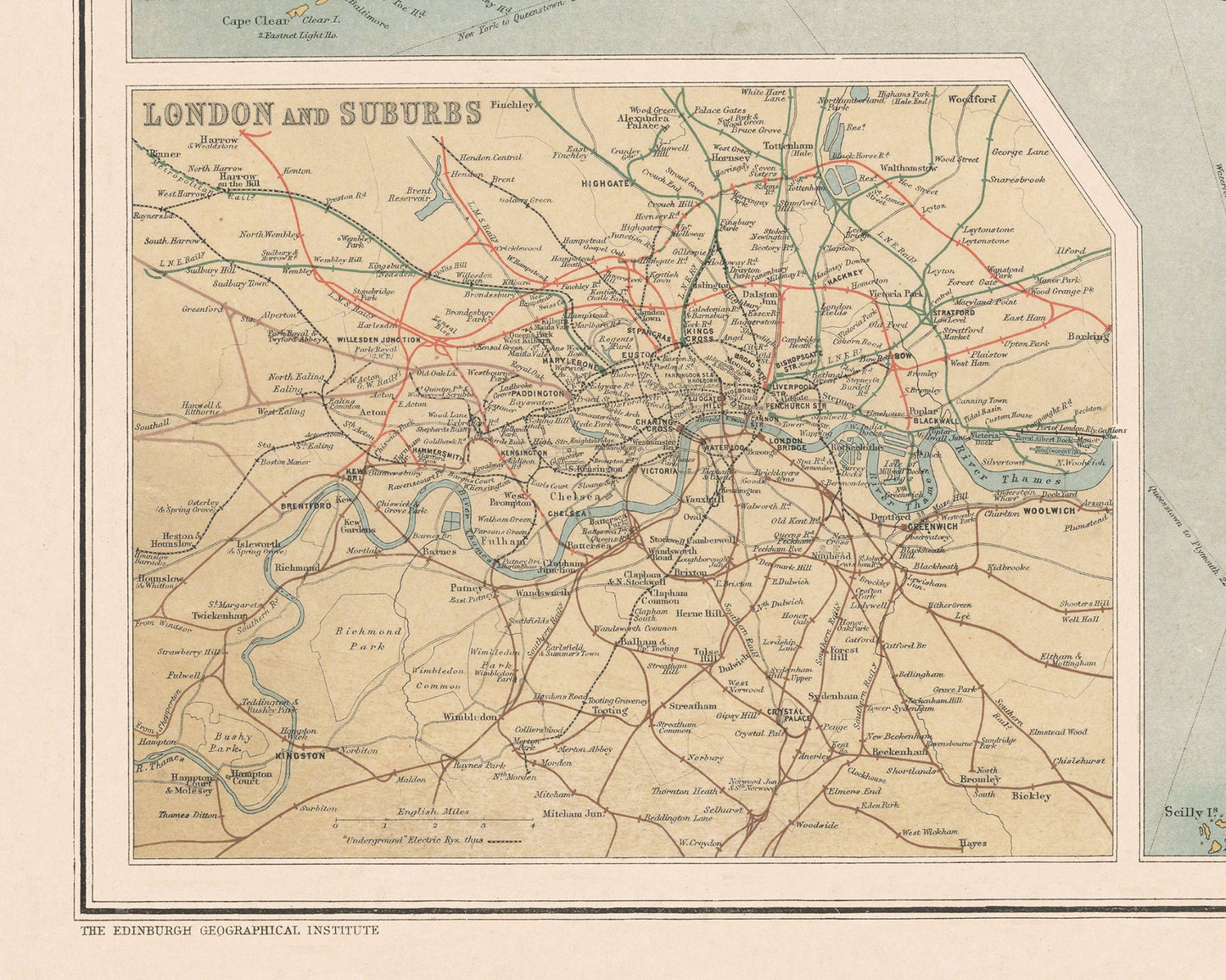
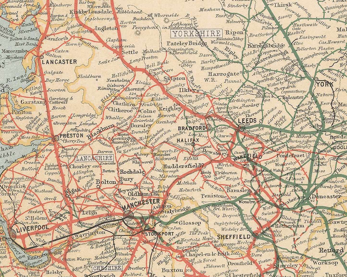
Our reworking of this superb map shows all railway lines within the British Isles and gives a great visual representation of which companies ran which lines and in which areas. There is an accompanying key. Also there is a fantastic zoomed in inset map of London and Suburbs network. Many sea routes are shown with the corresponding miles of the crossings noted.
This is a rare and highly detailed map of one of the most important times in railway history. This new system continued until the formation of the nationalised British Railways in 1948.
This is real gold for any railway enthusiast and is much sought after!!
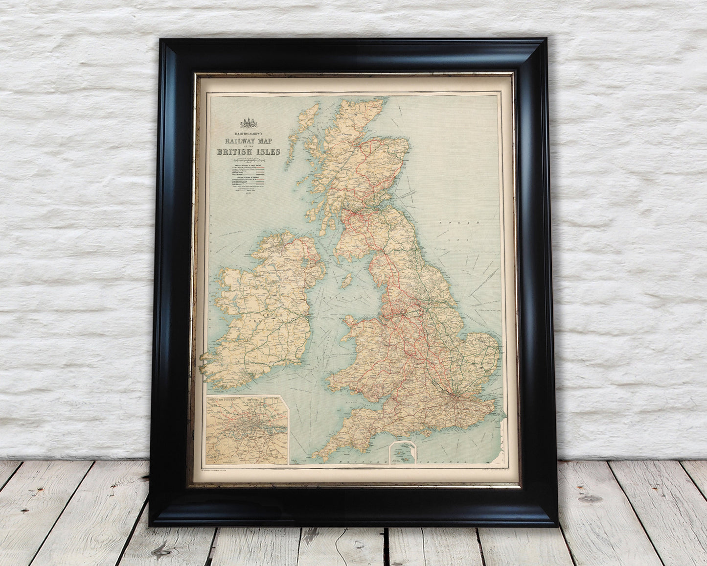
***Please note that this map does not come with a frame - images are for illustration purposes only