Classic Maps and Prints
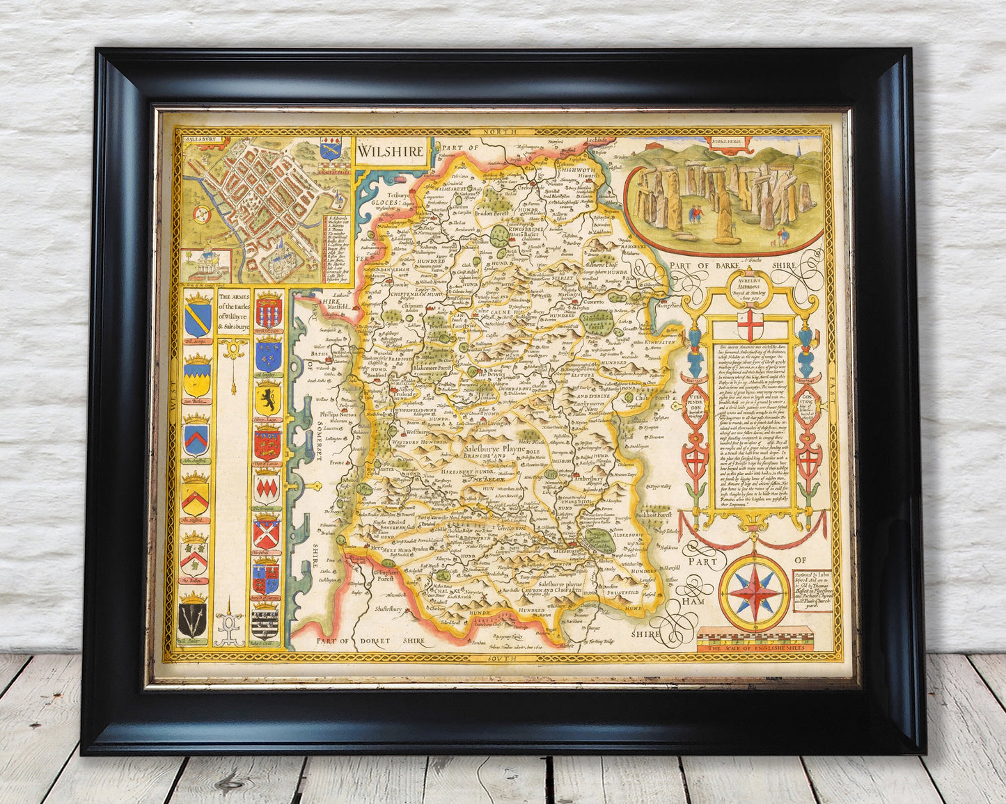
Old WILTSHIRE Map John Speed 1676 Salisbury Stonehenge Swindon
Old WILTSHIRE Map John Speed 1676 Salisbury Stonehenge Swindon
Couldn't load pickup availability
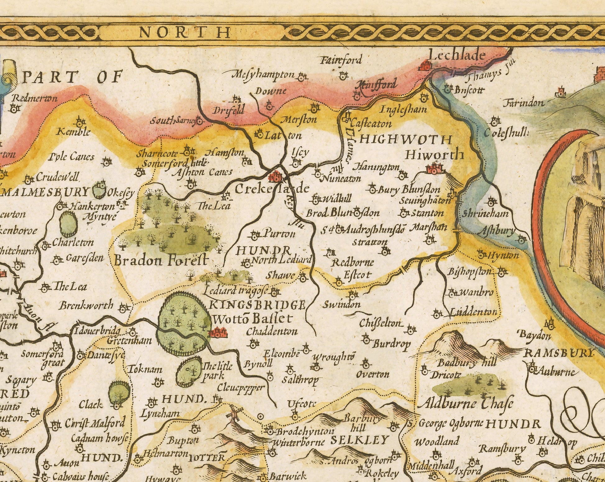
This classic piece was produced by John Speed the best known mapmaker of the Stuart period. It is a wonderful example of a decorative county map that was produced over 400 years since. This is an antique reproduction of the original hand coloured map and therefore each original map is in itself unique.
Of Wiltshire Speed stated:
The great wealth of Wiltshire rested not in its carefully maintained woods and its ploughlands, but
in the desolate and windswept plains and downs, devoid of trees, thin of soil and scarce of habitation, yet capable of sustaining 'an infinite number of sheep, whose fleeces and flesh bring in an yearly revenue to their owners'. The wool produced by the graziers was turned into cloth by weavers living in numerous
small towns situated by the fast-flowing rivers, whose water-power was put to such good use in preparing the wool and in its weaving, making Wiltshire one of the most heavily industrialized counties in early-seventeenth-century England.
This full colour antique reproduction would look stunning when mounted and would form a striking centrepiece to any room.
This would make a wonderful gift for someone from Wiltshire or who has Wiltshire in their heart.
Features:
-------------
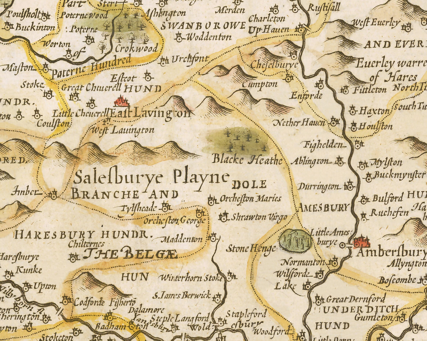
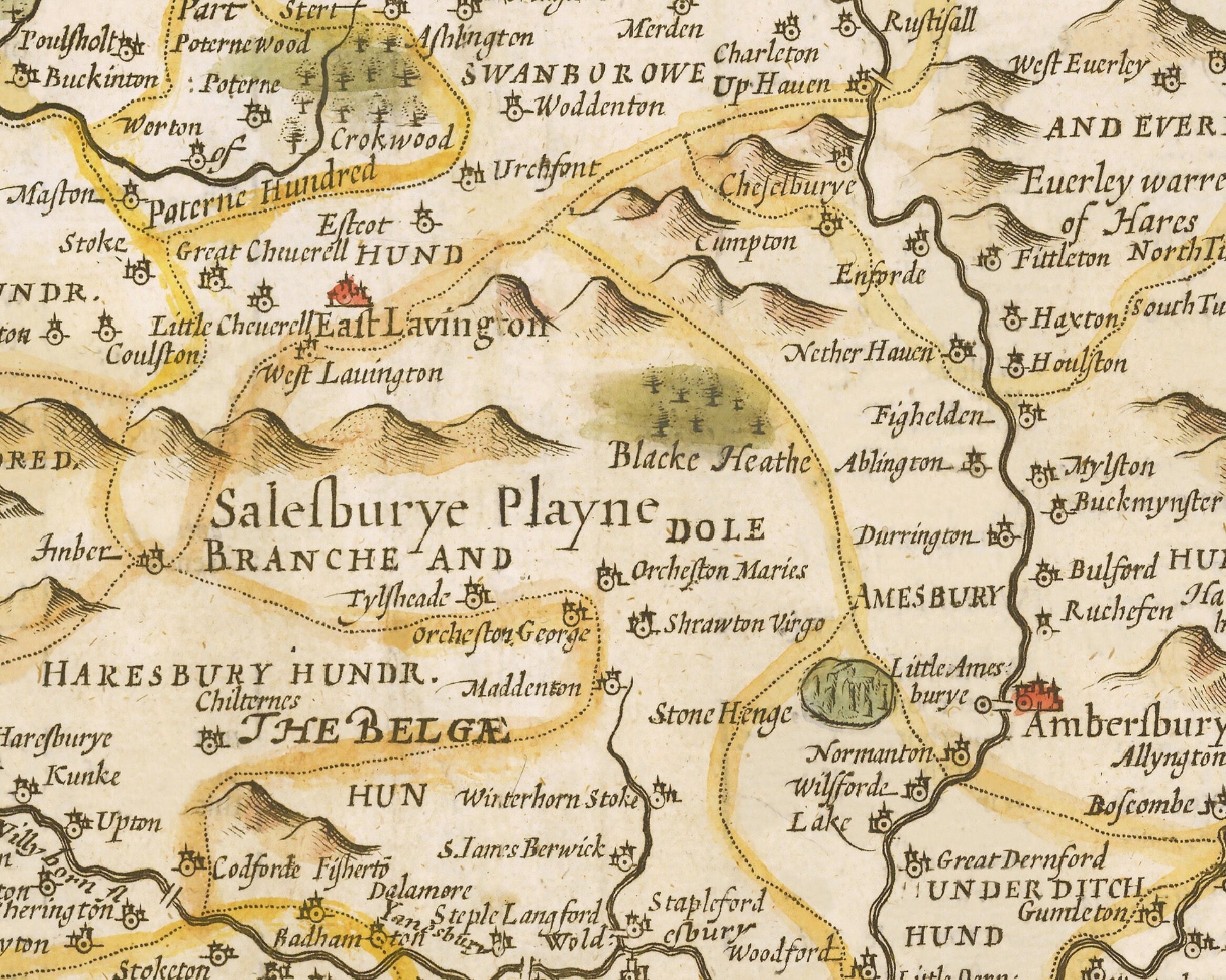
• A visually beautiful stunning and detailed map of 17th century Wiltshire which including rivers, wooded areas, place names and hill ranges
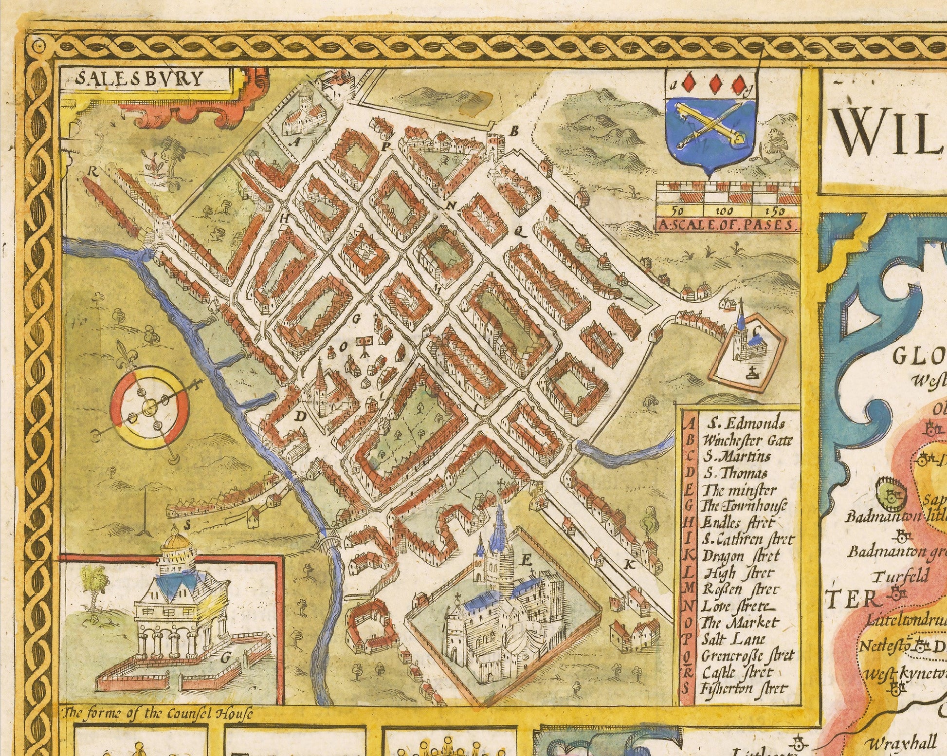
• A superb inset map of the county town of Salisbury including an index of places of interest
• Twelve Coats of Arms are depicted of nobility linked with the Salisbury and Wiltshire area
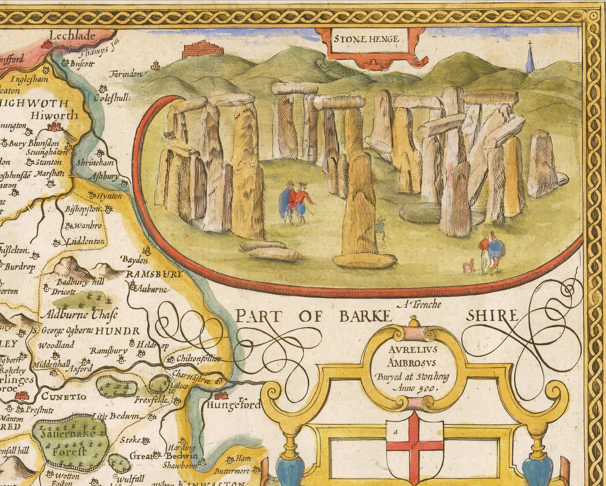
• A superb vignette of Stonehenge
• All offset with a lovely decorative border
Share