
Classic Maps and Prints
Old SUSSEX map John Speed 1611 Brighton Worthing Eastbourne Crawley
Old SUSSEX map John Speed 1611 Brighton Worthing Eastbourne Crawley
Couldn't load pickup availability
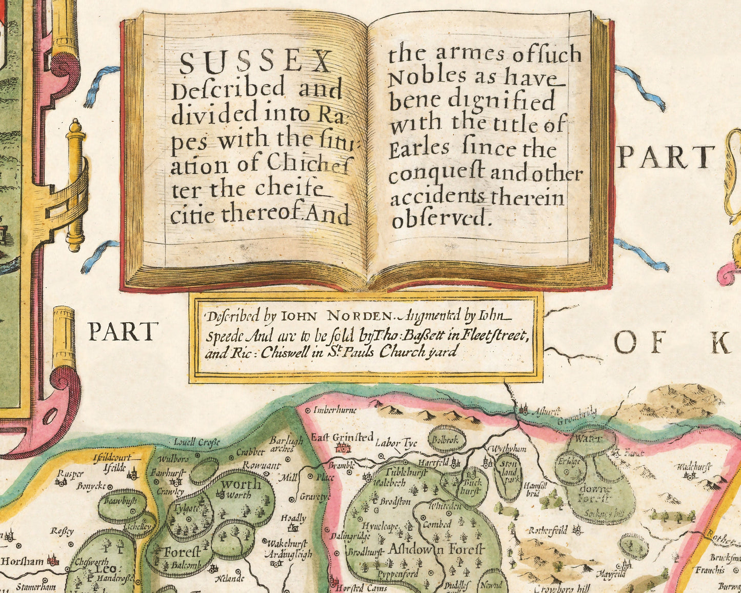
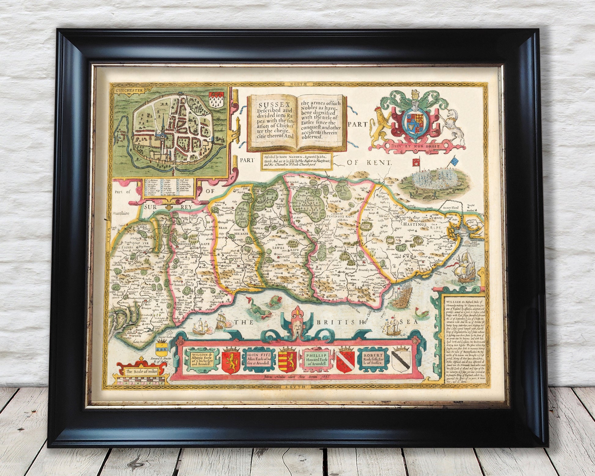
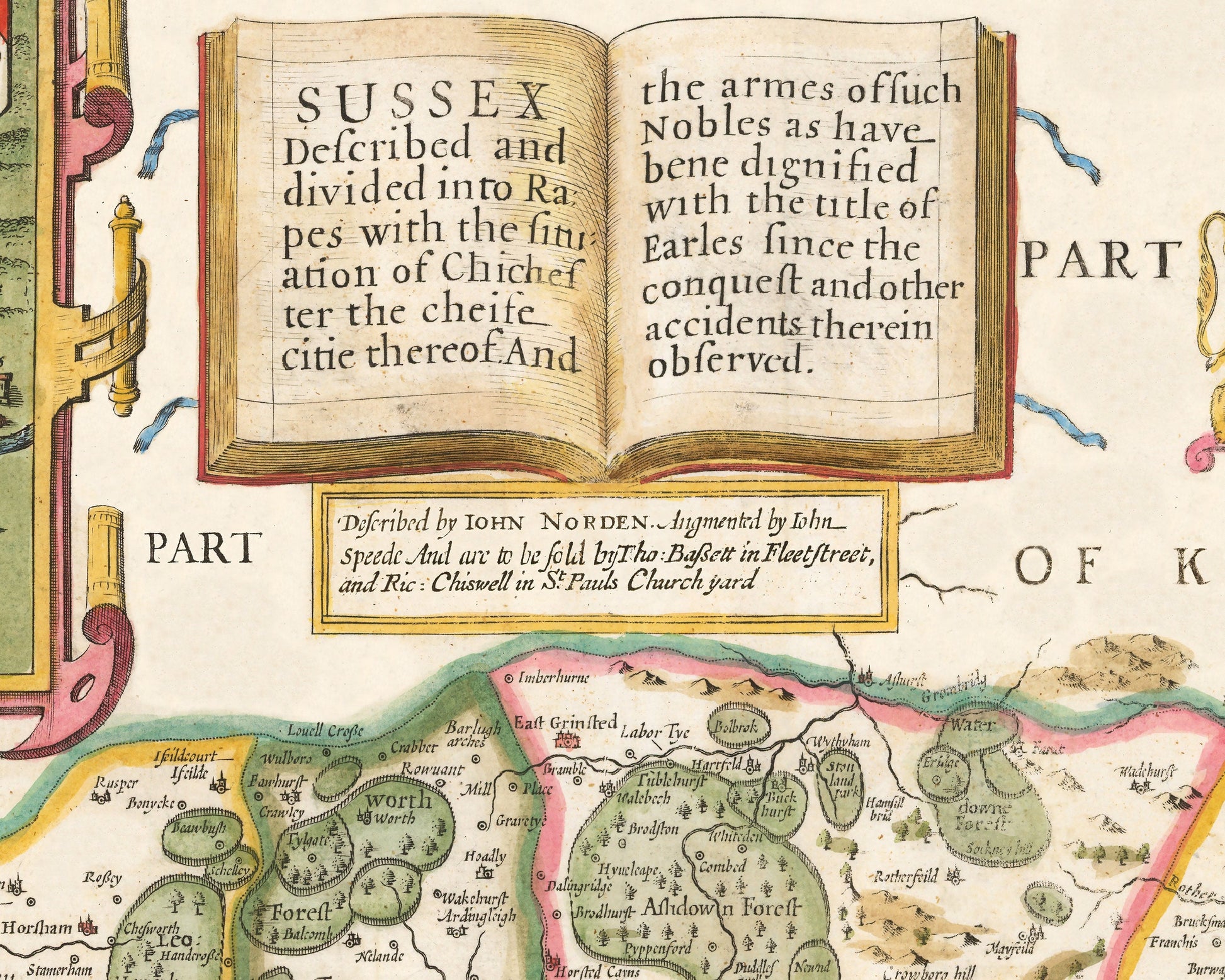
This classic piece was produced by John Speed the best known mapmaker of the Stuart period. It is a wonderful example of a decorative county map that was produced over 400 years since. This is an antique reproduction of the original hand coloured map and therefore each original map is in itself unique.
The Counties of Britain: A Tudor Atlas had the following to say of Sussex. "The absence of good roads going northwards into Surrey and Kent meant that despite its geographical closeness to London, Sussex was a curiously isolated and somewhat introverted county in the early seventeenth century. The English Channel was still an excellent fishing ground, but the nature of the Sussex coast with few harbours and anchorages prevented the full exploitation of this asset, and what was caught was intended for local consumption only".
This is a highly sought after work and is sure to form an interesting conversation piece to any living room. This piece looks stunning mounted - see our framed edition!
Features:
-------------
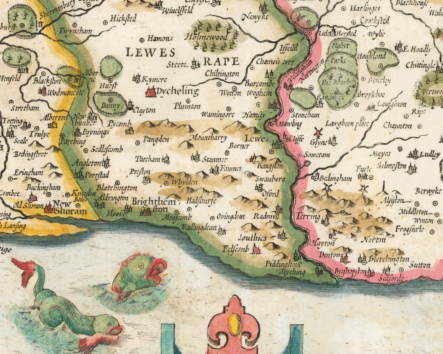
• A detailed geography of the hills, rivers and forests of Sussex from the early 17th century
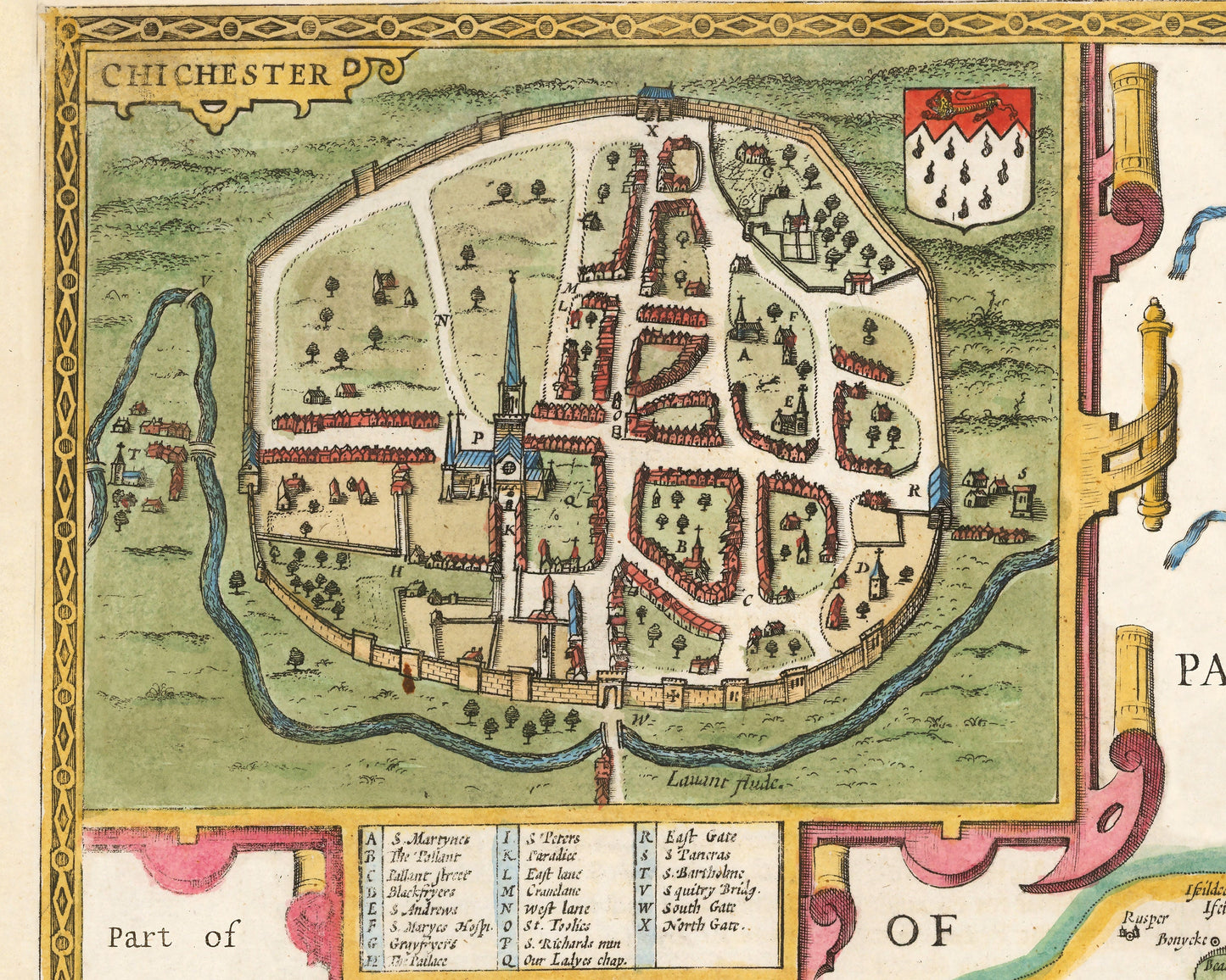
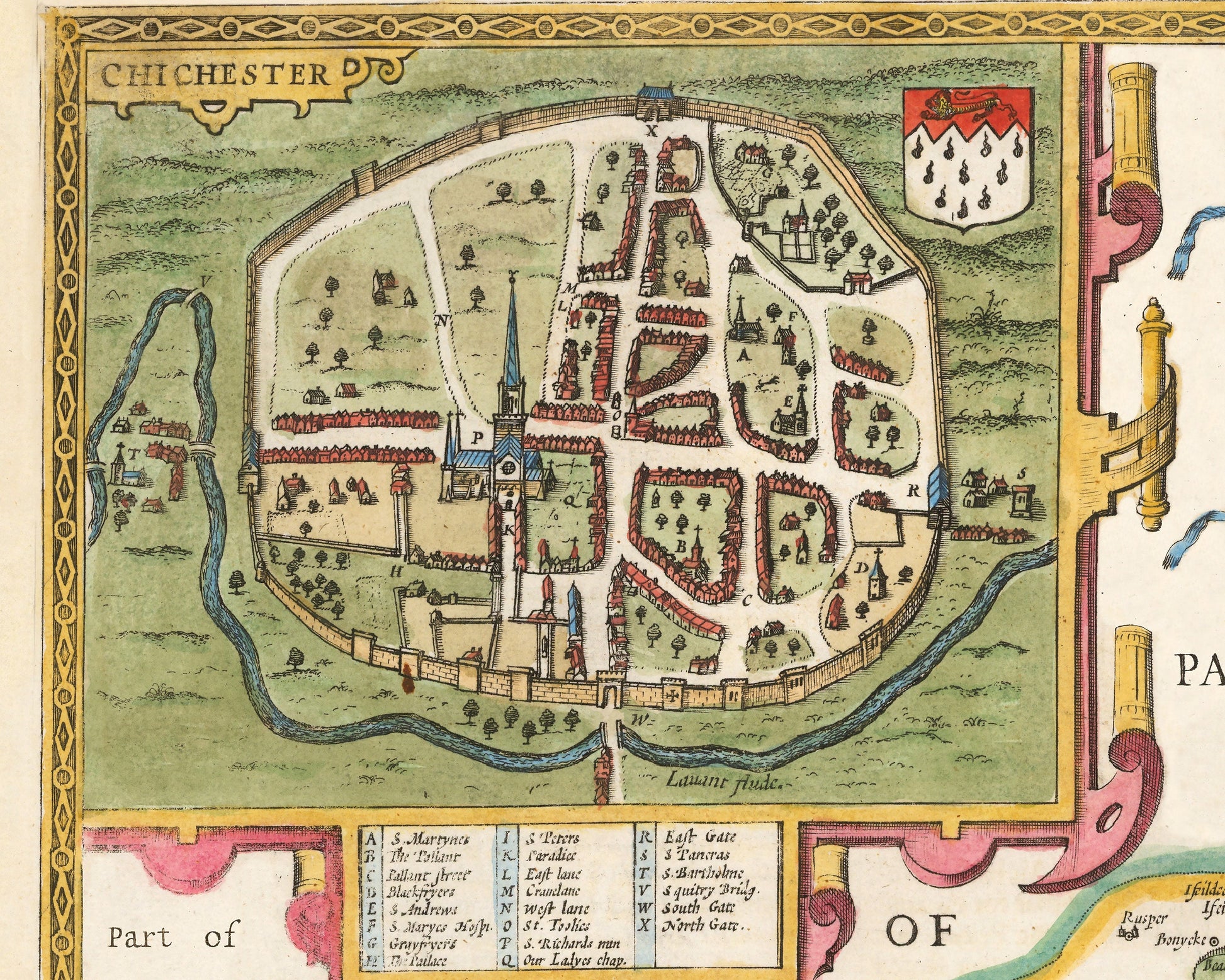
• A wonderful inset map of Chichester with accompanying index
• Coats of Arms of the local nobility
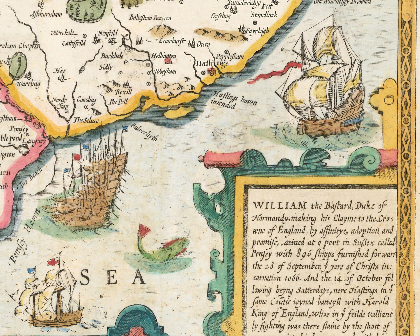
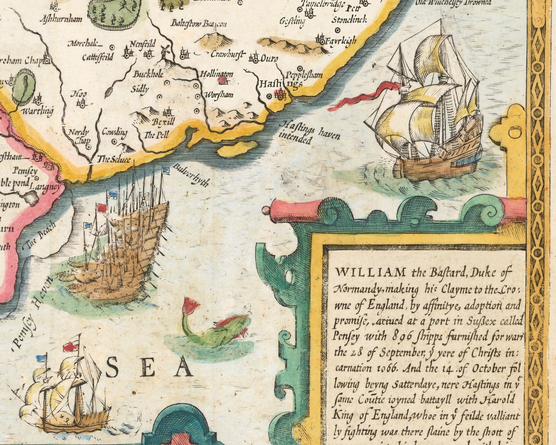
• Contemporary ships and wonderous sea creatures
• All offset with a beautiful stylistic border
Share