Classic Maps and Prints
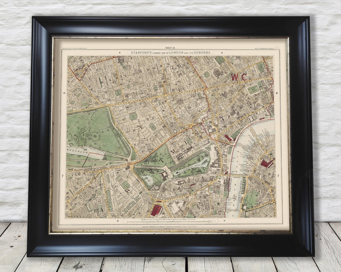
Old LONDON Colour map 1891 Mayfair Westminster Hyde Park
Old LONDON Colour map 1891 Mayfair Westminster Hyde Park
Couldn't load pickup availability
Stanford's is a longstanding name synonymous with detail and quality in the map world. The company was established by Edward Stanford in 1853 and situated at Charing Cross, London. Their most important work began in 1862 and whose aim was to produce the most accurate map of London possible. They duly achieved their goal aided by the skills of Chief Cartographer John Bolton. The Royal Geographical Society lauded their praise of Stanford's maps stating they were “the most perfect map of London that has ever been issued.”
I have digitally restored this superb 1891 colour version removing a number of blemishes and signs of ageing yet keeping the look, feel and integrity of the original piece.
Sheet 10 features:
------------------------
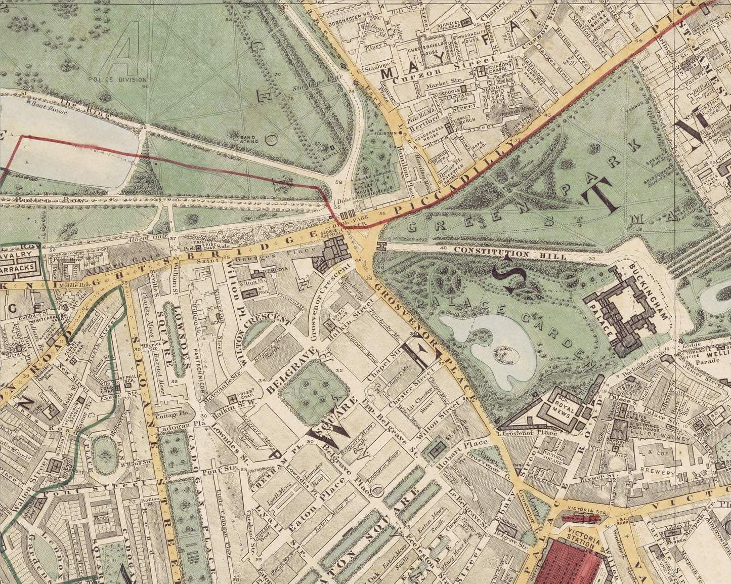
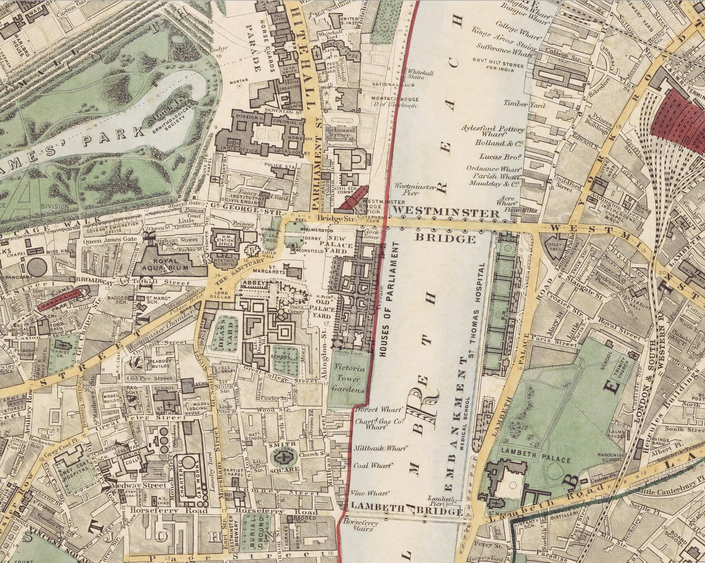
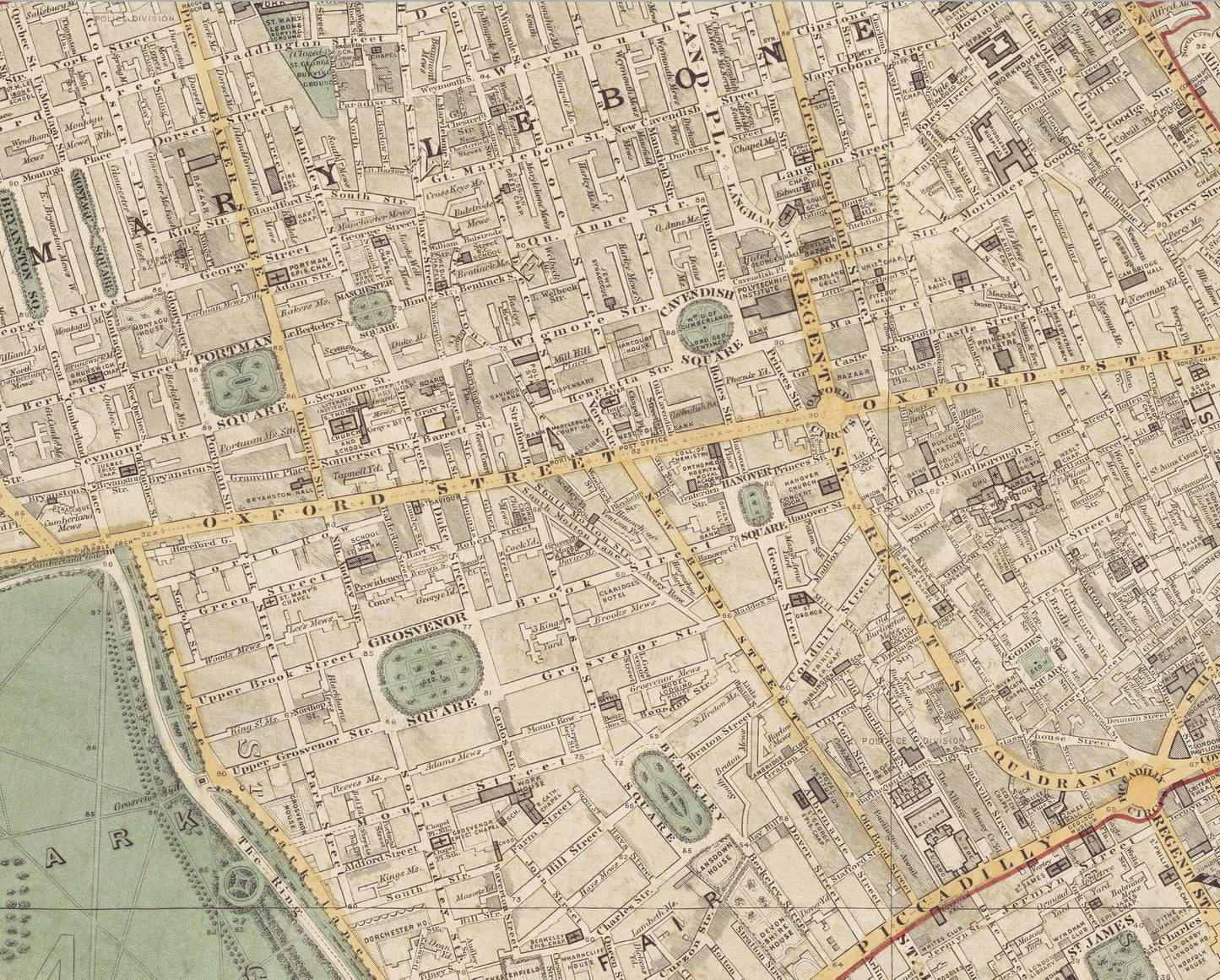
• A highly accurate and stylish rendition of Westminster, Mayfair, Marylebone and Hyde Park districts
• Beautifully depicted in a 1:10,560 scale
• Buckingham Palace
• The Houses of Parliament
• St James Park and Hyde Park
• Trafalgar Square
• Covent Garden
• Westminster Abbey
A classic work that creates a centrepiece for any home and would look stunning framed. This print is produced on premium heavyweight 230 gsm paper and uses the finest quality inks that will not fade or smudge.
This is a highly sought-after work.
Share