
Classic Maps and Prints
Old LEICESTERSHIRE map John Speed 1611 - Leicester Loughborough
Old LEICESTERSHIRE map John Speed 1611 - Leicester Loughborough
Couldn't load pickup availability
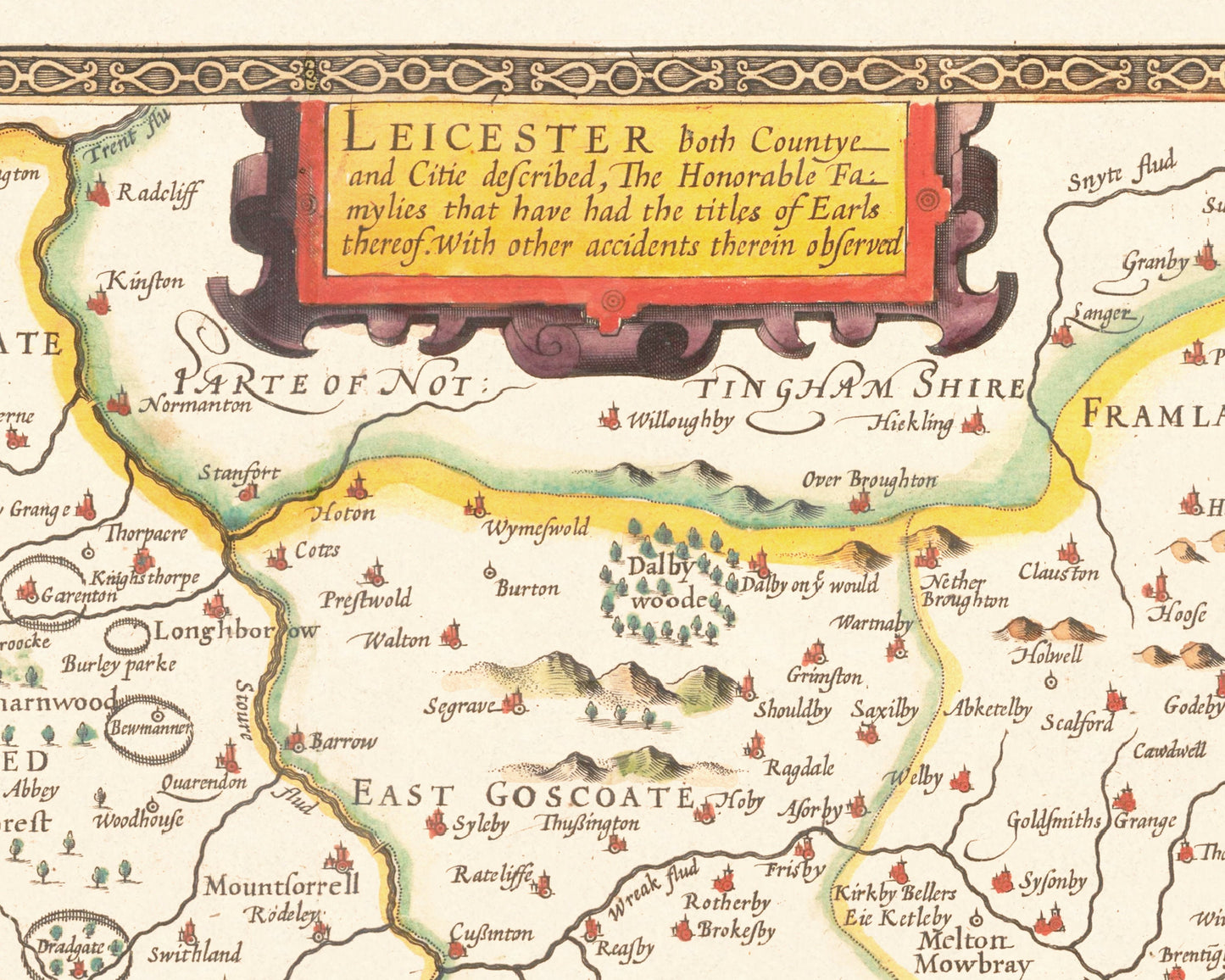
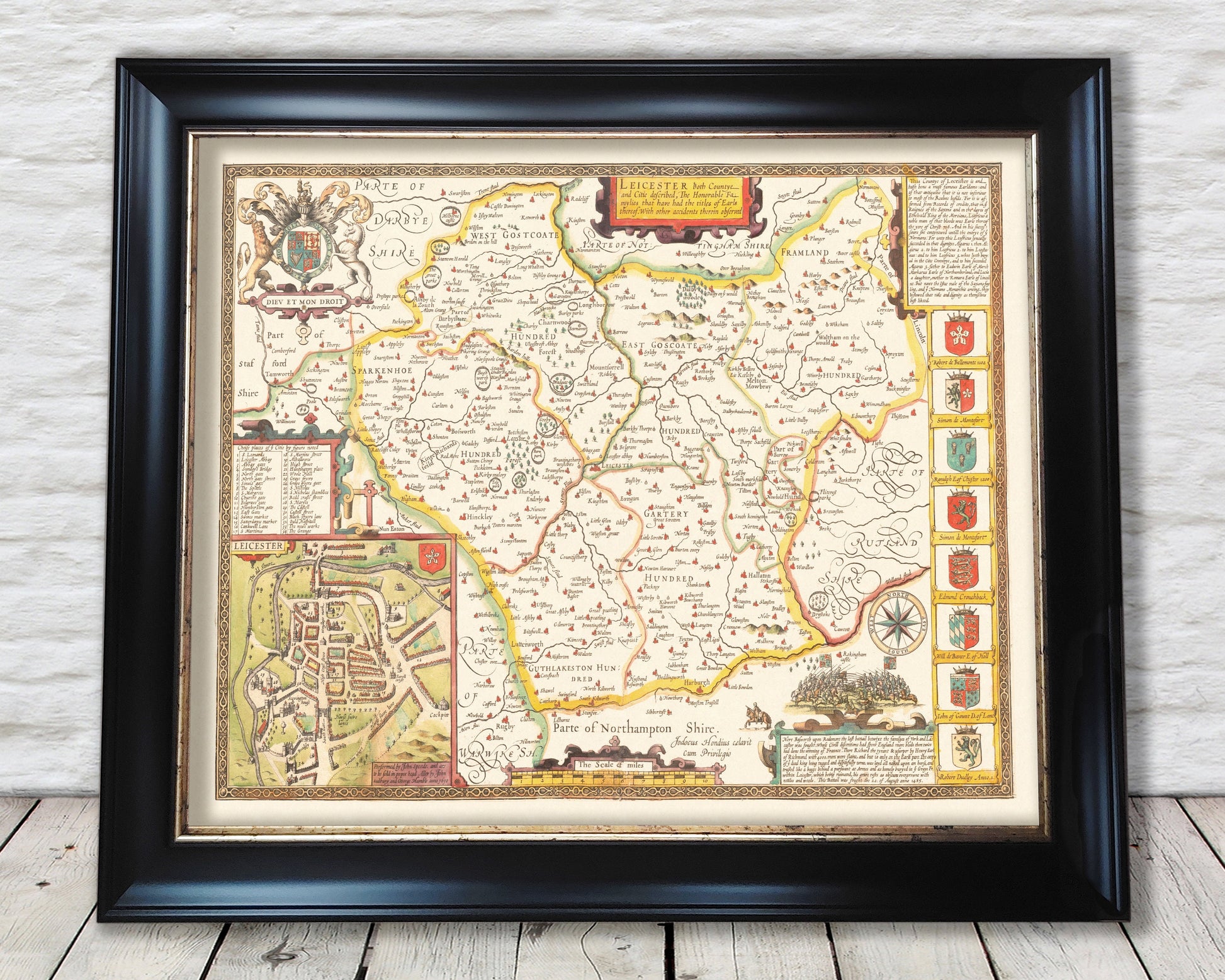
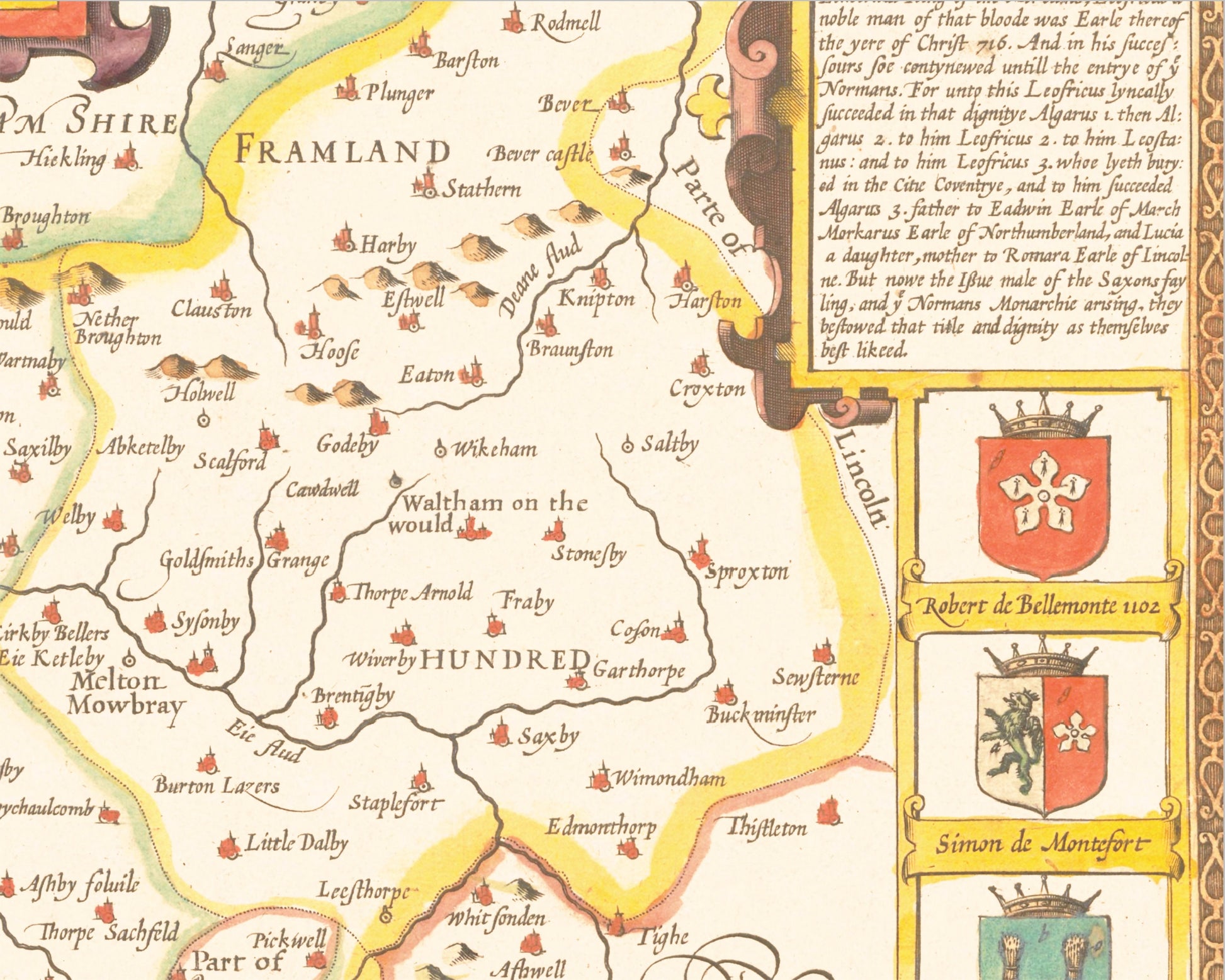
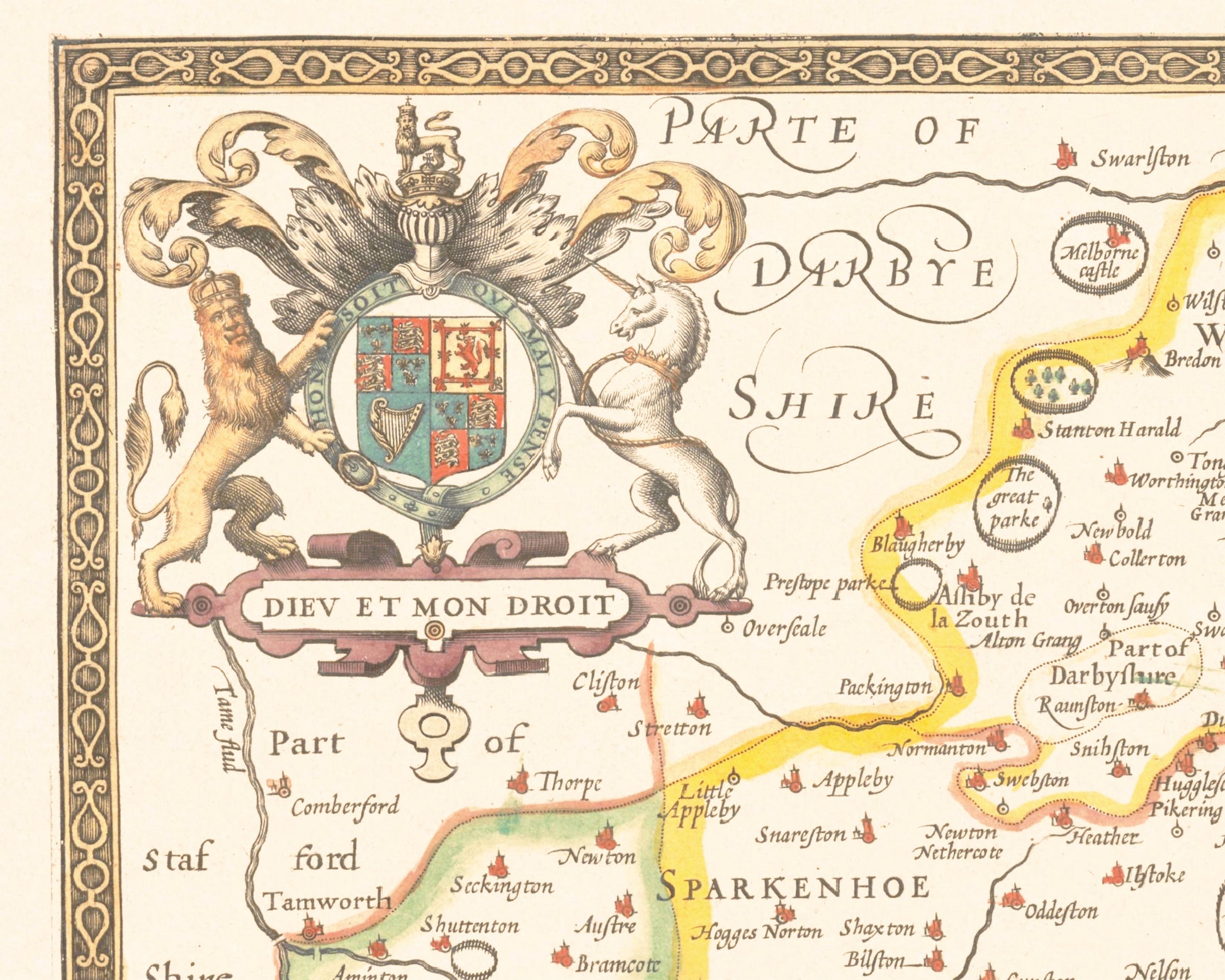
This classic piece was produced by John Speed the best known mapmaker of the Stuart period. It is a wonderful example of a decorative county map that was produced over 400 years since. This is an antique reproduction of the original hand coloured map and therefore each original map is in itself unique.
"Of its twelve market towns, the county town of Leicester, with the regional headquarters of the Duchy of Lancaster, was by far the most important. Leicester had long been established as a centre of the leather trade, and the quality of its goods and of the cattle and horses for auction at its sales often attracted purchasers from as far afield as London" (The Counties of Britain: A Tudor Atlas)
This is a highly sought after work and is sure to form an interesting conversation piece to any living room. This piece looks stunning mounted.
Features:
-------------
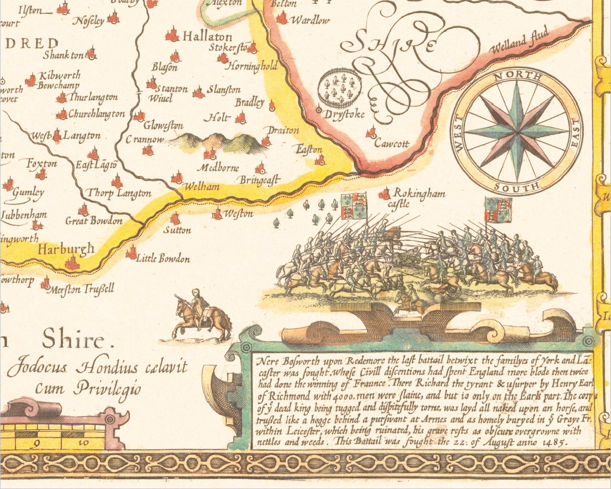
• A detailed geography of the hills, rivers and forests of Leicestershire from the early 17th century
• A wonderful inset map of the county town Leicester with accompanying index
• A vignette of the final Battle of the Roses at Bosworth in 1485, complete with a Latin inscription
• Coats of Arms of important dignitaries such as Simon de Montefort and John of Gaunt
• All offset with a beautiful stylistic border
Share