
Classic Maps and Prints
Old LANCASHIRE map 1610 by John Speed - Manchester Liverpool Lancaster
Old LANCASHIRE map 1610 by John Speed - Manchester Liverpool Lancaster
Couldn't load pickup availability
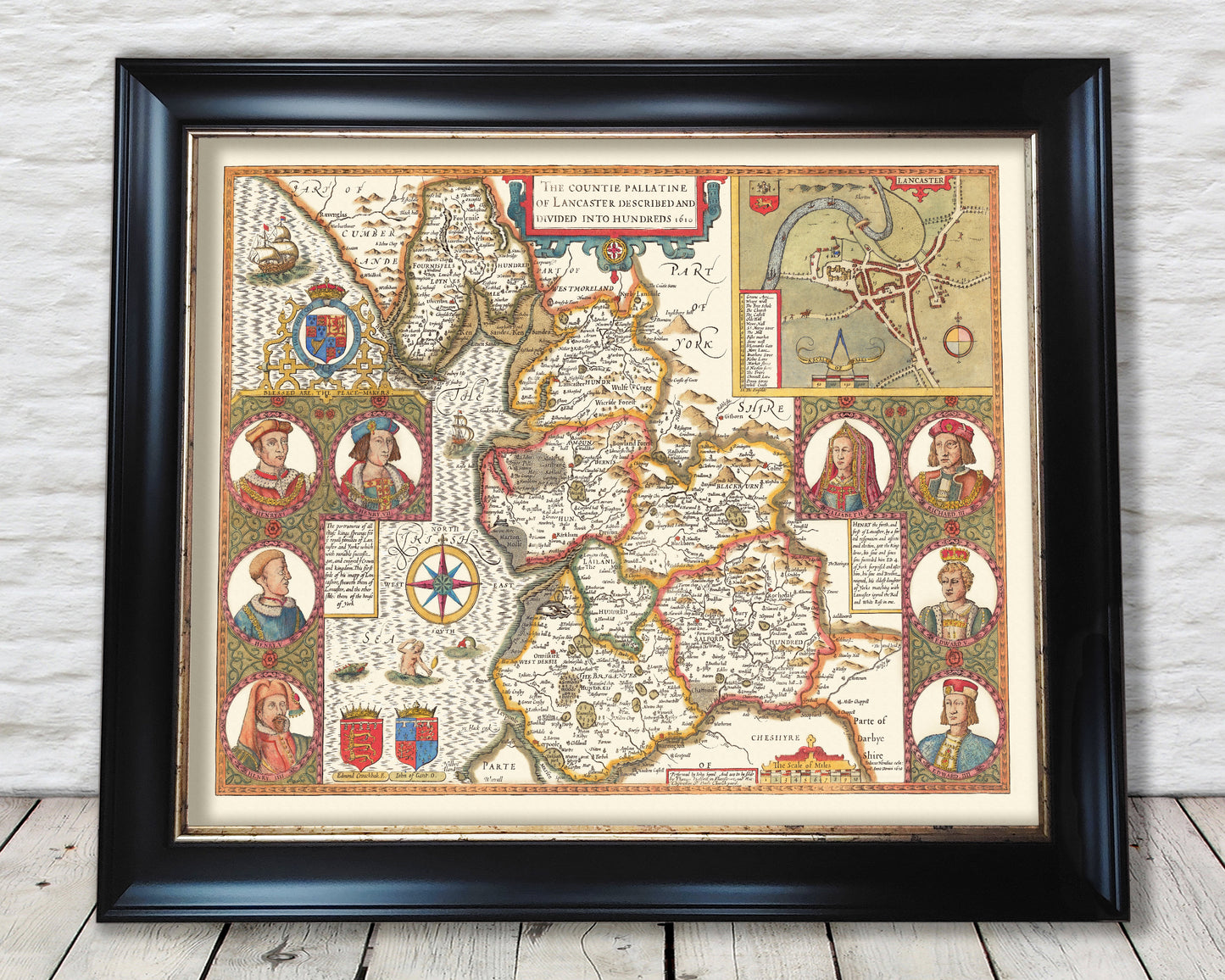
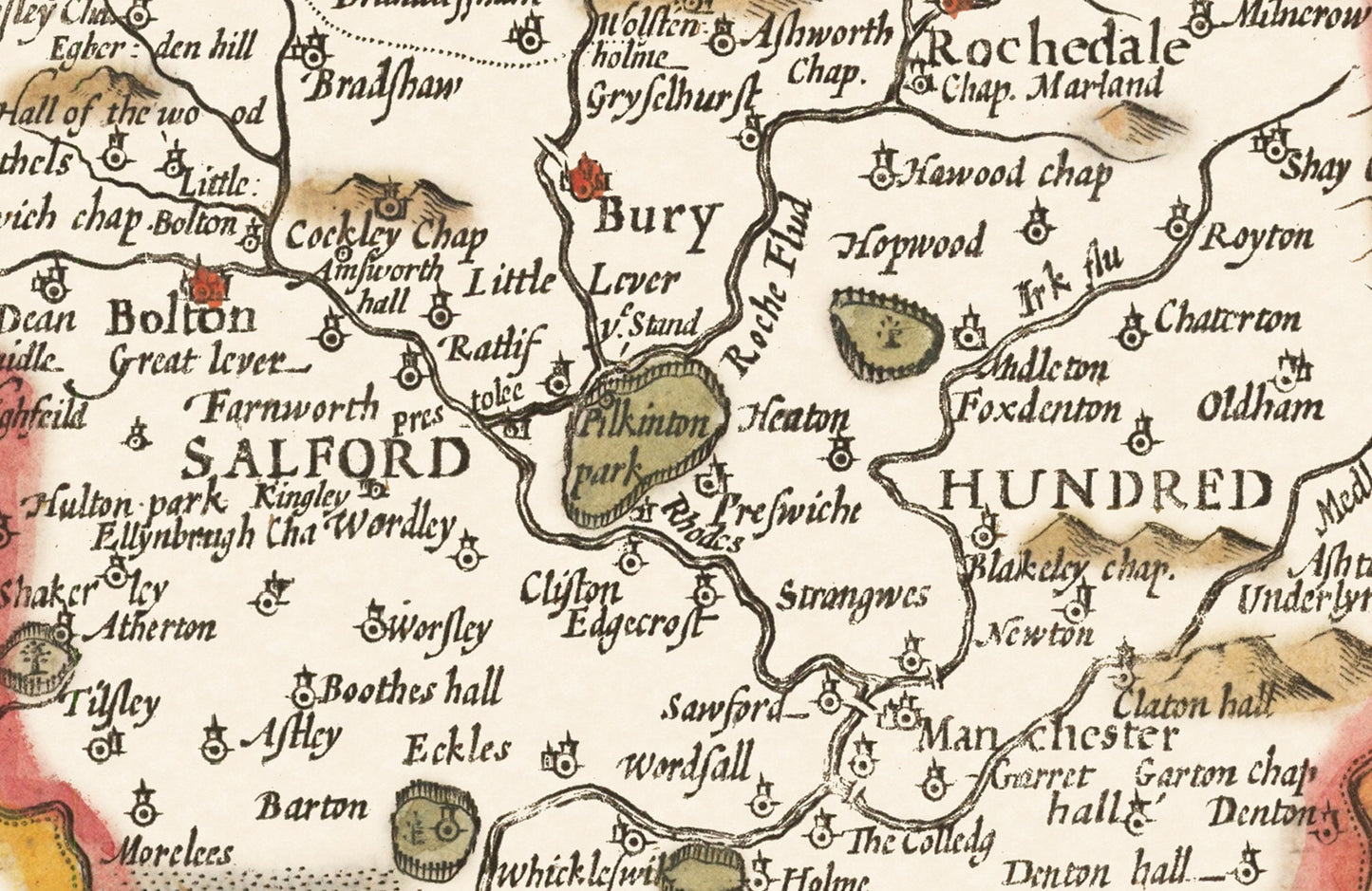
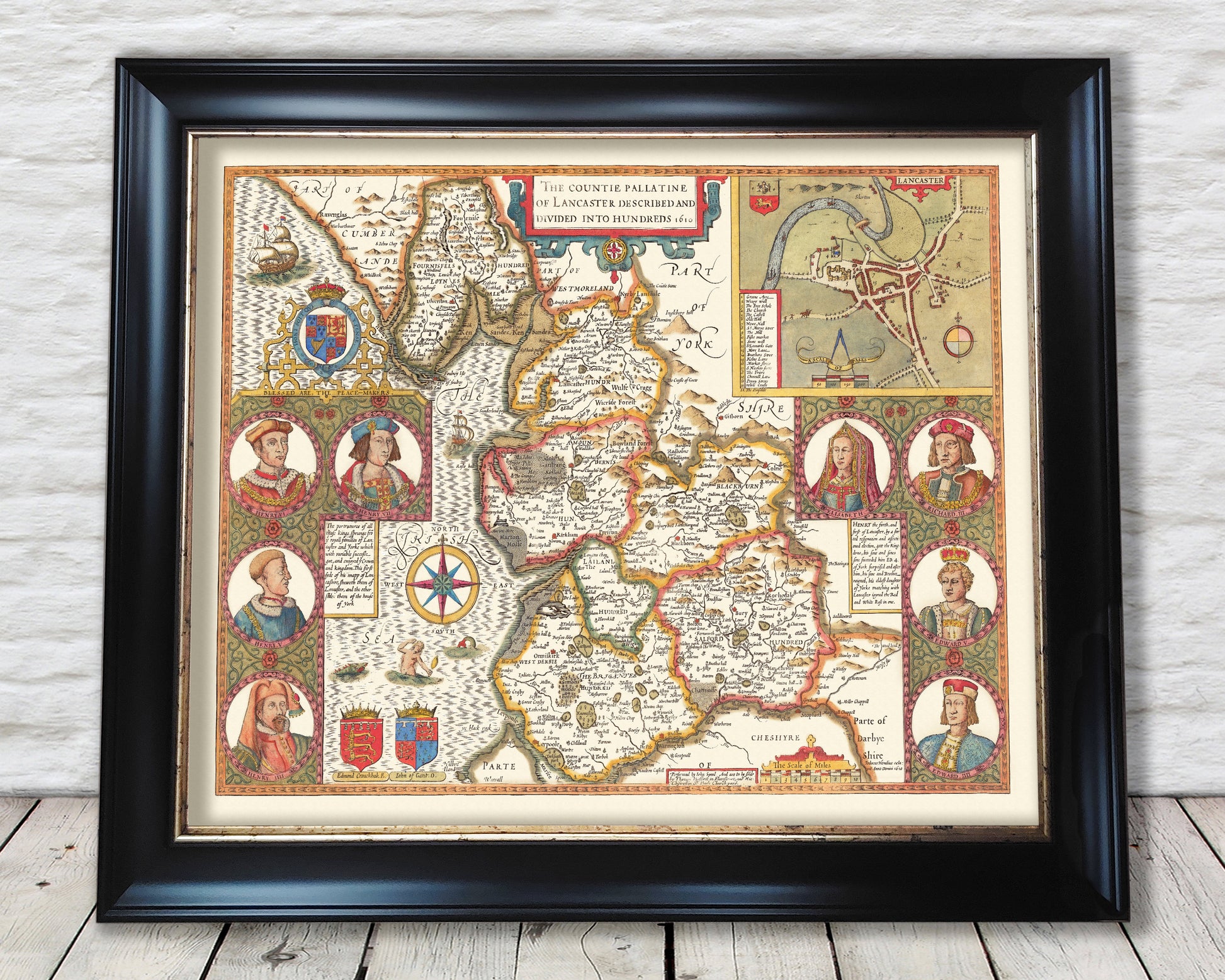
This classic piece was produced by John Speed the best known mapmaker of the Stuart period. It is a wonderful example of a decorative county map that was produced over 400 years since. This is an antique reproduction of the original hand coloured map and therefore each original map is in itself unique. Place name spellings are in Olde Worlde Englyshe and it is interesting note these differences! Lerpoole (Liverpool), Rochedale (Rochdale) and Blackborn (Blackburn) are examples. At this time land was divided in Hundreds for example the Hundred of Salford is shown. This work is packed with history featuring John of Gaunt (son of Edward III) and whose own son would accede to the throne in 1399 as Henry IV following the deposed Richard II. There is much to explore and this is a classic of its kind.
This map has been digitally cleaned to remove most of the marks and signs of ageing though it is faded in a few small places but is a strong print overall as represented by the images.
A classic work that creates a centrepiece for any home and would look stunning framed (frame for illustration purposes only). This print is produced on premium heavyweight 230 gsm paper and uses the finest quality inks that will not fade or smudge.
Features:
• A detailed geography of the hills, rivers and forests within the county of Lancaster in the early 17th century
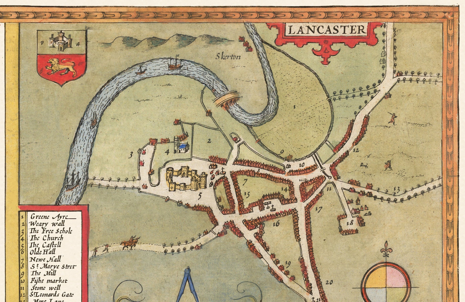
• A plan of the city of Lancaster including a key detailing the many churches and gates (see above)
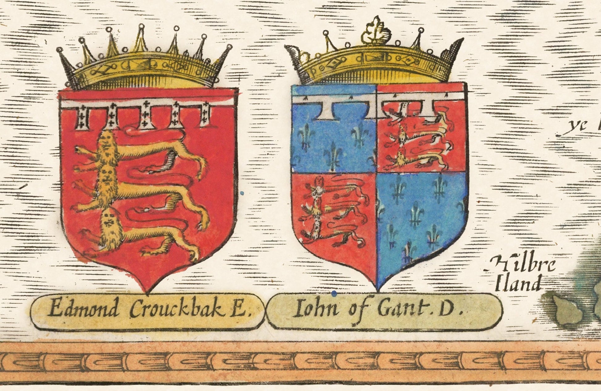
• Crests of Arms of John of Gaunt and Edmund Crouchback (for those interested in Heraldry)
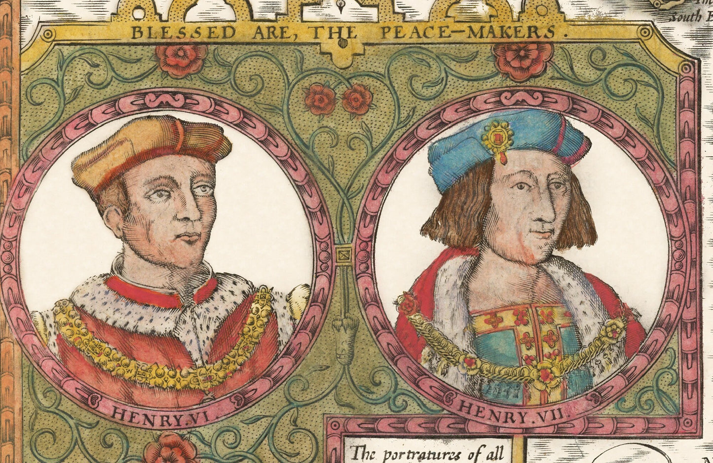
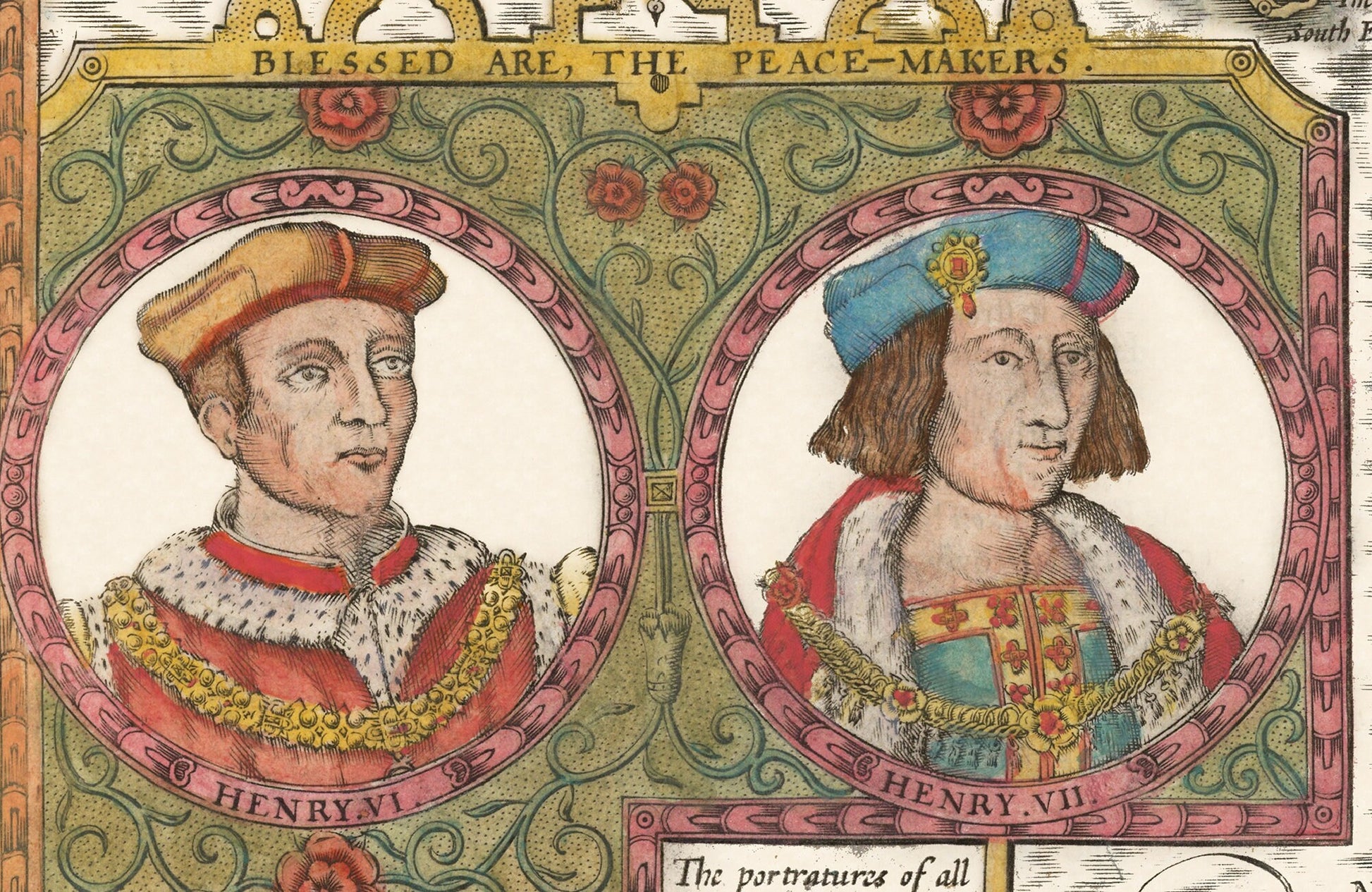
• Portraits of eight former members of royalty including King Henry (IV to VII inclusive)
• A classic, clean and vibrant print
Share