

Classic Maps and Prints
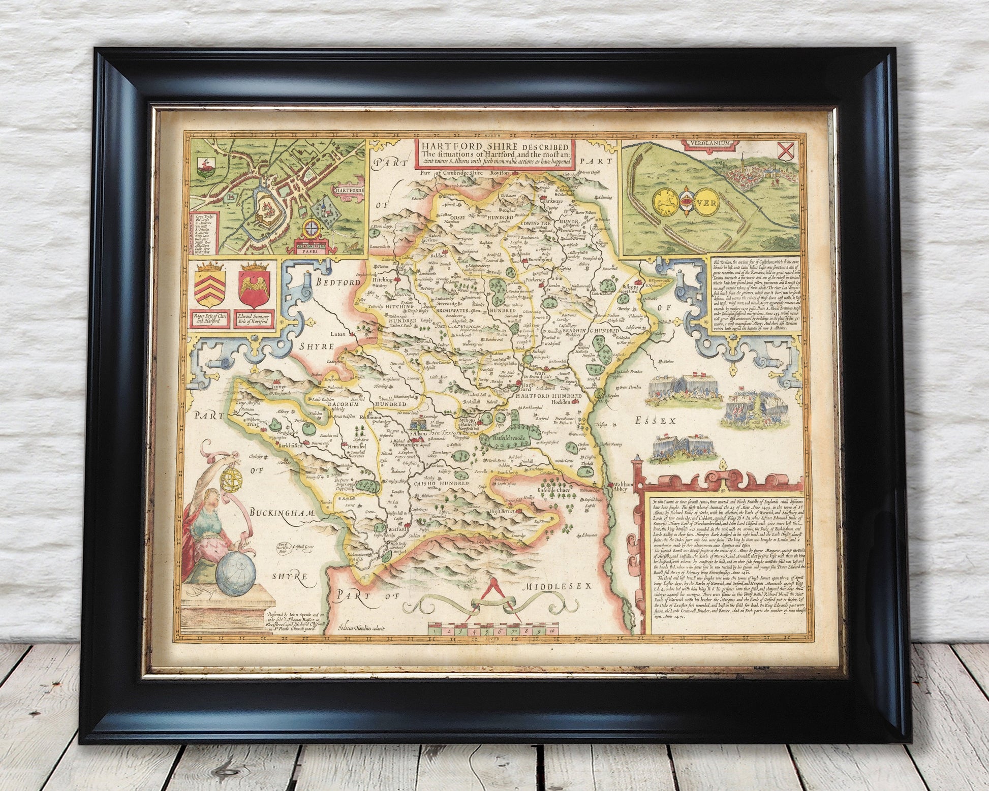
Old HERTFORDSHIRE map by John Speed 1611 St Albans Watford Stevenage
Old HERTFORDSHIRE map by John Speed 1611 St Albans Watford Stevenage
Couldn't load pickup availability
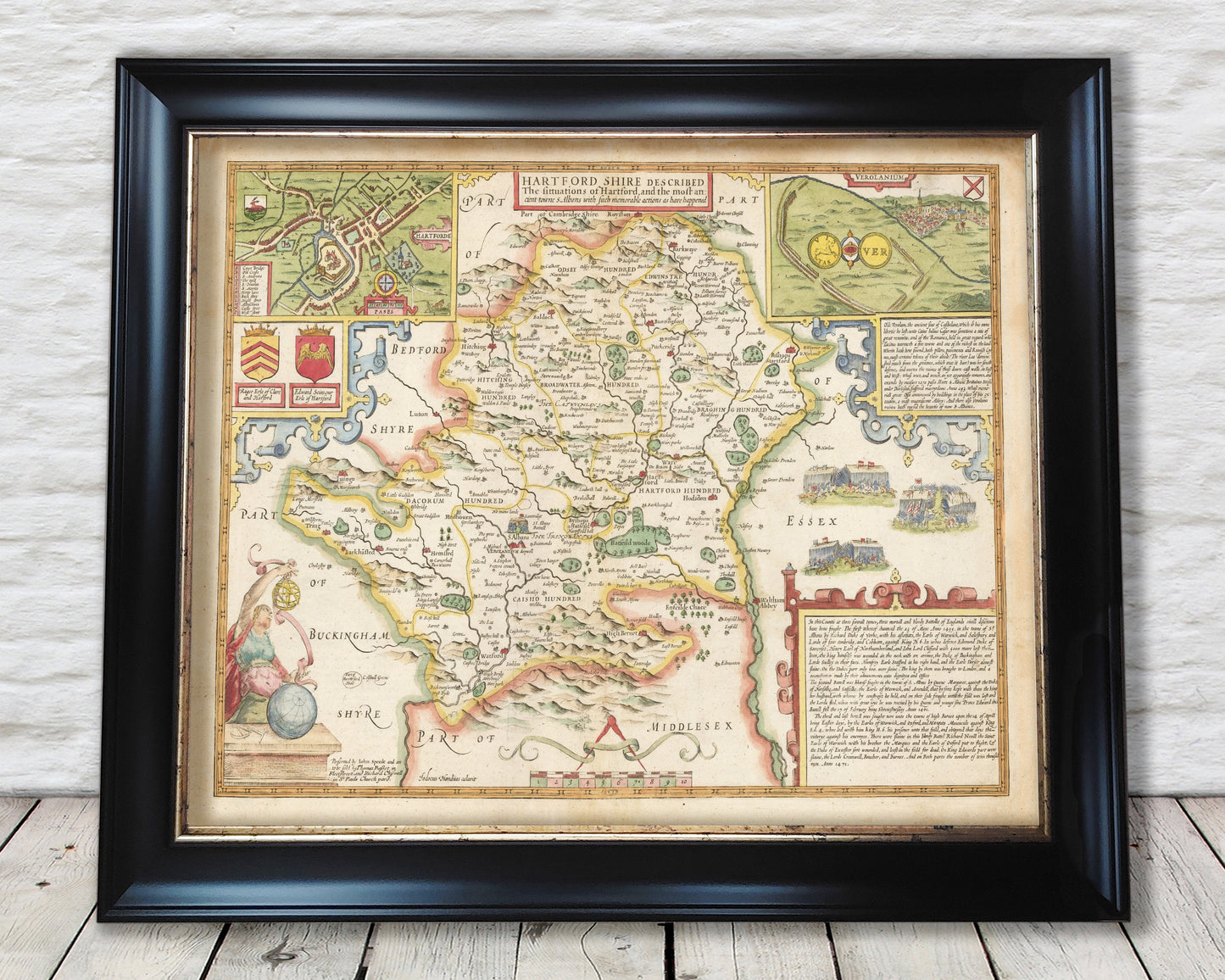
This classic piece was produced by John Speed the best known mapmaker of the Stuart period. It is a wonderful example of a decorative county map that was produced over 400 years since. This is an antique reproduction of the original hand coloured map and therefore each original map is in itself unique.
The economy of Hertfordshire was geared to providing the foodstuffs so much in demand
in London. Its corn went to make bread for Londoners and its hay fodder for their horses. The county bred cattle in
large numbers for sale as beef at Smithfield, and supported a larger number of cattle driven down from the North for
fattening up before completing their journey to London. Market gardening figured less than in Middlesex, but the
county's watercress beds were already famous, watercress being recognized as an antidote to the scurvy which inflicted
so many Londoners. Woods as sources of timber and of fuel and parks for deer and for pleasure completed the
amenities which led Speed to say of Hertfordshire that it was 'destitute of nothing that ministreth profit or pleasure of
life'. (The Counties of Britain: A Tudor Atlas)
This is a highly sought after work and is sure to form an interesting conversation piece to any living room. This piece looks stunning mounted.
Features:
-------------
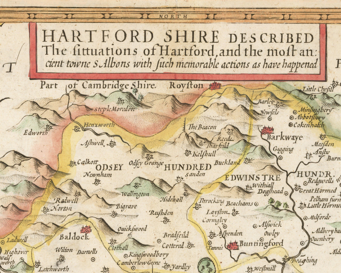
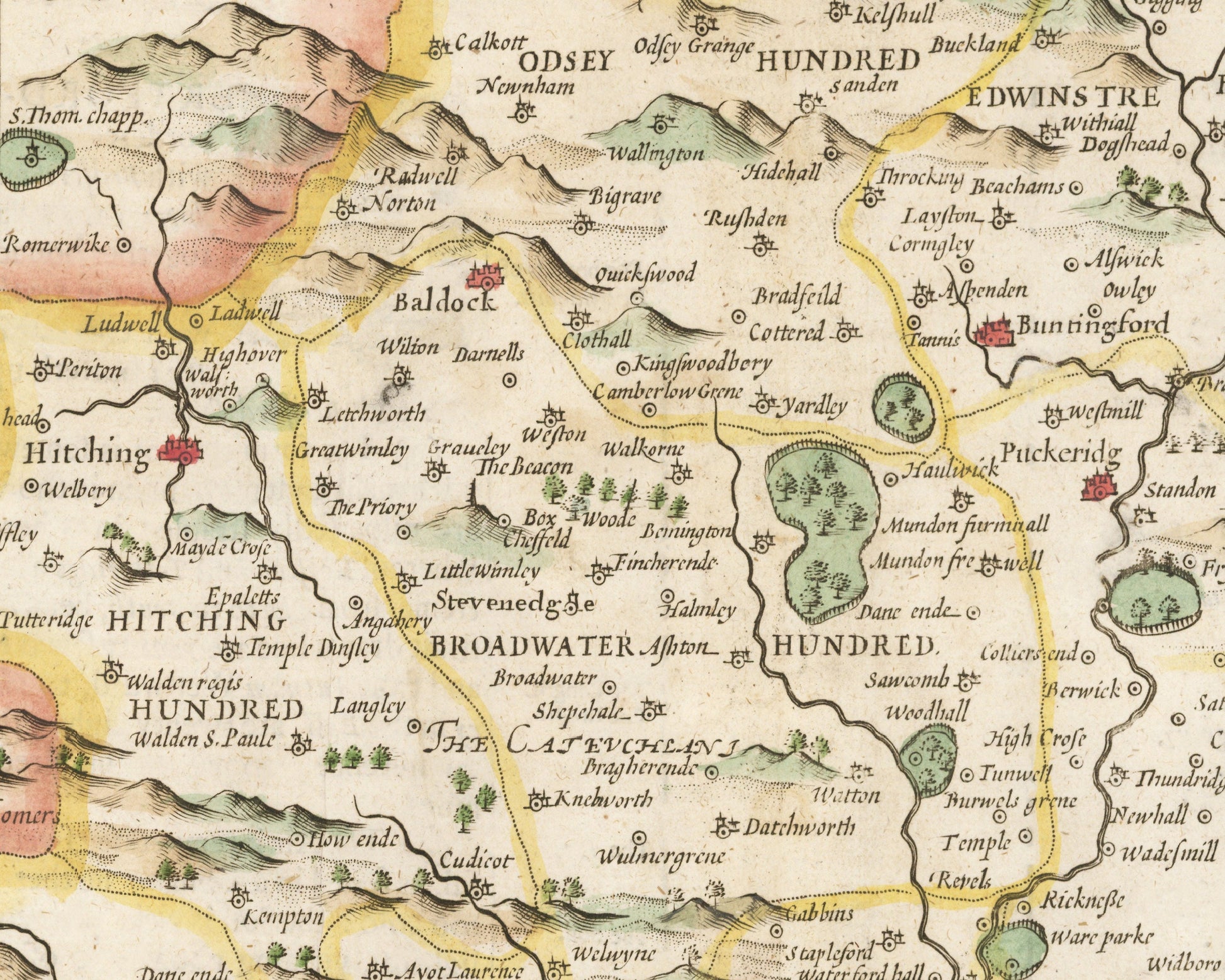
• A detailed geography of the hills, rivers and forests of Hertfordshire from the early 17th century
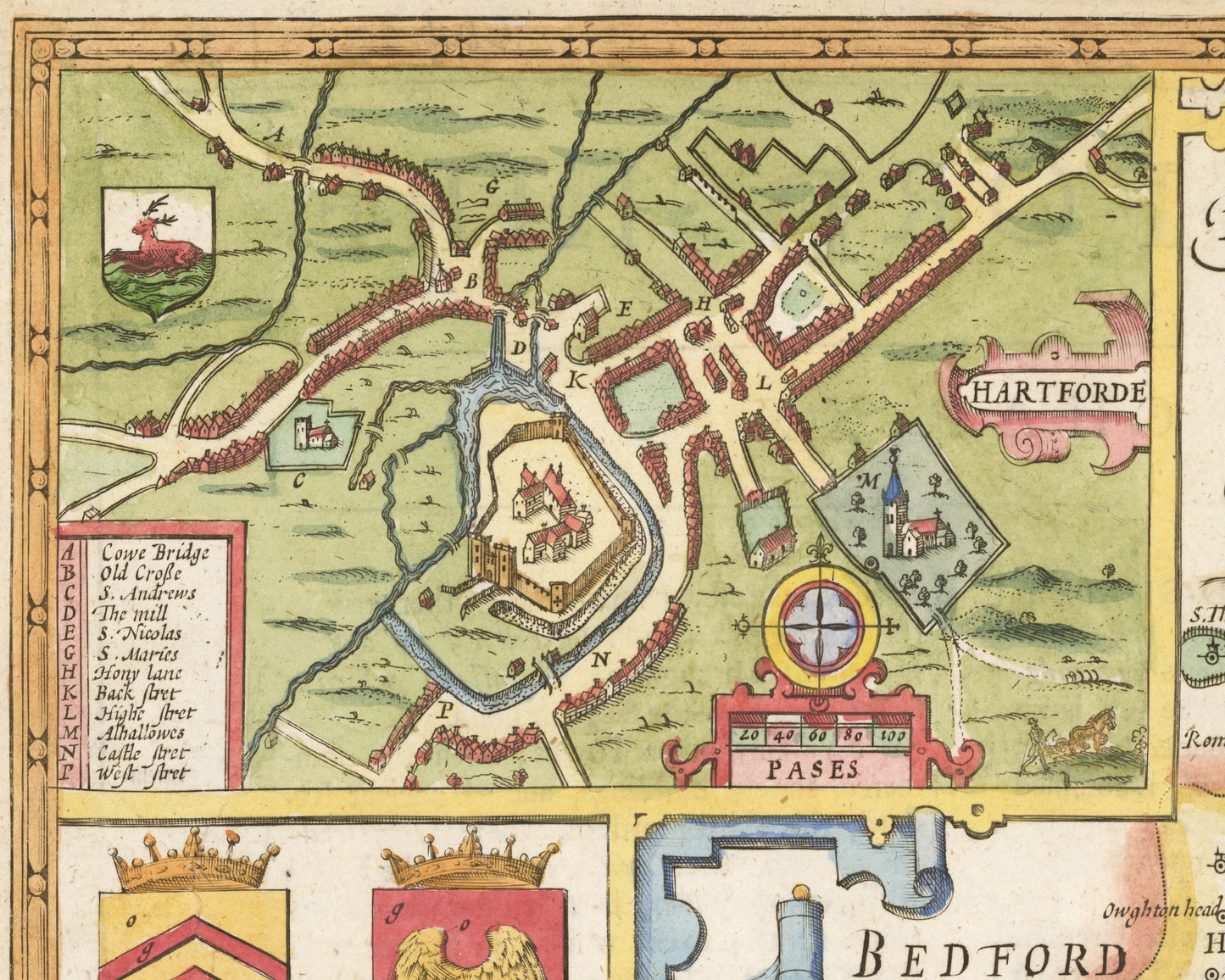
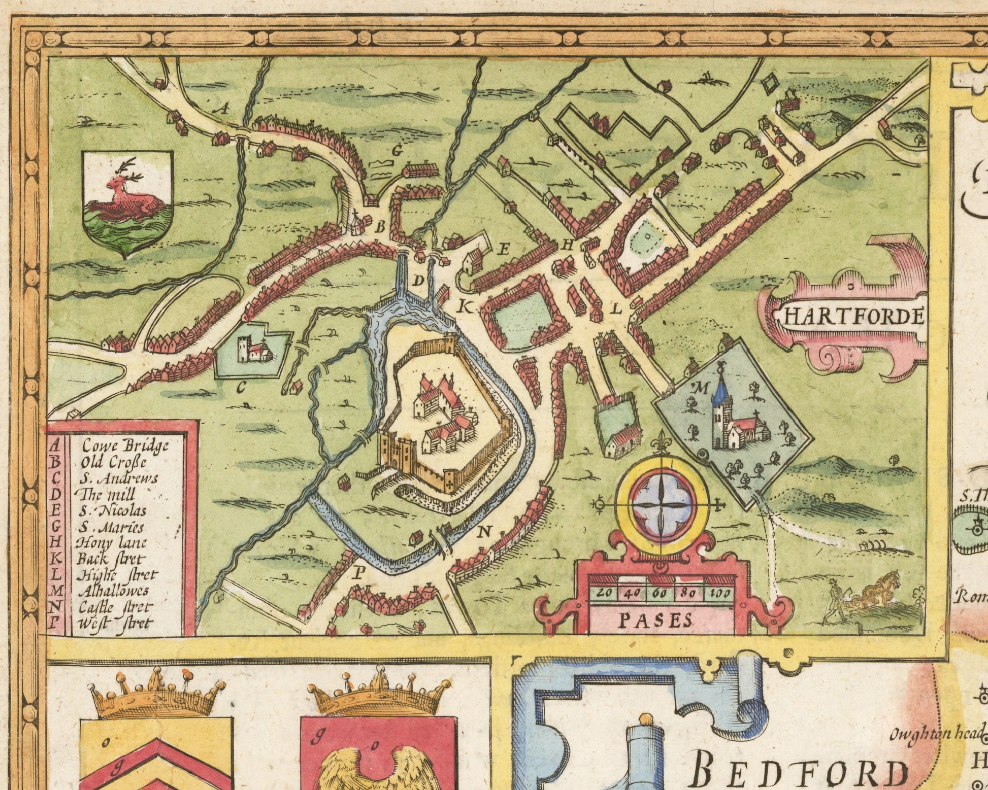
• A wonderful inset map of Hartford with accompanying index
• An illustration showing the remains of the Roman town of Verulamium
• Three battle scenes
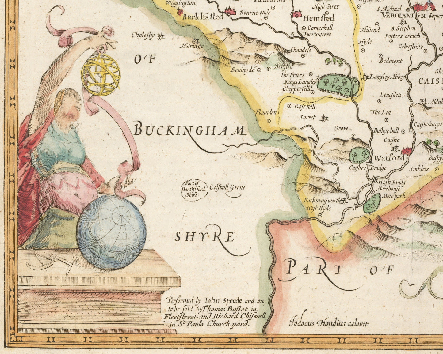
• All offset with a beautiful stylistic border
Share