Classic Maps and Prints
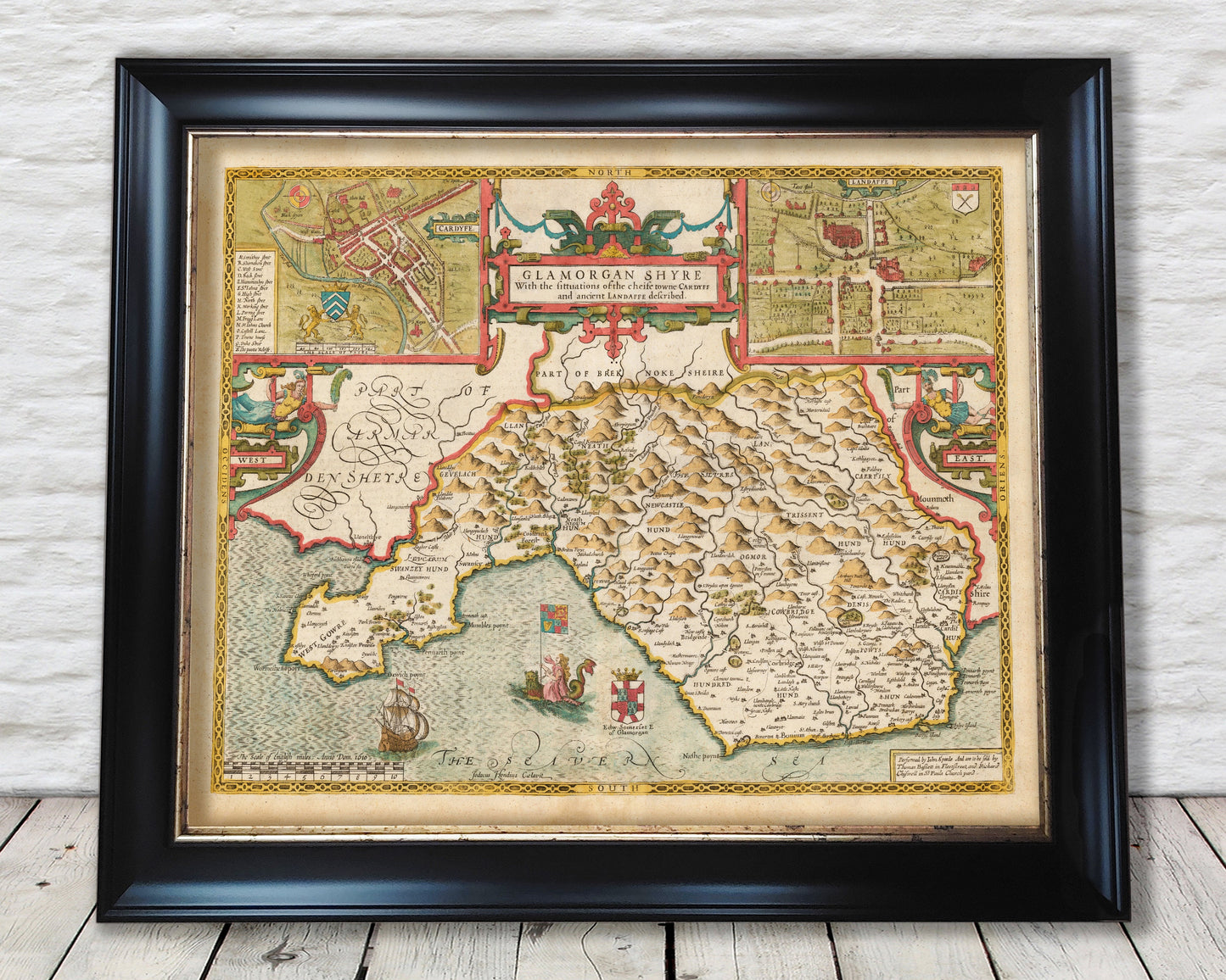
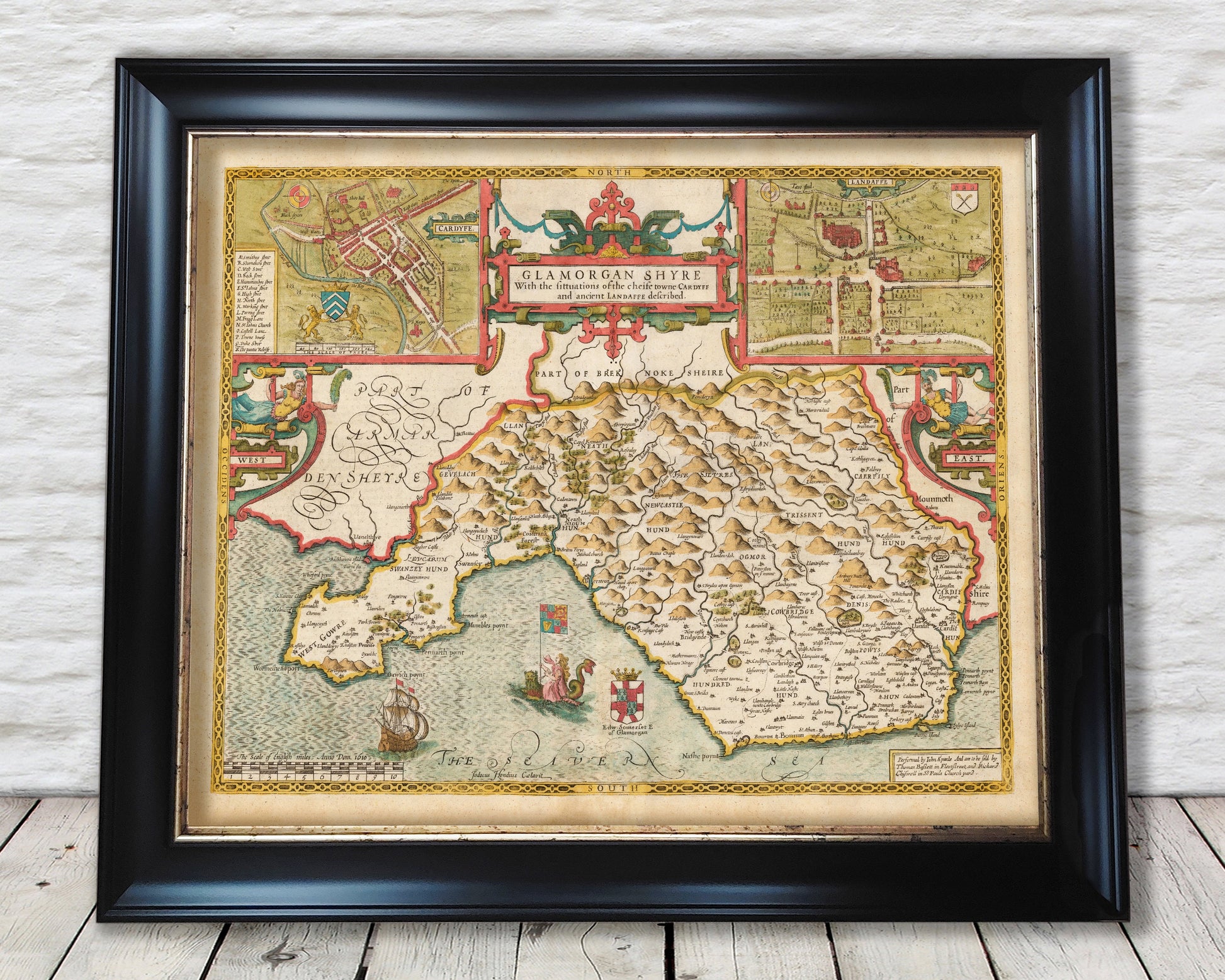
Old GLAMORGAN map by John Speed 1611 Cardiff Swansea Neath Bridgend
Old GLAMORGAN map by John Speed 1611 Cardiff Swansea Neath Bridgend
Couldn't load pickup availability
This classic piece was produced by John Speed the best known mapmaker of the Stuart period. It is a wonderful example of a decorative county map that was produced over 400 years since. This is an antique reproduction of the original hand coloured map and therefore each original map is in itself unique.
"Glamorganshire was one of the wealthiest and most populous areas in Wales.
Although its uplands, and the poor soil in the Vale of Glamorgan and the
Gower Peninsula, were not well suited to farming, the introduction of liming
during the Tudor period had improved local grain production, and increased
agricultural profits from wheat, oats, barley and rye had led to a belated start
in enclosing the common fields of the villages along the Bristol Channel coast.
The hills and woodlands of Glamorganshire were well suited to deer which
roamed freely, and to herds of cattle, sheep and goats which were tended, and
the celebrated dairy produce from these herds was shipped from ports such
as Oxwich, Swansea and Porteynon across the Channel to Devonshire and
Cornwall, along the Welsh coast as far as Anglesey, or over St George's
Channel to Ireland." (The Counties of Britain: A Tudor Atlas)
This is a highly sought after work and is sure to form an interesting conversation piece to any living room. This piece looks stunning mounted.
Features:
-------------
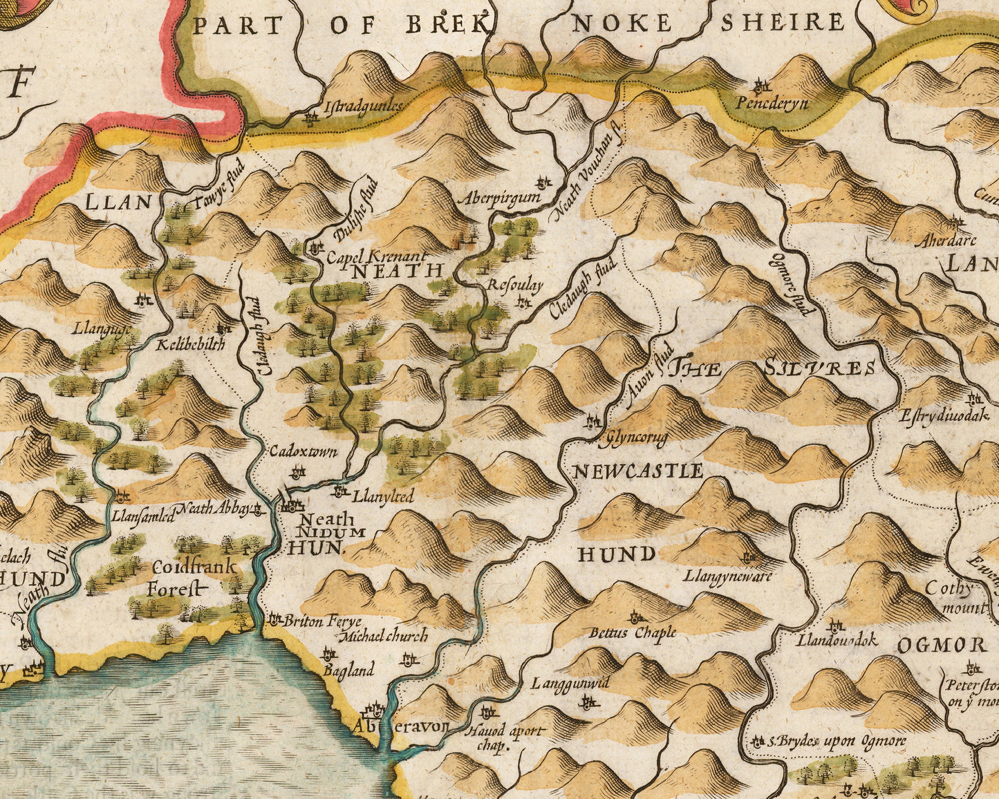
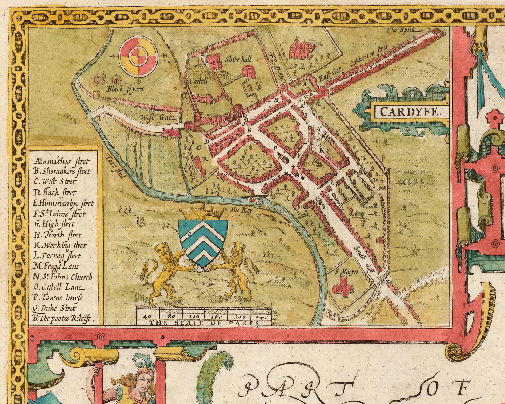
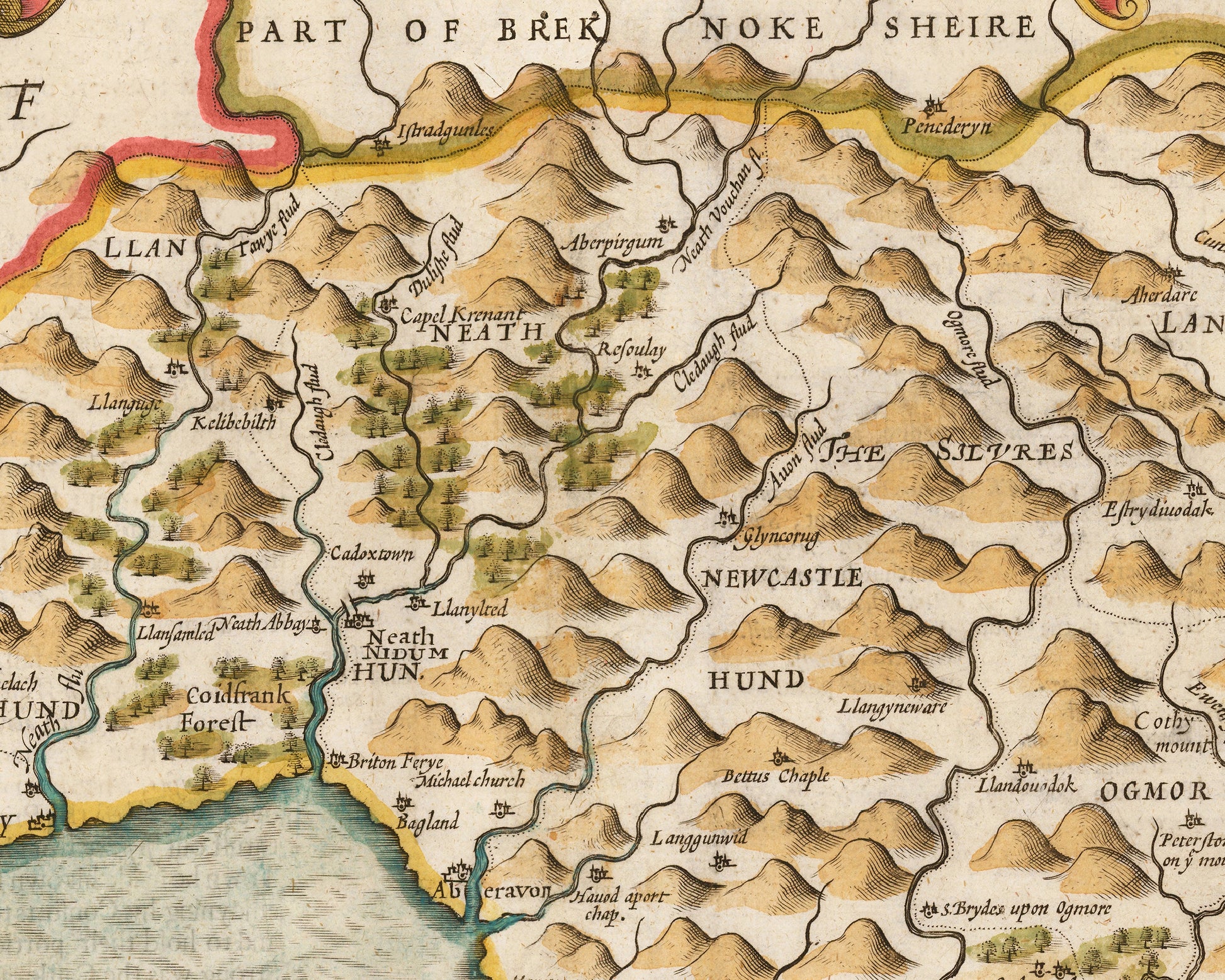
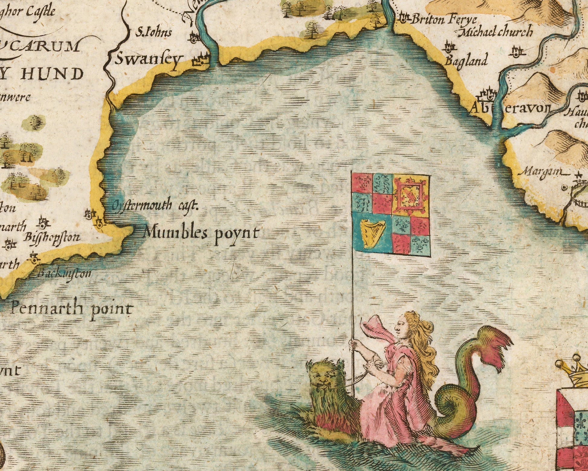
• A detailed geography of the hills, rivers and forests of Glamorgan from the early 17th century
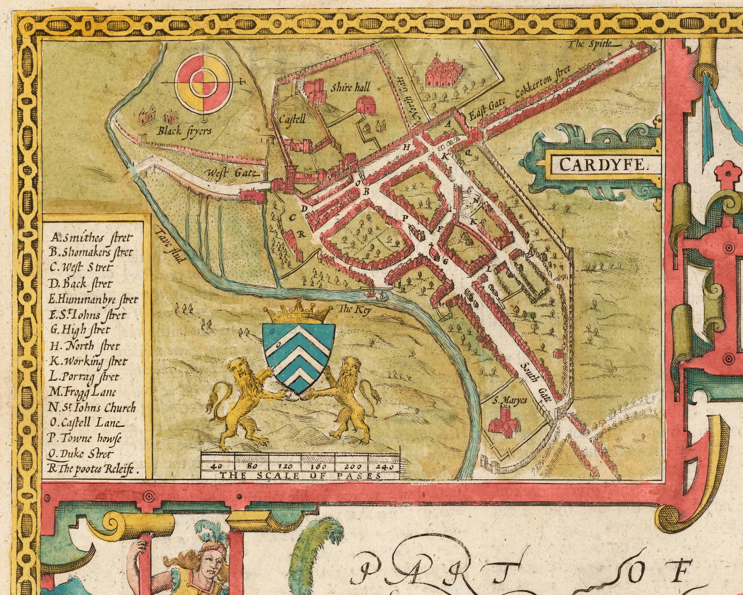
• A wonderful inset map of Cardiff with accompanying index
• A wonderful inset map of Llandaff
• A contemporary ship and a maiden riding a sea serpent
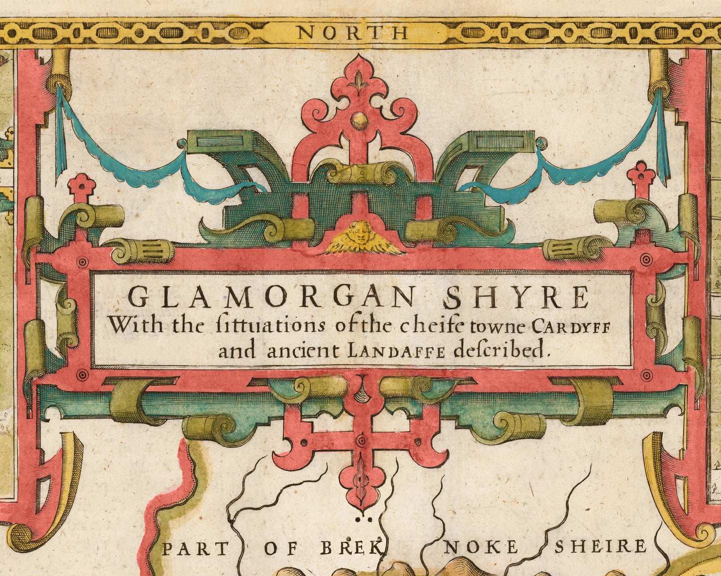
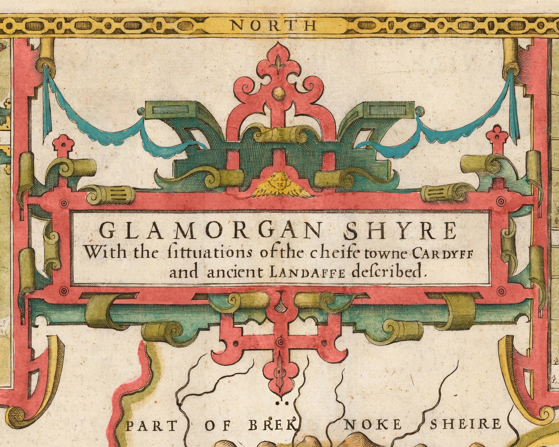
• All offset with a beautiful stylistic border
Share