Classic Maps and Prints
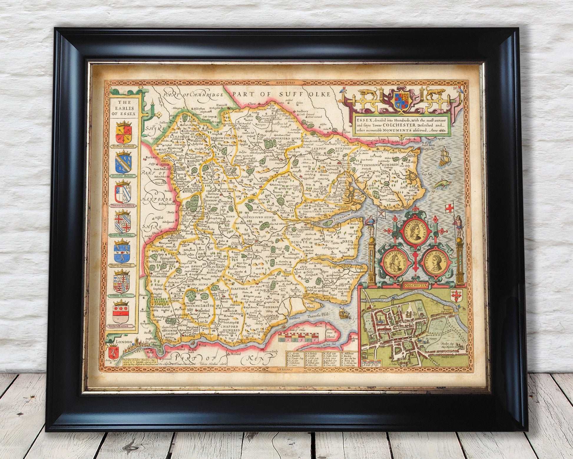
Old ESSEX map John Speed 1610 Southend Romford Colchester Chelmsford
Old ESSEX map John Speed 1610 Southend Romford Colchester Chelmsford
Couldn't load pickup availability
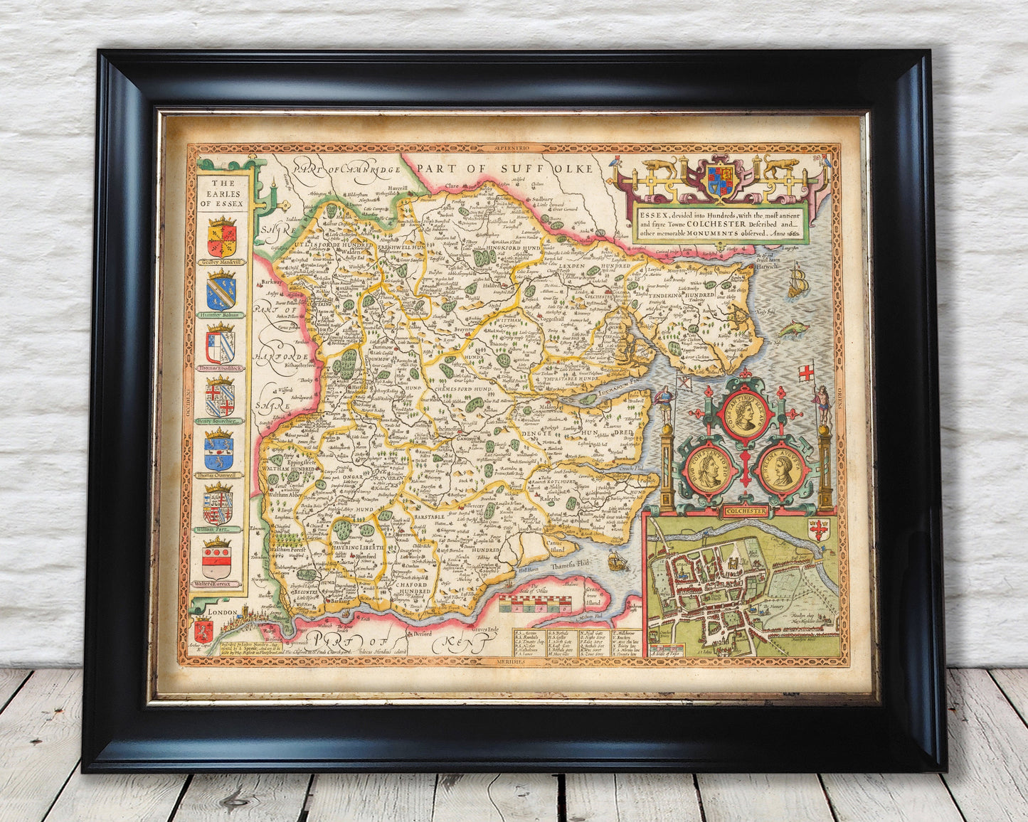
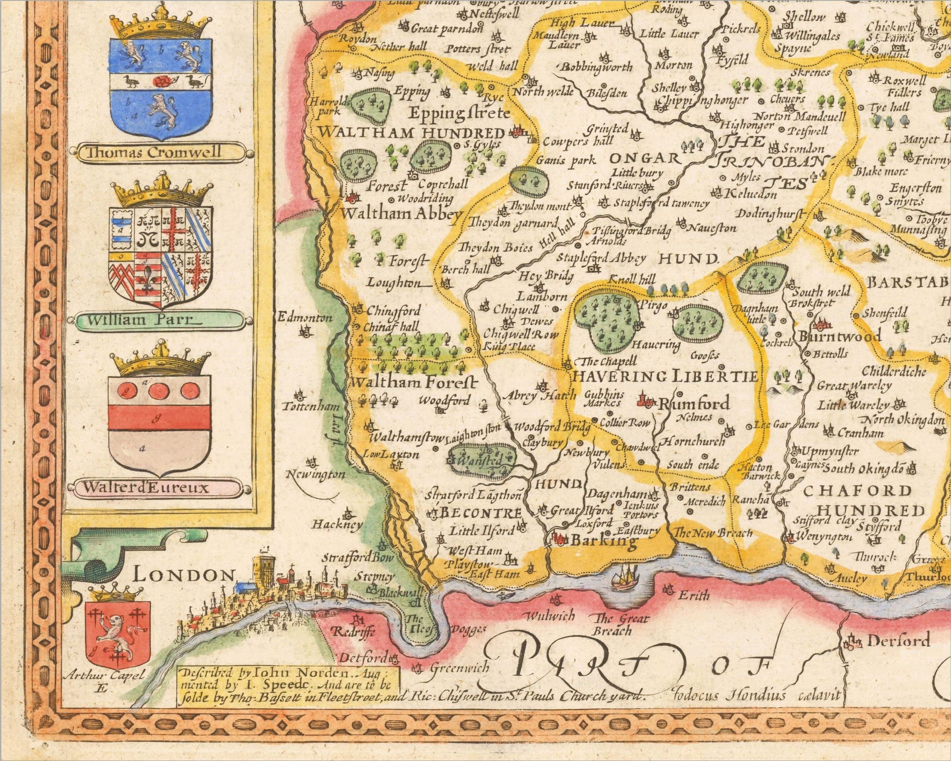
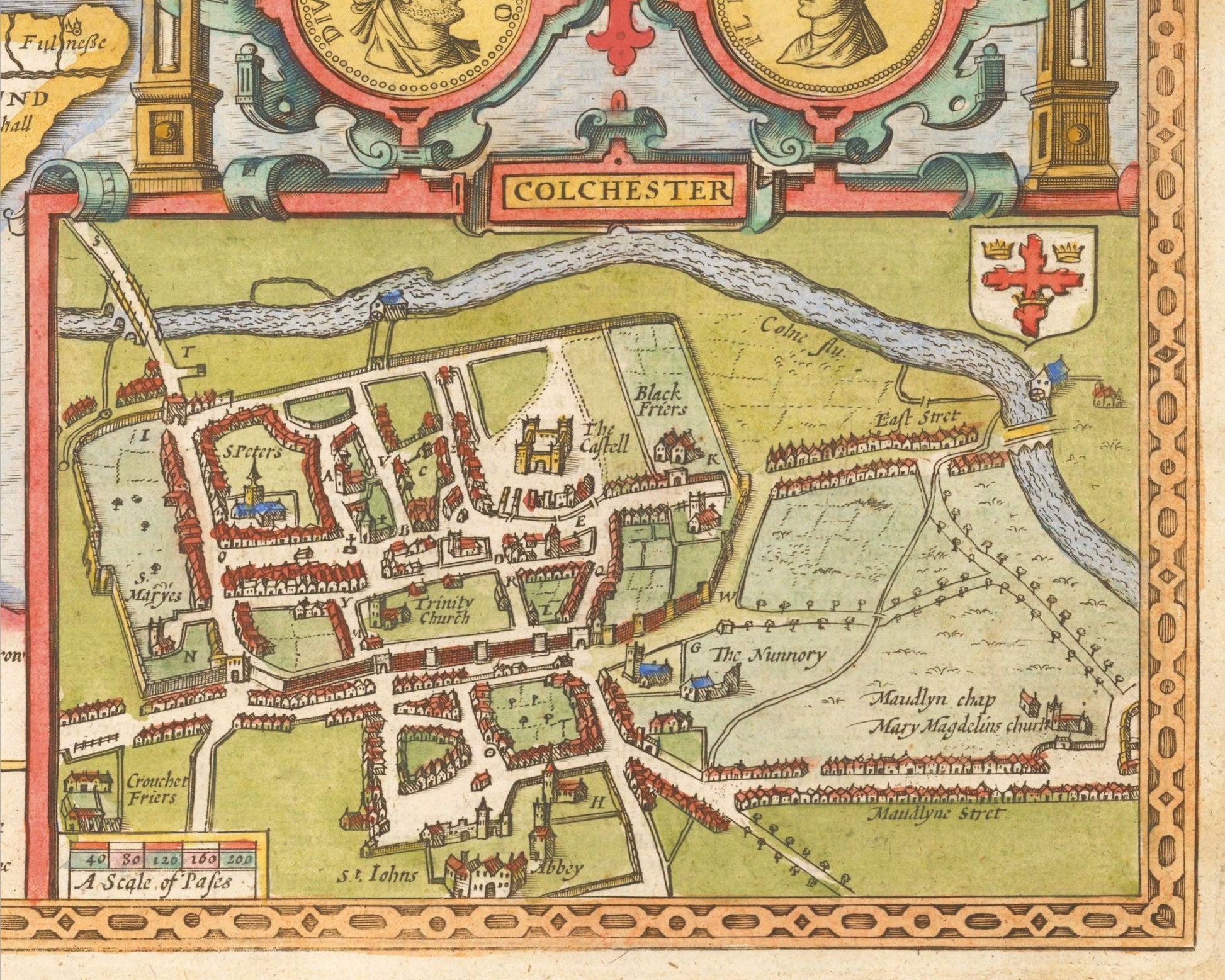
This classic piece was produced by John Speed the best known mapmaker of the Stuart period. It is a wonderful example of a decorative county map that was produced over 400 years since. This is an antique reproduction of the original hand coloured map and therefore each original map is in itself unique. This is the 1676 Thomas Bassett and Richard Chiswell based on Speed's original plates.
"Essex was curiously isolated from London. The river Lea with its many courses and its largely undrained wetlands near the River Thames served as a barrier between the capital and Essex ... Important to the area's well-being were sheep and cattle production, the fleece supplying wool for the weavers in the north of the county, and the milk being turned into 'great and thick' cheese which was marketed in London and elsewhere." (The Counties of Britain: A Tudor Atlas)
This is a highly sought after work and is sure to form an interesting conversation piece to any living room. This piece looks stunning mounted.
Features:
-------------
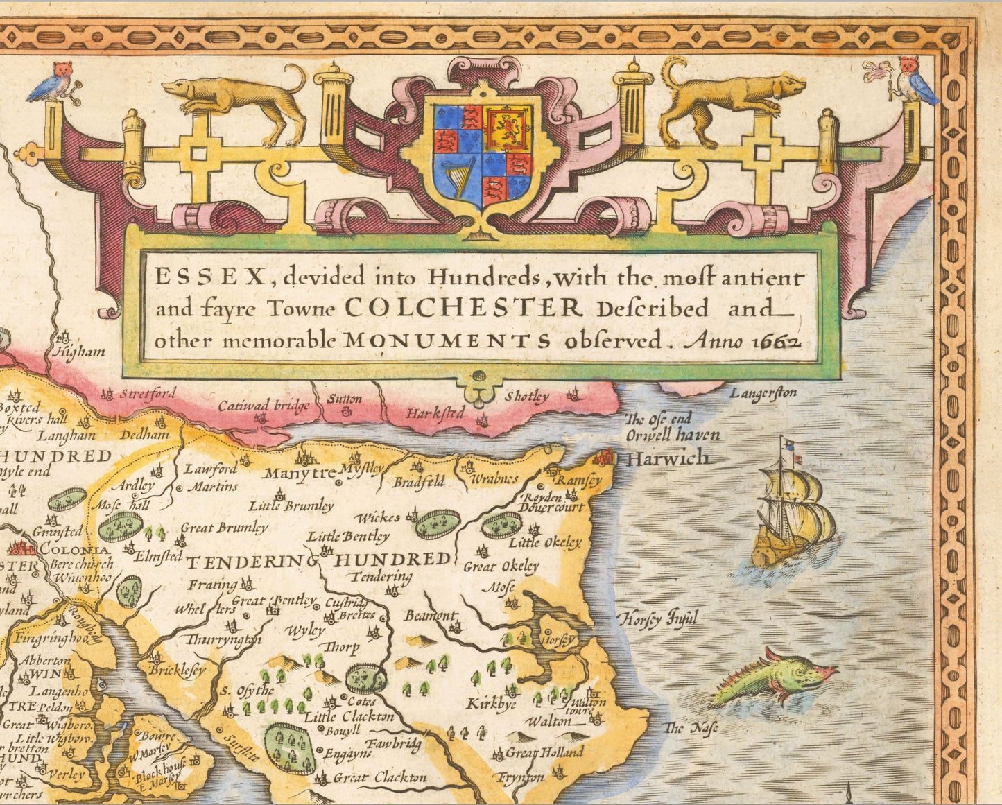
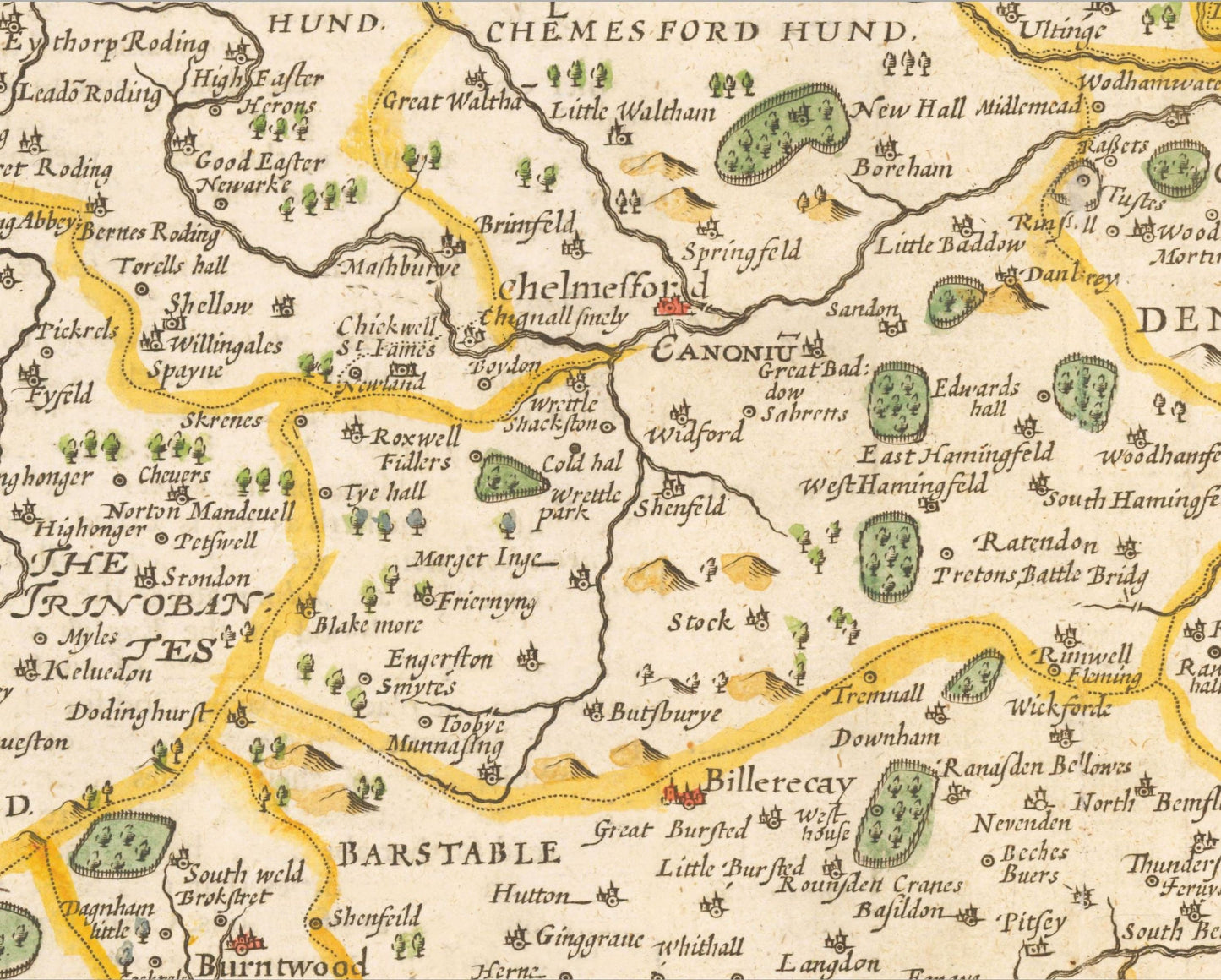
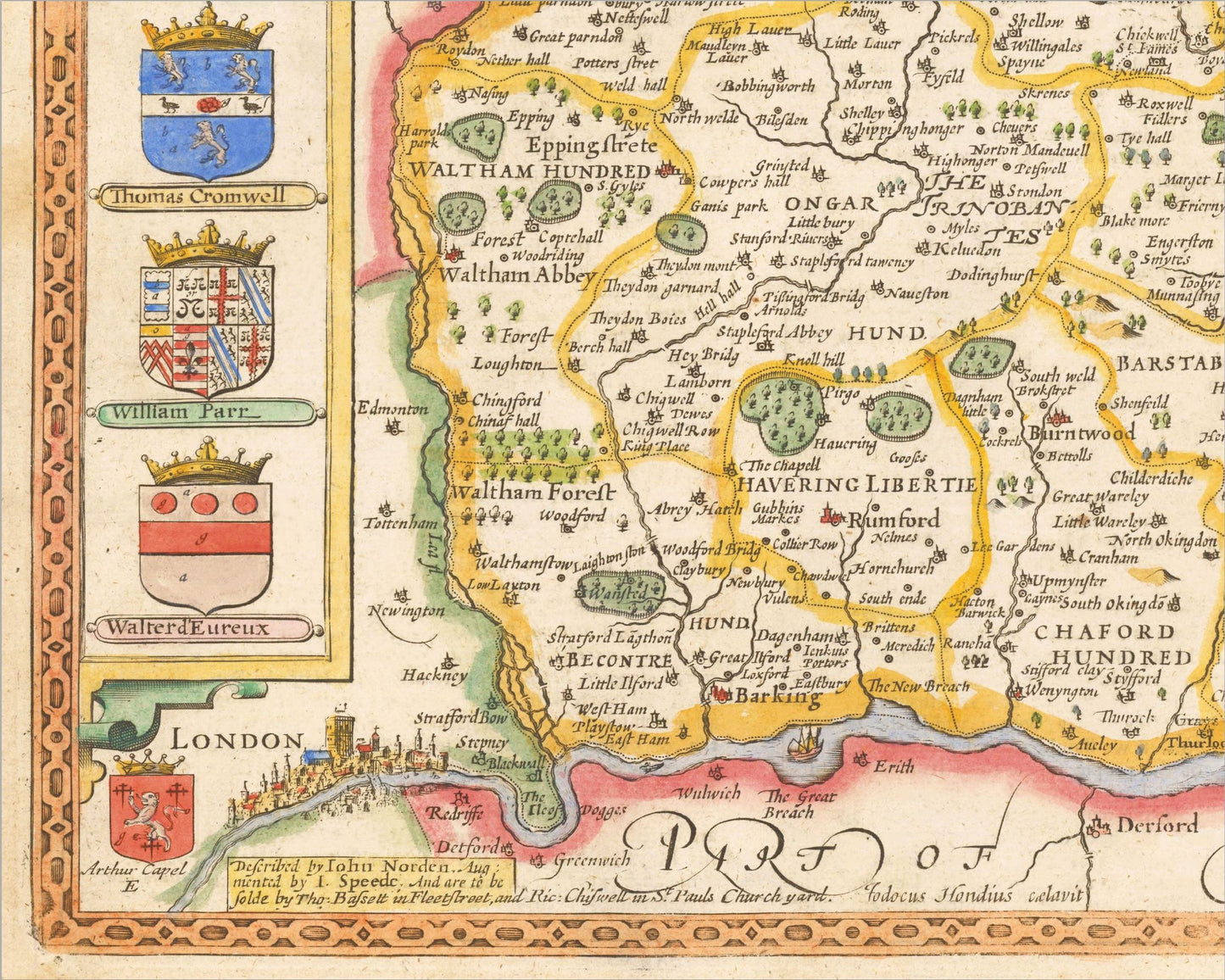
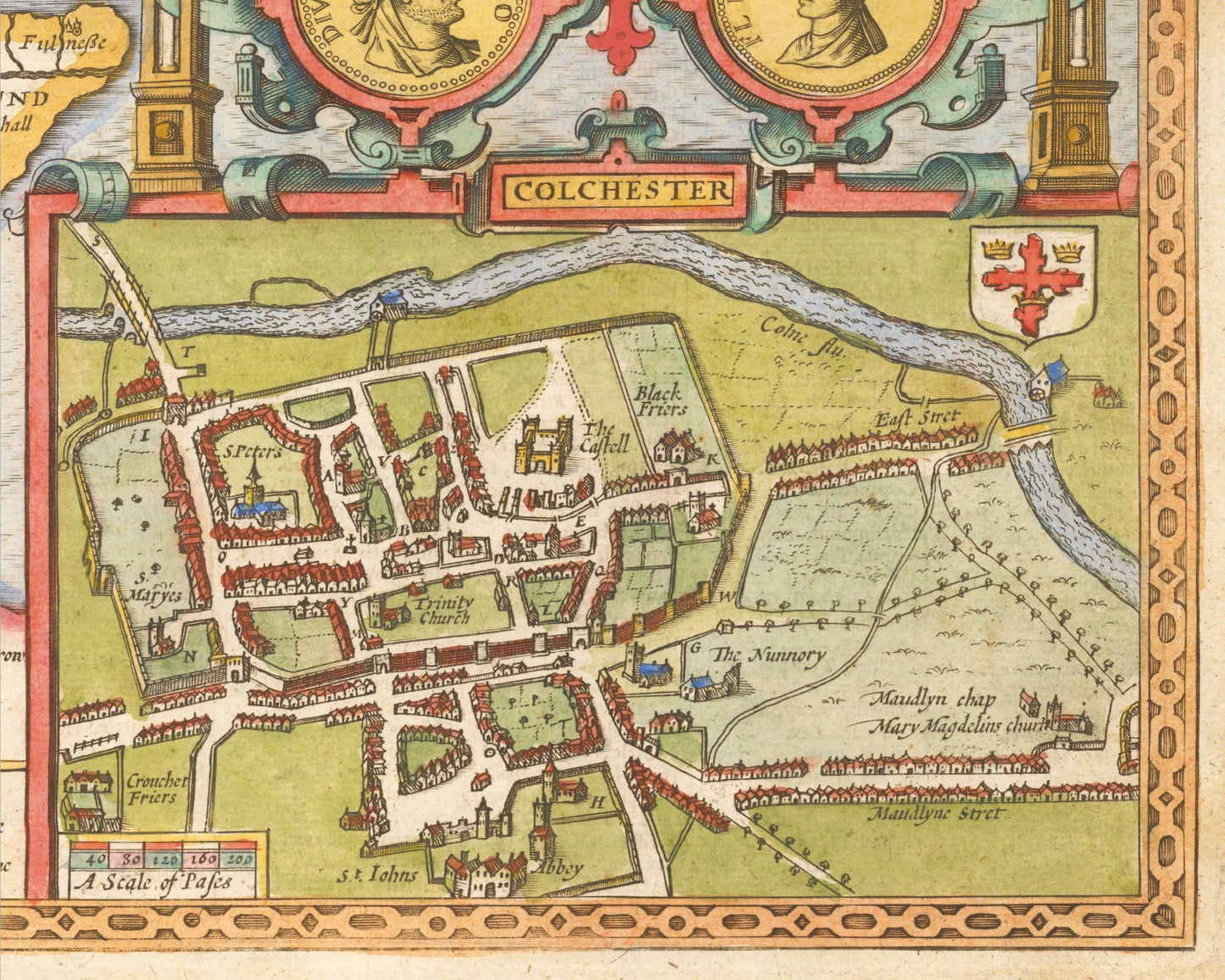
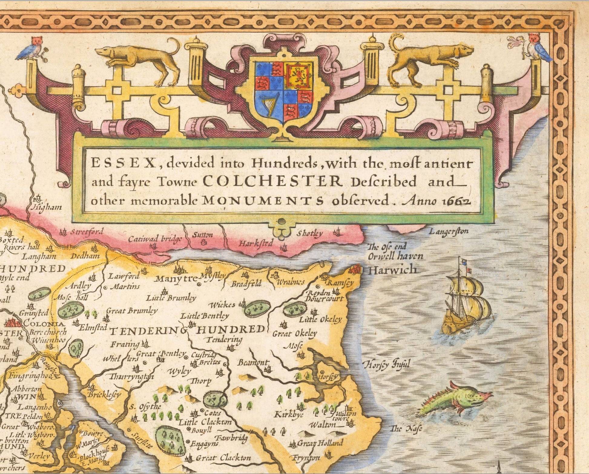
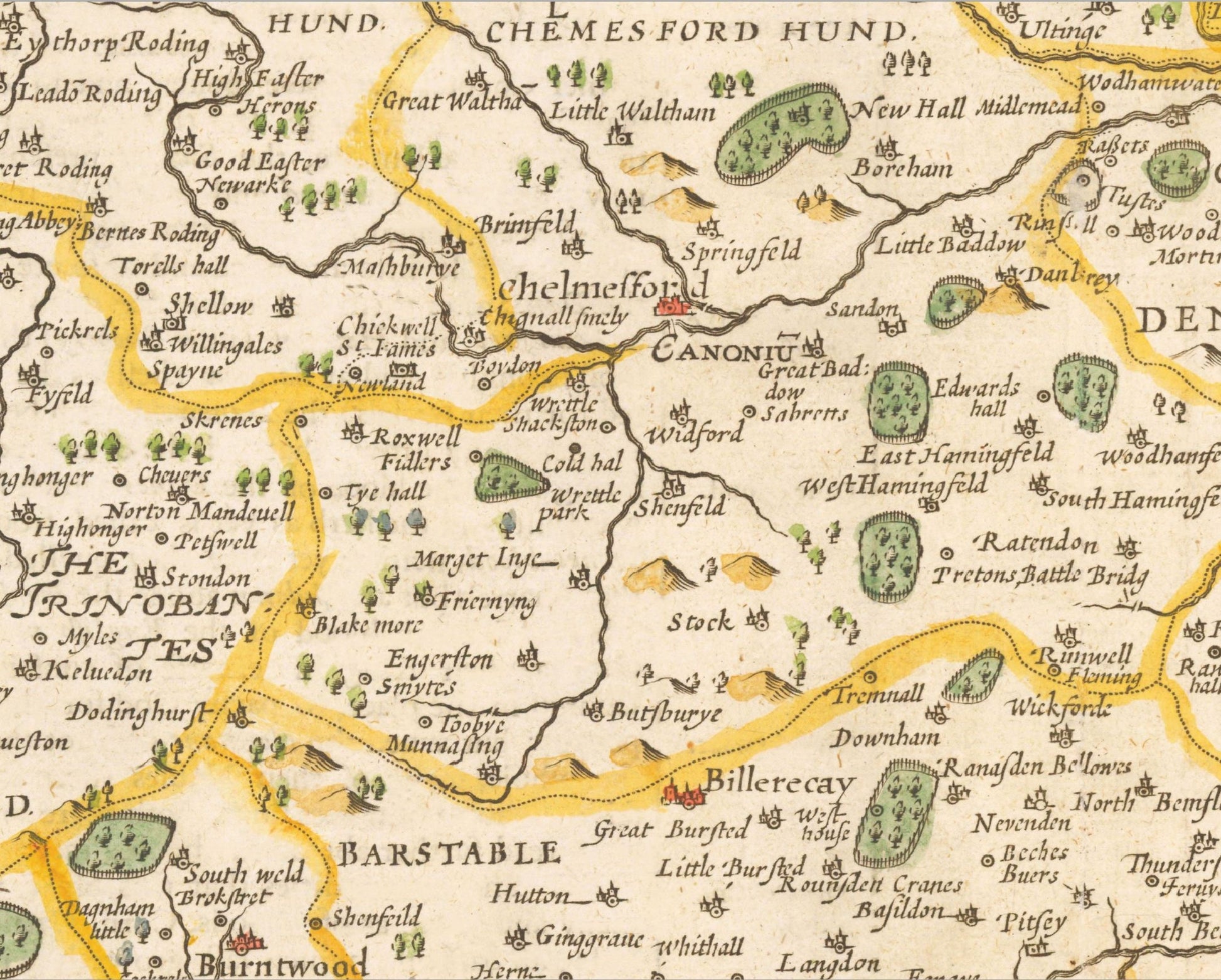
• A detailed geography of the hills, rivers and forests of Essex from the early 17th century
• A wonderful inset map of the county town Colchester with accompanying index
• Illustrations of three Roman coins and columns depicting the importance the Roman administration had on the ancient county
• Coats of Arms of important dignitaries such as William Parr and Thomas Cromwell
• All offset with a beautiful stylistic border
Share