Classic Maps and Prints
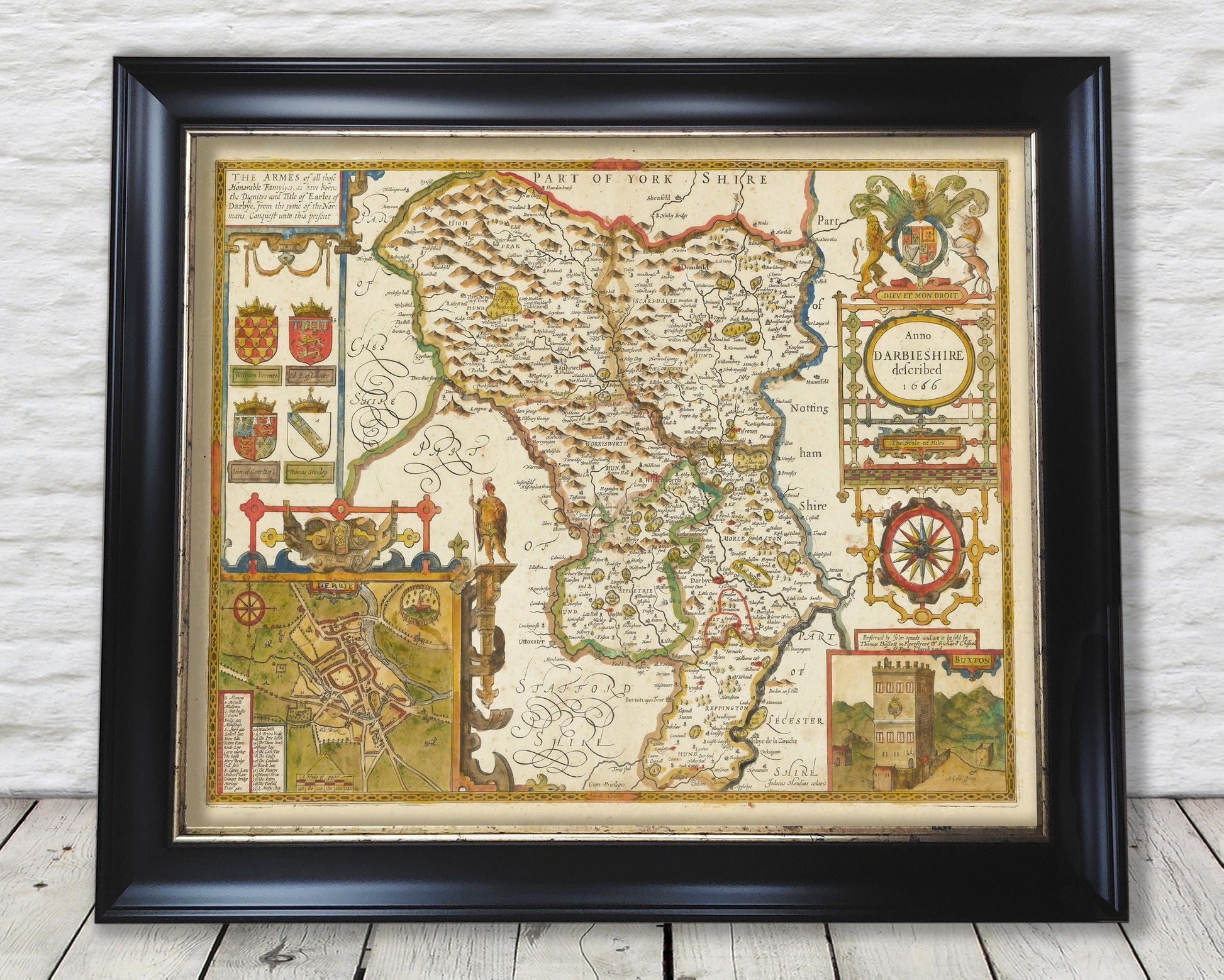
Old DERBYSHIRE map John Speed 1611 - Derby Matlock Buxton
Old DERBYSHIRE map John Speed 1611 - Derby Matlock Buxton
Couldn't load pickup availability
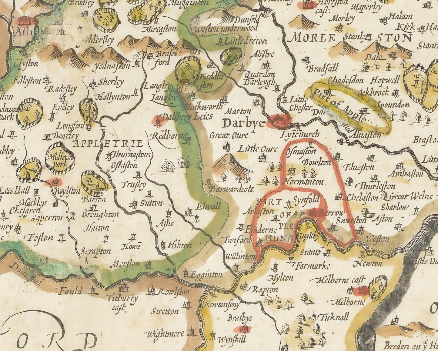
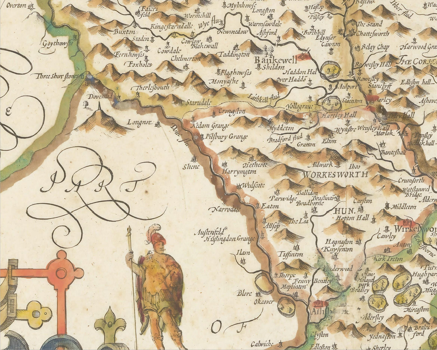
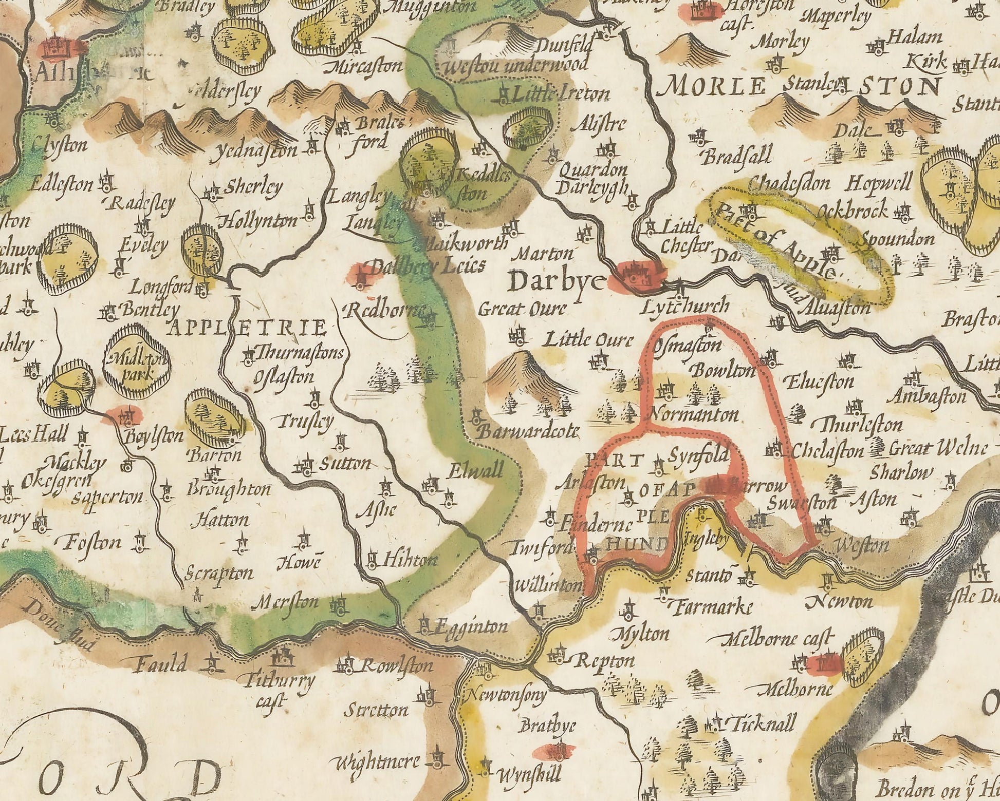
This classic piece was produced by John Speed the best known mapmaker of the Stuart period. It is a wonderful example of a decorative county map that was produced over 400 years since. This is an antique reproduction of the original hand coloured map and therefore each original map is in itself unique.
Of Derbyshire Speed said the following:
"With the mountainous grandeur of the Peak, the flatter and less eventful landscape towards Nottinghamshire and the rolling scenery towards Leicestershire, Derbyshire is a county of contrasts. Except for the moorland in the north-west of Derbyshire, described graphically by Speed as 'black and mossy ground', the county was heavily wooded and forested with no less than thirty-six parks for the keeping of deer."
"Besides its woods and cattle, sheep and corn', Derbyshire was a producer of lead mined in the vicinity of Wirksworth, Matlock, Bakewell and Hope."
This full colour antique reproduction is a highly sought-after work which is sure to form an interesting conversation piece to any living room and looks even more stunning in our 20" x 16" framed edition.
This would make a wonderful gift for someone from Derbyshire or who has Derbyshire in their heart.
Features:
-------------
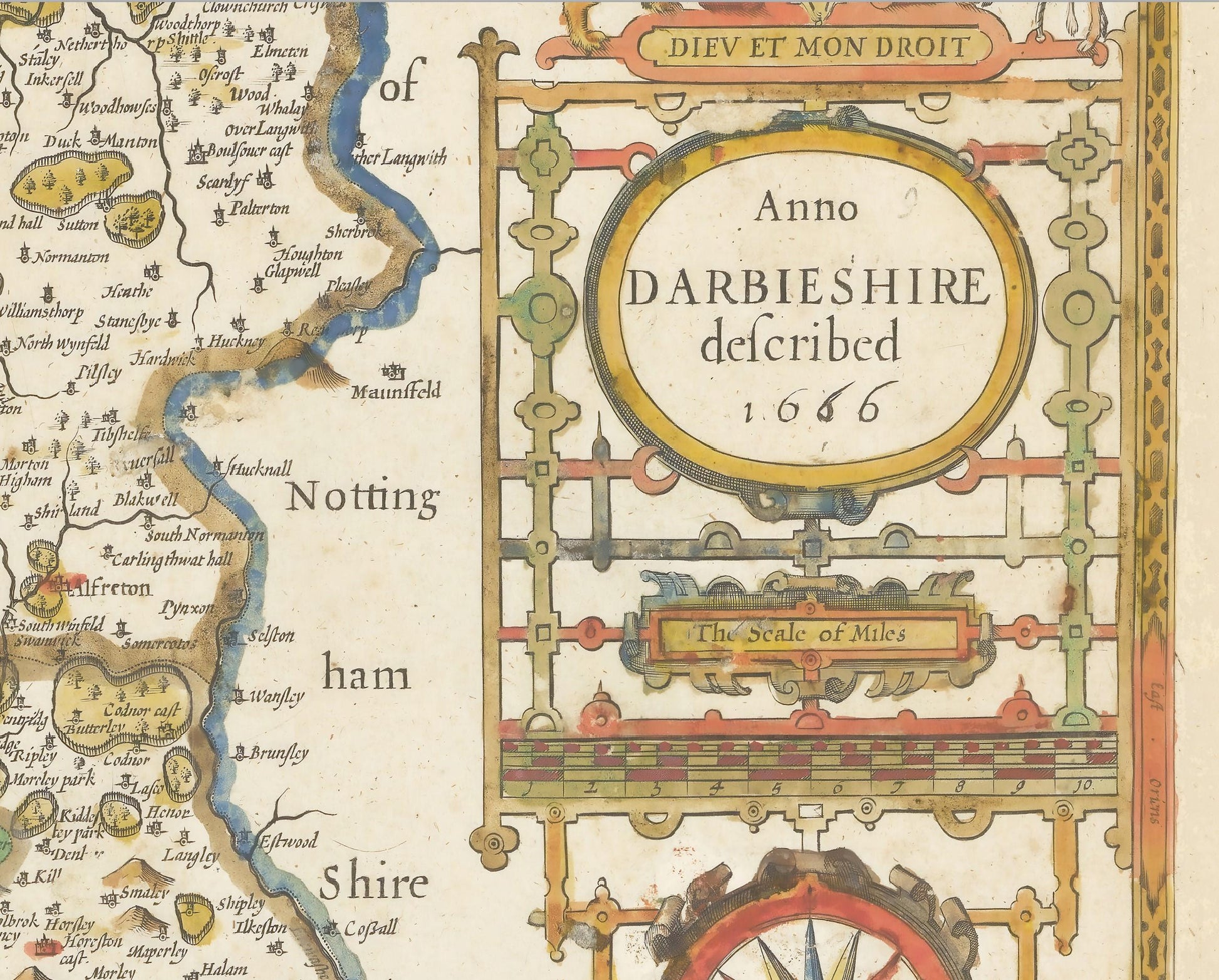
• A visually beautiful stunning and detailed map of 17th century Derbyshire which includes rivers, wooded areas, place names and hill ranges
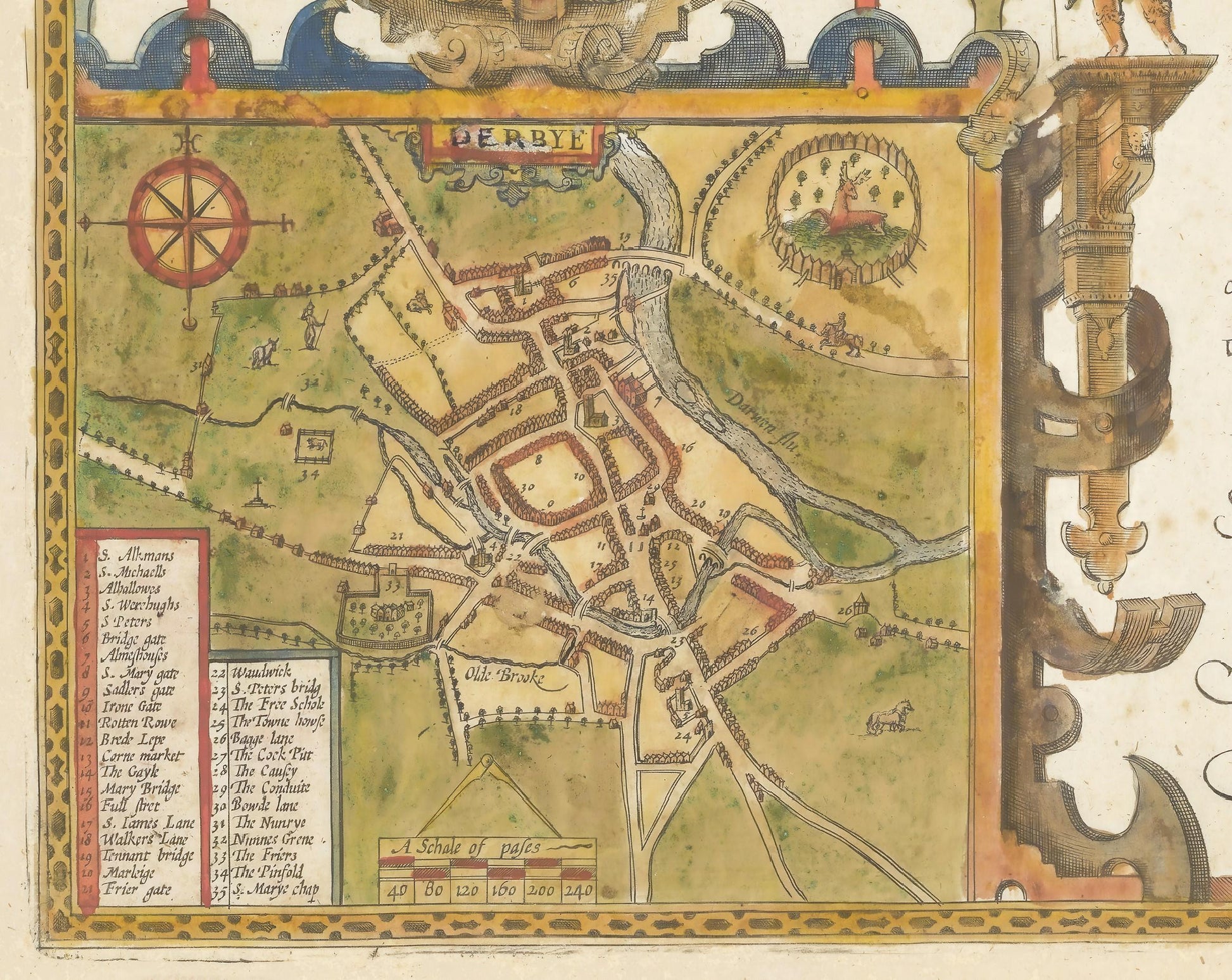
• An inset map of Derby with key
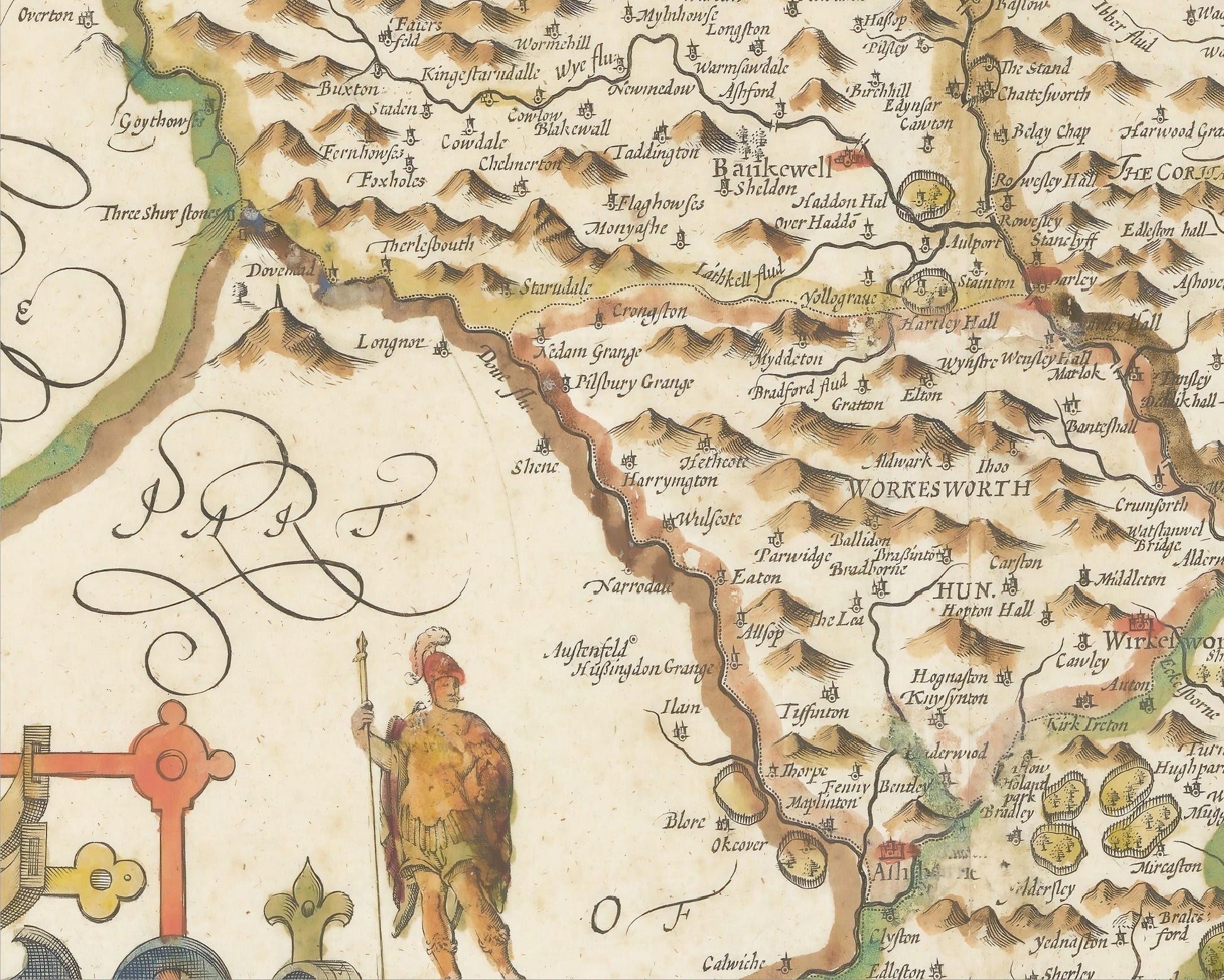
• A vignette of Buxton - famed for its spring waters
• Coats of Arms of the Earl's of Derby
• All offset with a lovely decorative border
Share