

Classic Maps and Prints
Old CANTERBURY Map 1588 by Braun - Cantuarbury Chaucer Christ Church
Old CANTERBURY Map 1588 by Braun - Cantuarbury Chaucer Christ Church
Couldn't load pickup availability
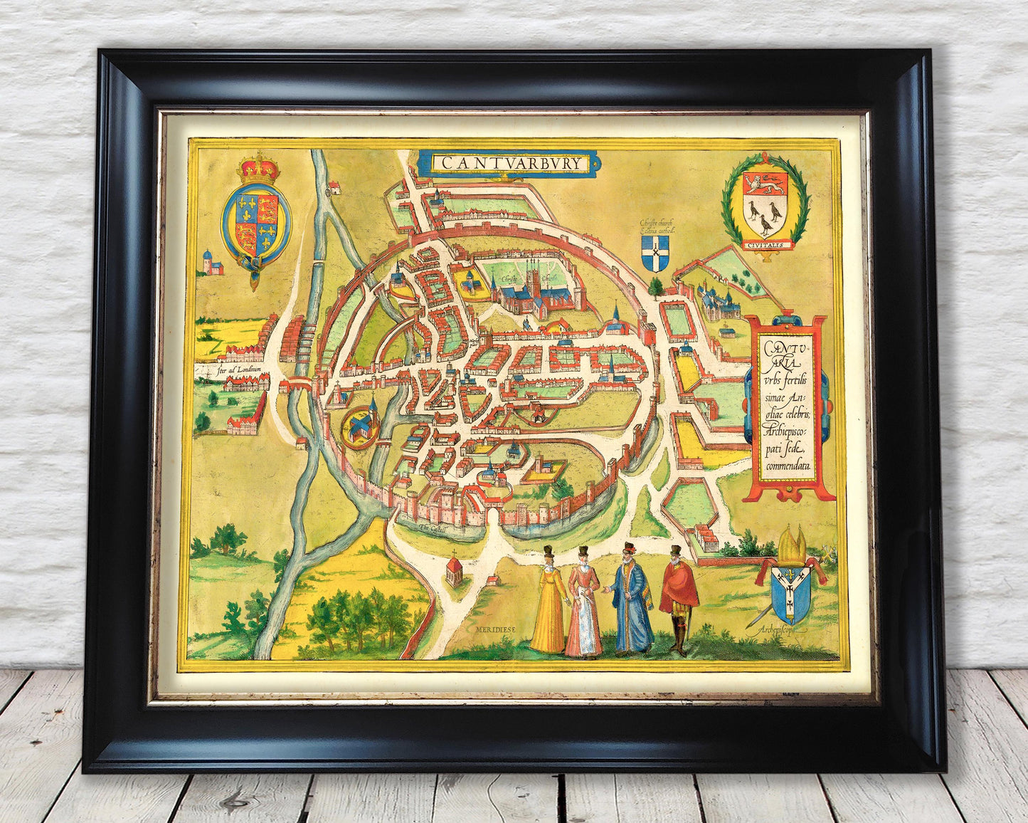
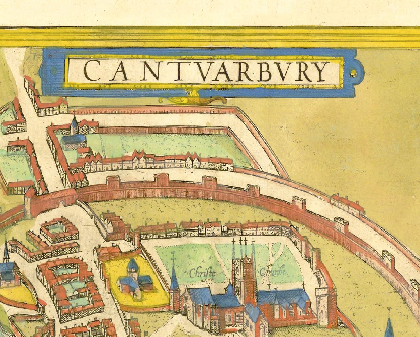
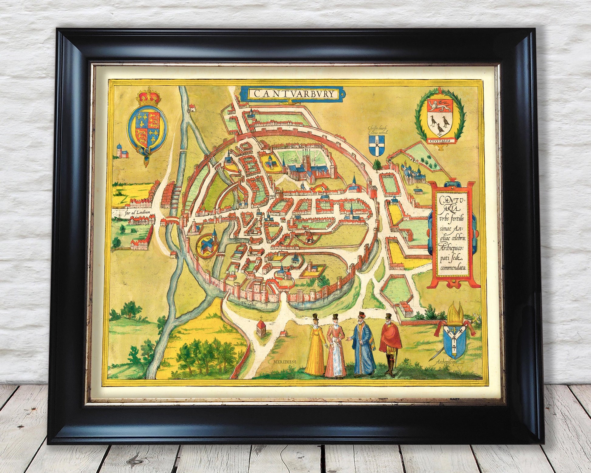
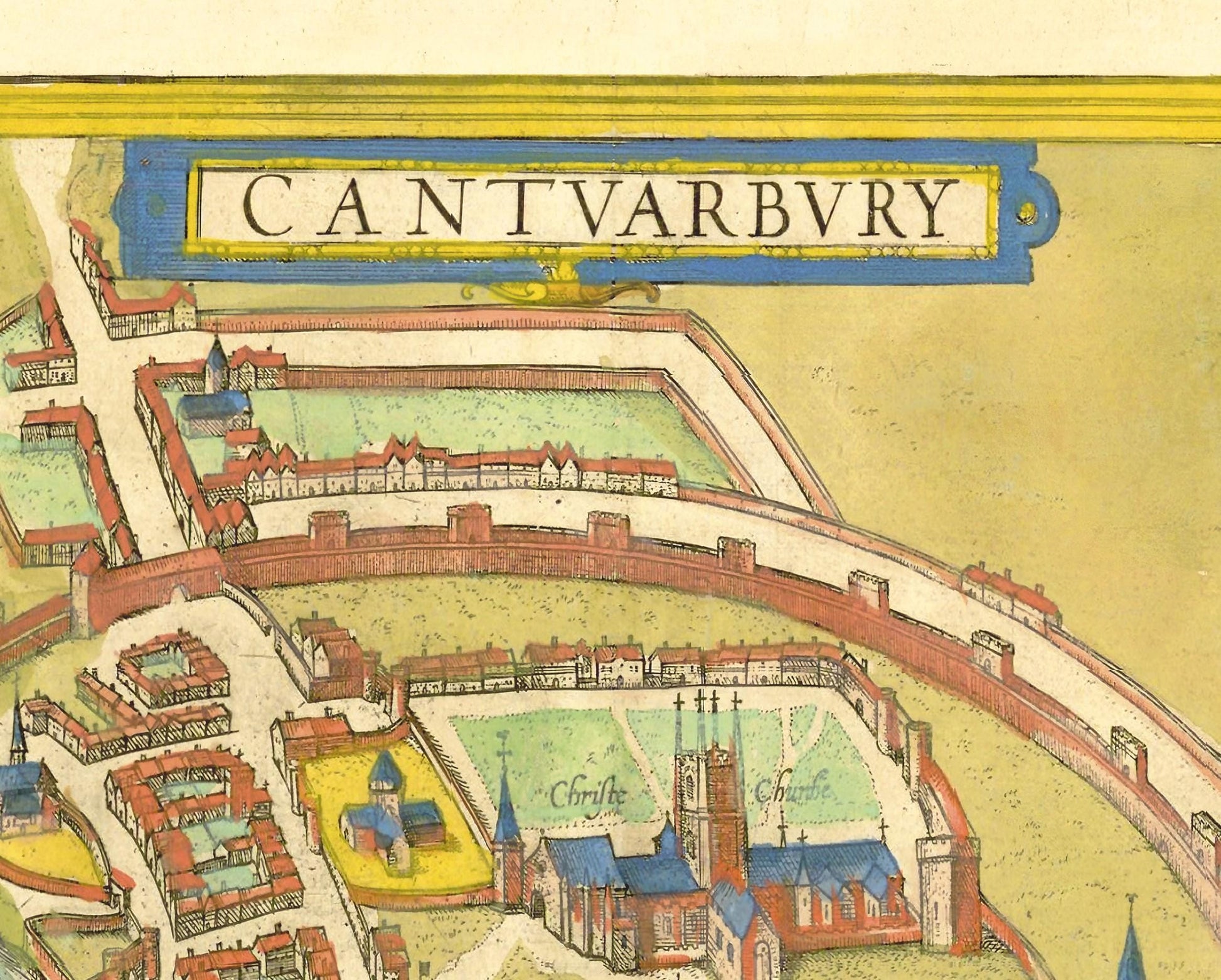
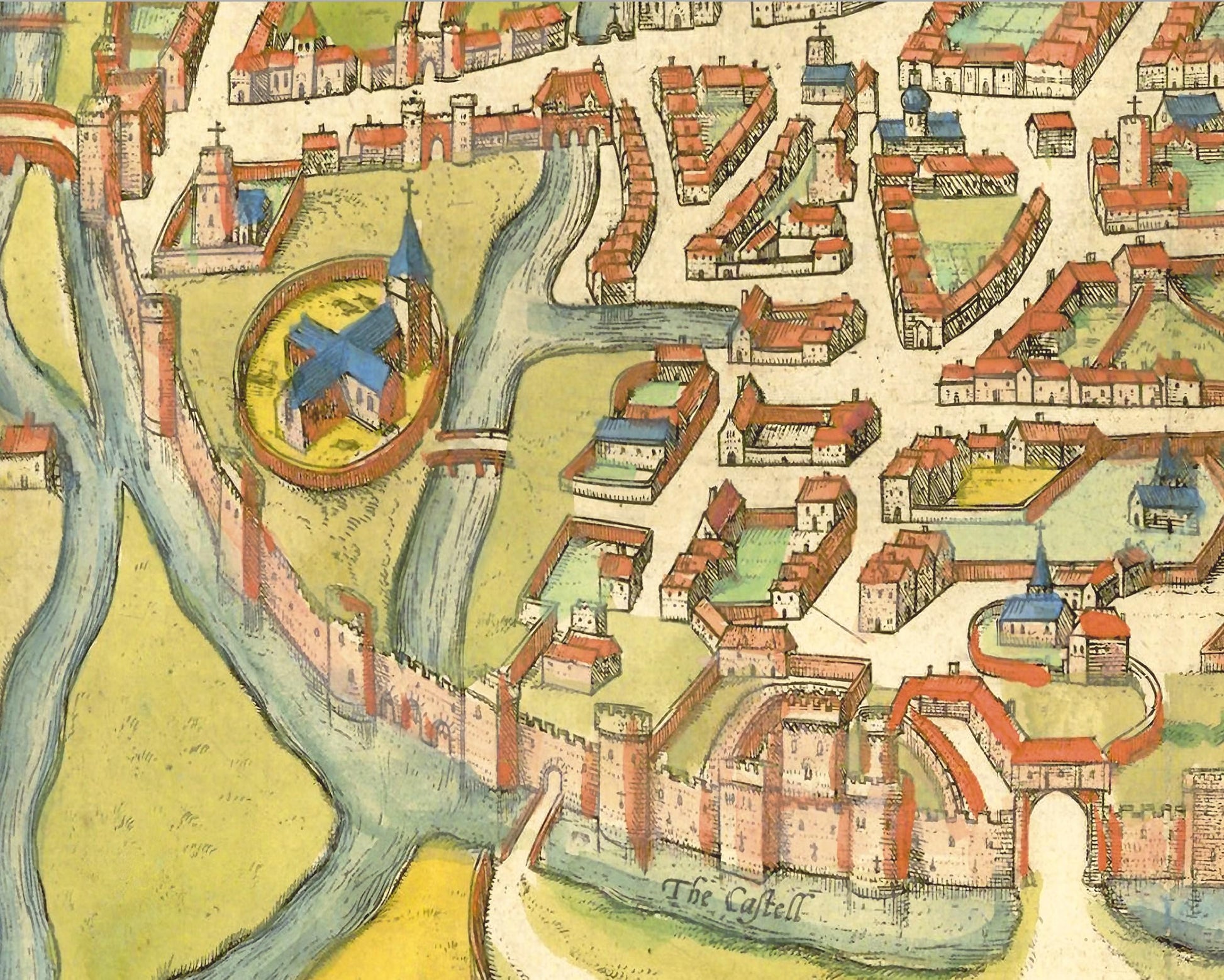
Published in 1588 by Georg Braun and Frans Hogenberg, this is one of the first printed maps of Canterbury - or Cantuarbury as it was known then. This map was first published in Civitates Orbis Terrarum - the Cities of the World - which was a cartographical masterpiece featuring 546 maps.
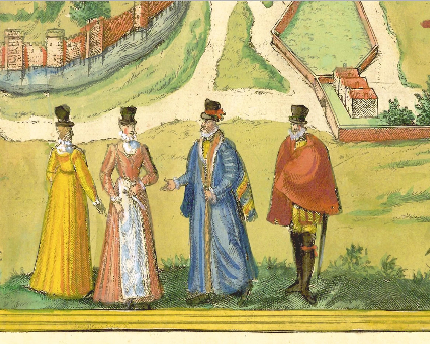
This bird's-eye view from the south shows Canterbury enclosed within a circular defensive wall. It was originally a Roman city named Durovernum Cantiacorum. In AD 597, Augustine, "Apostle to the English", converted a church dating from Roman times into a cathedral and built a monastery there. From the 11th to the 15th century, the old cathedral was replaced by the building that can be seen today. Archbishop Thomas à Becket was murdered in this church in 1170 because he opposed reintroducing royal privileges within the ecclesiastical sphere. Becket was canonised by Pope Alexander III in 1173. His tomb developed into an essential place of pilgrimage until Henry VIII ordered the destruction of the shrine and the relics in 1538. On the left, the Westgate Tower can be seen next to the bridge over the Stour. The episcopal coat of arms underlines the special status enjoyed by the city in the lower right-hand corner. The Archbishop of Canterbury has been head of the Anglican Church since its separation from Rome in the 16th century.
This rare work is highly sought-after work and is sure to form an interesting conversation piece to any living room. This piece looks stunning mounted as shown in either our A2 or 20x16 inch framed editions.
Share