


Classic Maps and Prints
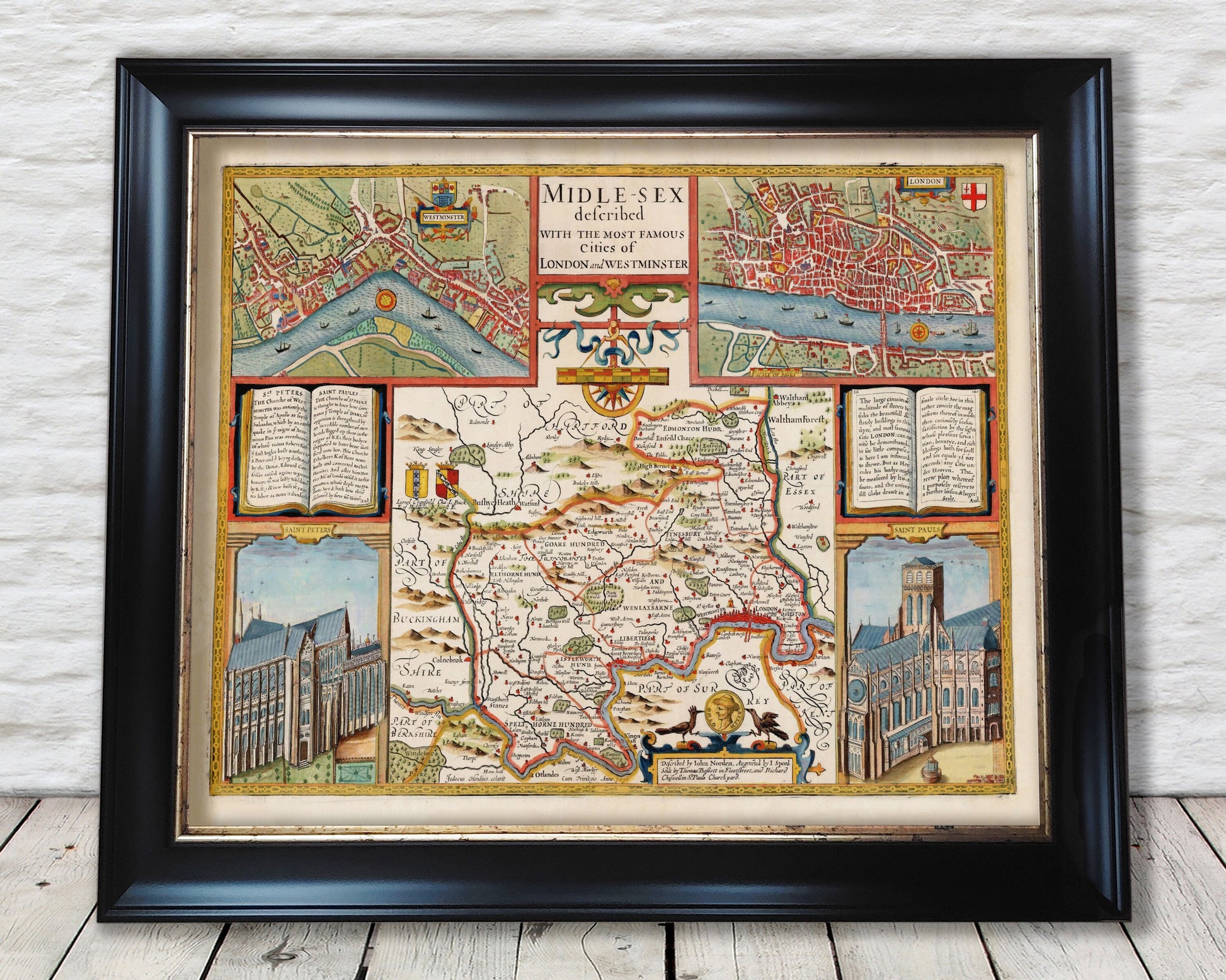
MIDDLESEX old Map in 1611 by John Speed - City of London, Westminster
MIDDLESEX old Map in 1611 by John Speed - City of London, Westminster
Couldn't load pickup availability
This classic piece was produced by John Speed the best known mapmaker of the Stuart period. It is a wonderful example of a decorative county map that was produced over 400 years since. This is an antique reproduction of the original hand coloured map and therefore each original map is in itself unique.
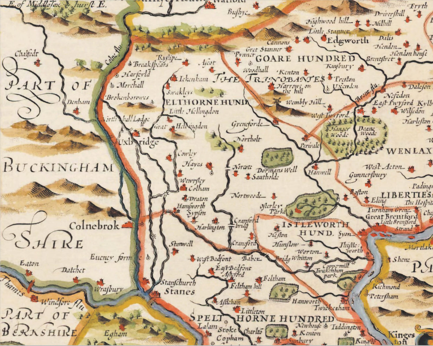
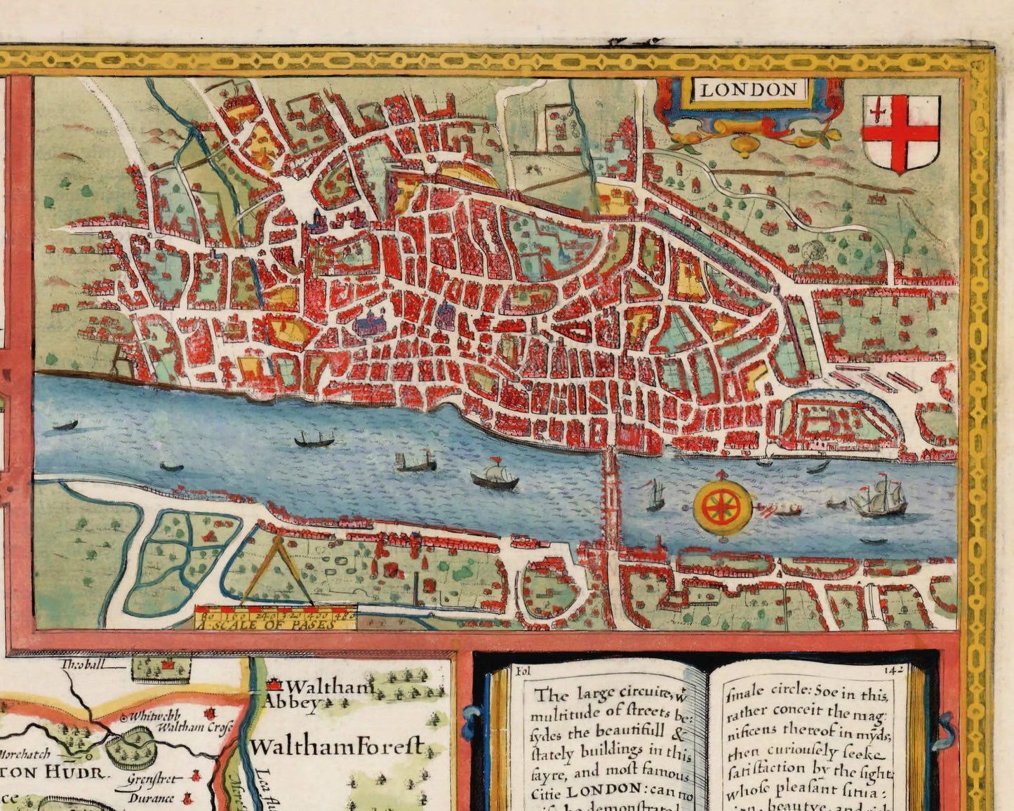
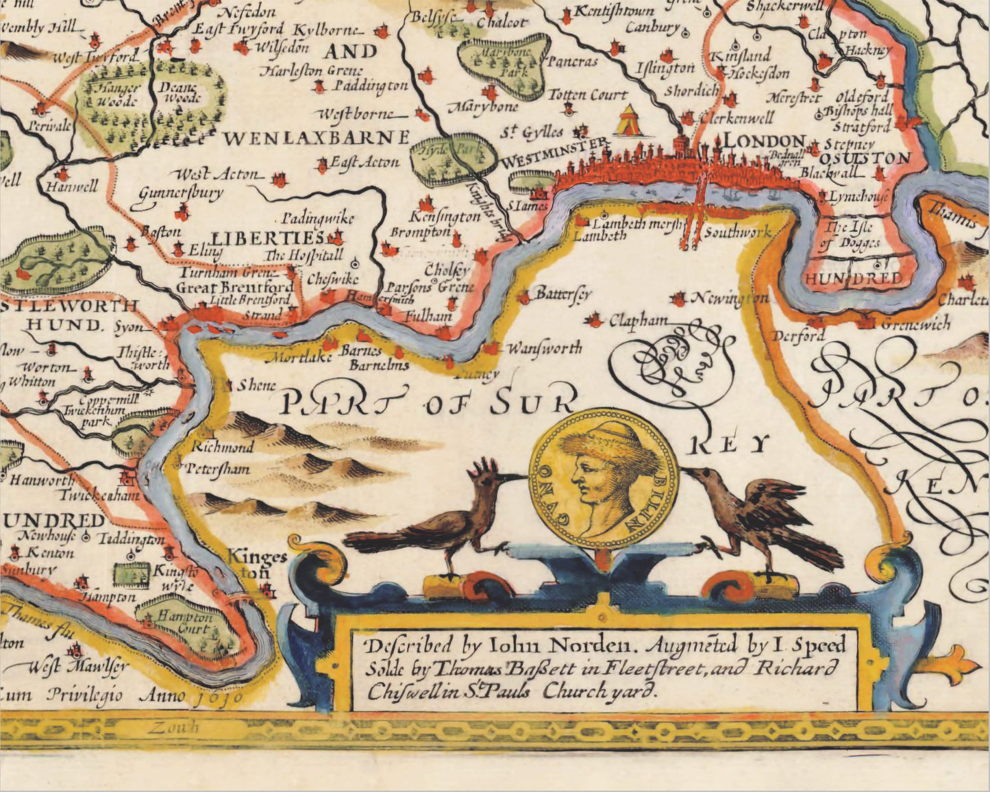
This superb map of Middlesex has the Nation's capital London within its borders and also the city of Westminster. Even by the start of the 17th century many place names or similar sounding names at least are established. Putney, Lambeth, Clerkenwell, Cheswike, Kensington, the Isle of Dogges and Battersey are names that modern day Londoners would recognise and are in evidence on this map. The Medieval walled City of London by this time was largely now left to business and industry with the population living outside the walls.
Speed noted "general overcrowding led peers, courtiers and officials to seek more salubrious accommodation outside London's walls, leaving the medieval city to its merchants, craftsmen and artisans with their warehouses and industrial premises. Not only was London the most heavily industrialized town in England, with products ranging from pottery through leather and cloth goods to guns and body armour, but it was also a port of national and international consequence"
I have colour graded this map with warm hues to bring out the true beauty of Speed's work.
This full colour antique reproduction would look stunning when mounted and would form a striking centrepiece to any room.
Features:
-------------
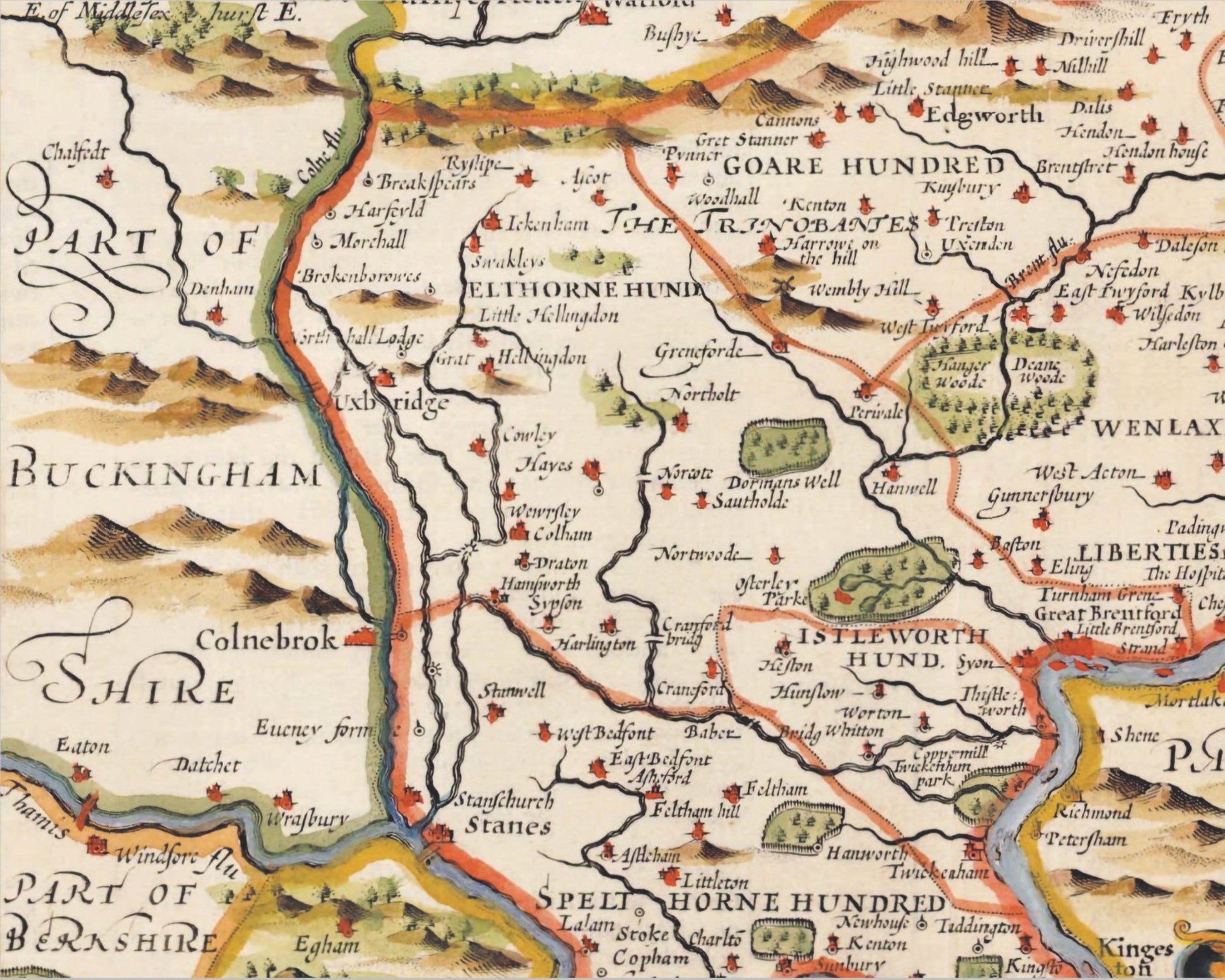
• This beautiful map captures the geography, rivers, forests and place names of early 17th century Middlesex
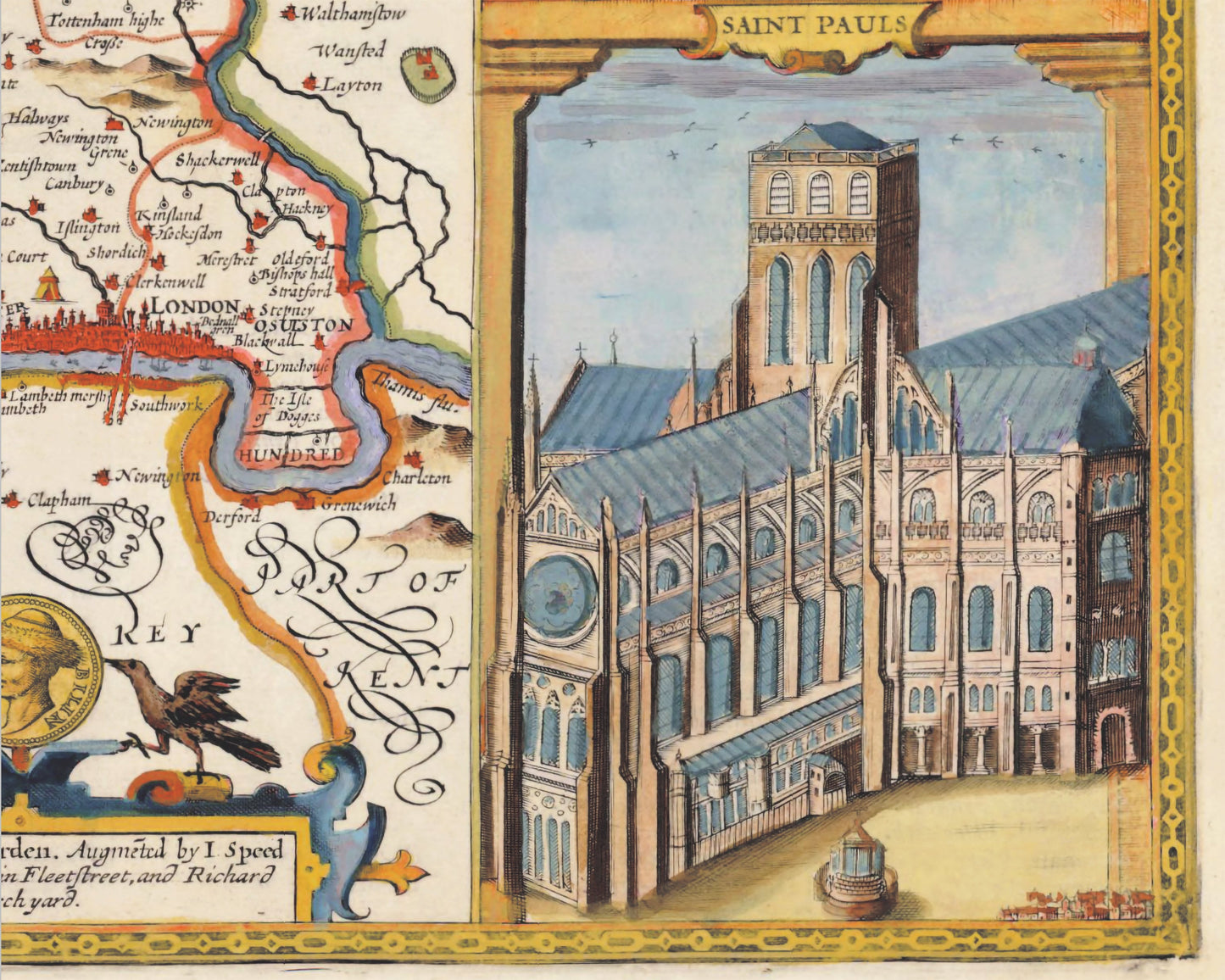
• Two lovely vignettes feature of St Paul's and St Peter's
• Numerous places of interest can be seen in and around the banks of the Thames including Hyde Park and Hampton Court
• The map accurately records how Middlesex was divided into various Hundreds during this time
• Two wonderful inset maps of London and Westminster feature including contemporary river vessels
• This work is offset by a colourful stylised border
Share