
Classic Maps and Prints
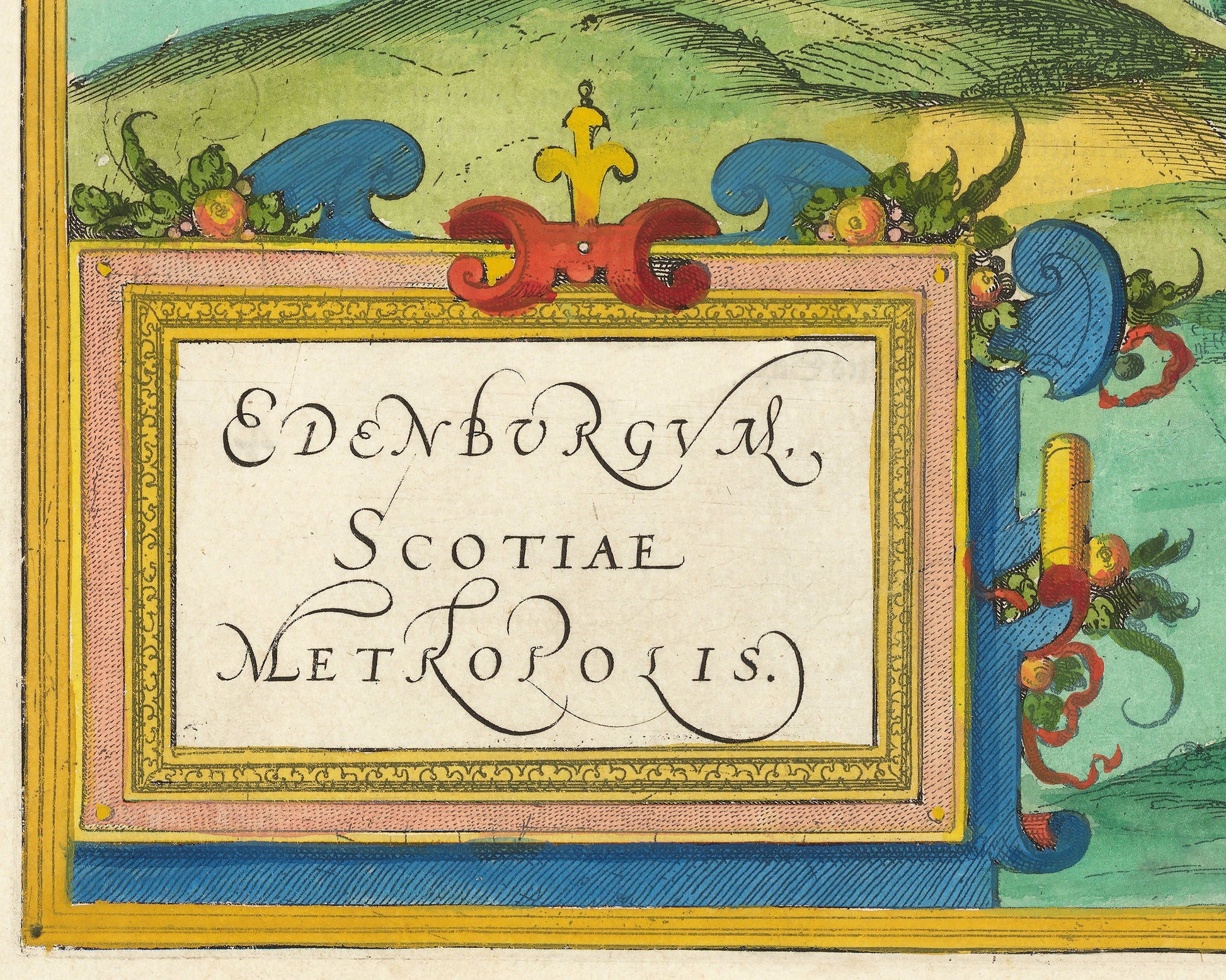
Map of old EDINBURGH 1580 Braun and Hogenberg - Castle, Walls, Holyrood
Map of old EDINBURGH 1580 Braun and Hogenberg - Castle, Walls, Holyrood
Couldn't load pickup availability
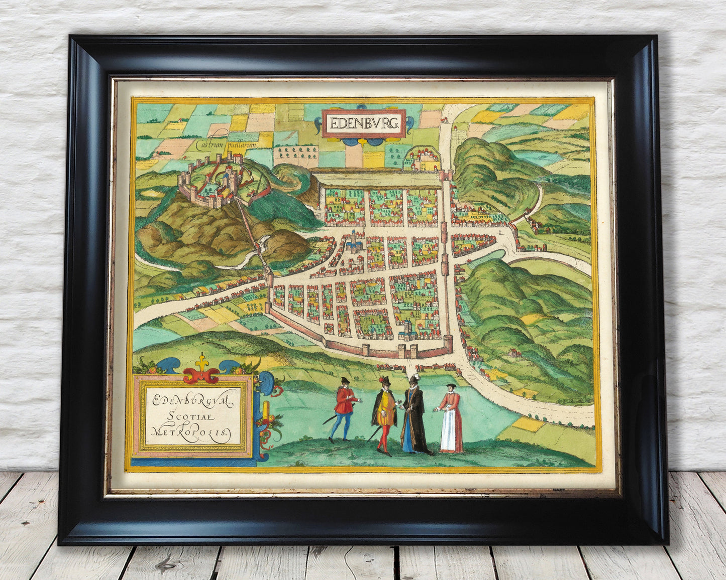
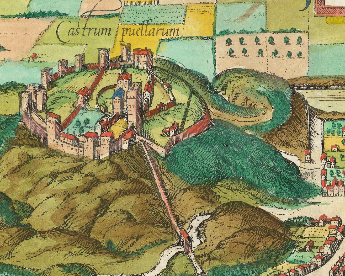
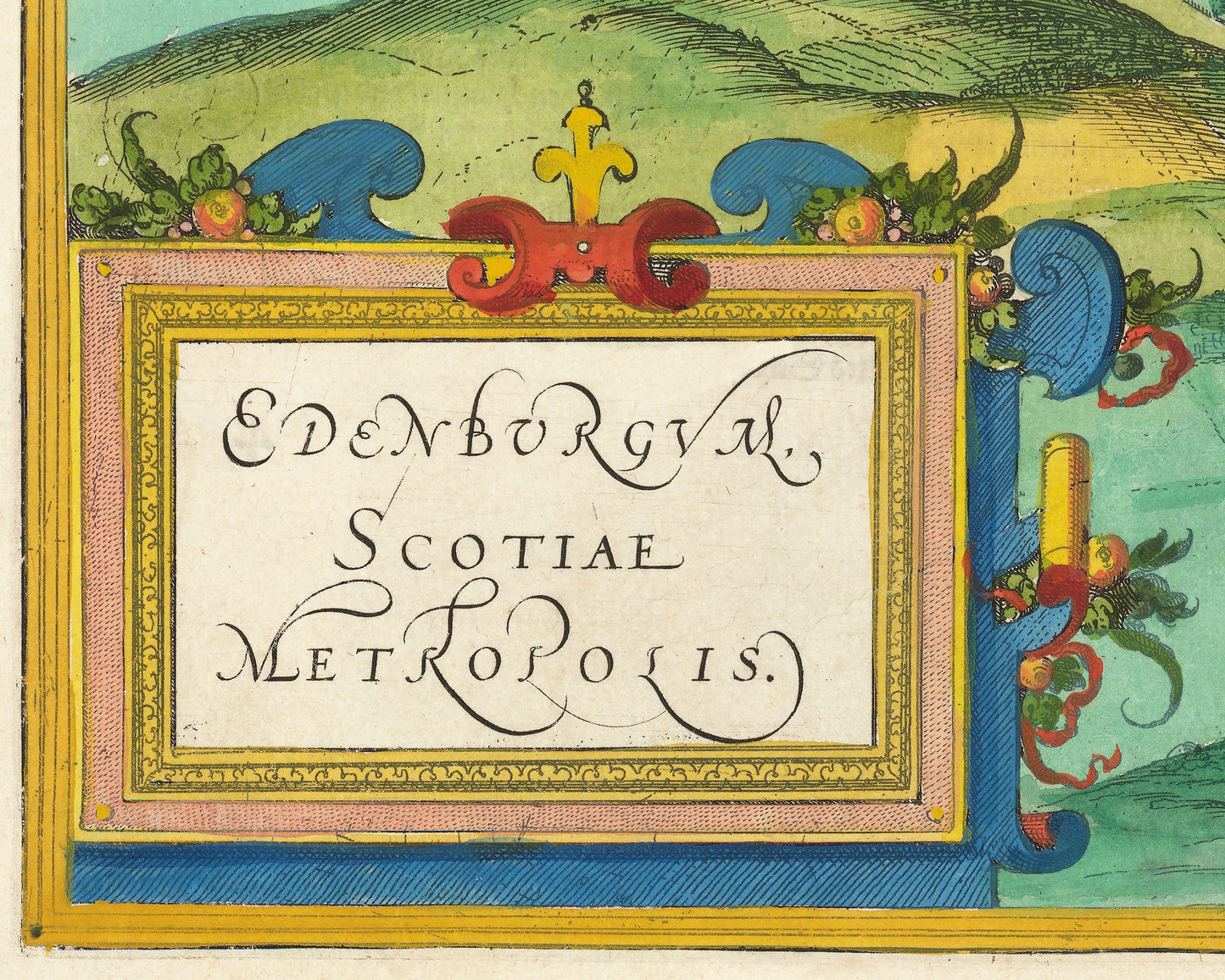
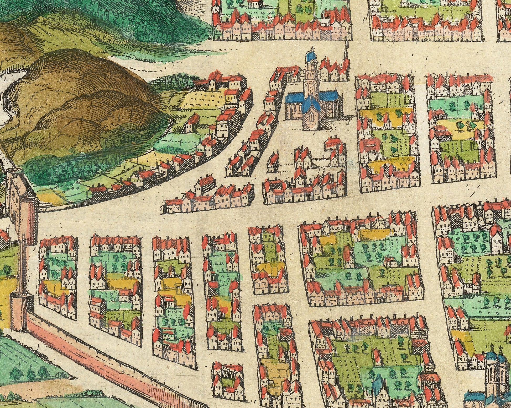
This superb map of Edinburgh was produced by Georg Braun and Frans Hogenberg in 1580. Taken from their Civitates Orbis Terrarum - the Cities of the World - this was one of over 500 such masterpieces. This particular example has been hand coloured and captures Scotland's capital in a vibrant style. Who better to describe this map than Braun himself.
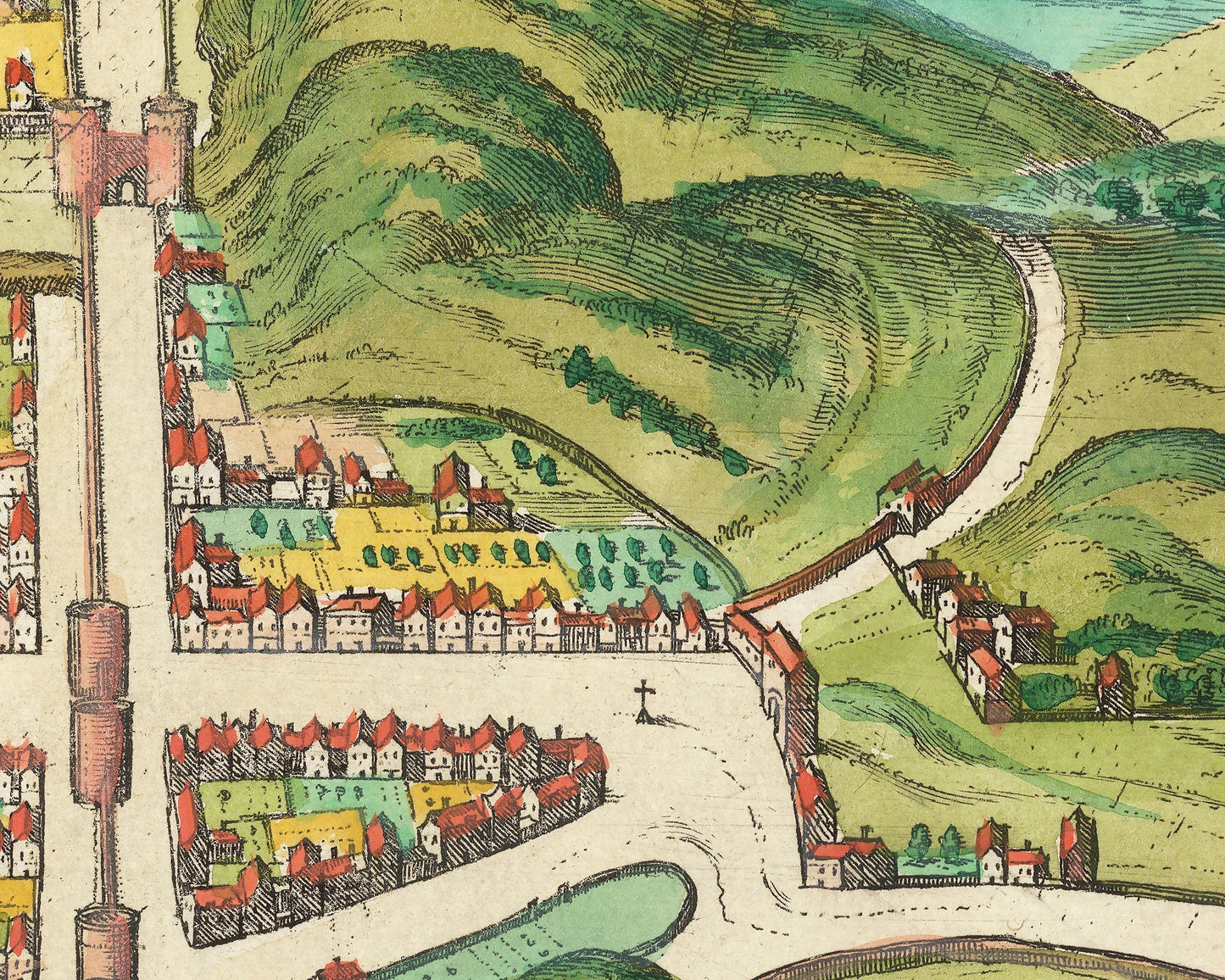
“To the west of the city a mountain with a tall cliff rises up, upon which stands a castle, which is extremely secure due to its natural setting. On the side of the city to the east lies a majestic monastery to the Holy Cross, alongside it a royal palace set within an exceedingly charming garden. There are two large streets in this city, one that is paved with ashlar stone (now the Royal Mile), leading from the Maidens’ Castle to the monastery and to the royal palace, and the other is the highway. From the highway running from north to south countless smaller roads branch off, all of which are lined with very tall buildings.”
This is a much sought after work. Our special framed edition really offsets this print to great effect and is sure to be a great conversation piece in any living room.
Share