Classic Maps and Prints
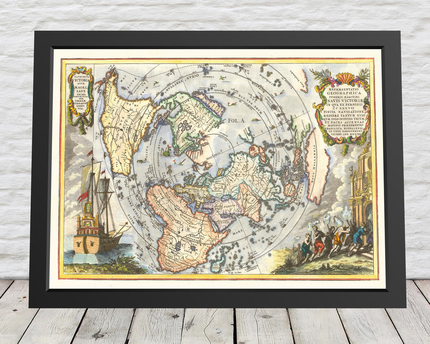
Magellan's Circumnavigation of the Globe Map in 1522 by Heinrich Scherer
Magellan's Circumnavigation of the Globe Map in 1522 by Heinrich Scherer
Couldn't load pickup availability
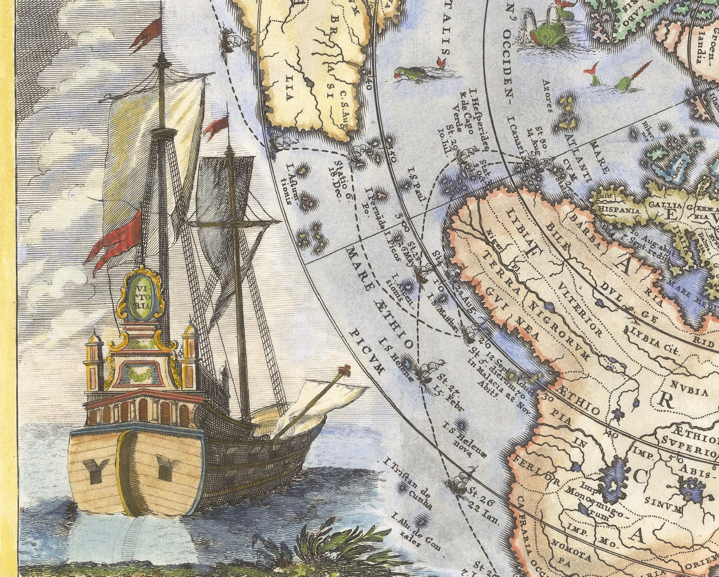
This striking map of the world based on Cassini's projection was made Heinrich Scherer. It details the first navigation of the globe undertake by the Portuguese explorer. A translation of the Latin in the left corner says that the ship Victoria was commanded by Magellan and took 1124 days to complete the first circumnavigation of the earth. Victoria was in fact one of five ships that started the quest. The note in the right corner states that of the 237 crew that set sail only 18 made it home and only the Victoria returned safely to Spain on 6th September 1522. Following his death on 27 April 1522 in a skirmish with Lapulapu warriors Juan Sebastián Elcano assumed command of the voyage.
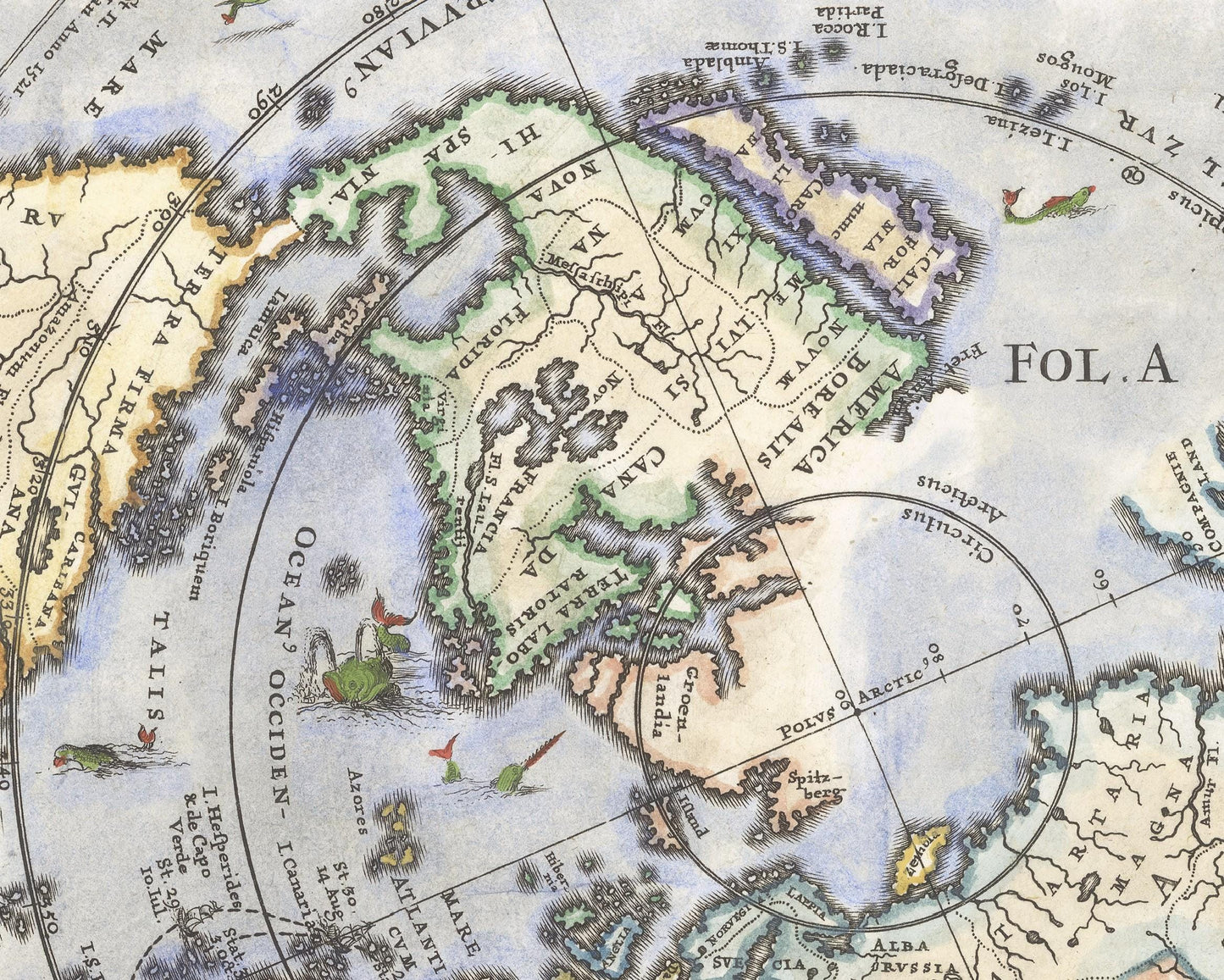
California is shown as an Island. Nova Hollandia is now clearly separated from Nova Guinea, although without a Southern Coastline. Northwest and Northeast passages are shown. New Zealand appears, although only a part of its coastline is known.
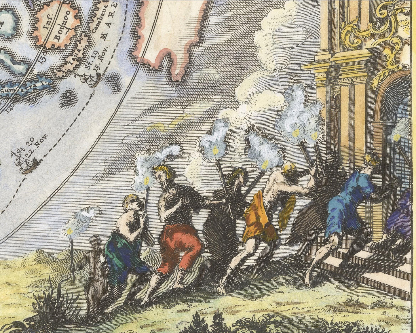
The map shows Magellan's circumnavigation of the world, with the route and dates. The map is ringed by various cartouches and elegant decorative scenes.
***Please note - This map does not include a frame. The framed image is for illustrative purposes only.
Share