Classic Maps and Prints
LONDON Underground Tube Railway Map 1912 Oxford Circus, Piccadilly
LONDON Underground Tube Railway Map 1912 Oxford Circus, Piccadilly
Couldn't load pickup availability
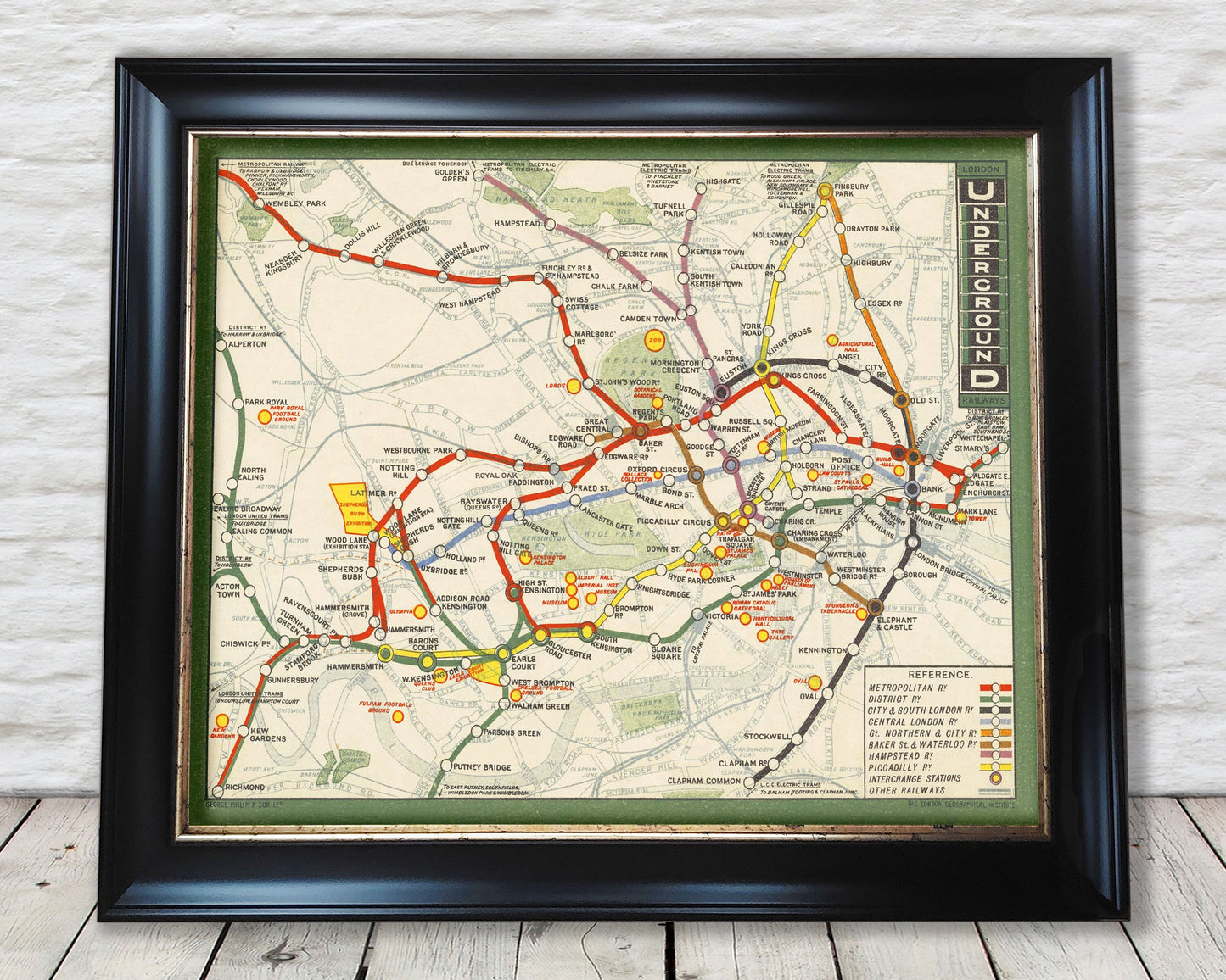
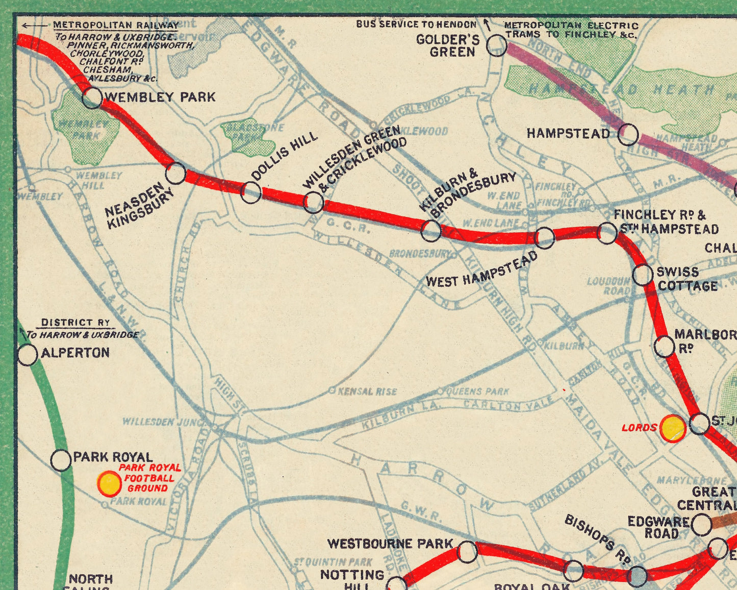
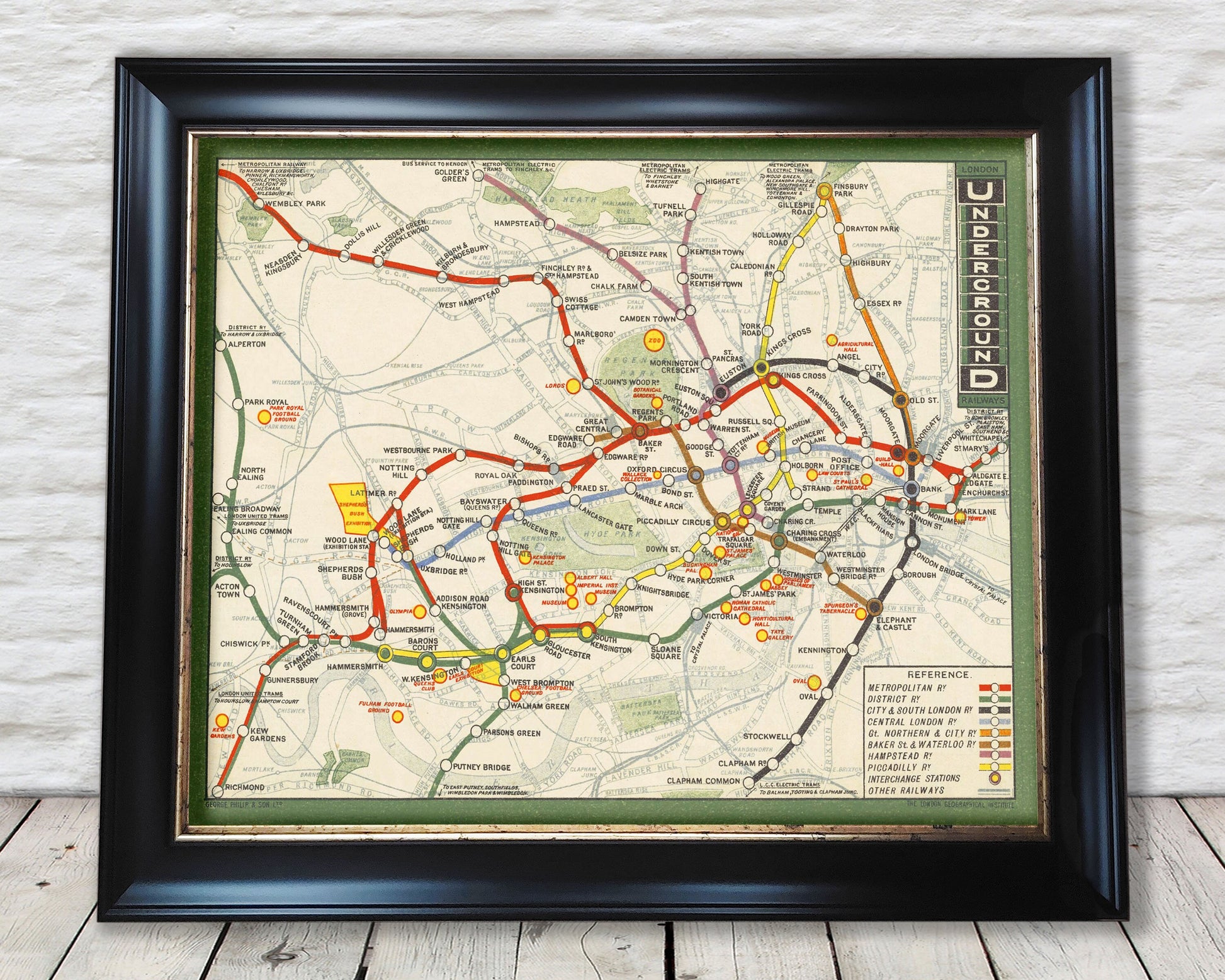
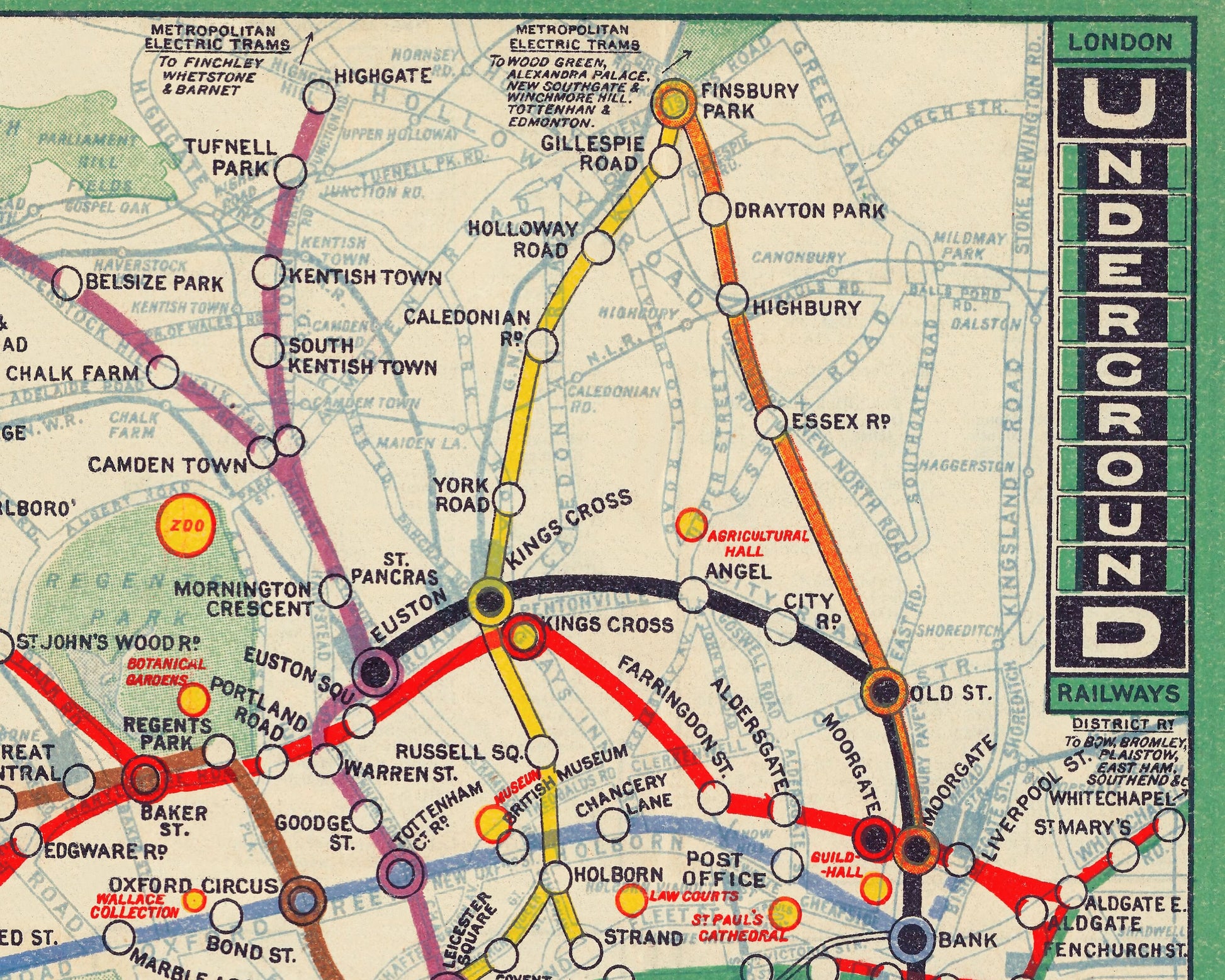
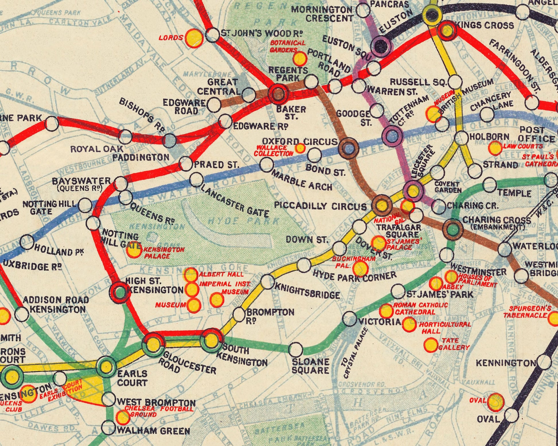
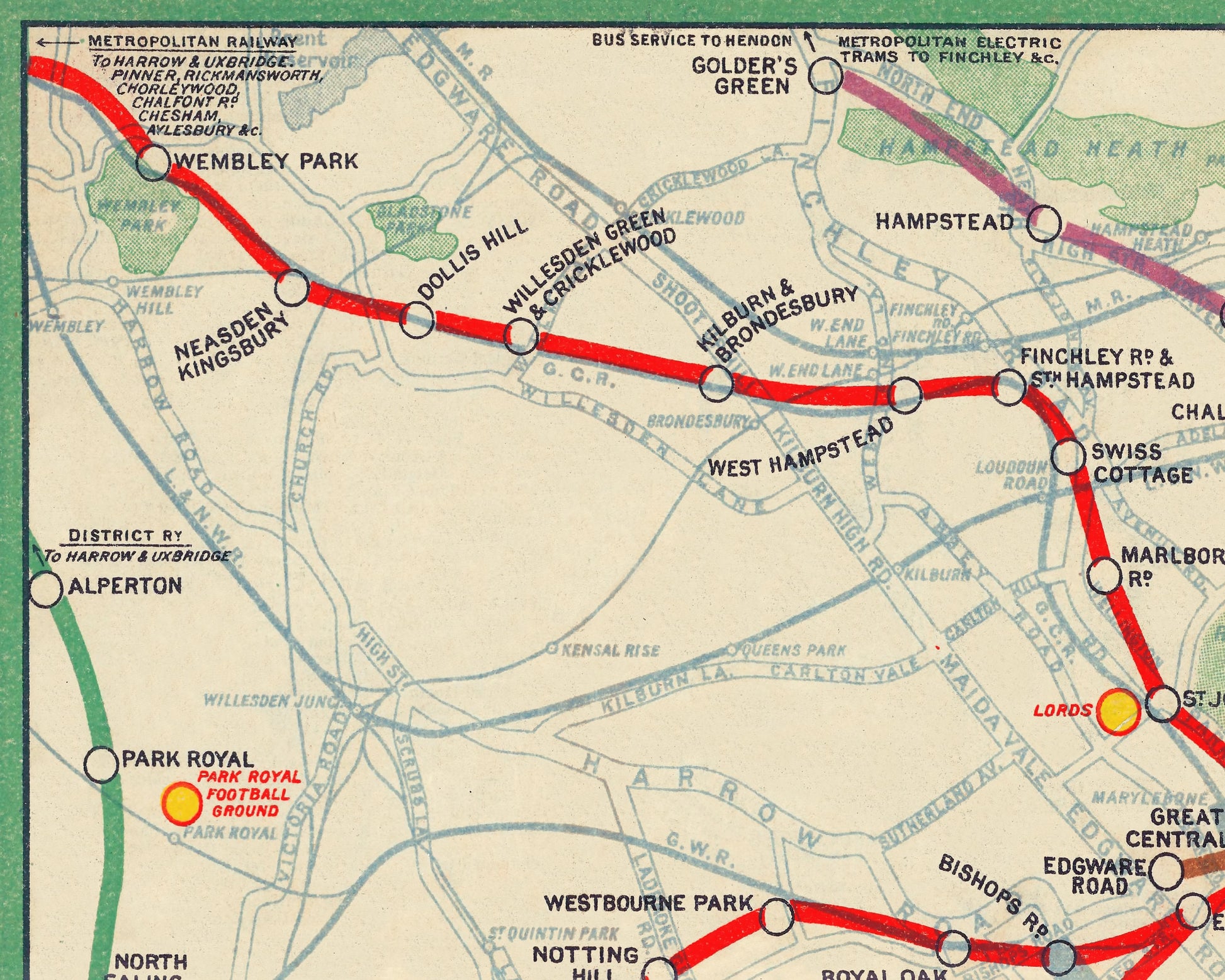
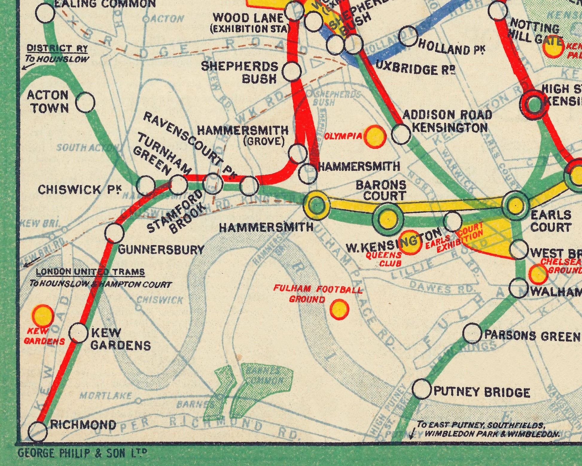
This superb geographic Underground map by George Philip & Son Ltd shows the Railway lines belonging to the Underground Group as well as the Central London Railway and Metropolitan Railway lines as they were in 1912. Each line is represented by a different colour, other railways are marked with lighter blue lines. General geographic features such as roads and parks are also included in more detail and more obvious than in previous editions of the London Underground Railways series of maps.
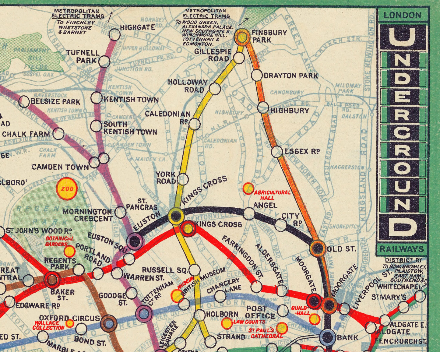
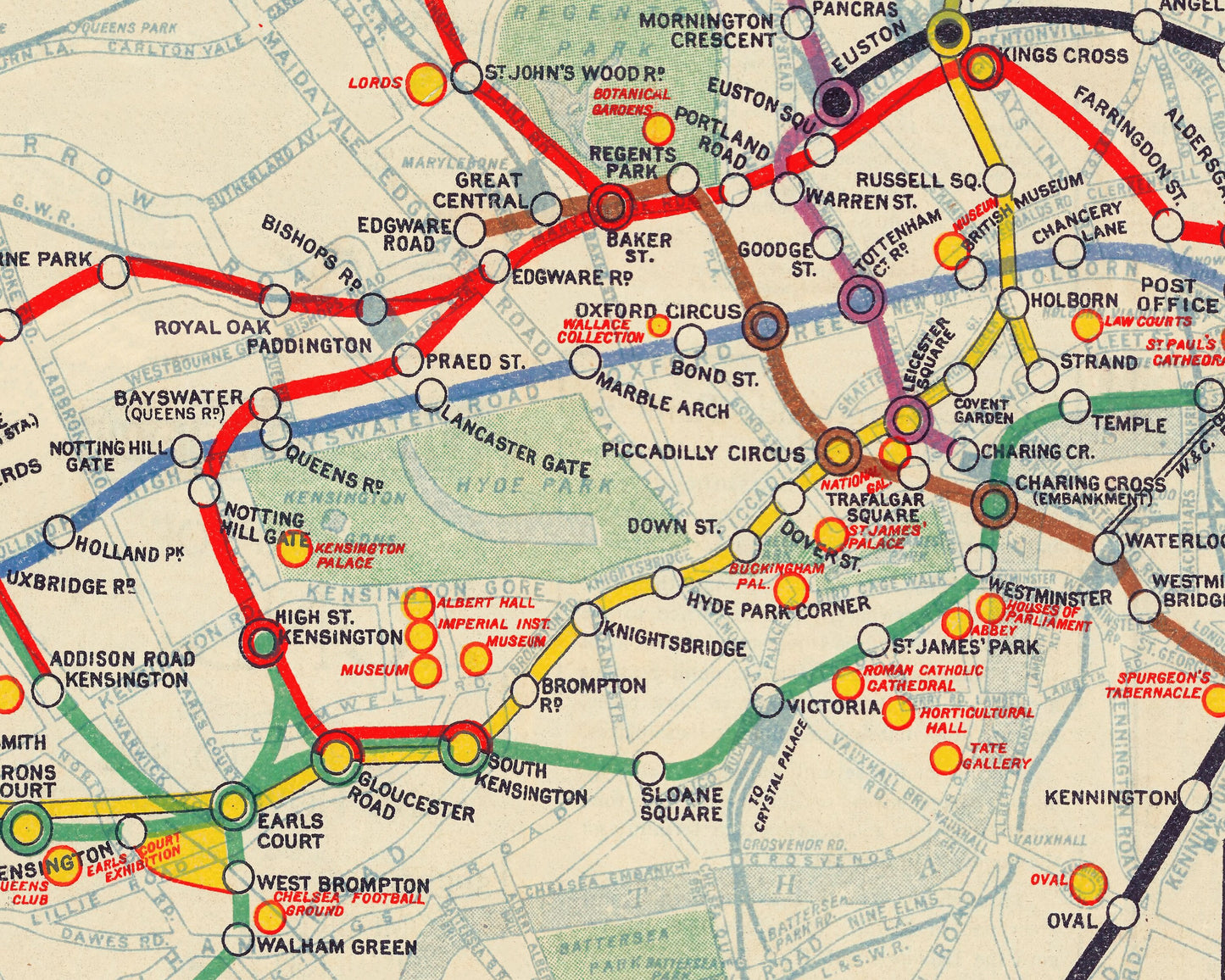
This map shows the Central London Railway extension between Bank and Liverpool Street under construction as a broken blue line. Lines which are served by two railways use the colours of both lines and dual interchanges are shown as solid circles with one colour in the centre and the other as a circular border. Places of interest and exhibition grounds are marked as yellow and red circles. The border of this map is green with the title in the top right hand corner.
Originally published as a fold up pocket sized map I have made a high resolution scanned image and then digitally painted away those distracting fold marks and some of the discolouration.
A classic work that creates a centrepiece for any home and would look stunning framed. This print is produced on premium heavyweight 230 gsm paper and uses the finest quality inks that will not fade or smudge.
This is a highly sought-after work.
Share