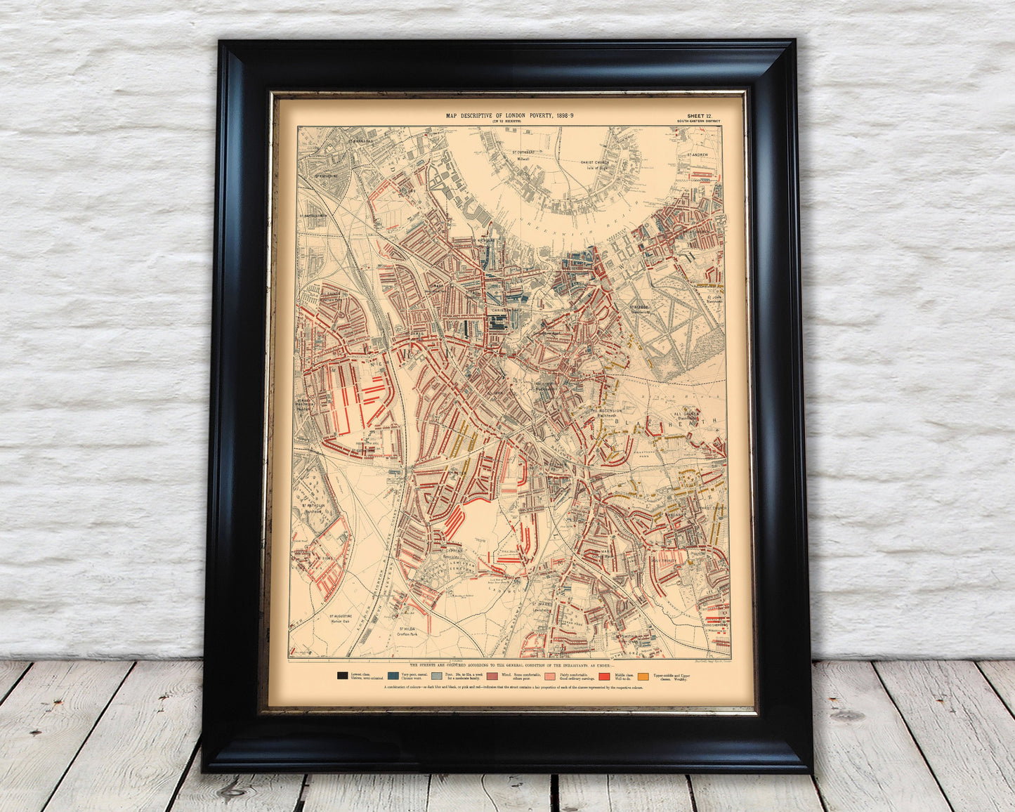
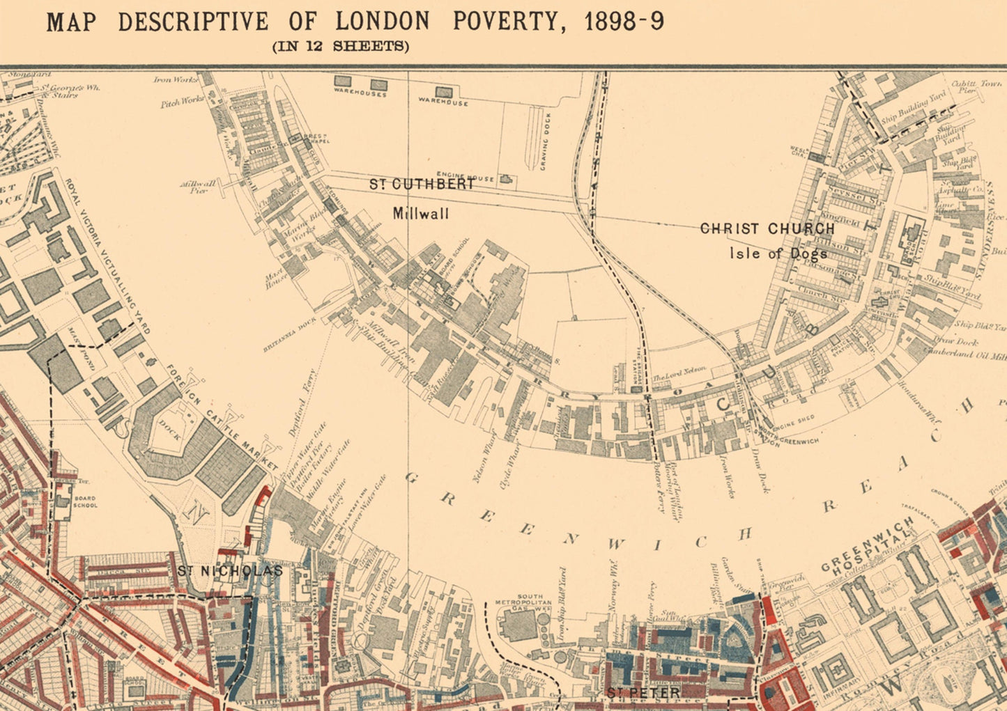
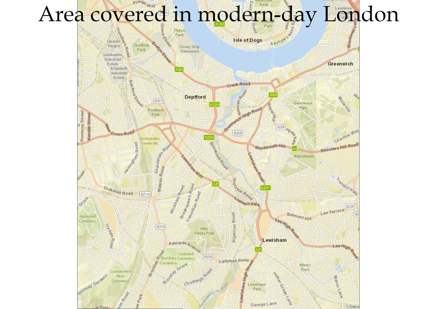
This is an exceptional quality, museum-grade reproduction map which represents an important part of our social history. Social researcher and reformer Charles Booth conducted one of the first surveys to systematically study poverty experienced in the nation's capital. This map - sheet 12 covering Greenwich, Southwark and Lewisham - was one of twelve such maps produced in this comprehensive survey. View the above picture to see the modern-day equivalent area which this map covered.
Areas of interest include:
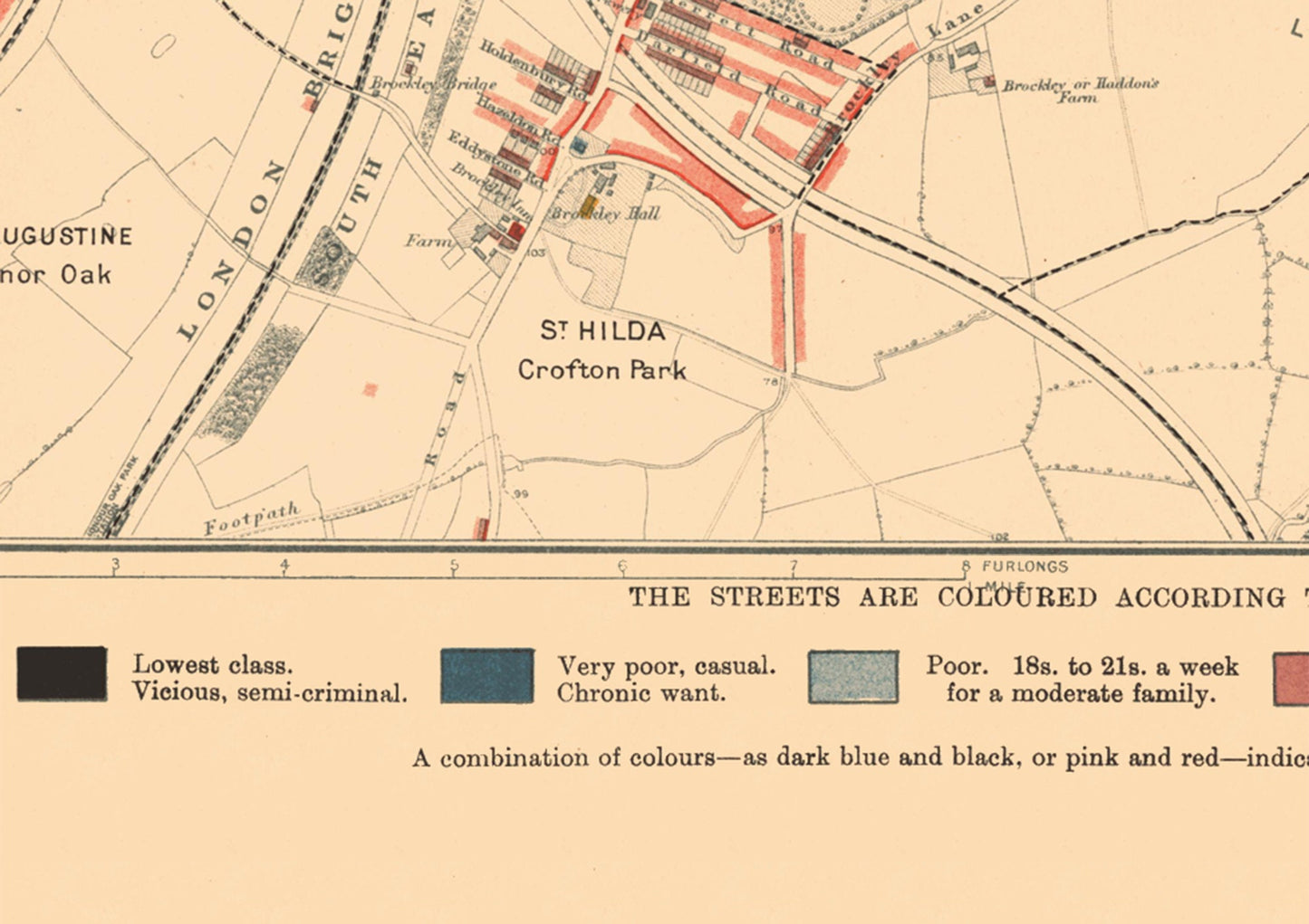
• Nunhead Cemetery • Greenwich Hospital • The London Brighton & South Coast Railway • Isle of Dogs • Deptford and Lewisham Cemeteries
The detail provided is extensive and shows the conditions in which inhabitants lived in East End Victorian London. The colour coded key ranges from "Lowest class. Vicious, Semi-criminal", "Very poor, casual. Chronic want" through to "Middle class. Well-to-do" and "Upper-middle and Upper classes. Wealthy"
This is a much sought after work which provides a centrepiece for any room and looks stunning mounted.