
Classic Maps and Prints
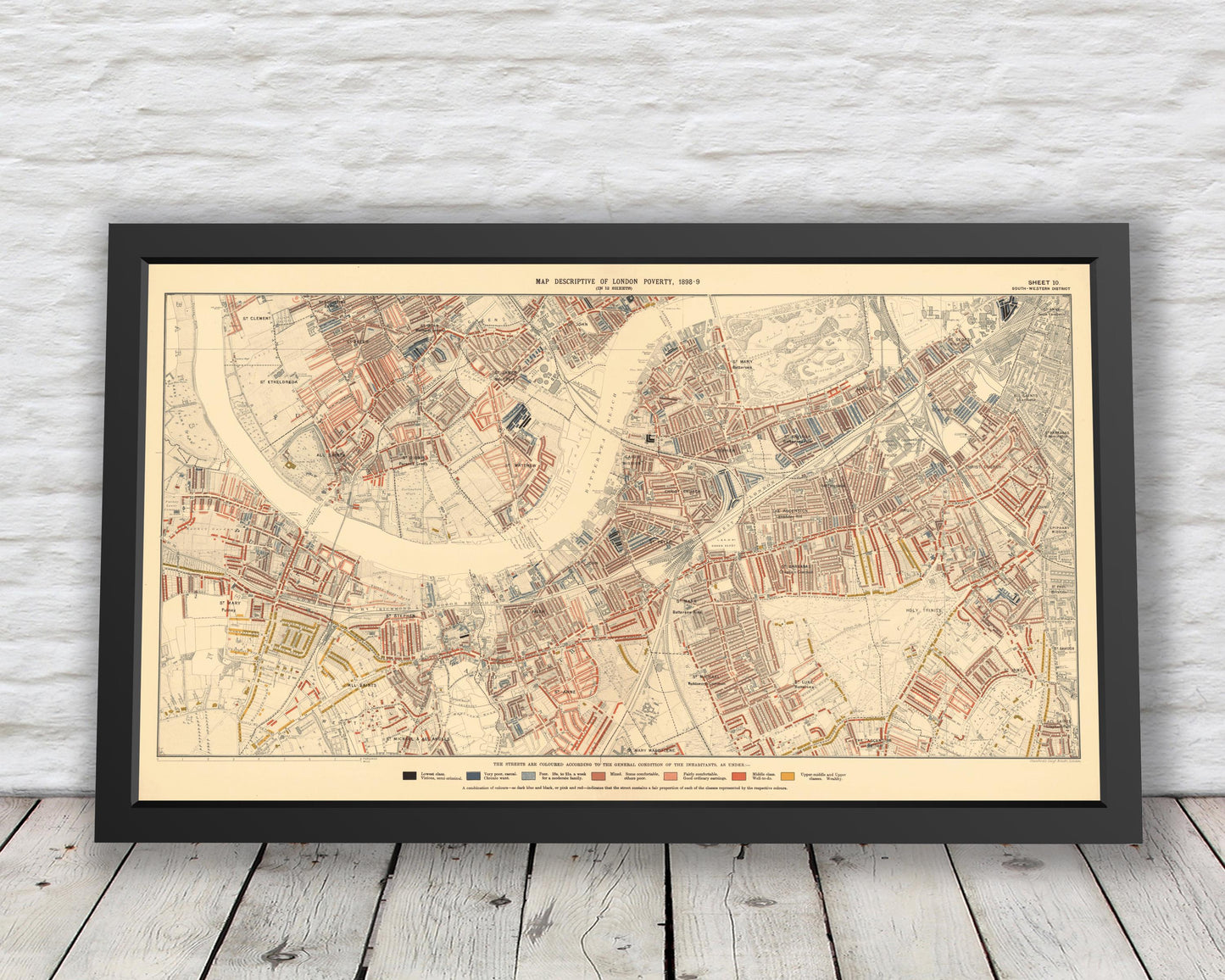
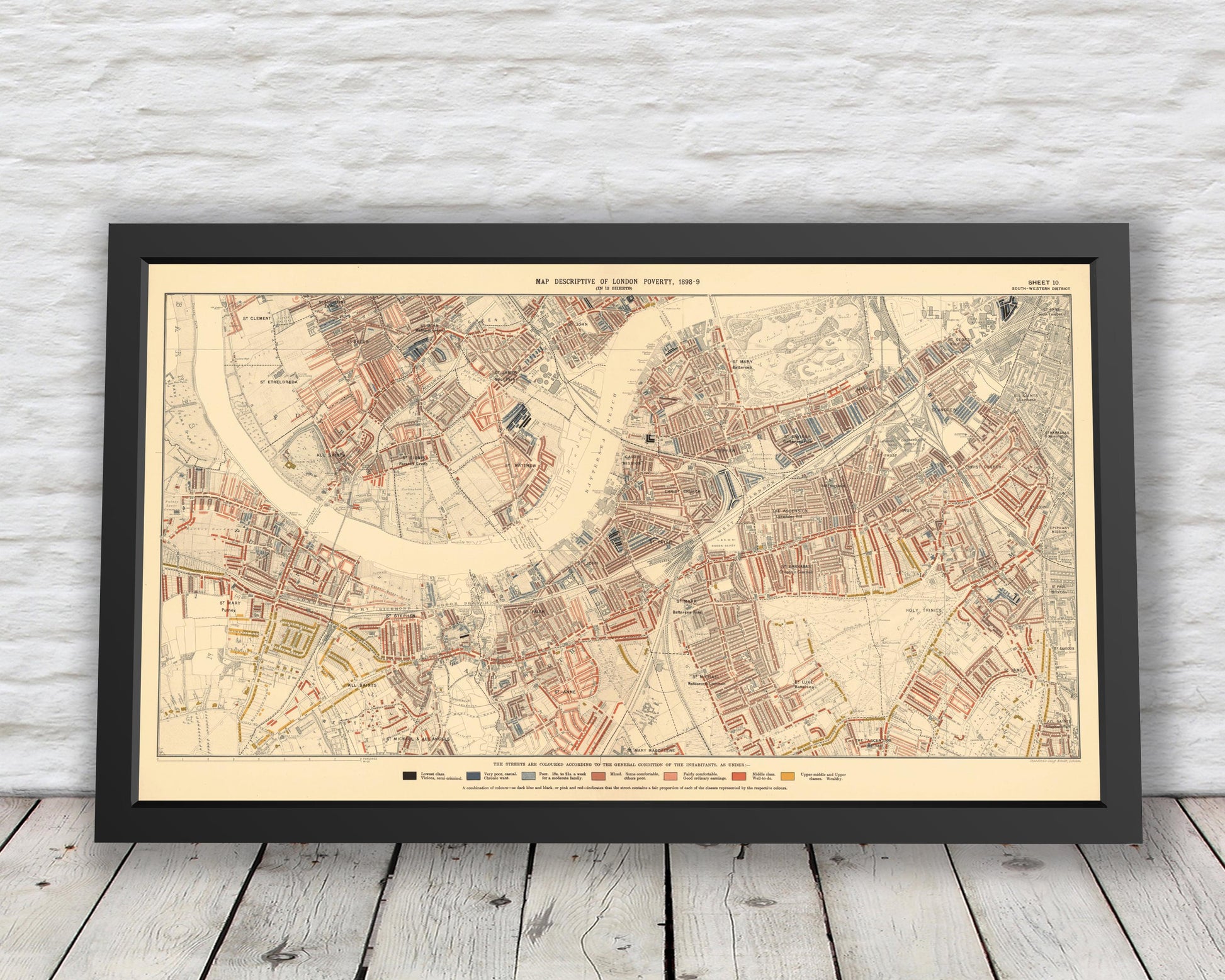
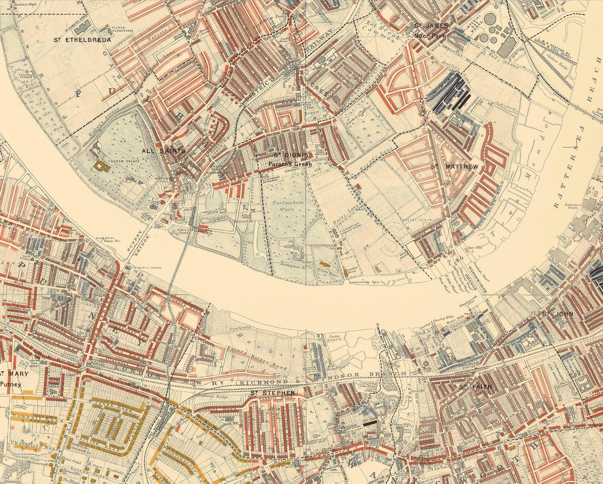
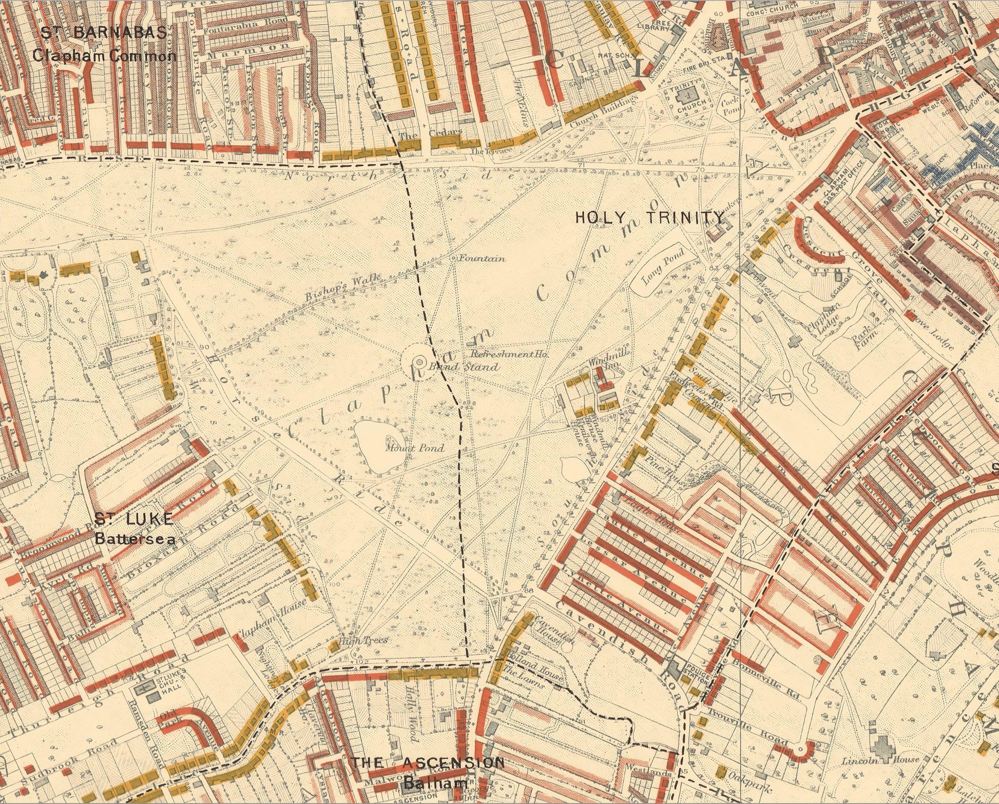
LONDON poverty Map 1898 by Charles BOOTH - Battersea Clapham Putney
LONDON poverty Map 1898 by Charles BOOTH - Battersea Clapham Putney
Couldn't load pickup availability
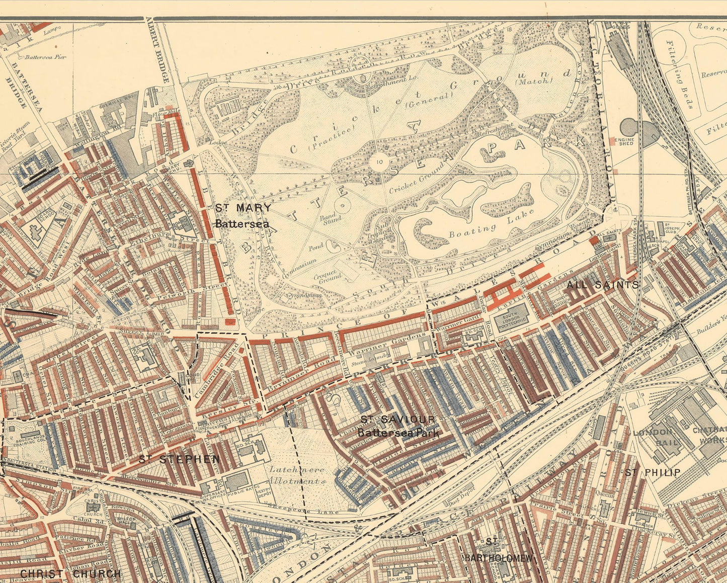
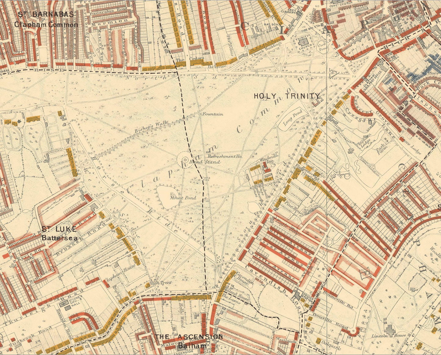
This is an exceptional quality, museum-grade reproduction map which represents an important part of our social history. Social researcher and reformer Charles Booth conducted one of the first surveys to systematically study poverty experienced in the nation's capital. This map - South-Western district sheet 10 covering Battersea, Clapham, Putney and Wandsworth - was one of twelve such maps produced in this comprehensive survey
The detail provided is extensive and shows the conditions in which inhabitants lived in Victorian London.
The colour coded key ranges from "Lowest class. Vicious, Semi-criminal", "Very poor, casual. Chronic want" through to "Middle class. Well-to-do" and "Upper-middle and Upper classes. Wealthy"
This work is highly sought-after work and is sure to form an interesting conversation piece to any living room. Please note that this print is not framed and is for illustration purposes only
Share