
Classic Maps and Prints
LEEDS map - Cossins Plan of Leedes 1726 Headrow The Calls Briggate
LEEDS map - Cossins Plan of Leedes 1726 Headrow The Calls Briggate
Couldn't load pickup availability
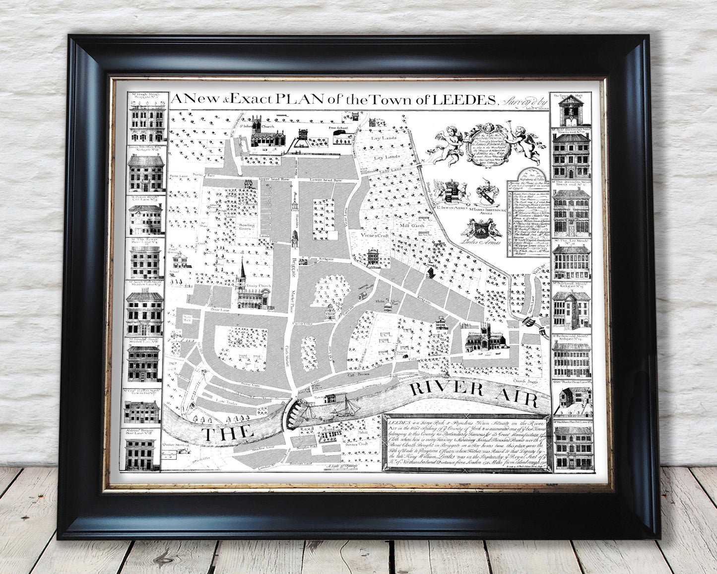
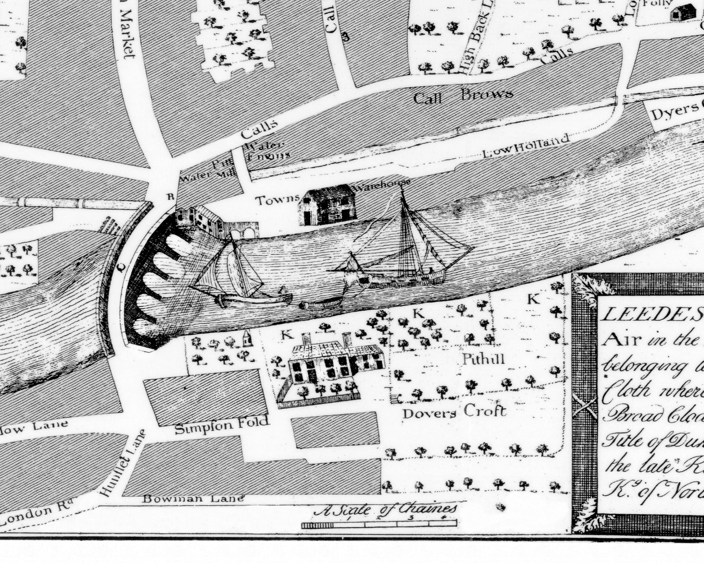
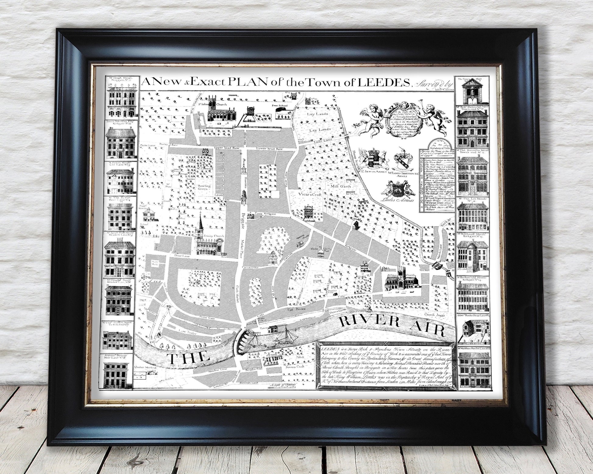
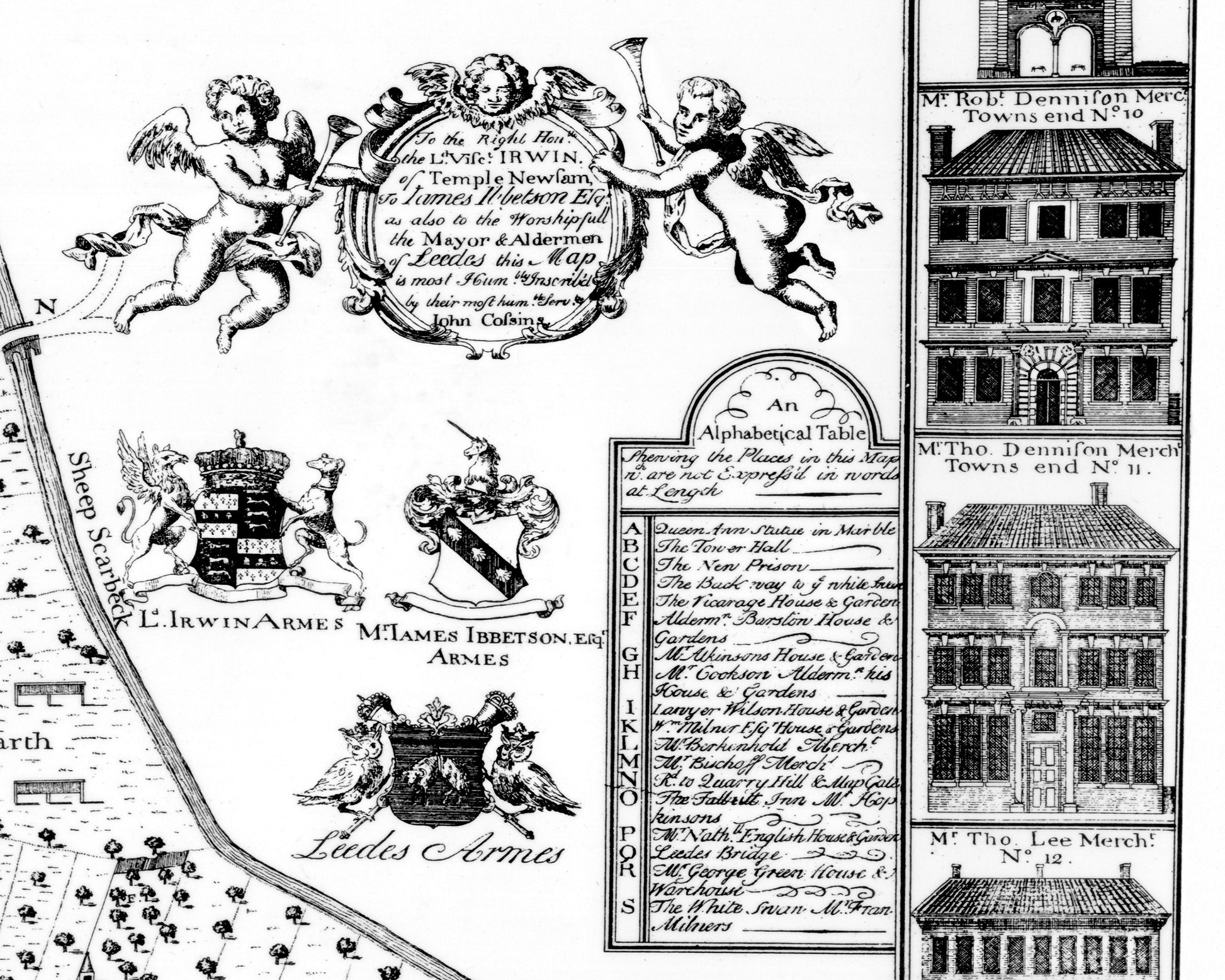
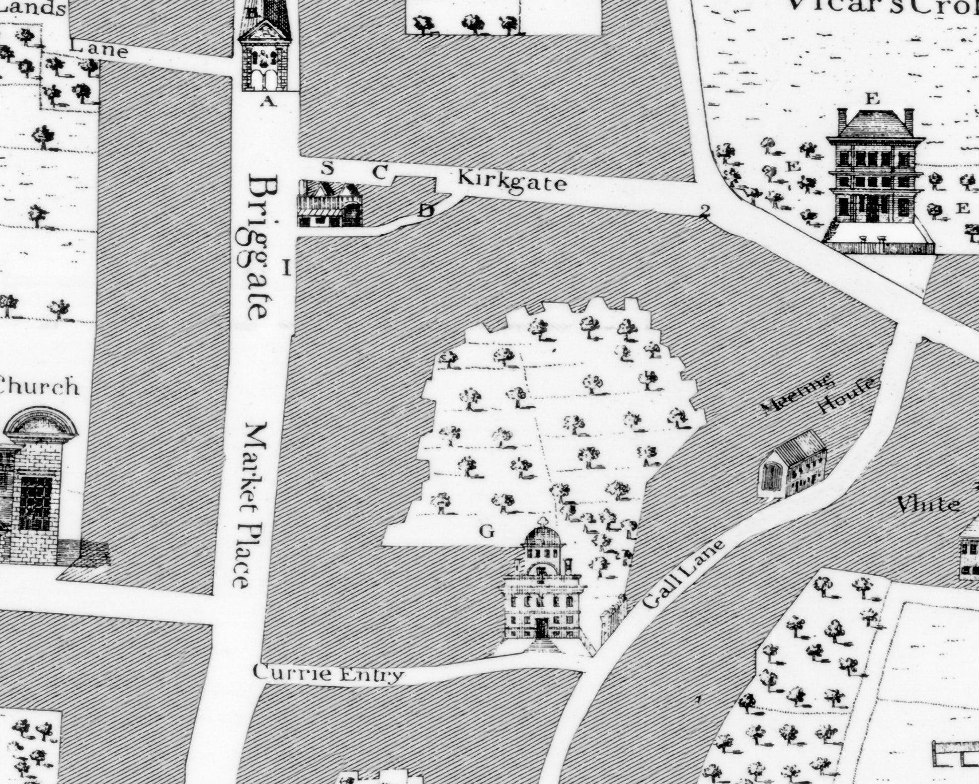
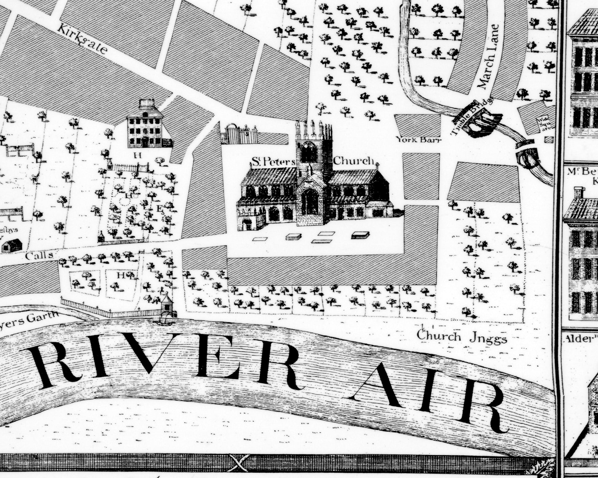
This is a superb reproduction map of Leeds from 1726 produced by London-born cartographer John Cossins (1697-1743). During the early Georgian period Leeds numbered around 7000 souls and was located by the River Aire (or Air as referred on the map). Cloth by far and a way was the most important industry at that time and can be seen in the lower left corner with names such as Lower Tenter, an early mill and watermills. Indeed the inscription describes Leeds succinctly thus "Leeds is a large rich and populous town situate on the River Air in the West Riding of the County of York and is accounted one of the best towns belonging to this county and is particularly famous for its great manufacture of cloth."
This map features:
• A superb hand drawn plan by Cosssins
• Sixteen superb cartouches of properties of local merchants and other esteemed dignitaries
• An 18 piece index showing places of interest
• The churches of St Peter, St John and Trinity church are included along with the town hall
• Various coats of arms including that of Leeds corporation featuring owls
• Streets such as Head Row, Calls, Vicar Lane, Kirkgate and Briggate which still form part of modern day Leeds
This is a very attractive and much sought after piece. It looks stunning framed and we do have a framed offering available at our shop (see below)
Share