Classic Maps and Prints
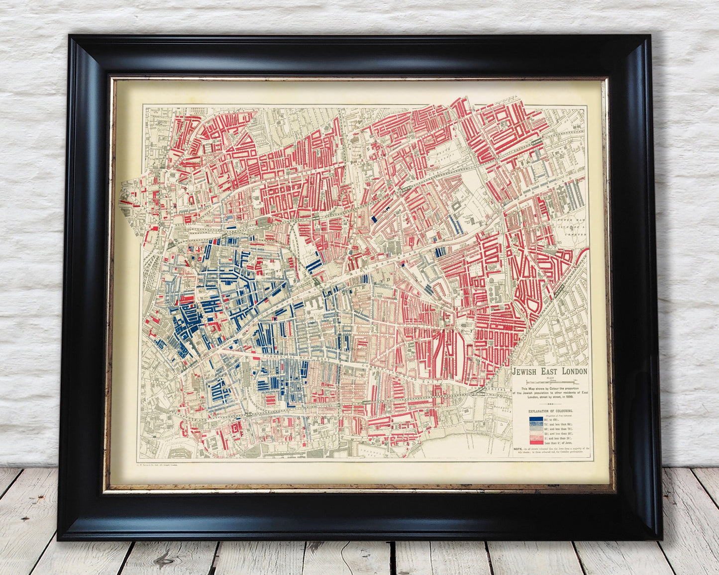
JEWISH East London Map 1899 Whitechapel George Arkell
JEWISH East London Map 1899 Whitechapel George Arkell
Couldn't load pickup availability
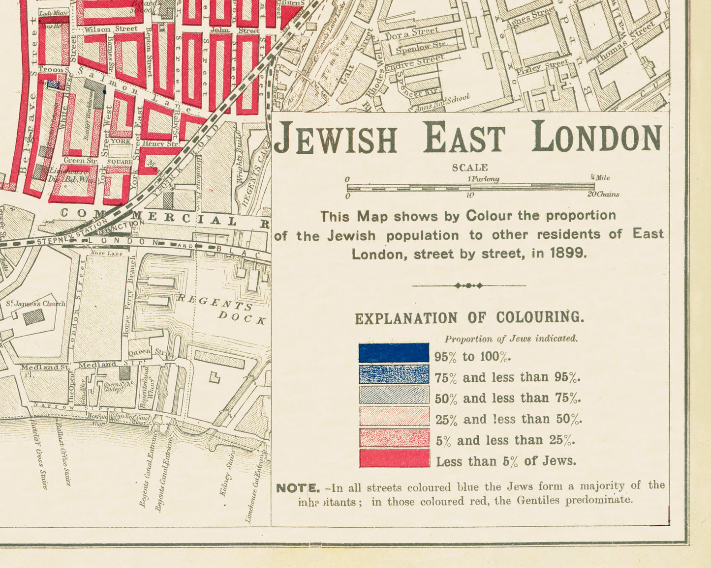
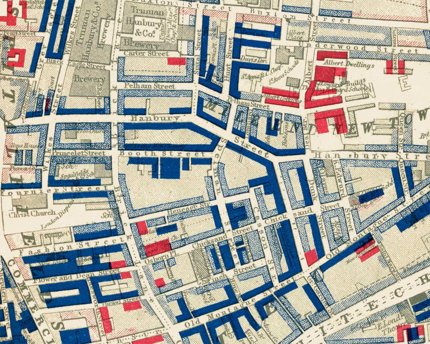
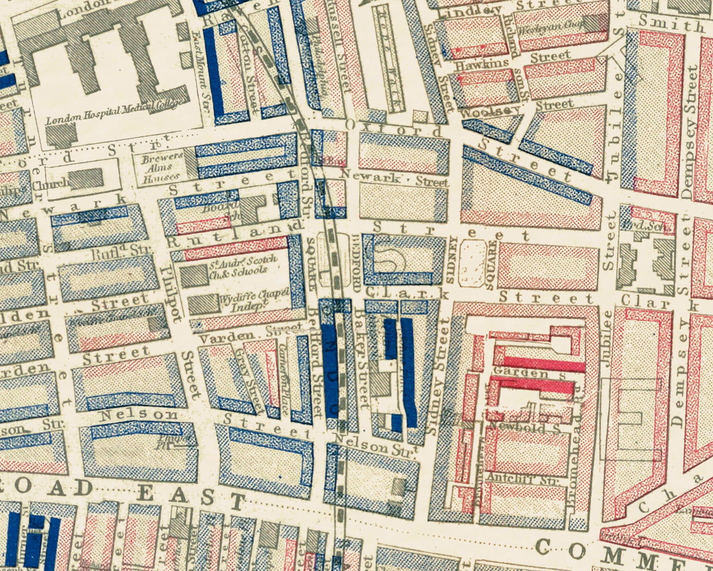
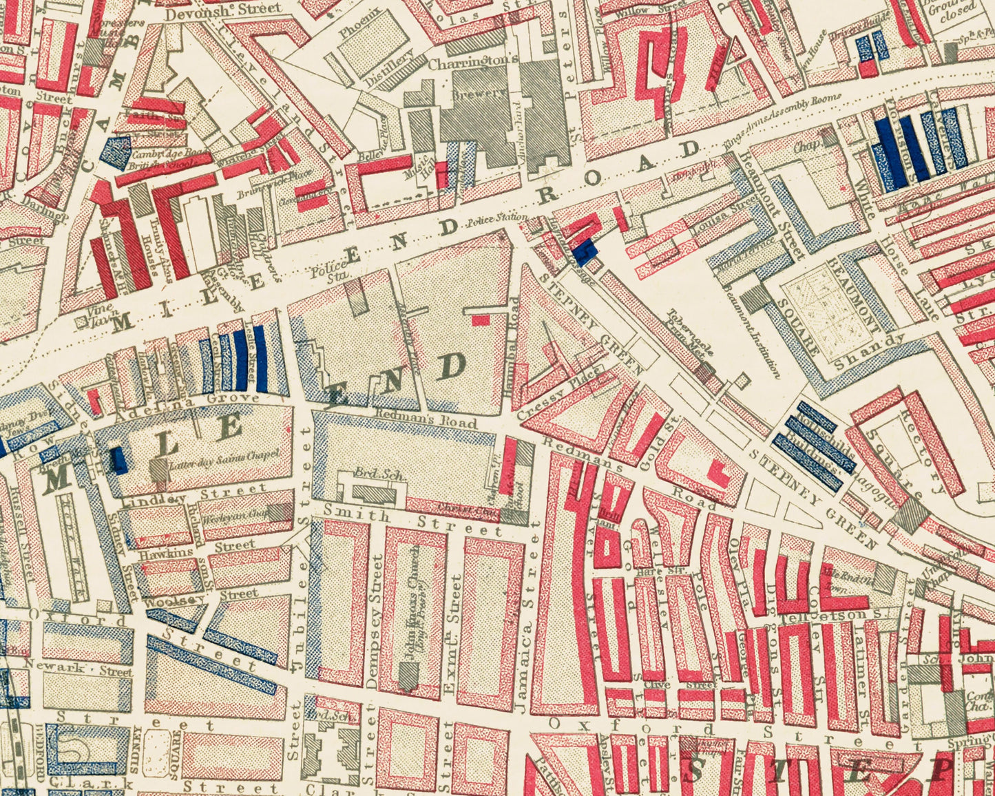
This map looks very much in keeping with the Charles Booth London poverty maps also available from our shop. There is a very good reason for this as the creator of this map cartographer George Arkell had previously worked on the aforementioned Booth Poverty Maps. This Jewish East London map was commissioned by the Toynbee Trust in 1899 and focussed on the location patterns of Jewish people within the East End of London. Jewish communities existed in especially in Whitechapel and Spitafields areas, although coverage extended much further out: north beyond the Bethnal Green Road, east to the Tower Hamlets Cemetery, and south beyond Cable Street. Arkell used a similar type of colour-coding used in the Poverty maps except this time it is used to portray the population density of Jewish People in the East End.
This work provides a superbly detailed map of the East End of London and carries a striking title and explanatory key. Our 20x16 framed edition looks superb and truly accentuates this fascinating study. This is a must have for people with an interest in East End history and indeed Jewish ancestors from this area.
Share