


Classic Maps and Prints
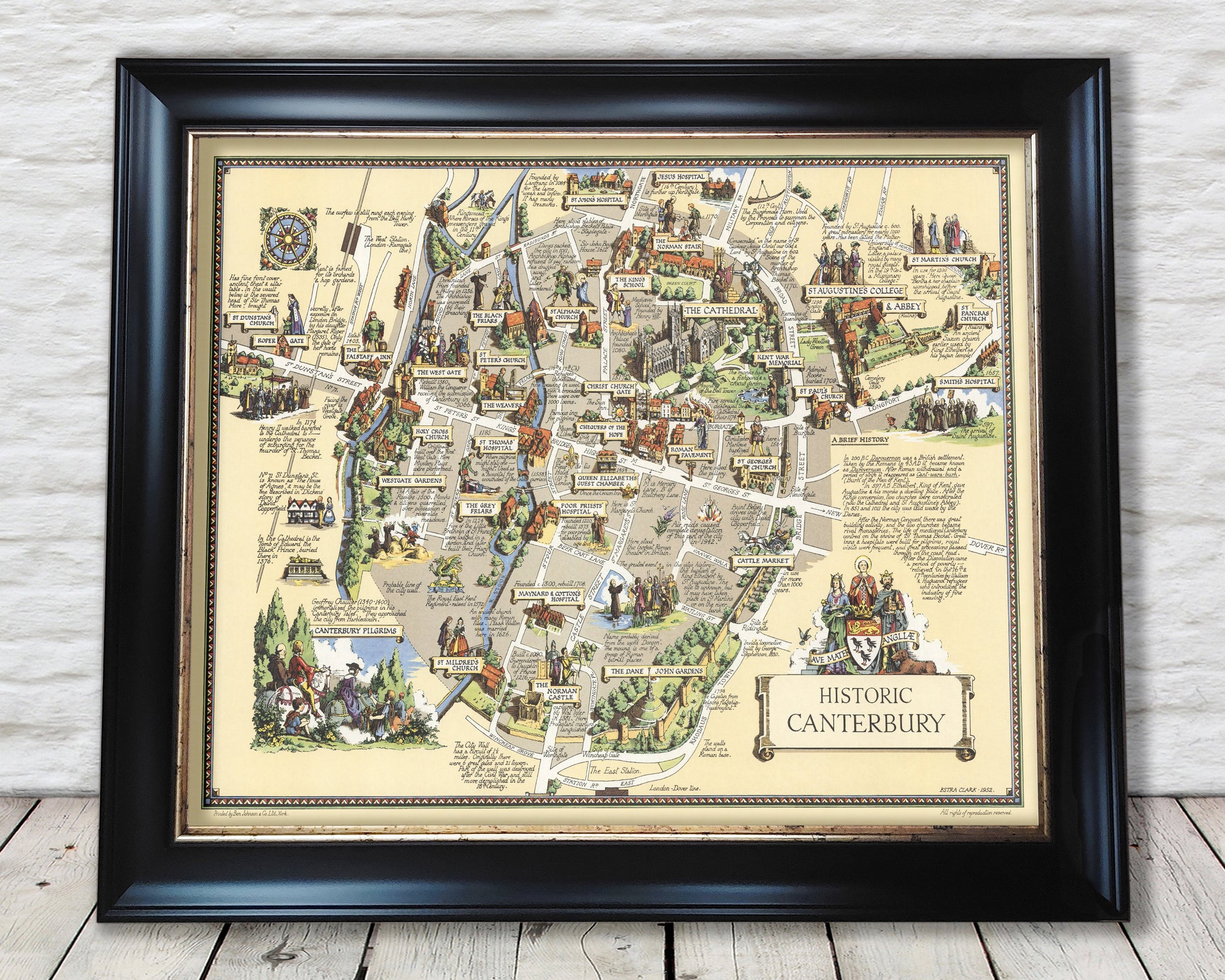
Historic CANTERBURY Map, 1952 by Estra Clark, pictorial map
Historic CANTERBURY Map, 1952 by Estra Clark, pictorial map
Couldn't load pickup availability
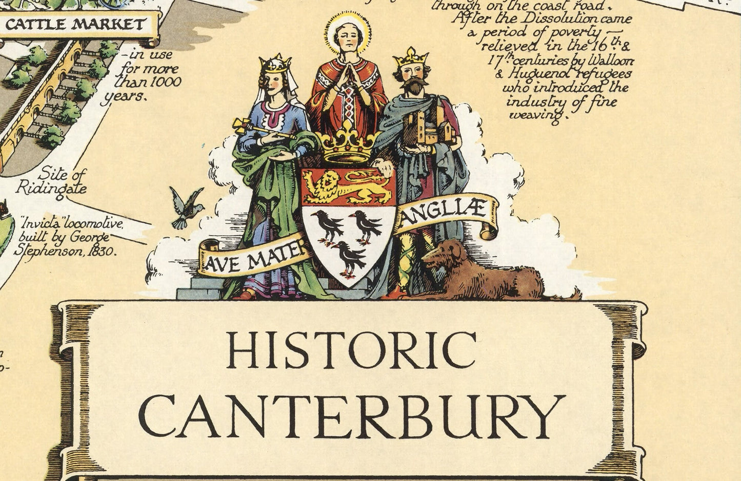
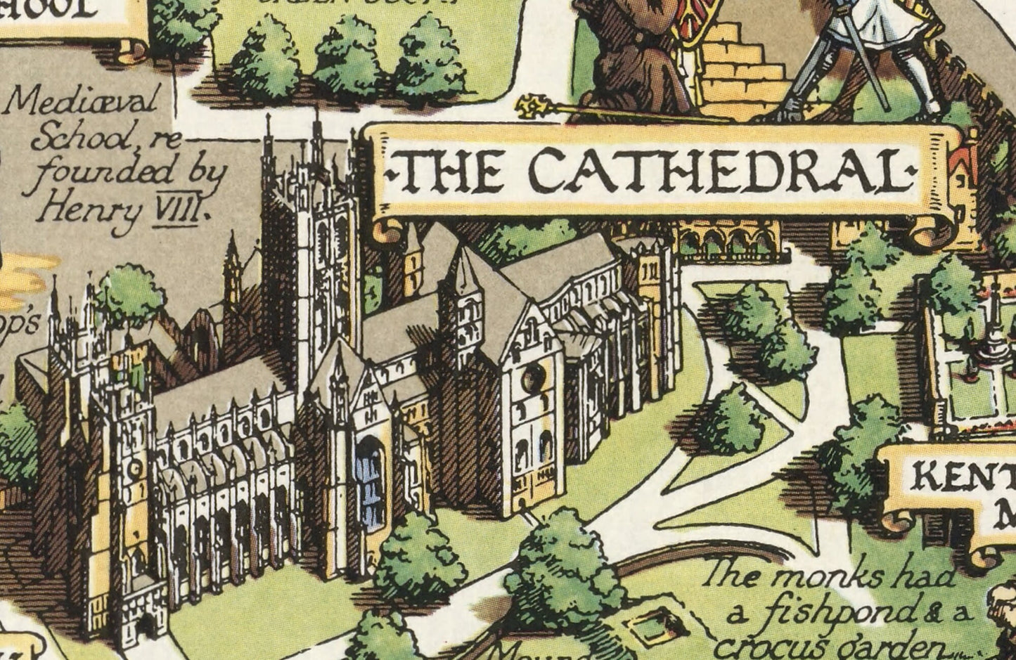
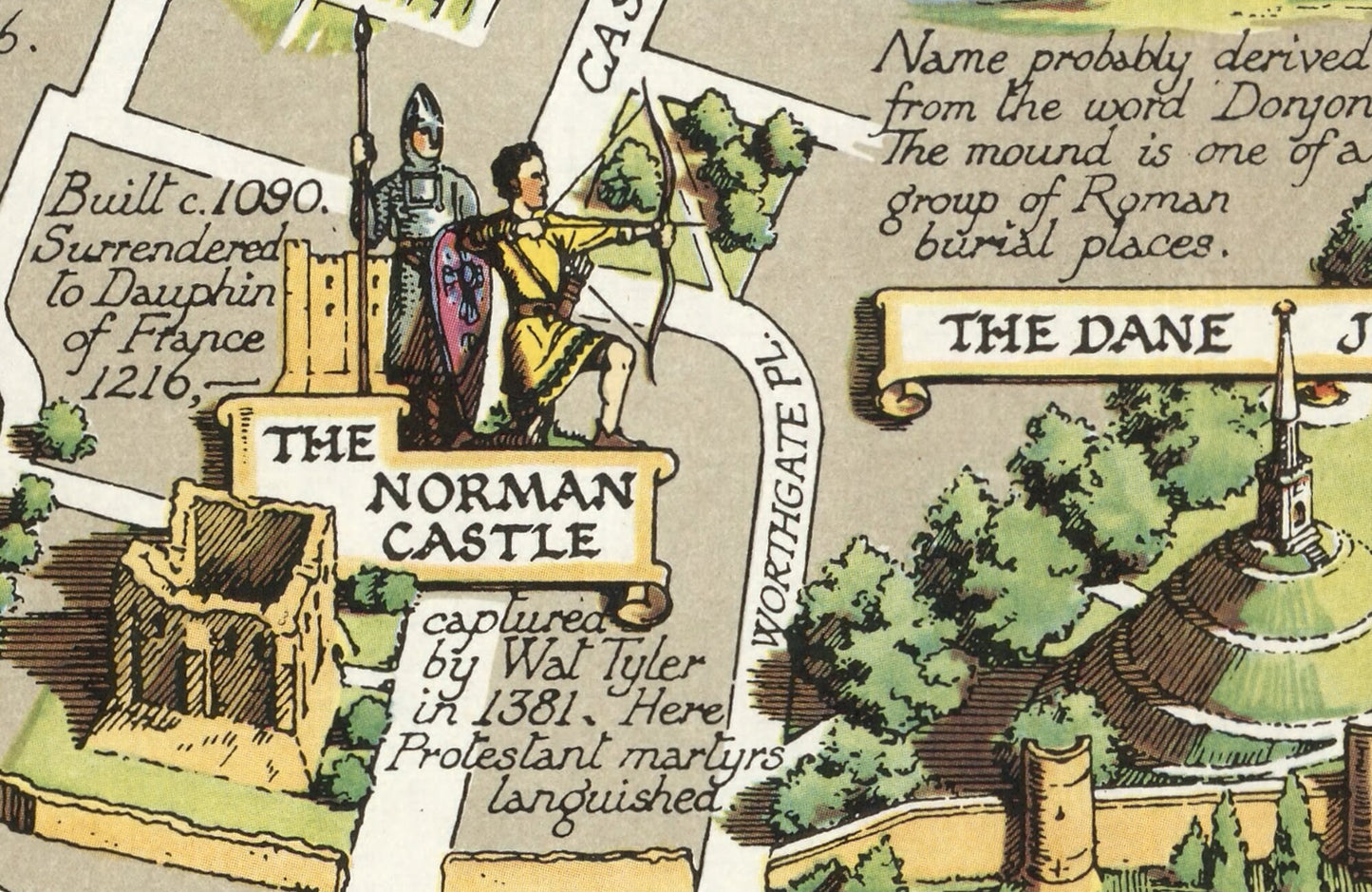
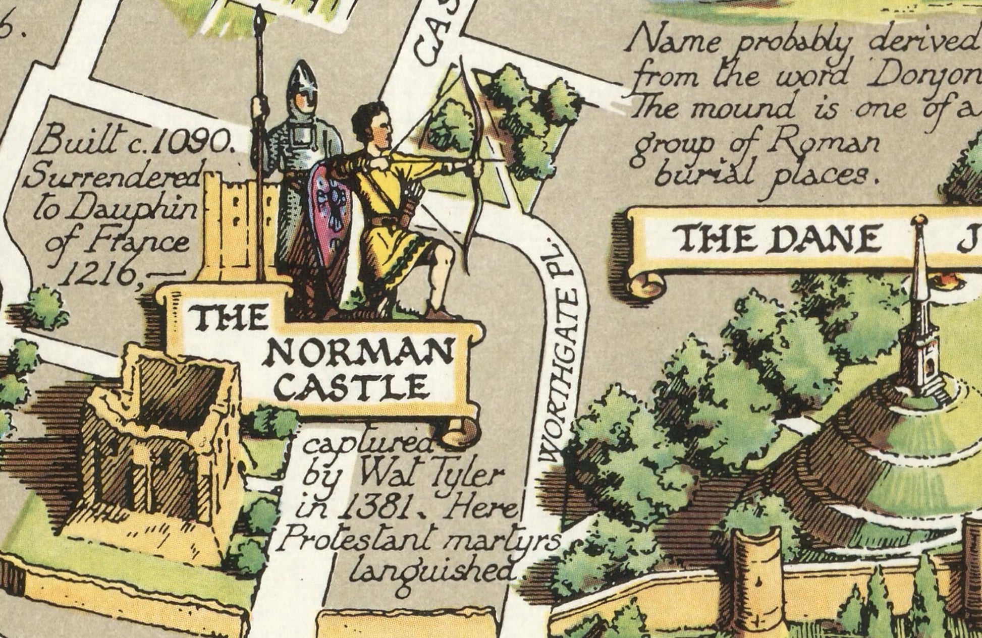
This charming print of Historic Canterbury is a reproduction of York's famed pictorial cartographer artist Estra Clark originally created by her in 1953. This stunning work recaptures the rich and varied history of Canterbury along with the site of many important locations and buildings. Beautifully illustrated there are accompanying historical notes or literal anecdotes such as Canterbury Tales to further spellbind the viewer. This is far more than just a map; it tells a story of Canterbury and of its people.
It is a much sought after work.
This piece has been digitally cleaned in order to remove blemishes and most signs of ageing but keeps the look, feel and integrity of the original.
A classic work that creates a centrepiece for any home and would look stunning framed. This print is produced on premium heavyweight 230 gsm paper and uses the finest quality inks that will not fade or smudge.
Features:
------------
• 35 beautiful illustrations of key places of interest in Canterbury's history including the Cathedral and Canterbury Pilgrims
• Anecdotes and facts that add a richness to the story
• A wonderfully illustrated title of Historic Canterbury
• A clean, crisp digitally cleaned print
• All offset by a stunning, colourful border
Share