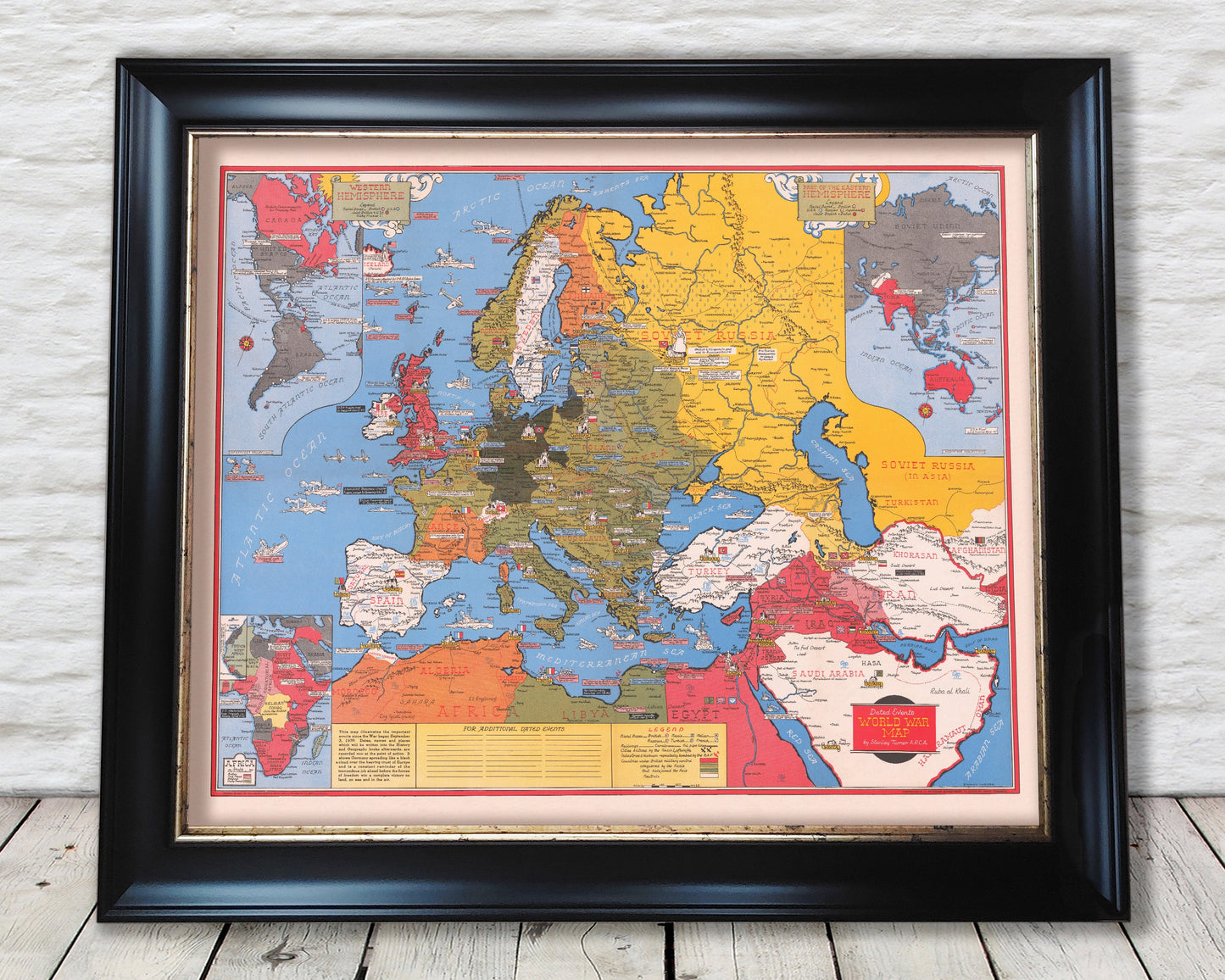
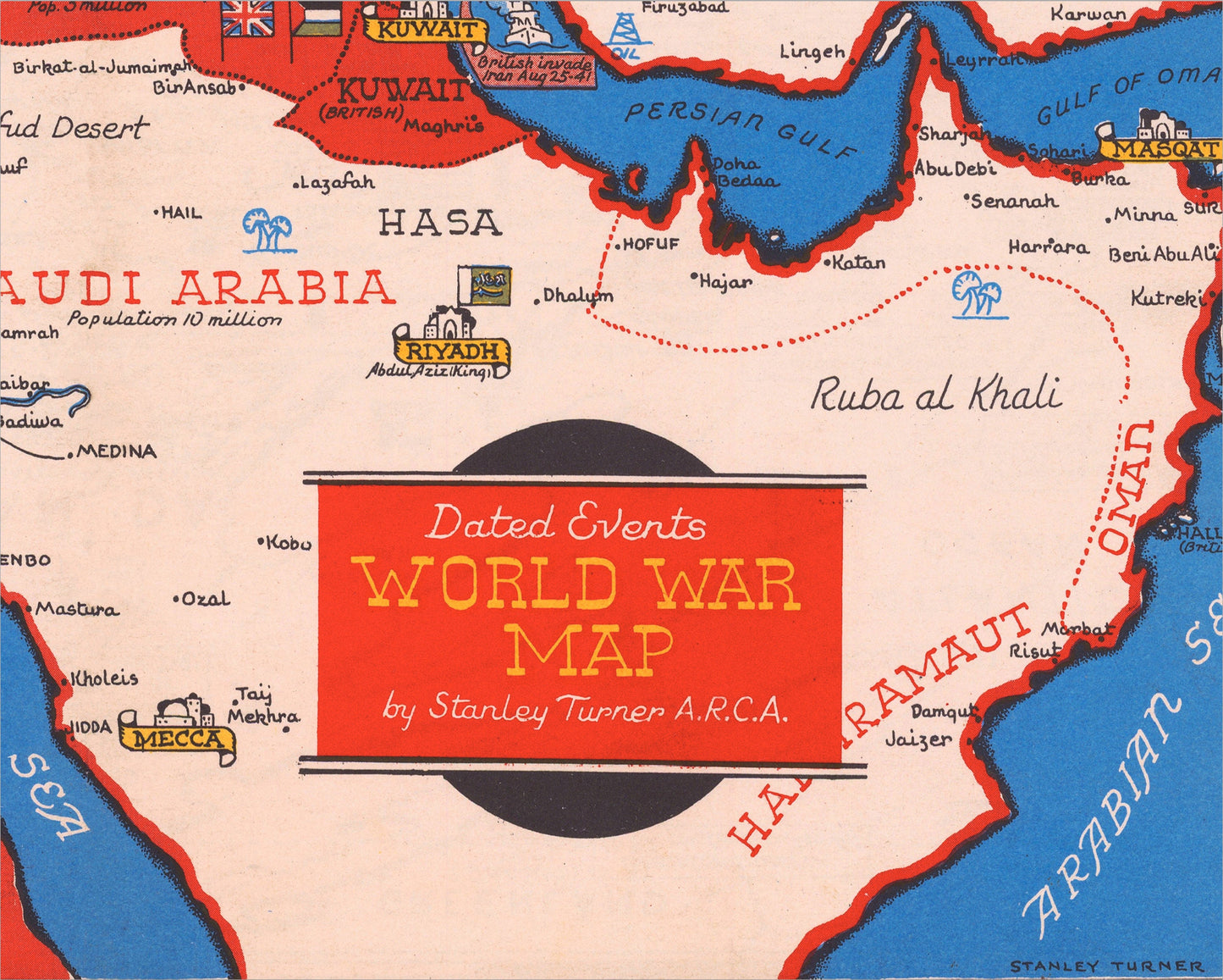
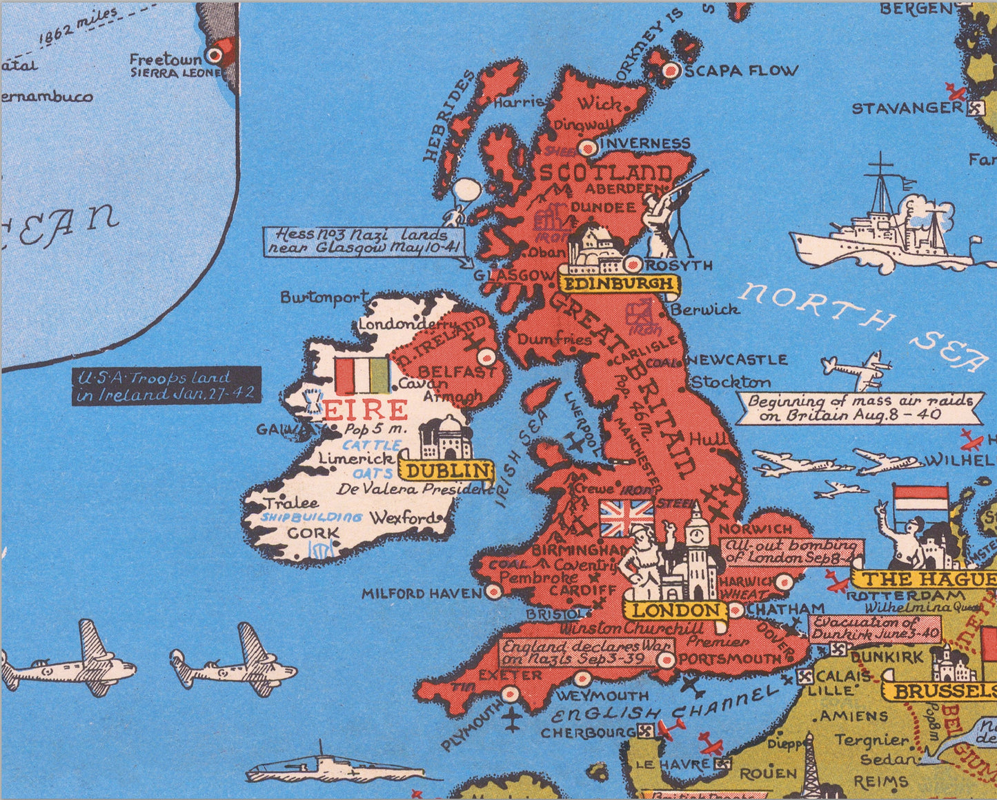
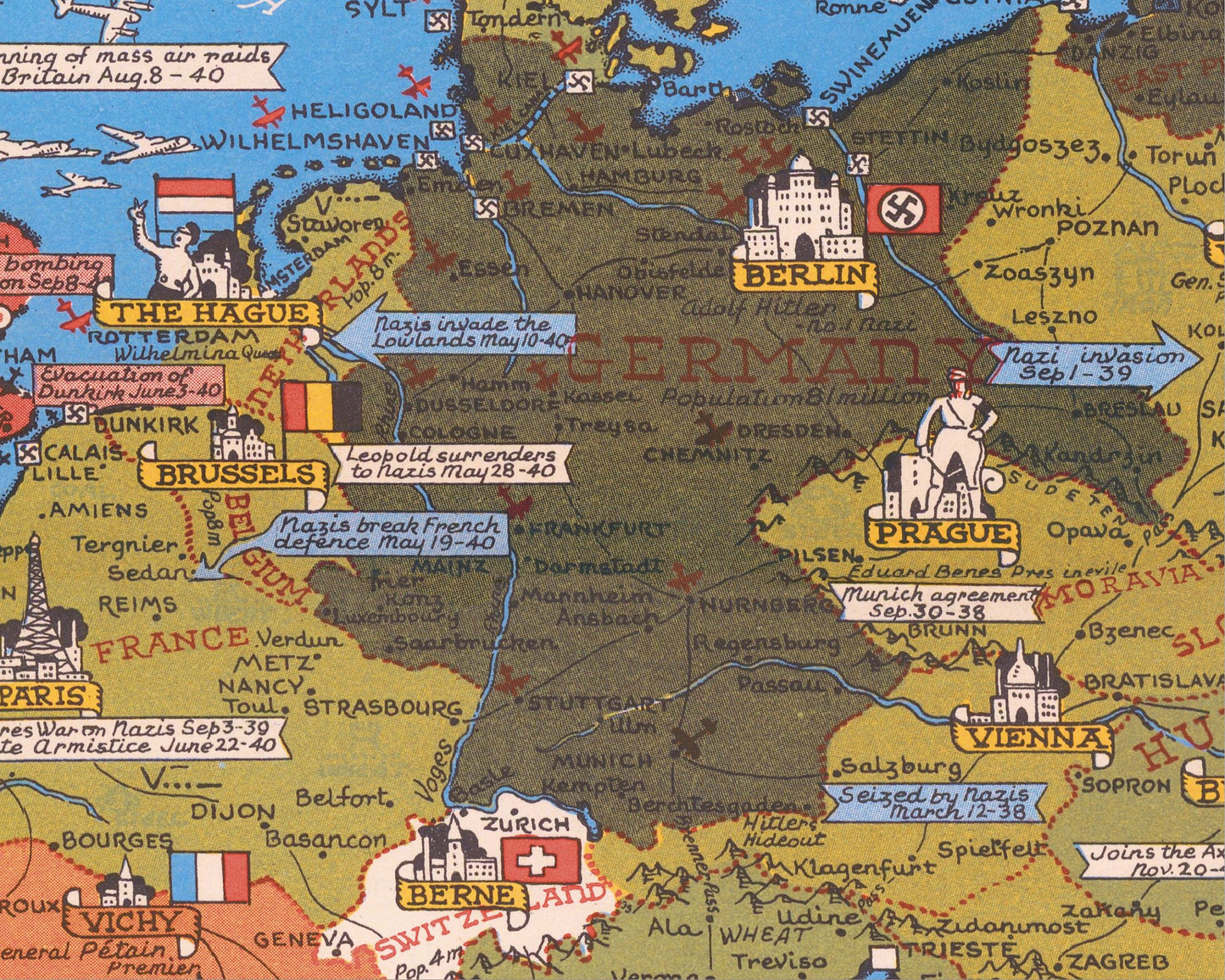
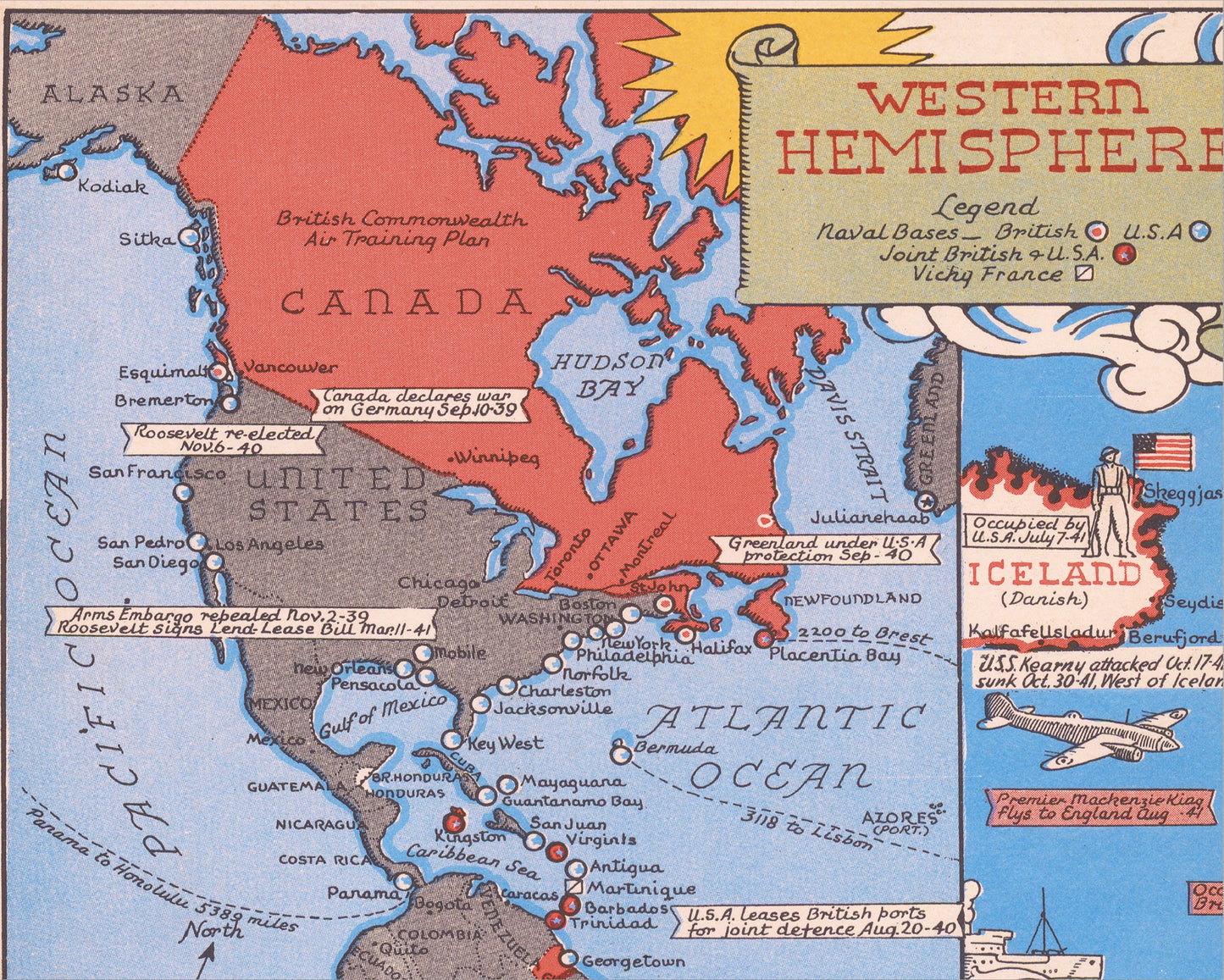
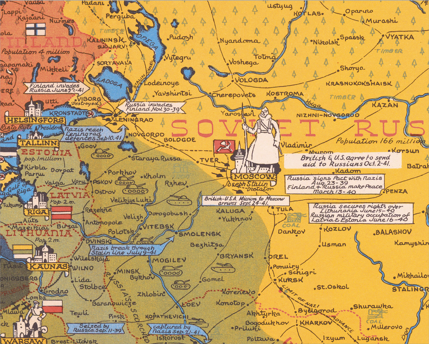
This fascinating World War II map was produced by the renowned Toronto artist Stanley Turner. Its pictorial style captures the War in the European Theatre as it stood in early 1942. The Allied powers of Great Britain, the United States and the Soviet Union fought to overthrow the Axis powers of Nazi Germany, the Kingdom of Italy and the Empire of Japan. This map captured the opposing territories and those countries that had been occupied by this key stage. Attention is also given to key areas producing raw materials essential to the war effort including iron, steel, coal, oil and wheat.
Each country is depicted with its population total, its national flag and a representation of its capital city. Key towns and cities are marked as are numerous events that had taken place to date including invasions, battles and other interesting information. The targets of bombing raids are also shown. Key railways, canals and oil pipelines are also shown and are fully detailed in the corresponding legend. There is so much information squeezed into this classic wartime map.
This is a highly sought-after work and is sure to form an interesting conversation piece to any living room. This piece looks stunning mounted as shown in our 20" x 16" framed edition.