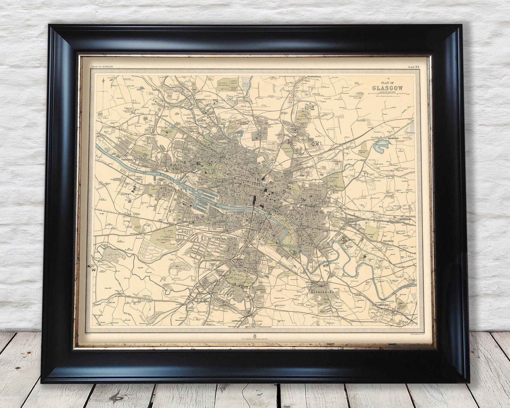
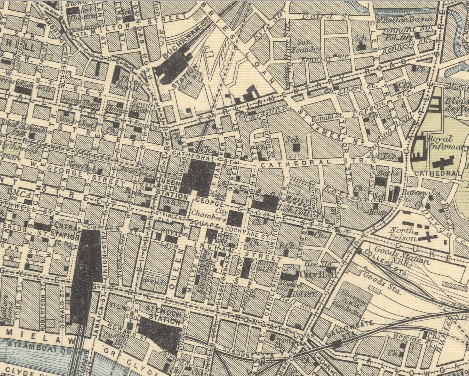
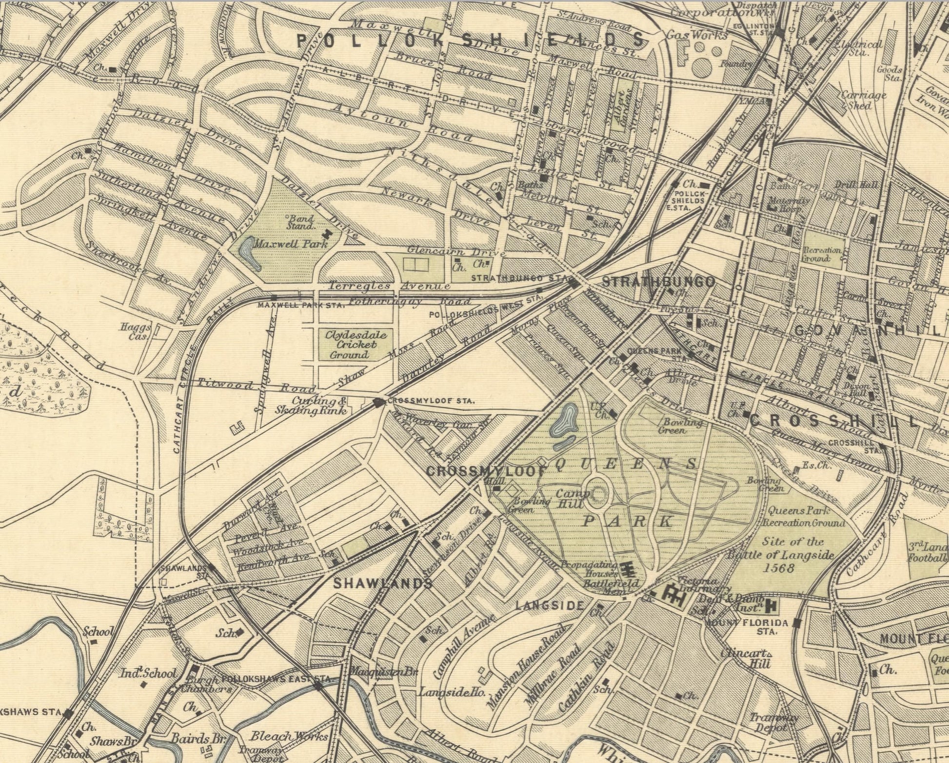
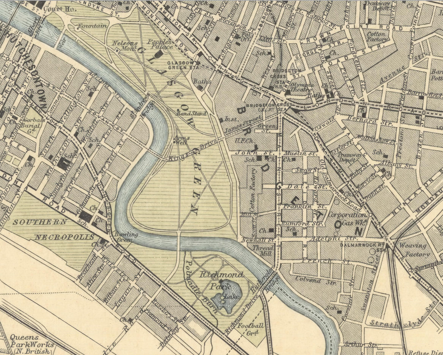
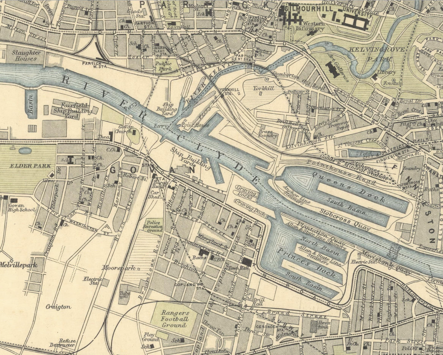
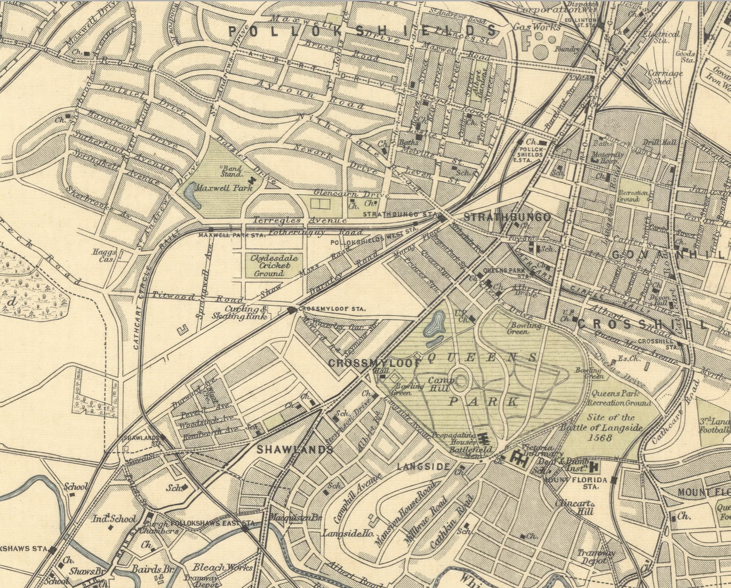
This superb map by famous map makers Bartholomew captures the extended view of Glasgow as a developing city in 1912. The map identifies many of the growing city's important buildings and factories along with pretty much every street and lane in the city.
Places of interest include Glasgow Cathedral, Glasgow Green, University of Glasgow, the Docklands area and the Central, Buchanan, Queen Street and St Enoch railway stations.
This detailed, crisp and clear was one of 68 to feature in Bartholomew's Survey Atlas of Scotland,1912 and is very pleasing to the eye.
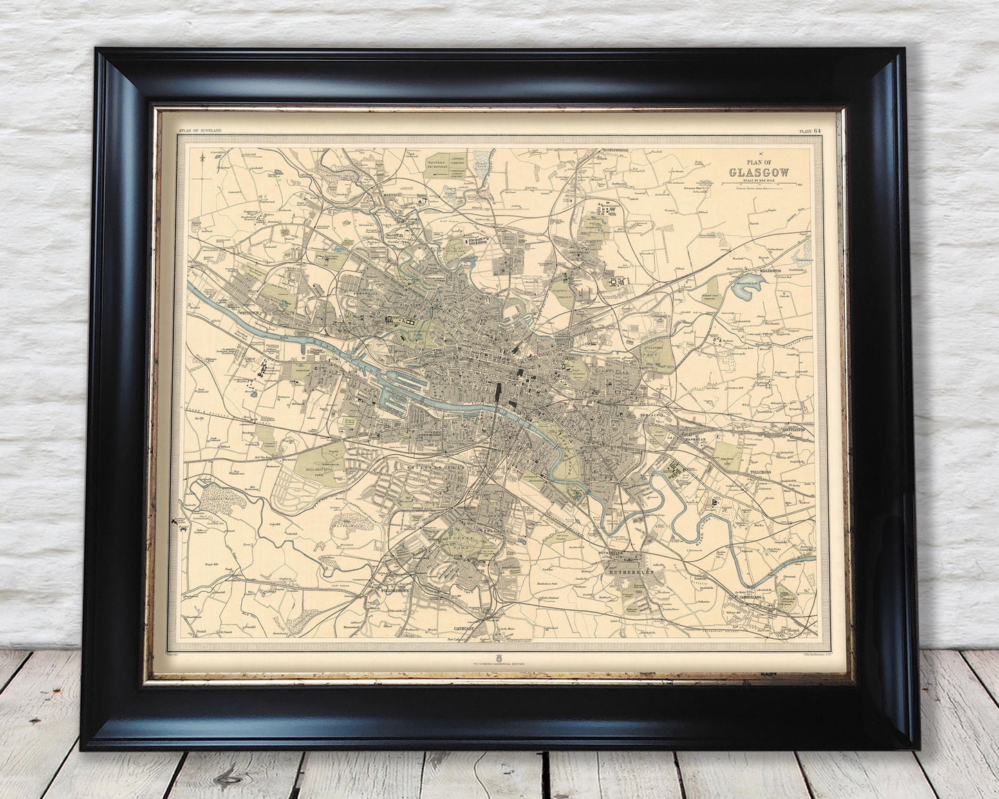
This full colour vintage reproduction looks stunning when mounted and would form a striking centrepiece to any room as shown in either our A2 or 20x16 inch framed editions.