

Classic Maps and Prints
Charming LONDON UNDERGROUND Map 1928 Perman
Charming LONDON UNDERGROUND Map 1928 Perman
Couldn't load pickup availability
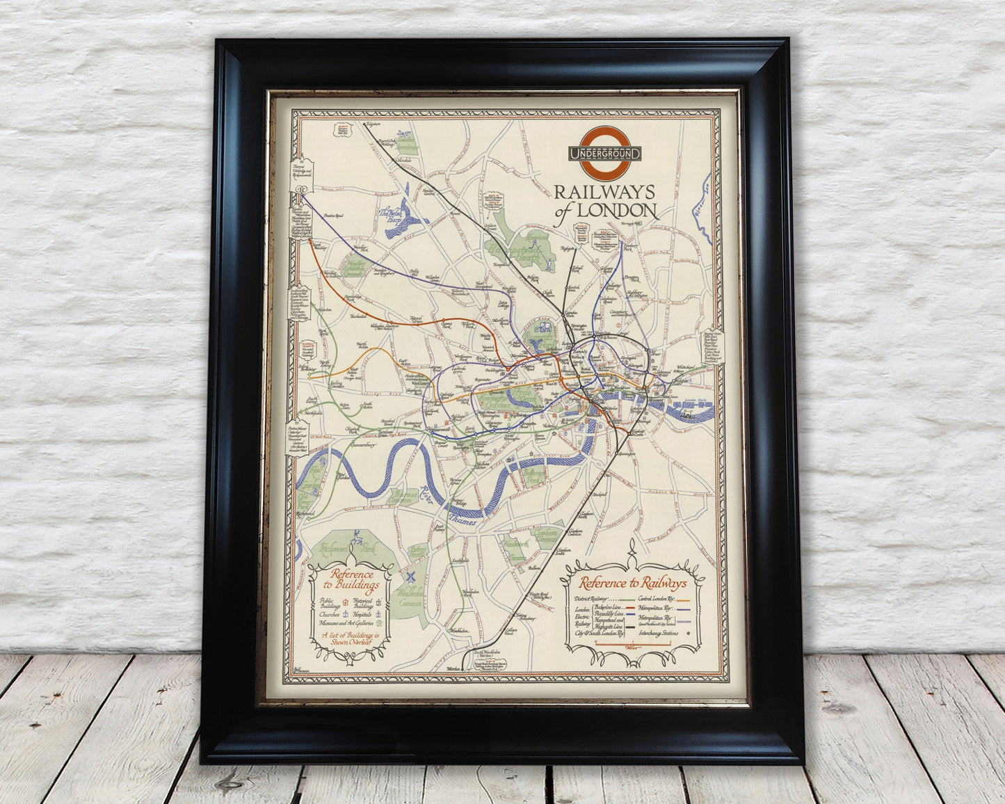
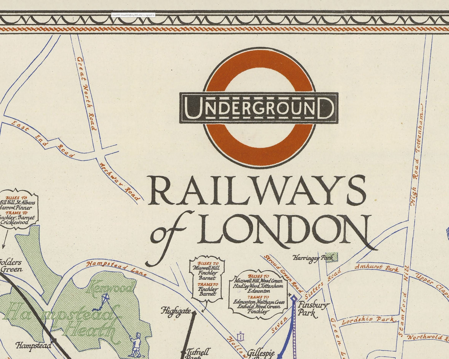
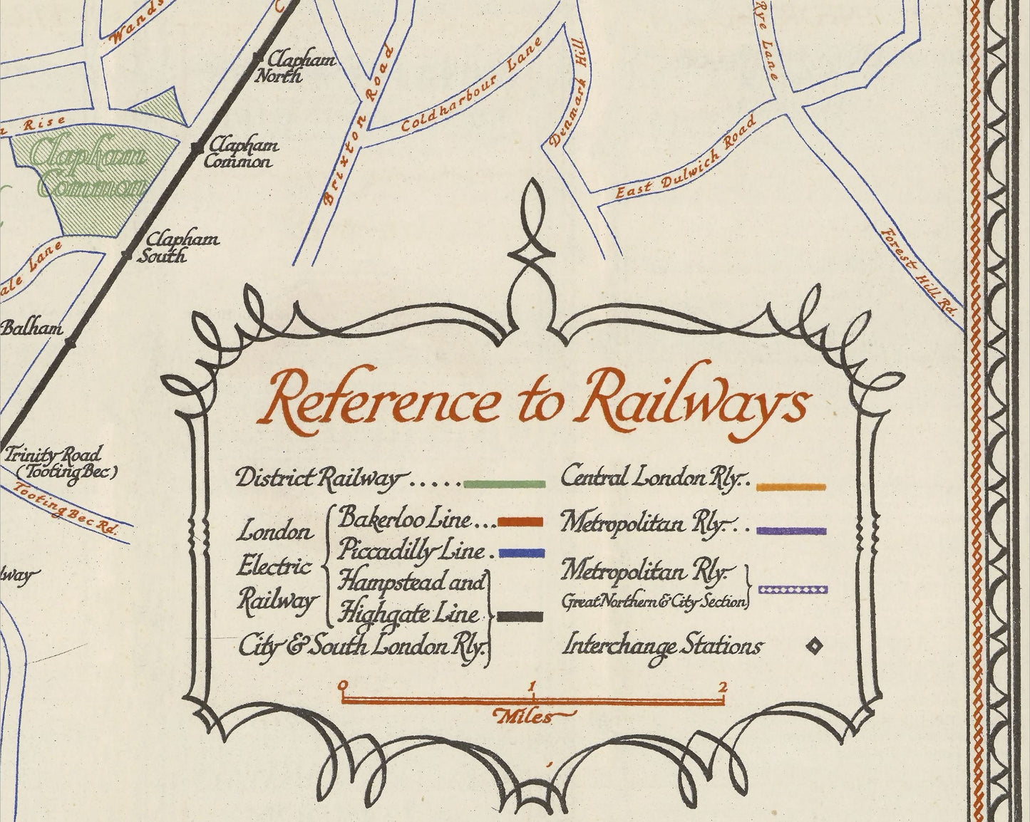
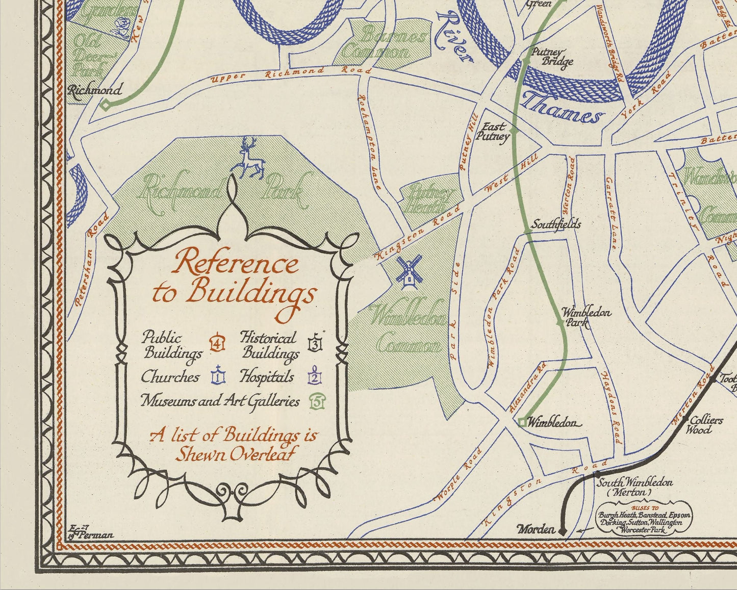
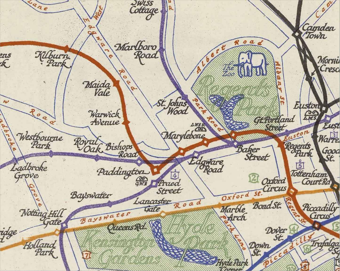
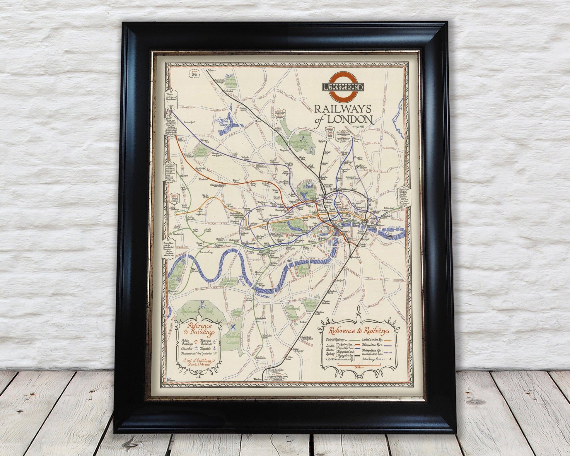
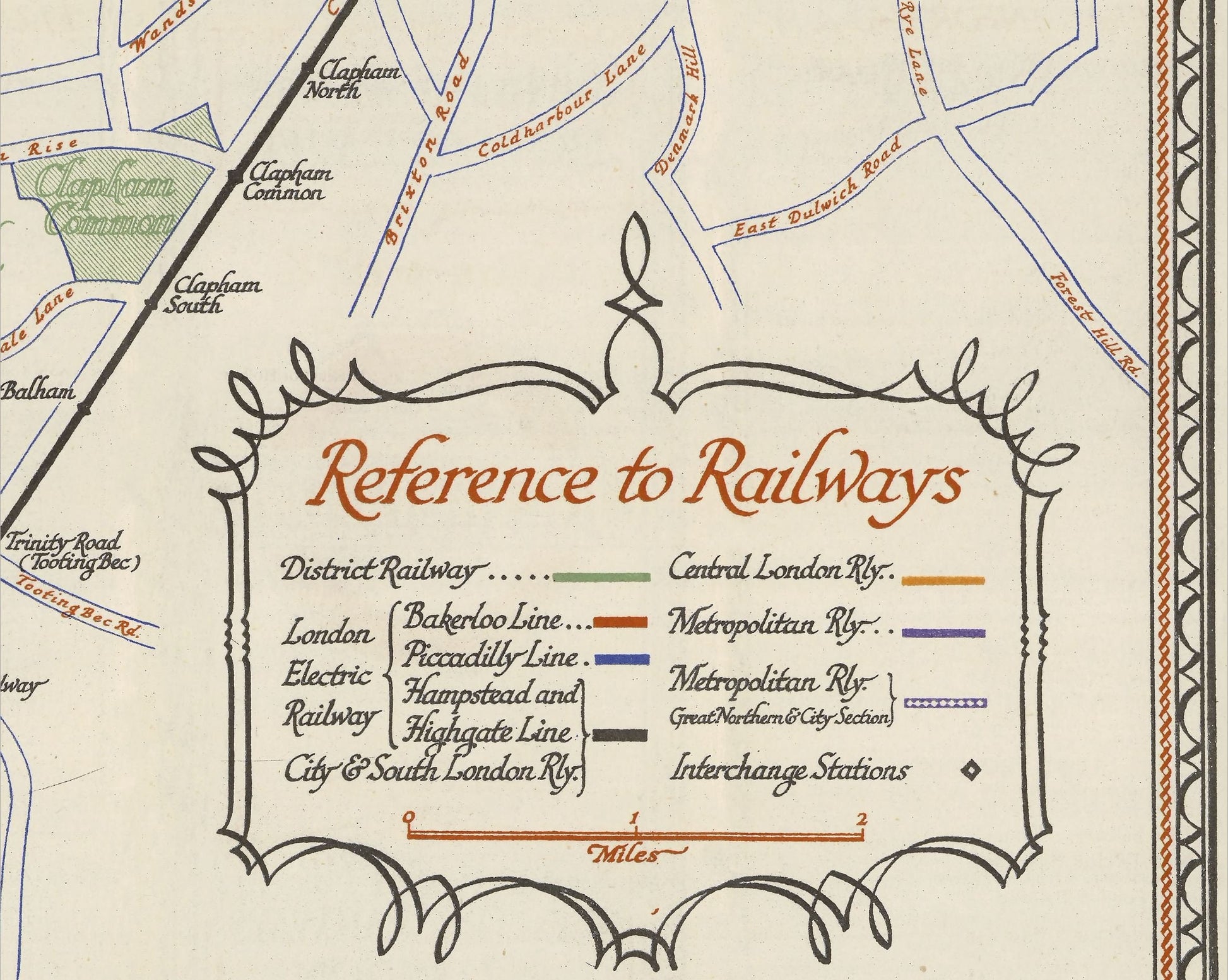
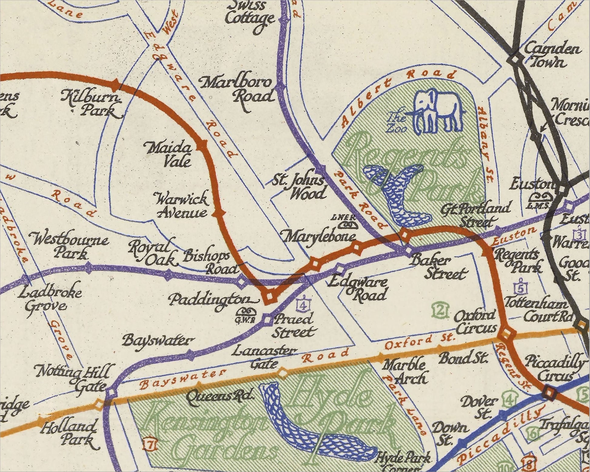
This charming London Underground map was designed by EG Perman and is widely considered the most decorative and beautiful London Underground map ever published. It is the last of the decorative era of London Underground maps with its calligraphy, decorative borders and pictorial content and stands in contrast to the tidy and formal Stingemore Underground pocket maps in circulation at the same time. Perman uses background detail and includes icons for the key tourist attractions of the time. It is understood Perman was commissioned to produce this map specifically for foreign visitors to promote London's key sights and attractions.
Being issued five years before the iconic Beck map, it is shown geographically-correct with above-ground landmarks. This has meant the further reaches of the system could not be included, so the District Line is shown as far east as Whitechapel; the Metropolitan as far north as Preston Road; Bakerloo to North Wembley; and what is now the Piccadilly Line is shown only to Alperton & Northfields, although as part of the District Line Services. In the north the Northern Line has yet to extend past Highgate (now Archway Station) and the Piccadilly Line past Finsbury Park.
This is a highly sought-after work and is sure to form an interesting conversation piece to any living room. This piece looks stunning mounted as shown in our 20" x 16" framed edition.
Share