
Classic Maps and Prints
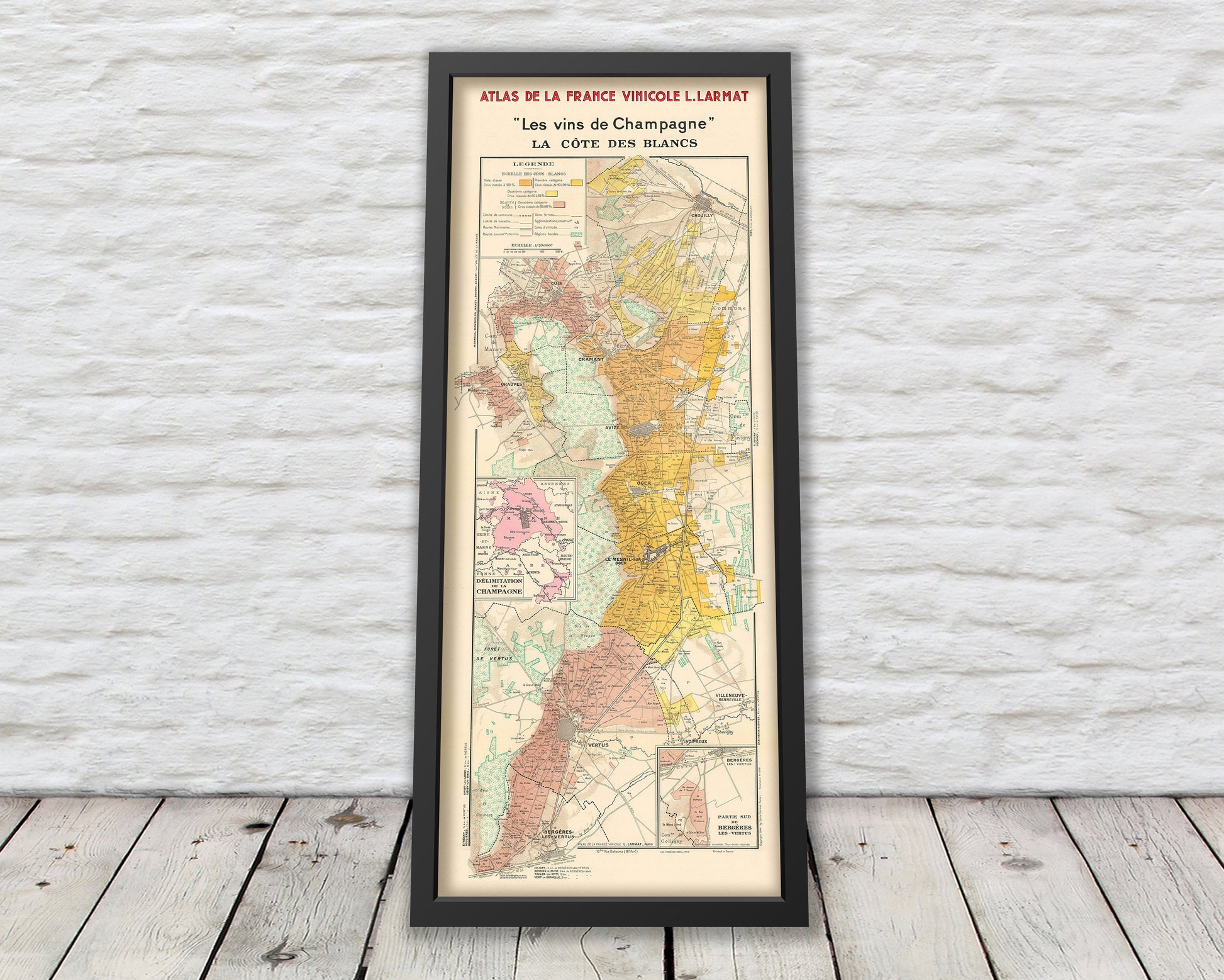
CHAMPAGNE MAP Les Vins de Champagne by Larmat 1944
CHAMPAGNE MAP Les Vins de Champagne by Larmat 1944
Couldn't load pickup availability
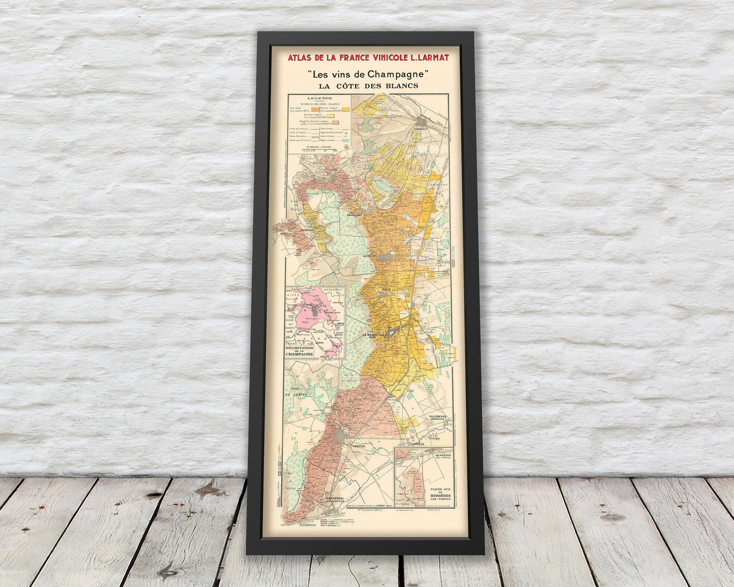
Louis Larmat published the world's first national wine atlas, his Atlas de la France Vinicole between 1941 and 1947. Divided into six volumes, each volume focused on a specific wine producing region. This wonderful map covers the Champagne region of France.
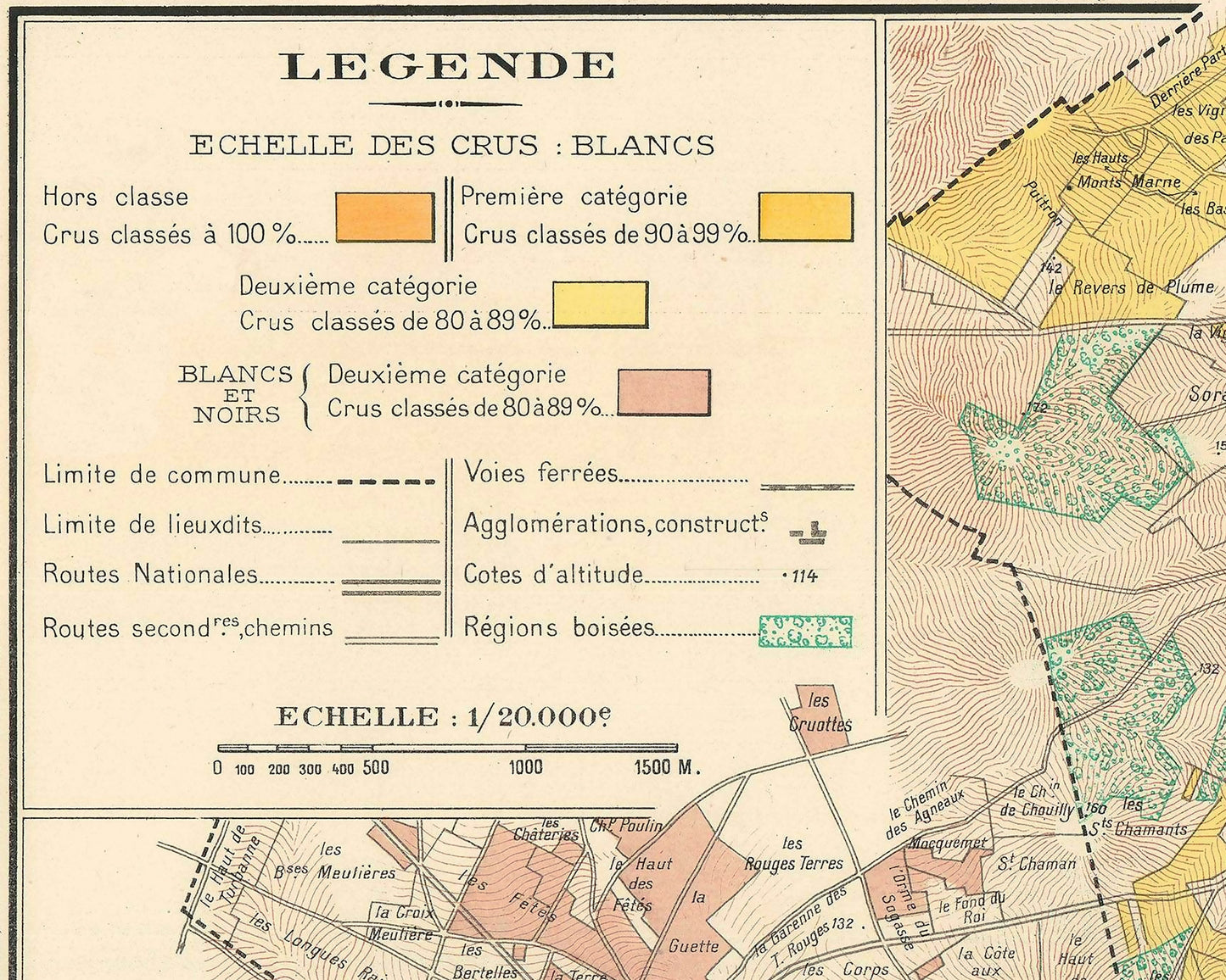
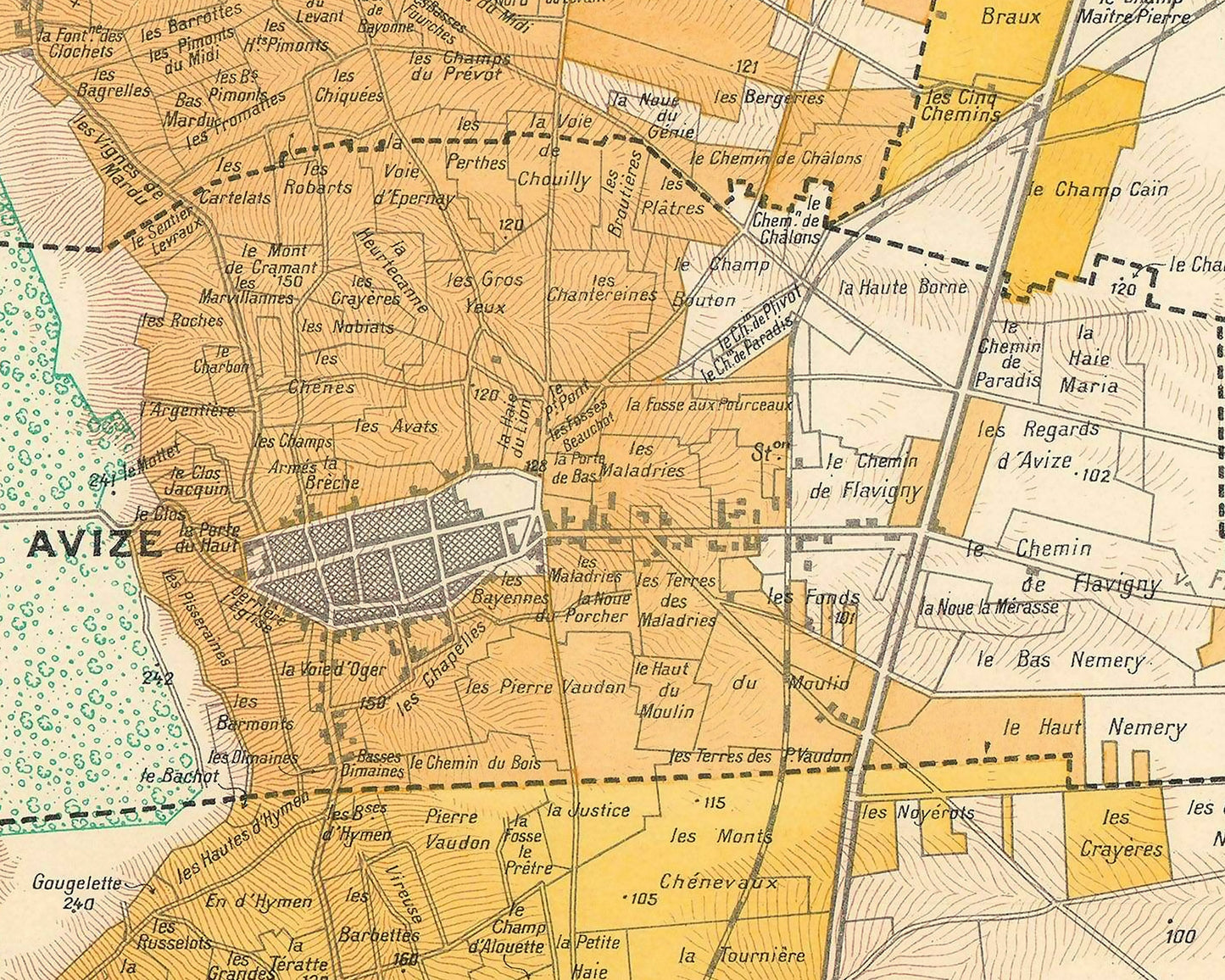
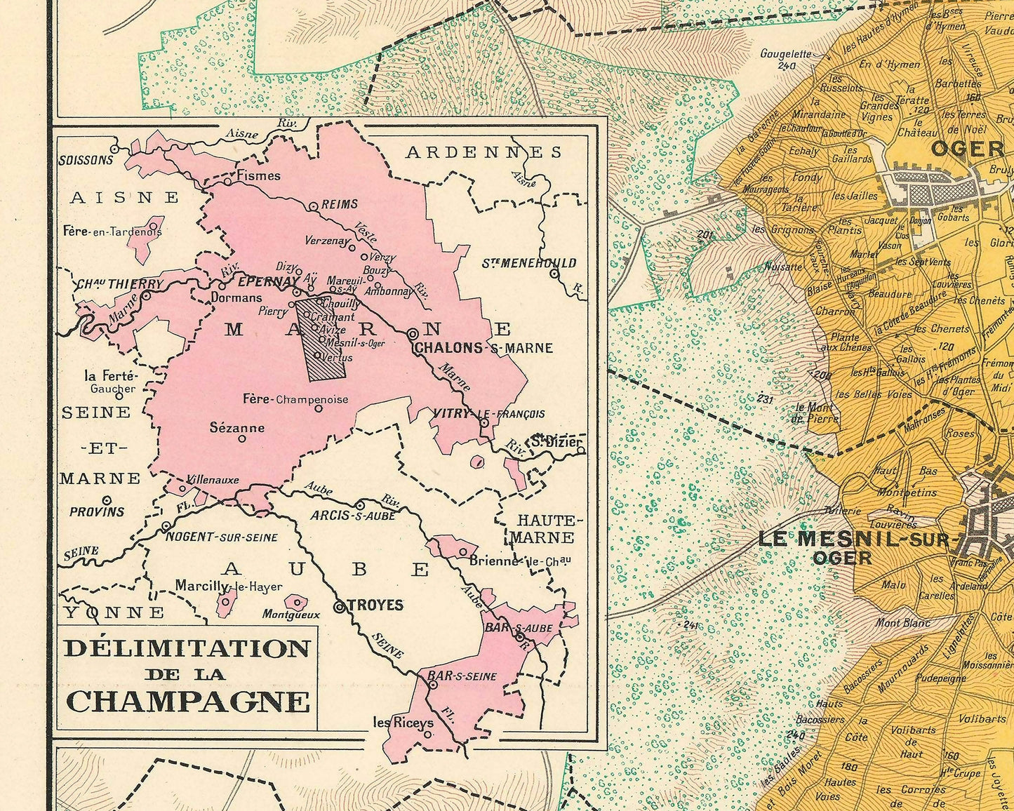
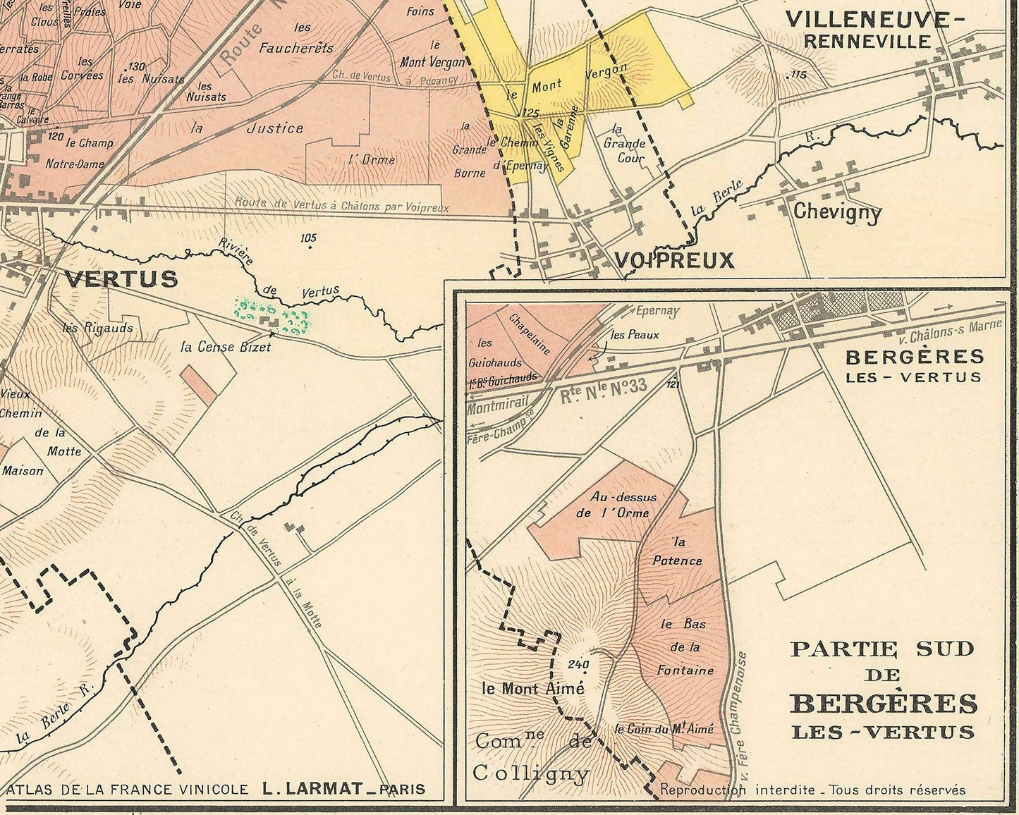
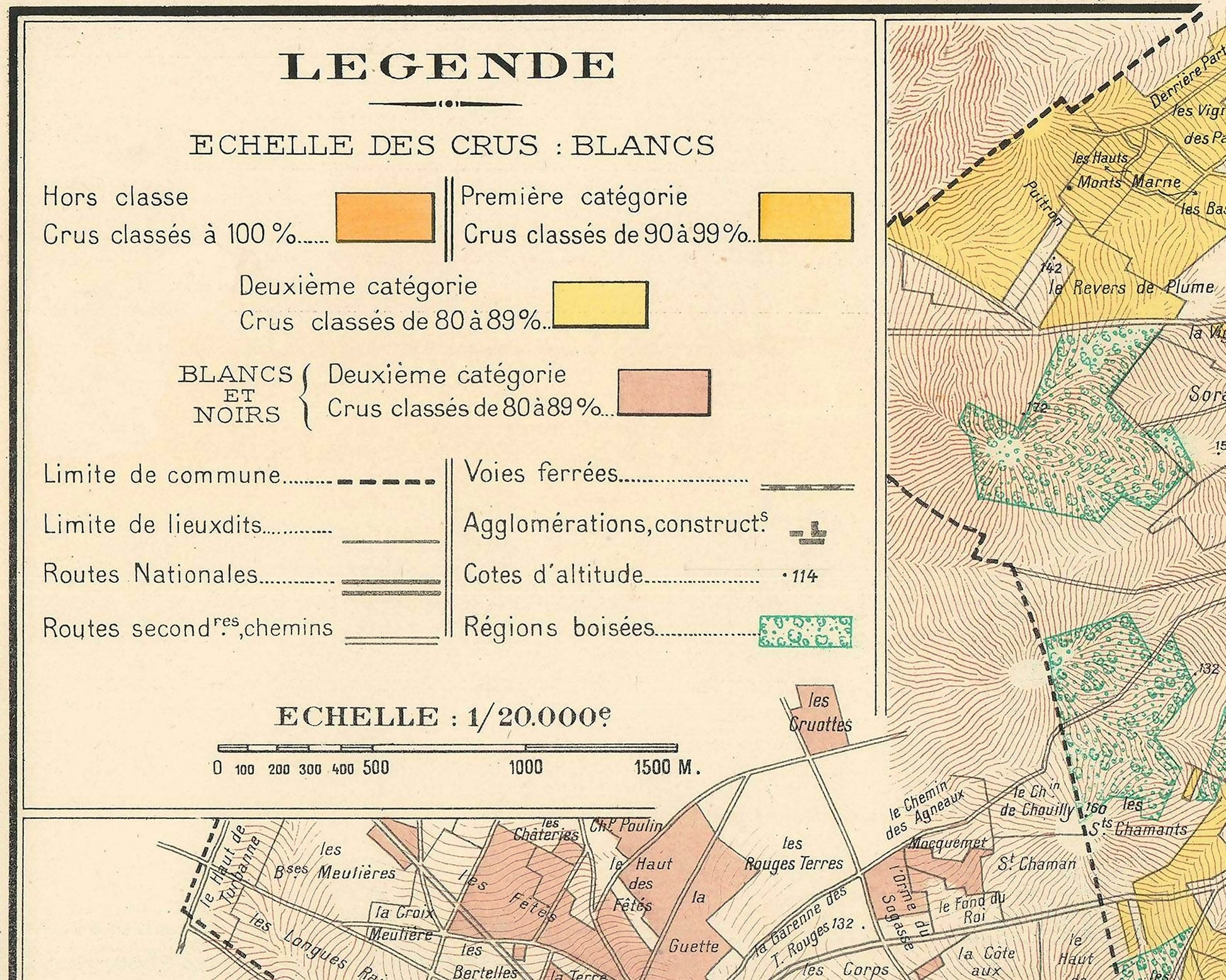
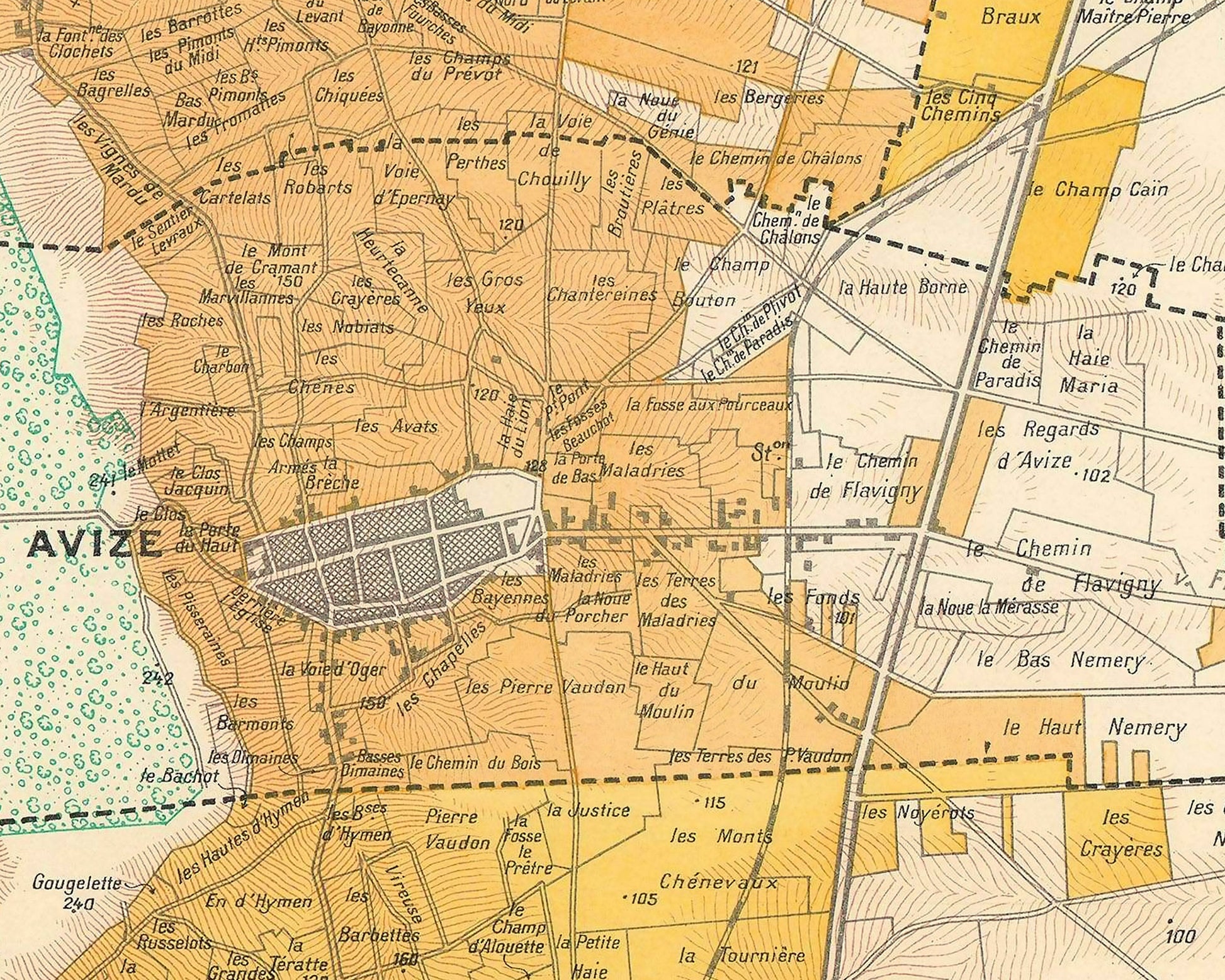
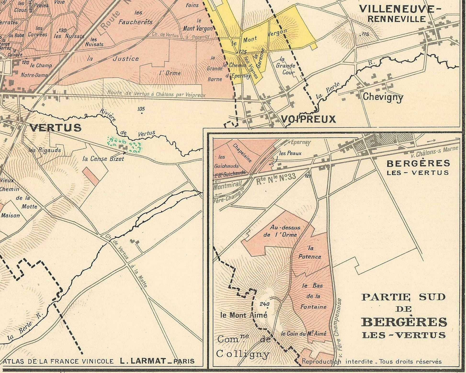
This is a 1944 Louis Larmat map of the Côte des Blancs. Depicting from Chouilly to Bergères-les-Vertus and from Montgrimaux to commune de Flavigny, the map focuses on the grape producers, the vignobles. Black dashed lines create the boundaries of the region's villages, including Oger, Le Mesnil-sur-Oger, Cuis, and Avize. Innumerable hamlets are identified in small italics, many of which are likely only known to local inhabitants. Roads and railroads are illustrated, as are wooded areas and parks. Inset maps shows the area south of Bergères-les-Vertus and the second situates the maint map within the Champagne region.
This is a truly magnificent gift either to yourself or to a fellow wine lover.
Please note this is an unframed print, the frame used is for illustration purposes only. If you require a map of different dimensions please message me with your requirements and I'll be only too please to help.
Share